Barford Heath

Downs, Moorland in Wiltshire

England

Barford Heath

Cemetery, Compton Chamberlayne
Cemetery, Compton Chamberlayne Credit: Roger Cornfoot

Barford Heath, located in Wiltshire, England, is a picturesque area encompassing downs and moorland landscapes. The heath is situated in the southern part of the county, near the village of Barford St Martin. Covering an expansive area, it is characterized by its undulating terrain, rich flora and fauna, and stunning panoramic views.

The heathland is predominantly covered by open grassland, interspersed with patches of heather and gorse. This diverse vegetation provides a vital habitat for a range of species, including many rare and protected birds such as the Dartford warbler and the nightjar. The area is also home to various reptiles, including adders and common lizards, as well as an array of insects like butterflies and dragonflies.

Walking through Barford Heath, visitors can enjoy the tranquility of the surroundings while admiring the stunning vistas across the rolling countryside. The heath is crisscrossed by footpaths and bridleways, making it a popular destination for hikers, cyclists, and horse riders. There are also designated areas for picnicking and nature observation, allowing visitors to fully immerse themselves in the natural beauty of the heath.

Barford Heath is not only renowned for its natural splendor but also for its historical significance. The area contains several prehistoric burial mounds, known as barrows, which date back thousands of years. These ancient monuments offer a glimpse into the region's past and provide a sense of connection to those who inhabited the area long ago.

Overall, Barford Heath in Wiltshire offers a unique and enchanting experience for nature enthusiasts, history buffs, and those seeking a peaceful escape from the hustle and bustle of everyday life.

If you have any feedback on the listing, please let us know in the comments section below.

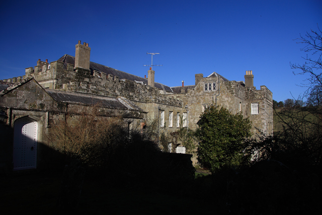
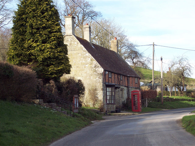
Barford Heath Images

Images are sourced within 2km of 51.074456/-1.9349188 or Grid Reference SU0430. Thanks to Geograph Open Source API. All images are credited.

Cemetery, Compton Chamberlayne
A30 heading west Emerging from the shade of Pond Copse.
A30 heading west
Emerging from the shade of Pond Copse.
A30 heading west
A30 heading west
Old Milestone by the A30, Compton Chamberlayne Carved stone post by the A30, in parish of Compton Chamberlayne (Salisbury District), Compton Chamberlayne; 100m West of lodge entrance, in hedgerow, on North side of road. Sarum Shaston triangle, erected by the Whitesheet turnpike trust in the 19th century. 

Inscription reads:-
: To / (Salisbury / 8) : : To / (Shaftesbury / 12) : 

Grade II listed.
List Entry Number: 1318737 <span class="nowrap"><a title="https://historicengland.org.uk/listing/the-list/list-entry/1318737" rel="nofollow ugc noopener" href="https://historicengland.org.uk/listing/the-list/list-entry/1318737">Link</a><img style="margin-left:2px;" alt="External link" title="External link - shift click to open in new window" src="https://s1.geograph.org.uk/img/external.png" width="10" height="10"/></span>

Milestone Society National ID: WI_SHSA12
Old Milestone by the A30, Compton Chamberlayne
Carved stone post by the A30, in parish of Compton Chamberlayne (Salisbury District), Compton Chamberlayne; 100m West of lodge entrance, in hedgerow, on North side of road. Sarum Shaston triangle, erected by the Whitesheet turnpike trust in the 19th century. Inscription reads:- : To / (Salisbury / 8) : : To / (Shaftesbury / 12) : Grade II listed. List Entry Number: 1318737 LinkExternal link Milestone Society National ID: WI_SHSA12
Farmland on Crouch's Down A crop grows apace on rolling downland on the north side of the Nadder valley. There are patches of woodland around, but I can't quite understand the wedge-shaped feature in the centre, half scrub and half apparently bare earth. It's on the side of a steep re-entrant, but doesn't appear from the shape to be anything to do with an old chalk pit, for instance.
Farmland on Crouch's Down
A crop grows apace on rolling downland on the north side of the Nadder valley. There are patches of woodland around, but I can't quite understand the wedge-shaped feature in the centre, half scrub and half apparently bare earth. It's on the side of a steep re-entrant, but doesn't appear from the shape to be anything to do with an old chalk pit, for instance.
The Barford Inn, Barford St Martin
Downland slope south of Barford St Martin The slope rises from the level fields near Hurdcott
Downland slope south of Barford St Martin
The slope rises from the level fields near Hurdcott
Bridge over River Nadder at Barford St Martin
The Barford Inn, Barford St Martin
Filling station on A30 east of Barford St Martin This is now a BP station; formerly it was a Texaco station <a href="https://www.geograph.org.uk/photo/331372">SU0631 : Tinkerbell Service Station, Barford St Martin</a>
Filling station on A30 east of Barford St Martin
This is now a BP station; formerly it was a Texaco station SU0631 : Tinkerbell Service Station, Barford St Martin
St Michael & All Angels, Compton Chamberlayne: late December 2013
St Michael & All Angels, Compton Chamberlayne: entrance
St Michael & All Angels, Compton Chamberlayne: churchyard (a)
St Michael & All Angels, Compton Chamberlayne: churchyard (b)
St Michael & All Angels, Compton Chamberlayne: churchyard (c)
St Michael & All Angels, Compton Chamberlayne: churchyard (d)
Inside St Michael & All Angels, Compton Chamberlayne (1)
Inside St Michael & All Angels, Compton Chamberlayne (2)
Show me another place!

Barford Heath is located at Grid Ref: SU0430 (Lat: 51.074456, Lng: -1.9349188)

Unitary Authority: Wiltshire

Police Authority: Wiltshire

What 3 Words

///enjoys.freshest.hiking. Near Dinton, Wiltshire

Related Wikis

Barford St Martin

Barford St Martin is a village and civil parish in Wiltshire, England, about 2.5 miles (4 km) west of Wilton, around the junction of the A30 and the B3089...

Compton Park House

Compton Park House (or Compton House) is a Grade I listed manor house in Compton Chamberlayne, Wiltshire, England, about 7 miles (11 km) east of Salisbury...

Compton Chamberlayne

Compton Chamberlayne is a small village and civil parish in the Nadder Valley in south Wiltshire, England, about 7 miles (11 km) west of Salisbury. The...

Burcombe Down

Burcombe Down (grid reference SU064295) is an area of chalk grassland situated on a north-facing scarp slope to the south of Burcombe in Wiltshire, England...

Nearby Amenities

Located within 500m of 51.074456,-1.9349188
Historic: milestone
Lat/Long: 51.0703762/-1.9353227
The data included in this document is from www.openstreetmap.org. The data is made available under ODbL.

Have you been to Barford Heath?

Leave your review of Barford Heath below (or comments, questions and feedback).