Bleaberry Pots

Downs, Moorland in Yorkshire Richmondshire

England

Bleaberry Pots

On Height of Hazely, Penhill Looking down over the junction of Wensleydale and Bishopdale. This is open access land but the route up from West Burton is complicated by new fences and blocked gateways.
On Height of Hazely, Penhill Credit: Karl and Ali

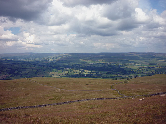
Bleaberry Pots is a picturesque area located in Yorkshire, England. Situated amidst the stunning landscape of the Yorkshire Downs and Moorland, it is a popular destination for nature lovers, hikers, and outdoor enthusiasts.

The area is characterized by its unique geological features, known as "pots." Pots are deep, cylindrical depressions in the ground that were formed during the last Ice Age. These natural formations were created by the movement of glaciers, which carved out the land and left behind these distinctive features. Bleaberry Pots is renowned for its particularly impressive examples of these geological wonders.

Visitors to Bleaberry Pots can explore the area by following a network of well-maintained footpaths. The trails offer breathtaking views of the surrounding moorland, with its rolling hills, heather-covered landscapes, and abundant wildlife. It is not uncommon to spot native species such as curlews, grouse, and the occasional red deer.

The area is also home to a variety of plant life, including wildflowers such as heather and bilberry. The vibrant colors of these blooms create a stunning contrast against the rugged moorland.

Bleaberry Pots is a peaceful and tranquil place, offering visitors a chance to connect with nature and escape the hustle and bustle of everyday life. Whether it's a leisurely stroll through the countryside or a challenging hike along the hills, this area offers something for everyone to enjoy.

If you have any feedback on the listing, please let us know in the comments section below.

Bleaberry Pots Images

Images are sourced within 2km of 54.259464/-1.9554636 or Grid Reference SE0284. Thanks to Geograph Open Source API. All images are credited.

On Height of Hazely, Penhill Looking down over the junction of Wensleydale and Bishopdale. This is open access land but the route up from West Burton is complicated by new fences and blocked gateways.
On Height of Hazely, Penhill
Looking down over the junction of Wensleydale and Bishopdale. This is open access land but the route up from West Burton is complicated by new fences and blocked gateways.
Climbing above West Burton It's a steep pull up the lower flanks of Penhill through several bands of limestone. Down below is West Burton and the valley of Bishopdale extending away beyond. The flat-topped hill on the right is Addlebrough.
Climbing above West Burton
It's a steep pull up the lower flanks of Penhill through several bands of limestone. Down below is West Burton and the valley of Bishopdale extending away beyond. The flat-topped hill on the right is Addlebrough.
Benchmark on gatepost at entrance to Riddings, Dame Lane Ordnance Survey cut mark benchmark described on the Bench Mark Database at <span class="nowrap"><a title="http://www.bench-marks.org.uk/bm44113" rel="nofollow ugc noopener" href="http://www.bench-marks.org.uk/bm44113">Link</a><img style="margin-left:2px;" alt="External link" title="External link - shift click to open in new window" src="https://s1.geograph.org.uk/img/external.png" width="10" height="10"/></span>
Benchmark on gatepost at entrance to Riddings, Dame Lane
Ordnance Survey cut mark benchmark described on the Bench Mark Database at LinkExternal link
Junction of Dame Lane and track to Riddings There is an OS benchmark <a href="https://www.geograph.org.uk/photo/3063983">SE0186 : Benchmark on gatepost at entrance to Riddings, Dame Lane</a> on the gatepost on the right hand side of the gateway
Junction of Dame Lane and track to Riddings
There is an OS benchmark SE0186 : Benchmark on gatepost at entrance to Riddings, Dame Lane on the gatepost on the right hand side of the gateway
Benchmark on barn on north road to Walden Ordnance Survey cut mark benchmark described on the Bench Mark Database at <span class="nowrap"><a title="http://www.bench-marks.org.uk/bm44114" rel="nofollow ugc noopener" href="http://www.bench-marks.org.uk/bm44114">Link</a><img style="margin-left:2px;" alt="External link" title="External link - shift click to open in new window" src="https://s1.geograph.org.uk/img/external.png" width="10" height="10"/></span>
Benchmark on barn on north road to Walden
Ordnance Survey cut mark benchmark described on the Bench Mark Database at LinkExternal link
Barn on north road to Walden There is an OS benchmark <a href="https://www.geograph.org.uk/photo/3064090">SE0186 : Benchmark on barn on north road to Walden</a> on the front of the barn beside the black door
Barn on north road to Walden
There is an OS benchmark SE0186 : Benchmark on barn on north road to Walden on the front of the barn beside the black door
Benchmark on the wall of Whiterow Road Ordnance Survey cut mark benchmark described on the Bench Mark Database at <span class="nowrap"><a title="http://www.bench-marks.org.uk/bm44112" rel="nofollow ugc noopener" href="http://www.bench-marks.org.uk/bm44112">Link</a><img style="margin-left:2px;" alt="External link" title="External link - shift click to open in new window" src="https://s1.geograph.org.uk/img/external.png" width="10" height="10"/></span>
Benchmark on the wall of Whiterow Road
Ordnance Survey cut mark benchmark described on the Bench Mark Database at LinkExternal link
Whiterow Road looking towards West Burton There is an OS benchmark <a href="https://www.geograph.org.uk/photo/3064218">SE0185 : Benchmark on the wall of Whiterow Road</a> on the wall on the right hand side of the lane behind the sycamore sapling.
Whiterow Road looking towards West Burton
There is an OS benchmark SE0185 : Benchmark on the wall of Whiterow Road on the wall on the right hand side of the lane behind the sycamore sapling.
Benchmark on parapet of Cote Bridge Ordnance Survey cut mark benchmark described on the Bench Mark Database at <span class="nowrap"><a title="http://www.bench-marks.org.uk/bm44111" rel="nofollow ugc noopener" href="http://www.bench-marks.org.uk/bm44111">Link</a><img style="margin-left:2px;" alt="External link" title="External link - shift click to open in new window" src="https://s1.geograph.org.uk/img/external.png" width="10" height="10"/></span>
Benchmark on parapet of Cote Bridge
Ordnance Survey cut mark benchmark described on the Bench Mark Database at LinkExternal link
Cote Bridge There is an OS benchmark <a href="https://www.geograph.org.uk/photo/3064319">SE0185 : Benchmark on parapet of Cote Bridge</a> on the left hand side parapet.
Cote Bridge
There is an OS benchmark SE0185 : Benchmark on parapet of Cote Bridge on the left hand side parapet.
Thupton Gill Road On the way towards Cote Bridge
Thupton Gill Road
On the way towards Cote Bridge
Benchmarked gatepost beside track over Burton Moor Ordnance Survey cut mark benchmark described on the Bench Mark Database at <span class="nowrap"><a title="http://www.bench-marks.org.uk/bm44095" rel="nofollow ugc noopener" href="http://www.bench-marks.org.uk/bm44095">Link</a><img style="margin-left:2px;" alt="External link" title="External link - shift click to open in new window" src="https://s1.geograph.org.uk/img/external.png" width="10" height="10"/></span>
Benchmarked gatepost beside track over Burton Moor
Ordnance Survey cut mark benchmark described on the Bench Mark Database at LinkExternal link
Rushes on Harland Hill
Looking up Harland Hill
Dry stone wall beside track over Burton Moor There is an OS benchmark <a href="https://www.geograph.org.uk/photo/3064453">SE0385 : Benchmarked gatepost beside track over Burton Moor</a> on the gatepost
Dry stone wall beside track over Burton Moor
There is an OS benchmark SE0385 : Benchmarked gatepost beside track over Burton Moor on the gatepost
Braithwaite Lead Smelt Mill chimney A description of the mill is given on the plaque visible in the photo <a href="https://www.geograph.org.uk/photo/2246253">SE0185 : Information plaque, Braithwaite Lead Smelt Mill chimney</a>
Braithwaite Lead Smelt Mill chimney
A description of the mill is given on the plaque visible in the photo SE0185 : Information plaque, Braithwaite Lead Smelt Mill chimney
Height of Hazely [Carlton Moor] Parked after cattle grid on way to Melmerby. Walk back down road through red get sign Penhill. Penhill Beacon, trig then fallow wall until after second gate where headed south over flattish moorland. GPS used to locate summit. Cool Sunny and damp under foot.
Name: Height of Hazely [Carlton Moor]
Hill number: 3617
Height: 553m / 1814ft
Area: 35B: The Central Pennines
Class: Hu,5
Grid ref: SE 03744 85990
Summit feature: no feature
Drop: 124m
Col: 429m  SE021826
Height of Hazely [Carlton Moor]
Parked after cattle grid on way to Melmerby. Walk back down road through red get sign Penhill. Penhill Beacon, trig then fallow wall until after second gate where headed south over flattish moorland. GPS used to locate summit. Cool Sunny and damp under foot. Name: Height of Hazely [Carlton Moor] Hill number: 3617 Height: 553m / 1814ft Area: 35B: The Central Pennines Class: Hu,5 Grid ref: SE 03744 85990 Summit feature: no feature Drop: 124m Col: 429m SE021826
Approaching Carlton Moor Walked up from Penhill Beacon and trig over this damp moorland to walk around the flat top of Height of Hazely (Carlton Moor).
Approaching Carlton Moor
Walked up from Penhill Beacon and trig over this damp moorland to walk around the flat top of Height of Hazely (Carlton Moor).
Show me another place!

Bleaberry Pots is located at Grid Ref: SE0284 (Lat: 54.259464, Lng: -1.9554636)

Division: North Riding

Administrative County: North Yorkshire

District: Richmondshire

Police Authority: North Yorkshire

What 3 Words

///automatic.worms.corporate. Near Leyburn, North Yorkshire

Related Wikis

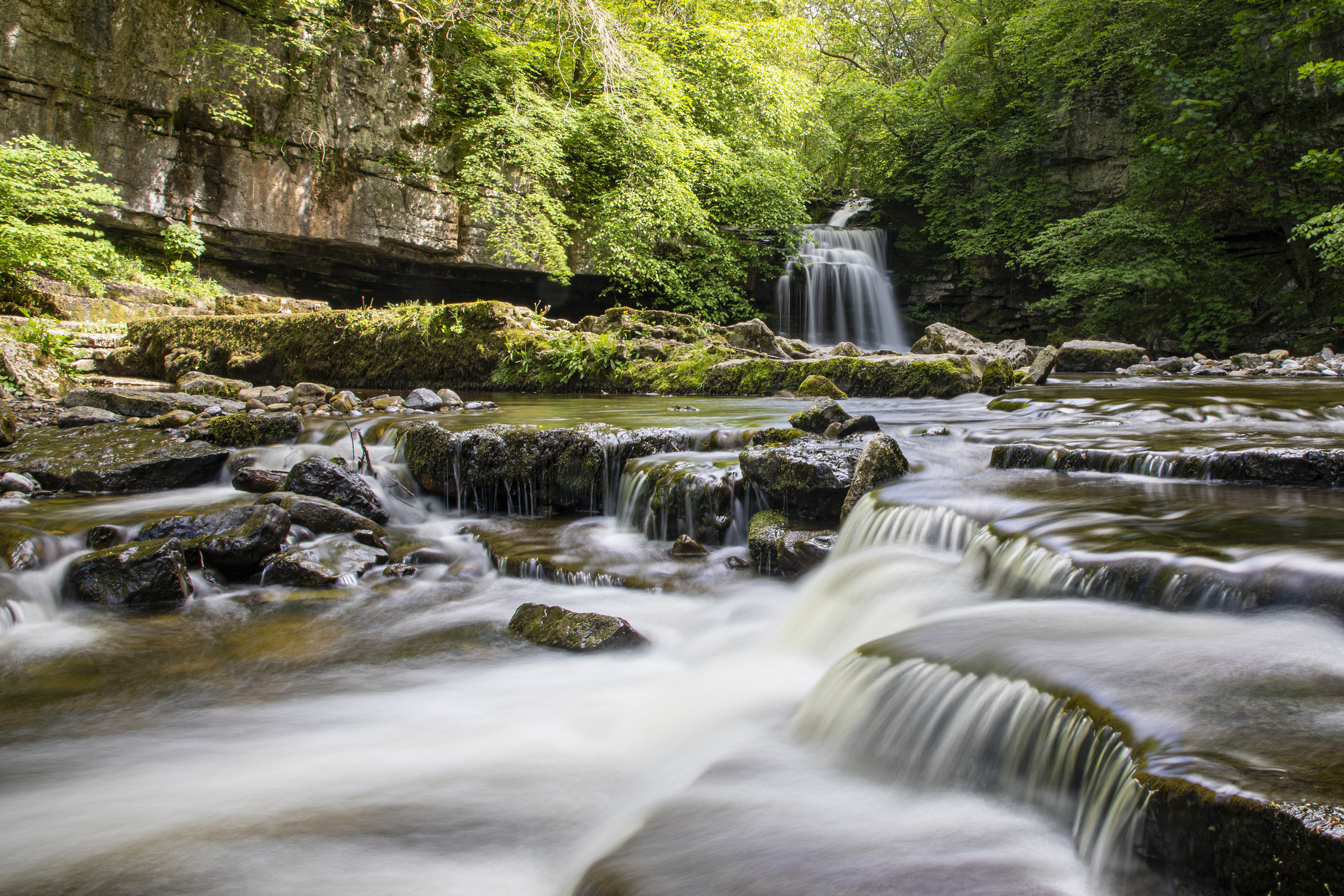
Cauldron Falls (North Yorkshire)

Cauldron Falls (also known as West Burton falls), is a series of waterfalls on Walden Beck in the village of West Burton, North Yorkshire, England. It...

Penhill

Penhill (526 metres (1,726 ft) high at the trig point, 553 metres (1,814 ft) at Height of Hazely) is a prominent hill, 5.5 miles (9 km) south west of Leyburn...

Burton-cum-Walden

Burton-cum-Walden is a civil parish in North Yorkshire, England, in the Yorkshire Dales National Park. It had a population of 303 according to the 2011...

West Burton, North Yorkshire

West Burton is a village in Bishopdale, a side valley of Wensleydale, in the Yorkshire Dales, North Yorkshire, England. It lies 6.2 miles (10 km) south...

Related Videos

Cauldron Falls

A walk around West Burton and a swim in Cauldron Falls. Starting from on-street parking: DL8 4JY.

west burton waterfall visit 2019

cauldron falls walden beck front nook west burton leyburn darlington yorkshire england.

Exploring West Burton - Yorkshire Dales

We're in the Yorkshire Dale's on hoilday and its beautiful. Only been here two hours and this walk was stunning!!!

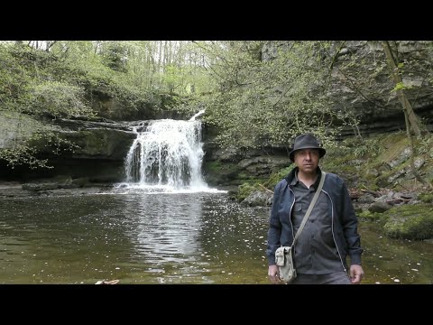
A Winter's Day at Cauldron Falls - Photographing A Waterfall.

Cauldron Falls in West Burton near Leyburn on the Yorkshire Dales is my location for my first waterfall landscape photography ...

Nearby Amenities

Located within 500m of 54.259464,-1.9554636
Natural: spring
Source: OS 1:25k
Lat/Long: 54.2592452/-1.9560345
Natural: spring
Source: OS 1:25k
Lat/Long: 54.259828/-1.9576545
Natural: spring
Source: OS 1:25k
Lat/Long: 54.2587563/-1.9578799
The data included in this document is from www.openstreetmap.org. The data is made available under ODbL.

Have you been to Bleaberry Pots?

Leave your review of Bleaberry Pots below (or comments, questions and feedback).