Axe Edge Moor

Downs, Moorland in Derbyshire High Peak

England

Axe Edge Moor

A view of Blackclough Farm
A view of Blackclough Farm Credit: Neil Theasby

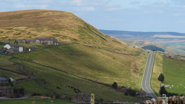
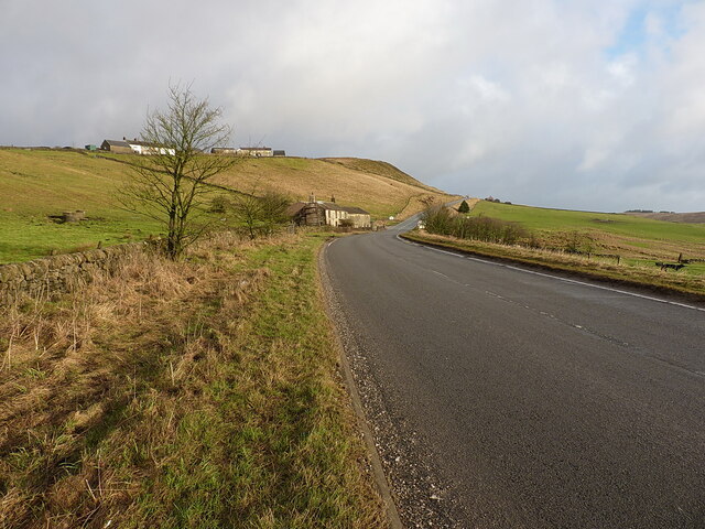
Axe Edge Moor is a vast expanse of moorland and upland located in Derbyshire, England. Stretching across approximately 18 square miles, it forms part of the Peak District National Park. The moorland is situated in the southern Pennines, near the border between Derbyshire and Staffordshire.

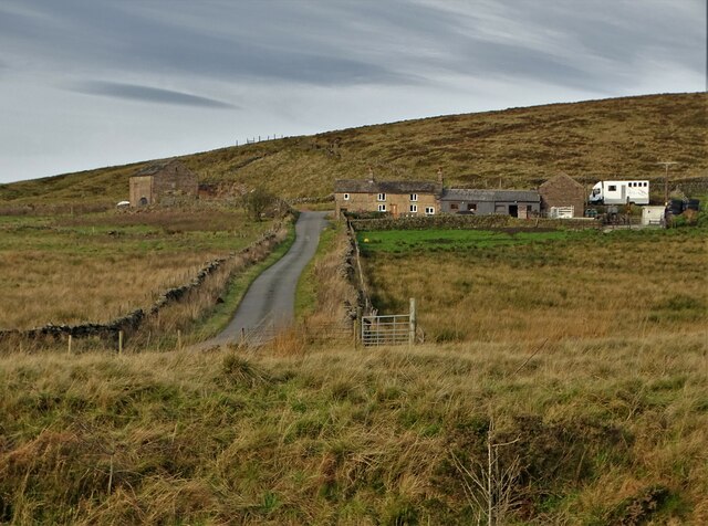
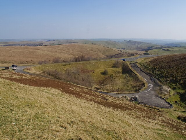
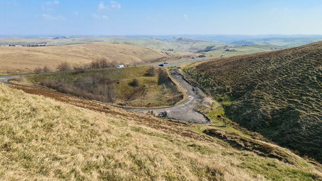
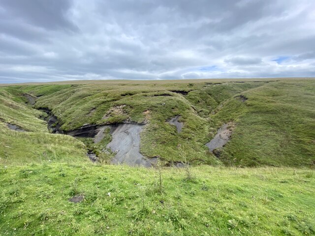
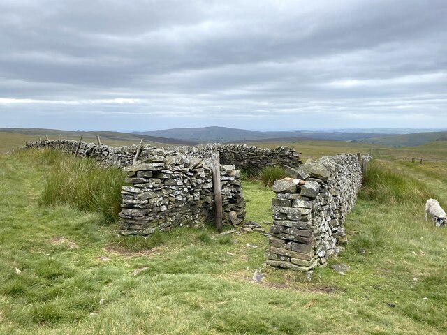
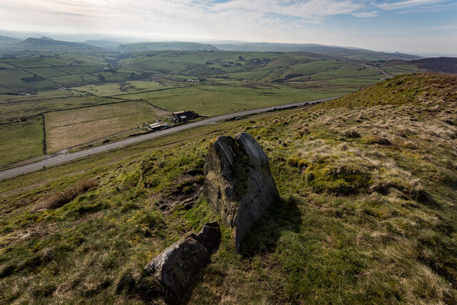
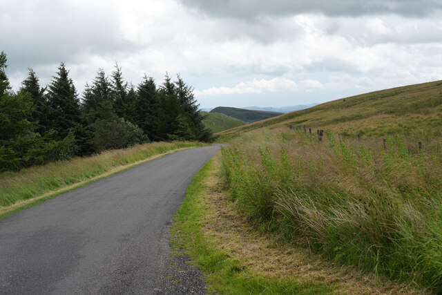
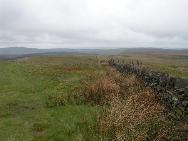
Axe Edge Moor is characterized by its rugged and wild landscape, with undulating hills, deep valleys, and wide open spaces. The area is mainly covered in heather and grass, interspersed with patches of peat bogs and rocky outcrops. The moorland is known for its breathtaking panoramic views, offering vistas of the surrounding countryside and distant hills.

The region is home to a variety of wildlife, including several bird species such as red grouse and golden plovers. Visitors may also spot hares, rabbits, and foxes roaming the moorland. The moor is rich in archaeological and historical features, with evidence of prehistoric settlements, ancient burial mounds, and packhorse trails.

Axe Edge Moor is a popular destination for outdoor enthusiasts and nature lovers. It offers opportunities for walking, hiking, and cycling, with numerous footpaths and trails crisscrossing the area. The moorland also attracts paragliders and model aircraft enthusiasts due to its favorable wind conditions.

Overall, Axe Edge Moor is a captivating and diverse landscape, offering a unique glimpse into the natural beauty and rich history of the Derbyshire countryside. Whether exploring the moorland on foot or simply admiring the stunning vistas, visitors are sure to be enthralled by the beauty and tranquility of this remarkable area.

If you have any feedback on the listing, please let us know in the comments section below.

Axe Edge Moor Images

Images are sourced within 2km of 53.230031/-1.9637531 or Grid Reference SK0270. Thanks to Geograph Open Source API. All images are credited.

A view of Blackclough Farm
View to Readyleech Green Farm
Blackclough & Dane Valley Way
Overlooking the A53 Leek - Buxton Road Evidence of the road having been straightened here.
Overlooking the A53 Leek - Buxton Road
Evidence of the road having been straightened here.
A53 below Axe Edge
A53 below Axe Edge
Disused chimney adjacent to the A54 Reeve-edge quarries in the background.
Disused chimney adjacent to the A54
Reeve-edge quarries in the background.
Farm track to Blackclough
Orchard Clough South of Axe Edge.
Orchard Clough
South of Axe Edge.
Boundary sheepfold Situated on the boundary of Derbyshire and Staffordshire.
Boundary sheepfold
Situated on the boundary of Derbyshire and Staffordshire.
A53 below Axe Edge from Oliver Hill
Axe Edge Summit Looking Down On The A53
Staffordshire County Top Cheeks Hill, Boundary wall Staffordshire on the right Derbyshire on the left of the wall ..

At 520m / 1706ft Cheeks Hill is the highest point in Staffordshire. 

<span class="nowrap"><a title="http://www.hill-bagging.co.uk/mountaindetails.php?qu=S&rf=5472" rel="nofollow ugc noopener" href="http://www.hill-bagging.co.uk/mountaindetails.php?qu=S&rf=5472">Link</a><img style="margin-left:2px;" alt="External link" title="External link - shift click to open in new window" src="https://s1.geograph.org.uk/img/external.png" width="10" height="10"/></span>
Staffordshire County Top Cheeks Hill, Boundary wall
Staffordshire on the right Derbyshire on the left of the wall .. At 520m / 1706ft Cheeks Hill is the highest point in Staffordshire. LinkExternal link
Dove Head Farm and the A53 at Axe Edge
The road on Axe Edge Generally the surface of the road is good but the few places where you can pull off the road are quite bad with potholes and lumps of tarmac.
The road on Axe Edge
Generally the surface of the road is good but the few places where you can pull off the road are quite bad with potholes and lumps of tarmac.
Near Leap Edge Not really very far from Buxton, but the area looks quite bleak.
Near Leap Edge
Not really very far from Buxton, but the area looks quite bleak.
Blackclough farm. Sunshine from the shade.
Blackclough farm.
Sunshine from the shade.
Rough pasture land near Orchard Farm
Track to Cheeks Hill Heading up to the highest point in Staffordshire.
Track to Cheeks Hill
Heading up to the highest point in Staffordshire.
Show me another place!

Axe Edge Moor is located at Grid Ref: SK0270 (Lat: 53.230031, Lng: -1.9637531)

Administrative County: Derbyshire

District: High Peak

Police Authority: Derbyshire

What 3 Words

///makes.rice.regret. Near Buxton, Derbyshire

Nearby Locations

Moss Chain Axe Edge Moor

Related Wikis

Nearby Amenities

Located within 500m of 53.230031,-1.9637531
Passing Place
Lat/Long: 53.2291802/-1.9574594
Cheeks Hill
Description: Highest point in Staffordshire
Ele: 520
Natural: peak
Wikidata: Q5089282
Wikipedia: en:Cheeks Hill
Lat/Long: 53.2262486/-1.9623094
Dane Head
Note: source of the River Dane
Waterway: source
Lat/Long: 53.2300272/-1.958339
Axe Edge Moor
Place: locality
Lat/Long: 53.2307065/-1.9588877
Barrier: stile
Material: stone
Source: survey;gps
Stile: stepover
Lat/Long: 53.2260847/-1.9625369
Passing Place
Lat/Long: 53.2303688/-1.9617071
Rest Area
Lat/Long: 53.2299247/-1.9606329
The data included in this document is from www.openstreetmap.org. The data is made available under ODbL.

Have you been to Axe Edge Moor?

Leave your review of Axe Edge Moor below (or comments, questions and feedback).