Barden Moor

Downs, Moorland in Yorkshire Craven

England

Barden Moor

From Nought to Nine in no Seconds Standing directly on top of SE 01234 56789 looking in a north easterly direction. This point was very difficult to reach as it's in very boggy and uneven ground as can be seen in the photo.  I just thought it would be a novelty to go here!  It's unlikely that anyone has ever been here before!!
From Nought to Nine in no Seconds Credit: Andy Beecroft

Barden Moor, located in Yorkshire, England, is a picturesque expanse of land renowned for its stunning natural beauty and diverse ecosystems. Spanning over 2,000 acres, this vast moorland is situated within the Yorkshire Dales National Park, making it an ideal destination for nature enthusiasts and outdoor adventurers alike.

The moorland is characterized by its rolling hills, heather-covered landscapes, and sweeping vistas that offer breathtaking views of the surrounding countryside. Barden Moor is teeming with a rich variety of flora and fauna, including heather, bilberry bushes, and cotton grass, which thrive in the acidic soil found in this region. It is also home to a wide range of bird species, such as curlews, lapwings, and red grouse, making it a haven for birdwatchers.

Historically, Barden Moor has been used for grazing livestock, particularly sheep, due to its nutrient-rich grasses. Today, visitors may still encounter flocks of sheep grazing on the moor, adding to its pastoral charm and rural ambiance.

The moorland is crisscrossed by numerous footpaths and trails, offering opportunities for hikers, walkers, and cyclists to explore the area and soak in the natural beauty. One popular route is the Barden Moor Circular Walk, which takes visitors on a journey through the heart of the moor, passing by ancient stone monuments and offering spectacular views of the surrounding countryside.

Barden Moor is not only a natural haven but also holds historical significance. It is home to the ruins of Barden Tower, a 16th-century fortified house, which adds an element of intrigue and charm to the moorland. The tower was once a hunting lodge and a residence for the powerful Clifford family.

Overall, Barden Moor is a captivating destination that offers visitors a chance to connect with nature, immerse themselves in the rugged beauty of the Yorkshire countryside, and delve into the region's rich history.

If you have any feedback on the listing, please let us know in the comments section below.
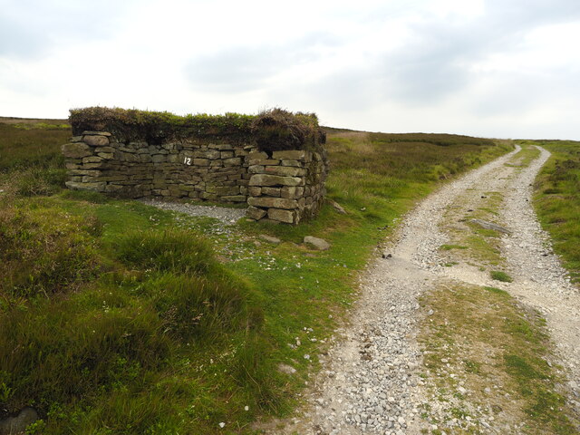
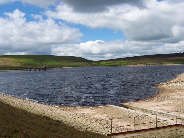
Barden Moor Images

Images are sourced within 2km of 54.011063/-1.9631589 or Grid Reference SE0257. Thanks to Geograph Open Source API. All images are credited.

From Nought to Nine in no Seconds Standing directly on top of SE 01234 56789 looking in a north easterly direction. This point was very difficult to reach as it's in very boggy and uneven ground as can be seen in the photo.  I just thought it would be a novelty to go here!  It's unlikely that anyone has ever been here before!!
From Nought to Nine in no Seconds
Standing directly on top of SE 01234 56789 looking in a north easterly direction. This point was very difficult to reach as it's in very boggy and uneven ground as can be seen in the photo. I just thought it would be a novelty to go here! It's unlikely that anyone has ever been here before!!
Grouse Butt 12 near Brayshaw
Bridleway at Hutchen Gill
Scruffy Moorland Resident
Halton Moor A very popular place to park and take in the extensive views of Wharfedale. The picture is looking NE over the Wharfe valley towards Simon Seat
Halton Moor
A very popular place to park and take in the extensive views of Wharfedale. The picture is looking NE over the Wharfe valley towards Simon Seat
The peak of Bilton Ings Bilton Ings is 433m above sea level
The peak of Bilton Ings
Bilton Ings is 433m above sea level
The retaining wall and Upper Barden Reservoir Built by the Corporation of Bradford
The retaining wall and Upper Barden Reservoir
Built by the Corporation of Bradford
Bridleway near Hut Crag
Lower Barden Reservoir Viewed from Halton Height
Lower Barden Reservoir
Viewed from Halton Height
Reservoir conduit Leading to Upper Barden reservoir. Although this track is not level, it seems to be built over a conduit. There are inspection hatches and inflows at several points along its length.
Reservoir conduit
Leading to Upper Barden reservoir. Although this track is not level, it seems to be built over a conduit. There are inspection hatches and inflows at several points along its length.
Barden Moor Although the name "Barden Moor" is generally applied to this whole area of moorland, this smaller part originally had the name.

Lower Barden Reservoir can be seen in the distance.
Barden Moor
Although the name "Barden Moor" is generally applied to this whole area of moorland, this smaller part originally had the name. Lower Barden Reservoir can be seen in the distance.
Upper Barden Formerly the reservoir keeper's house. The western edge of Barden Moor is on the skyline. The obelisk is Cracoe war memorial.
Upper Barden
Formerly the reservoir keeper's house. The western edge of Barden Moor is on the skyline. The obelisk is Cracoe war memorial.
Old track bed The track bed of a narrow gauge railway used in the construction of Upper Barden Reservoir, completed by Bradford Corporation Water Works in 1882.
Old track bed
The track bed of a narrow gauge railway used in the construction of Upper Barden Reservoir, completed by Bradford Corporation Water Works in 1882.
Grouse Butts Looking across Barden Moor from the bridleway. Lower Barden Reservoir is to the right.
Grouse Butts
Looking across Barden Moor from the bridleway. Lower Barden Reservoir is to the right.
Manhole cover This is in a pile of other large pieces of worked stone near the dam of Upper Barden Reservoir. The date of 1860 is the completion date of Lower Barden Reservoir: the upper reservoir was not completed until 1882.

BCWW stands for Bradford Corporation Water Works. A good water supply was essential for the wool industry and Bradford was rich enough to construct distant reservoirs and a good supply infrastructure.

Their final project was the enlargement of Grimwith Reservoir, started in 1970 and completed in 1983, just in time for the demise of the wool industry and the privatization of the water supply.
Manhole cover
This is in a pile of other large pieces of worked stone near the dam of Upper Barden Reservoir. The date of 1860 is the completion date of Lower Barden Reservoir: the upper reservoir was not completed until 1882. BCWW stands for Bradford Corporation Water Works. A good water supply was essential for the wool industry and Bradford was rich enough to construct distant reservoirs and a good supply infrastructure. Their final project was the enlargement of Grimwith Reservoir, started in 1970 and completed in 1983, just in time for the demise of the wool industry and the privatization of the water supply.
Halton Height trig Looking E from position
Halton Height trig
Looking E from position
Lower Barden Reservoir and Barden Moor. Looking N from Halton Moor.
Lower Barden Reservoir and Barden Moor.
Looking N from Halton Moor.
Grouse butt This is one of many butts on Barden Moor. This is the first of a line which now faces a plantation and is thus redundant.
Grouse butt
This is one of many butts on Barden Moor. This is the first of a line which now faces a plantation and is thus redundant.
Show me another place!

Barden Moor is located at Grid Ref: SE0257 (Lat: 54.011063, Lng: -1.9631589)

Division: West Riding

Administrative County: North Yorkshire

District: Craven

Police Authority: North Yorkshire

What 3 Words

///picked.heightens.tangent. Near Embsay, North Yorkshire

Nearby Locations

Turnmer Hill Barden Moor

Related Wikis

Nearby Amenities

Located within 500m of 54.011063,-1.9631589
Brass Castle
Place: locality
Source: NPE
Lat/Long: 54.0101522/-1.9560674
Turmner Hill
Natural: peak
Lat/Long: 54.008672/-1.9680682
Turning Circle
Source: Bing
Lat/Long: 54.0137046/-1.9685159
Shelter
Bench: yes
Bin: no
Locked: no
Shelter Type: weather_shelter
Lat/Long: 54.0103944/-1.9565985
Shelter
Bench: yes
Bin: no
Shelter Type: weather_shelter
Lat/Long: 54.0100176/-1.9560701
The data included in this document is from www.openstreetmap.org. The data is made available under ODbL.

Have you been to Barden Moor?

Leave your review of Barden Moor below (or comments, questions and feedback).