Harpsden

Settlement in Oxfordshire South Oxfordshire

England

Harpsden

Farmland, Shiplake The track here, at the edge of Lower Hailey Wood, is a permitted footpath.  A crop of oil-seed rape is to the right.
Farmland, Shiplake Credit: Andrew Smith

Harpsden is a picturesque village located in the county of Oxfordshire, England. Situated just three miles northwest of Henley-on-Thames, the village is nestled in the Chiltern Hills, offering breathtaking views of the surrounding countryside. Harpsden has a population of around 500 inhabitants, making it a small and close-knit community.

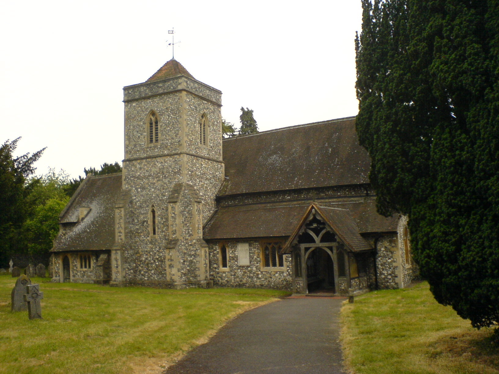
The village is characterized by its charming thatched cottages, traditional stone houses, and well-maintained gardens. Its historic buildings reflect the rich heritage of the area, with the St. Margaret's Church being a prominent feature. This Grade II listed church dates back to the 12th century and showcases stunning medieval architecture.

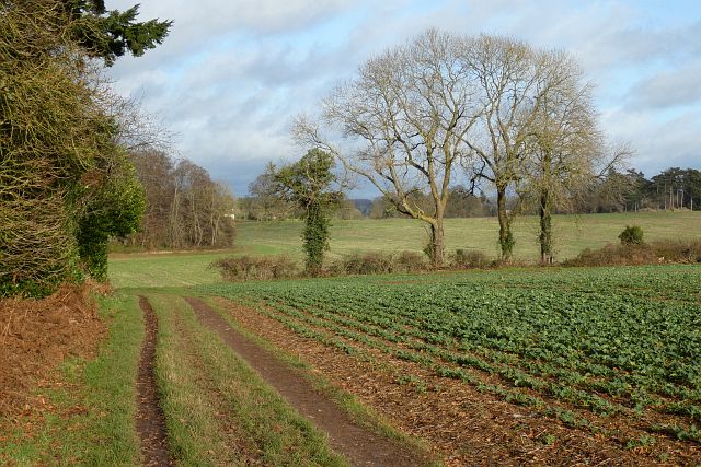
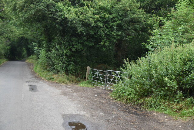
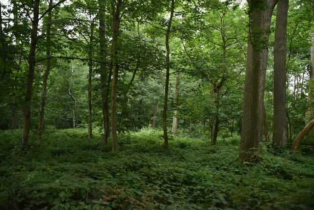
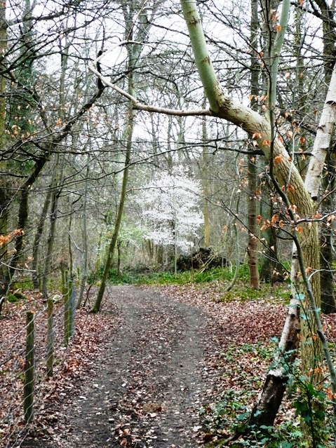
Harpsden is renowned for its tranquil atmosphere and natural beauty. It is surrounded by lush green fields, rolling hills, and woodlands, making it an ideal location for nature enthusiasts and walkers. The nearby Harpsden Woods, managed by the Woodland Trust, provide ample opportunities for exploring and enjoying the outdoors.

Despite its small size, the village is home to a thriving community. It has a primary school, village hall, and a pub called The Flower Pot, which serves as a social hub. The Flower Pot offers a warm and friendly atmosphere, where locals and visitors can enjoy a pint of real ale or indulge in hearty British cuisine.

Harpsden benefits from its proximity to Henley-on-Thames, a vibrant town known for its annual Royal Regatta and picturesque riverside setting. It provides residents with access to a wider range of amenities, including shops, restaurants, and leisure facilities.

In summary, Harpsden is a charming village in Oxfordshire that offers a peaceful countryside lifestyle, rich history, and natural beauty.

If you have any feedback on the listing, please let us know in the comments section below.

Harpsden Images

Images are sourced within 2km of 51.52075/-0.902403 or Grid Reference SU7680. Thanks to Geograph Open Source API. All images are credited.

Farmland, Shiplake The track here, at the edge of Lower Hailey Wood, is a permitted footpath.  A crop of oil-seed rape is to the right.
Farmland, Shiplake
The track here, at the edge of Lower Hailey Wood, is a permitted footpath. A crop of oil-seed rape is to the right.
Chiltern Way goes this way Created by the Chiltern Society as its Millennium Project, the Way originally took in all of the Chilterns from north to south across the Chilterns Area of Outstanding Natural Beauty, in a 125-miles circuit extending from Ewelme in the south west, Chorleywood in the south east and Sharpenhoe Clappers and Great Offley in the north east. It was based on an earlier unofficial route, the Chiltern Hundred.
The Way passes through some of the most attractive parts of the Chilterns, including the Bovingdon Plateau, the Chess valley, the Misbourne valley, Penn Country, the Hambleden valley, Stonor Park, Ewelme, Swyncombe Down, Bledlow Ridge, Hampden Country, Bulbourne valley and Dunstable Down.
The original 200km (125 miles) Way took in Hemel via Chalfont St Giles, the edge of Marlow, Hambleden, Bix Bottom, Ewelme, the Ridgeway, Stokenchurch, Great Hampden, Aldbury, the Dunstable Downs, Sharpenhoe Clappers and Harpenden.
Two extensions have been added in 2003: the southern adds a loop of 50km (35 miles) from Bix Bottom via Mapledurham on the Thames and the northern extension 44km (27 miles) from Sharpenhoe Clappers via the Icknield Way and the outskirts of Hitchin. A short cut from Bix Bottom creates a 16km (10 miles) loop via Ewelme.
Although officially starting at Hemel Hempstead Station, the walk can be started at many other places on the route. The Way also has links with other routes including Chiltern Heritage Trail, Ridgeway National Trail, Icknield Way Path, Oxfordshire, Swan's and South Bucks Ways and Grand Union Canal, Lea Valley and Chess Valley Walks.
Chiltern Way goes this way
Created by the Chiltern Society as its Millennium Project, the Way originally took in all of the Chilterns from north to south across the Chilterns Area of Outstanding Natural Beauty, in a 125-miles circuit extending from Ewelme in the south west, Chorleywood in the south east and Sharpenhoe Clappers and Great Offley in the north east. It was based on an earlier unofficial route, the Chiltern Hundred. The Way passes through some of the most attractive parts of the Chilterns, including the Bovingdon Plateau, the Chess valley, the Misbourne valley, Penn Country, the Hambleden valley, Stonor Park, Ewelme, Swyncombe Down, Bledlow Ridge, Hampden Country, Bulbourne valley and Dunstable Down. The original 200km (125 miles) Way took in Hemel via Chalfont St Giles, the edge of Marlow, Hambleden, Bix Bottom, Ewelme, the Ridgeway, Stokenchurch, Great Hampden, Aldbury, the Dunstable Downs, Sharpenhoe Clappers and Harpenden. Two extensions have been added in 2003: the southern adds a loop of 50km (35 miles) from Bix Bottom via Mapledurham on the Thames and the northern extension 44km (27 miles) from Sharpenhoe Clappers via the Icknield Way and the outskirts of Hitchin. A short cut from Bix Bottom creates a 16km (10 miles) loop via Ewelme. Although officially starting at Hemel Hempstead Station, the walk can be started at many other places on the route. The Way also has links with other routes including Chiltern Heritage Trail, Ridgeway National Trail, Icknield Way Path, Oxfordshire, Swan's and South Bucks Ways and Grand Union Canal, Lea Valley and Chess Valley Walks.
Harpsden Rd
Harpsden Rd
High Wood
High Wood
Harpsden Rd
Harpsden Rd
Harpsden Rd
Harpsden Rd
Bridleway, High Wood
Woodstock
Woodstock
Henley-on-Thames A section of the river frontage
Henley-on-Thames
A section of the river frontage
Henley on Thames Towpath View from towpath across to bridge
Henley on Thames Towpath
View from towpath across to bridge
The Drebbel A reproduction wooden submarine in the grounds of
the museum
The Drebbel
A reproduction wooden submarine in the grounds of the museum
Henley Town Hall
Henley Town Hall
Henley Bridge Looking across Henley Bridge, towards the Town Hall.
Henley Bridge
Looking across Henley Bridge, towards the Town Hall.
Town Hall, Henley Town Hall, Henley
Town Hall, Henley
Town Hall, Henley
Marsh Lock, Henley on Thames, Oxon Taken from the deck of a 'steamer' boat waiting to be let out of the lock.
Marsh Lock, Henley on Thames, Oxon
Taken from the deck of a 'steamer' boat waiting to be let out of the lock.
The White House, Lower Shiplake
Hunt's Green Looking southeast from the hamlet situated in a steep valley.
Hunt's Green
Looking southeast from the hamlet situated in a steep valley.
Henley Golf Club Looking down on Harpsden.
Henley Golf Club
Looking down on Harpsden.
Show me another place!

Harpsden is located at Grid Ref: SU7680 (Lat: 51.52075, Lng: -0.902403)

Administrative County: Oxfordshire

District: South Oxfordshire

Police Authority: Thames Valley

What 3 Words

///unearthly.sailed.issues. Near Henley-on-Thames, Oxfordshire

Nearby Locations

Harpsden Court Harpsden

Related Wikis

Harpsden

Harpsden is a rural and semi-rural village and civil parish immediately south of Henley-on-Thames in South Oxfordshire, Oxfordshire, England. Its scattered...

Harpsden Wood

Harpsden Wood is a 29.4-hectare (73-acre) biological Site of Special Scientific Interest south of Henley-on-Thames in Oxfordshire. It is owned by the Woodland...

Henley Town F.C.

Henley Town Football Club is a football club based in Henley-on-Thames in Oxfordshire, England. They are currently members of the Thames Valley Premier...
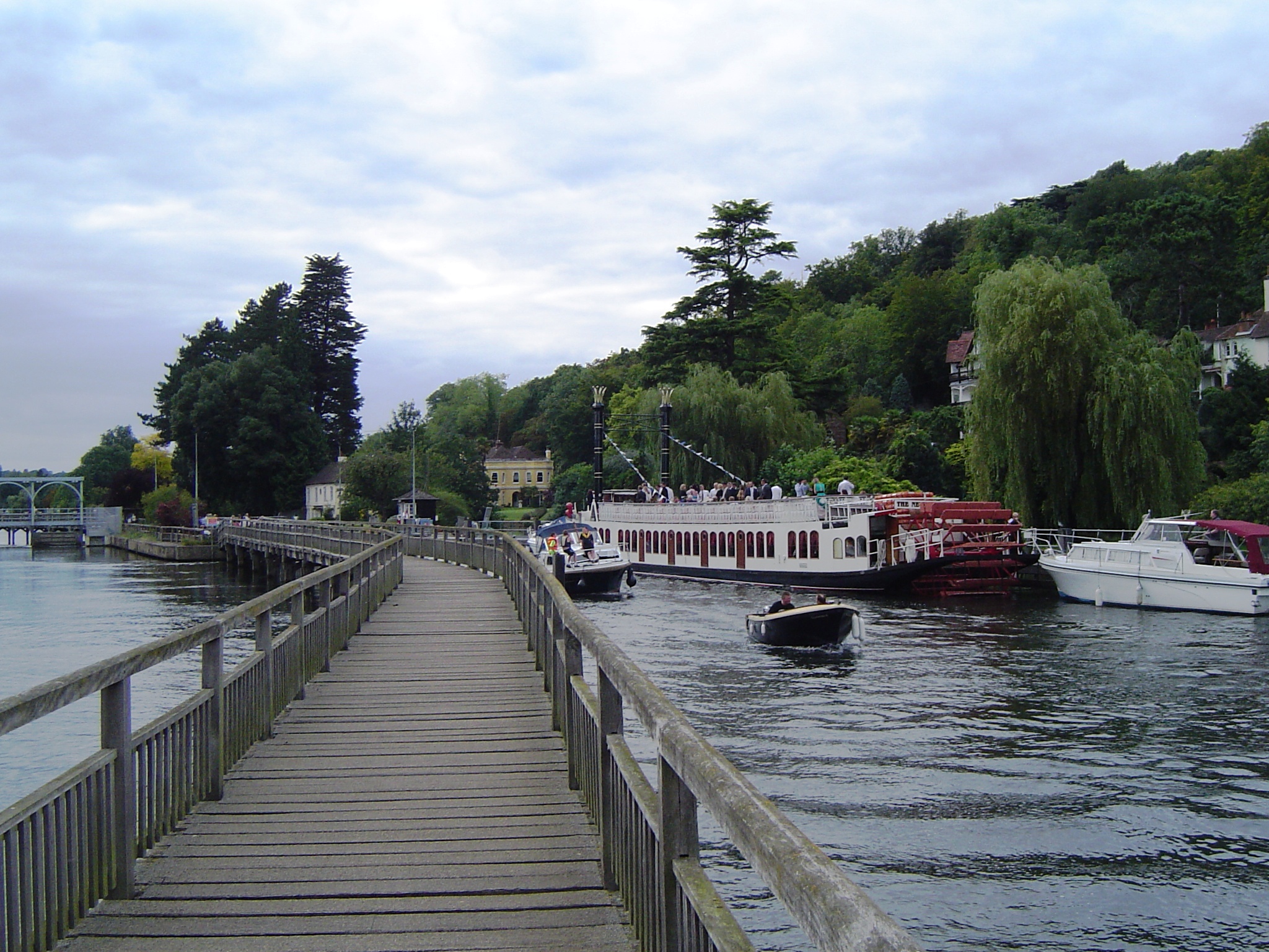
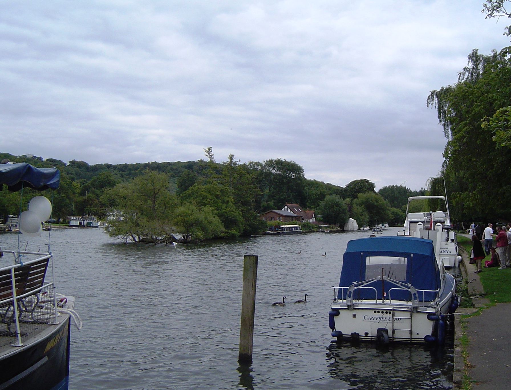
Marsh Lock

Marsh Lock is a lock and weir situated on the River Thames in England, about 1 mile upstream of Henley Bridge in Henley-on-Thames, Oxfordshire. The lock...

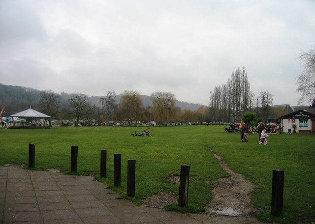
Mill Meadows, Henley-on-Thames

Mill Meadows is part of the flood plain of the River Thames at Henley-on-Thames, Oxfordshire, England. It is an area of natural beauty close to the town...

River and Rowing Museum

The River & Rowing Museum in Henley-on-Thames, Oxfordshire, England, is located on a site at Mill Meadows by the River Thames. It has three main themes...

Gillotts School

Gillotts School is a coeducational secondary school with academy status in Henley-on-Thames, Oxfordshire, England. The school is sited on a 33 acre verdant...

Rod Eyot

Rod Eyot or Rod Ait is an island in the River Thames in England near Henley-on-Thames on the reach above Hambledon Lock. It is close to Mill Meadows and...

Nearby Amenities

Located within 500m of 51.52075,-0.902403
Maxspeed: 30 mph
Traffic Sign: maxspeed
Lat/Long: 51.5215487/-0.9028137
Barrier: lych_gate
Foot: yes
Lat/Long: 51.5215653/-0.902994
Public Building
Harpsden Cricket Club
Sport: cricket
Lat/Long: 51.5220417/-0.9057659
Harpsden Park Airstrip
Aeroway: airstrip
Lat/Long: 51.5196266/-0.8970073
Natural: sinkhole
Lat/Long: 51.5180192/-0.905008
Direction: 165
Generator Method: photovoltaic
Generator Output Electricity: yes
Generator Solar Modules: 10
Generator Source: solar
Generator Type: solar_photovoltaic_panel
Location: roof
Power: generator
Lat/Long: 51.5244033/-0.900918
The data included in this document is from www.openstreetmap.org. The data is made available under ODbL.

Have you been to Harpsden?

Leave your review of Harpsden below (or comments, questions and feedback).