Cow Pasture

Downs, Moorland in Yorkshire Richmondshire

England

Cow Pasture

River Cover Ford This is the final ford at this stretch of the River Cover.
River Cover Ford Credit: John Walton

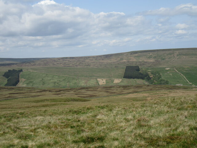
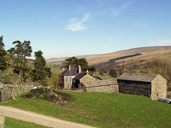
Cow Pasture is a picturesque and expansive area located in Yorkshire, England, renowned for its stunning natural beauty and diverse landscapes. Situated amidst the Yorkshire Downs and Moorland, it covers a vast expanse of rolling hills, verdant meadows, and grazing pastures, making it an idyllic haven for cows and other livestock.

The area is characterized by its rich and fertile soil, which provides ample grazing opportunities for cattle, resulting in an abundance of lush vegetation. Cow Pasture boasts a variety of grasses and wildflowers that not only serve as a food source for the cows but also add to the area's visual appeal, creating a tapestry of vibrant colors during the summer months.

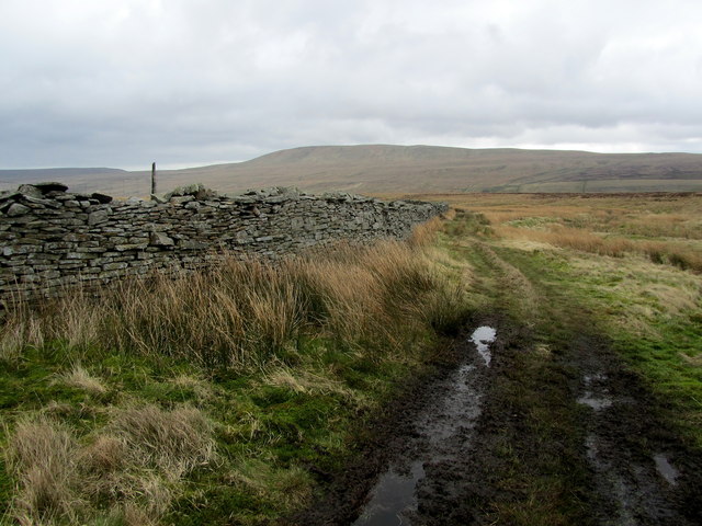
The Yorkshire Downs, with their gently sloping hills and panoramic views, provide a stunning backdrop to Cow Pasture. These hills are covered in a patchwork of heather, bracken, and grasses, creating a diverse and unique ecosystem. The moorland, on the other hand, offers a more rugged and wild environment, with its rocky outcrops, peat bogs, and heathland vegetation.

The area is also home to a variety of wildlife, including birds, small mammals, and insects. It is not uncommon to spot hares, rabbits, and foxes roaming the meadows, while overhead, birds of prey such as kestrels and buzzards can be seen circling the skies.

Cow Pasture, Yorkshire (Downs, Moorland), is a haven for nature lovers, offering breathtaking landscapes, diverse flora and fauna, and a serene atmosphere that allows visitors to connect with the beauty of the natural world.

If you have any feedback on the listing, please let us know in the comments section below.

Cow Pasture Images

Images are sourced within 2km of 54.206168/-1.9858147 or Grid Reference SE0178. Thanks to Geograph Open Source API. All images are credited.

River Cover Ford This is the final ford at this stretch of the River Cover.
River Cover Ford
This is the final ford at this stretch of the River Cover.
Heading down Coverdale The minor road from Kettlewell drops into Coverdale where mist lingers over the fellside and thick fog lurks a little further down valley.
Heading down Coverdale
The minor road from Kettlewell drops into Coverdale where mist lingers over the fellside and thick fog lurks a little further down valley.
Sun and mist in Coverdale A similar view to one taken almost 3 years previously, but on this occasion the late November sun contrasted with lengthening shadows and mist that was creeping over the fell tops from Nidderdale.
Sun and mist in Coverdale
A similar view to one taken almost 3 years previously, but on this occasion the late November sun contrasted with lengthening shadows and mist that was creeping over the fell tops from Nidderdale.
Mist creeping into the dale The view up Coverdale towards Woodale on a late autumn afternoon when mist was creeping in over the felltops to eventually fill the valley.
Mist creeping into the dale
The view up Coverdale towards Woodale on a late autumn afternoon when mist was creeping in over the felltops to eventually fill the valley.
On Little Whernside Looking NW.
On Little Whernside
Looking NW.
Slape Gill Seen from Cam Gill Road.
Slape Gill
Seen from Cam Gill Road.
Cover Bridge There are two stone bridges bearing this name, this one at the head of Coverdale and another at the foot where the A6108 crosses the river by the Cover Bridge Inn.
Cover Bridge
There are two stone bridges bearing this name, this one at the head of Coverdale and another at the foot where the A6108 crosses the river by the Cover Bridge Inn.
Lodge Dale Lathe Stone barn to be found on the narrow road between the tiny communities of Woodale and Braidley, in the secluded valley of Coverdale.
Lodge Dale Lathe
Stone barn to be found on the narrow road between the tiny communities of Woodale and Braidley, in the secluded valley of Coverdale.
Pastures near Woodale Following a footpath that runs down from Woodale, to loosely follow the north bank of the River Cover.
Pastures near Woodale
Following a footpath that runs down from Woodale, to loosely follow the north bank of the River Cover.
Stone Barn in Coverdale A faint grass footpath leads passed this stone barn in the secluded valley of Coverdale.
Stone Barn in Coverdale
A faint grass footpath leads passed this stone barn in the secluded valley of Coverdale.
Gate on Cow Side Retrospective view over Coverdale, while ascending Little Whernside from the north - a feat not recommended due to the thickness of vegetation that saps the strength from all but the fittest legs.
Gate on Cow Side
Retrospective view over Coverdale, while ascending Little Whernside from the north - a feat not recommended due to the thickness of vegetation that saps the strength from all but the fittest legs.
View towards High Pasture Fellside moorland dominates, looking down towards Coverdale.
View towards High Pasture
Fellside moorland dominates, looking down towards Coverdale.
Cam Gill Road above Coverdale looking North East Section of the moorland road running from Kettlewell down Coverdale towards Middleham.
Cam Gill Road above Coverdale looking North East
Section of the moorland road running from Kettlewell down Coverdale towards Middleham.
Cam Gill Road above Coverdale looking South West Section of road above the infant River Cover between Kettlewell and Middleham
Cam Gill Road above Coverdale looking South West
Section of road above the infant River Cover between Kettlewell and Middleham
Track by West Gill Track sandwiched between a dry stone wall and West Gill below the south eastern base of Brown Haw.
Track by West Gill
Track sandwiched between a dry stone wall and West Gill below the south eastern base of Brown Haw.
Track above Downs Gill On the other side of the wall from a plantation strip on Cover Head Bents.
Track above Downs Gill
On the other side of the wall from a plantation strip on Cover Head Bents.
Grouse Butt below the Southern Flanks of Brown Haw One of a string of grouse butts leading up to Brown Haw.
Grouse Butt below the Southern Flanks of Brown Haw
One of a string of grouse butts leading up to Brown Haw.
Plantation at Cover Head Top end of a strip of plantation conifers that drop down into the valley created by the infant River Cover.
Plantation at Cover Head
Top end of a strip of plantation conifers that drop down into the valley created by the infant River Cover.
Show me another place!

Cow Pasture is located at Grid Ref: SE0178 (Lat: 54.206168, Lng: -1.9858147)

Division: North Riding

Administrative County: North Yorkshire

District: Richmondshire

Police Authority: North Yorkshire

What 3 Words

///technical.darkest.charted. Near Grassington, North Yorkshire

Nearby Locations

Cow Pasture

Related Wikis

Woodale

Woodale is a hamlet in Coverdale in the Yorkshire Dales in England. It lies in the civil parish of Carlton Highdale in the Richmondshire district of North...

Carlton Highdale

Carlton Highdale is a civil parish in Coverdale, North Yorkshire, England. According to the 2001 census it had a population of 95. The parish covers the...

Little Whernside

Little Whernside is a hill in the Yorkshire Dales, North Yorkshire, England, 2.82 miles (4.54 km) north east of Great Whernside. It is on the boundary...

Braidley

Braidley is a hamlet in Coverdale in the Yorkshire Dales, England. It lies in the civil parish of Carlton Highdale in the Richmondshire district of North...

Nearby Amenities

Located within 500m of 54.206168,-1.9858147
lime kiln
Historic: archaeological_site
Mineral: limestone
Output: lime
Source: OS 1852
Lat/Long: 54.204559/-1.9923
lime kiln
Historic: archaeological_site
Mineral: lime
Source: OS 1852
Lat/Long: 54.2075584/-1.9869276
Power: pole
Lat/Long: 54.2039124/-1.9850279
Power: pole
Lat/Long: 54.2040939/-1.9841747
Power: pole
Lat/Long: 54.2043967/-1.9828927
Power: pole
Lat/Long: 54.2047463/-1.9814008
Power: pole
Lat/Long: 54.2045982/-1.9797971
The data included in this document is from www.openstreetmap.org. The data is made available under ODbL.

Have you been to Cow Pasture?

Leave your review of Cow Pasture below (or comments, questions and feedback).