Lea Green
Downs, Moorland in Yorkshire Craven
England
Lea Green
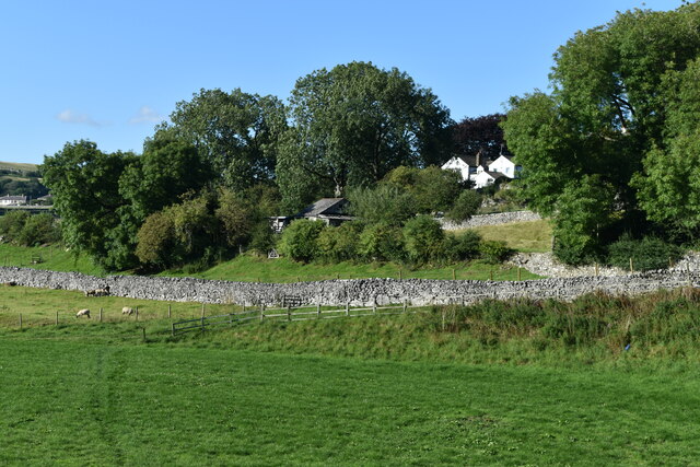
Lea Green is a small village located in the county of Yorkshire, in the northern part of England. Situated in the heart of the Yorkshire Dales, it is surrounded by stunning natural landscapes, including rolling hills, downs, and vast stretches of moorland. The village itself is characterized by its quaint charm and traditional stone-built houses, which are a testament to its rich history.
The Yorkshire Dales National Park, of which Lea Green is a part, offers visitors a multitude of opportunities for outdoor activities and exploration. Hiking and walking trails crisscross the area, providing breathtaking views of the surrounding countryside. The moorland in particular is a haven for nature enthusiasts, as it is home to a diverse range of wildlife, including birds of prey, sheep, and various plant species.
Lea Green is also known for its vibrant community spirit, with a range of local events and activities taking place throughout the year. The village has a small but welcoming population, and its residents take great pride in preserving its heritage and traditions. The local pub is a popular gathering spot, where locals and visitors alike can enjoy a pint of the region's famous ale and engage in friendly conversation.
In summary, Lea Green, Yorkshire, is a picturesque village nestled in the Yorkshire Dales, offering stunning natural landscapes, a rich history, and a tight-knit community. It is a perfect destination for those seeking a peaceful retreat amidst the beauty of the English countryside.
If you have any feedback on the listing, please let us know in the comments section below.
Lea Green Images
Images are sourced within 2km of 54.088325/-2.0060643 or Grid Reference SD9965. Thanks to Geograph Open Source API. All images are credited.
![A walk from Grassington to Kelber and return [58] Two footpaths cross at this point. The paths lead to Scot Gate Lane, Conistone, Bare House and Grassington.
After leaving the town, the walk crosses Grassington Moor via Bare House to Bycliffe Road. The road is followed past Kelber Gate towards Scot Gate Lane. The route then follows the long distance Dales Way back to Grassington. About 6½ miles.](https://s1.geograph.org.uk/geophotos/07/03/78/7037889_a8e1b32e.jpg)
![A walk from Grassington to Kelber and return [61] Two footpaths cross at this point. The paths lead to Scot Gate Lane, Conistone, Bare House and Grassington. This is the path to Bare House.
After leaving the town, the walk crosses Grassington Moor via Bare House to Bycliffe Road. The road is followed past Kelber Gate towards Scot Gate Lane. The route then follows the long distance Dales Way back to Grassington. About 6½ miles.](https://s2.geograph.org.uk/geophotos/07/03/78/7037894_f8fc142c.jpg)
![A walk from Grassington to Kelber and return [62] Two footpaths cross at this point. The paths lead to Scot Gate Lane, Conistone, Bare House and Grassington. This is the path, part of the long distance Dales Way, towards Grassington.
After leaving the town, the walk crosses Grassington Moor via Bare House to Bycliffe Road. The road is followed past Kelber Gate towards Scot Gate Lane. The route then follows the long distance Dales Way back to Grassington. About 6½ miles.](https://s3.geograph.org.uk/geophotos/07/03/78/7037895_d67962c5.jpg)
![A walk from Grassington to Kelber and return [63] At this high gated stile, a red navigation marker has been added.
After leaving the town, the walk crosses Grassington Moor via Bare House to Bycliffe Road. The road is followed past Kelber Gate towards Scot Gate Lane. The route then follows the long distance Dales Way back to Grassington. About 6½ miles.](https://s0.geograph.org.uk/geophotos/07/03/78/7037896_93088696.jpg)
![A walk from Grassington to Kelber and return [64] A restored lime kiln alongside the path. See also <a href="https://www.geograph.org.uk/photo/7037898">SD9967 : A walk from Grassington to Kelber and return [65]</a>.
After leaving the town, the walk crosses Grassington Moor via Bare House to Bycliffe Road. The road is followed past Kelber Gate towards Scot Gate Lane. The route then follows the long distance Dales Way back to Grassington. About 6½ miles.](https://s1.geograph.org.uk/geophotos/07/03/78/7037897_a554e4c3.jpg)
![A walk from Grassington to Kelber and return [65] A plaque near the restored lime kiln seen at <a href="https://www.geograph.org.uk/photo/7037897">SD9967 : A walk from Grassington to Kelber and return [64]</a>.
After leaving the town, the walk crosses Grassington Moor via Bare House to Bycliffe Road. The road is followed past Kelber Gate towards Scot Gate Lane. The route then follows the long distance Dales Way back to Grassington. About 6½ miles.](https://s2.geograph.org.uk/geophotos/07/03/78/7037898_1236a02c.jpg)
![A walk from Grassington to Kelber and return [66] The path towards Grassington continues between rock outcrops.
After leaving the town, the walk crosses Grassington Moor via Bare House to Bycliffe Road. The road is followed past Kelber Gate towards Scot Gate Lane. The route then follows the long distance Dales Way back to Grassington. About 6½ miles.](https://s3.geograph.org.uk/geophotos/07/03/78/7037899_94978fbb.jpg)
![A walk from Grassington to Kelber and return [67] Another high gated stile with a red navigation marker.
After leaving the town, the walk crosses Grassington Moor via Bare House to Bycliffe Road. The road is followed past Kelber Gate towards Scot Gate Lane. The route then follows the long distance Dales Way back to Grassington. About 6½ miles.](https://s0.geograph.org.uk/geophotos/07/03/79/7037900_4abf18eb.jpg)
![A walk from Grassington to Kelber and return [68] The path, part of the long distance Dales Way, continues towards Grassington through an area of old settlements with hut circles.
After leaving the town, the walk crosses Grassington Moor via Bare House to Bycliffe Road. The road is followed past Kelber Gate towards Scot Gate Lane. The route then follows the long distance Dales Way back to Grassington. About 6½ miles.](https://s1.geograph.org.uk/geophotos/07/03/79/7037901_9b1e422f.jpg)
![A walk from Grassington to Kelber and return [69] The path to Grassington passes through this rocky area which was an old settlement.
After leaving the town, the walk crosses Grassington Moor via Bare House to Bycliffe Road. The road is followed past Kelber Gate towards Scot Gate Lane. The route then follows the long distance Dales Way back to Grassington. About 6½ miles.](https://s2.geograph.org.uk/geophotos/07/03/79/7037902_3c00fd0b.jpg)
![A walk from Grassington to Kelber and return [70] The path continues towards Grassington.
After leaving the town, the walk crosses Grassington Moor via Bare House to Bycliffe Road. The road is followed past Kelber Gate towards Scot Gate Lane. The route then follows the long distance Dales Way back to Grassington. About 6½ miles.](https://s3.geograph.org.uk/geophotos/07/03/79/7037903_9f533b6c.jpg)
![A walk from Grassington to Kelber and return [71] The path, part of the long distance Dales Way, continues towards Grassington, now seen in the distance.
After leaving the town, the walk crosses Grassington Moor via Bare House to Bycliffe Road. The road is followed past Kelber Gate towards Scot Gate Lane. The route then follows the long distance Dales Way back to Grassington. About 6½ miles.](https://s0.geograph.org.uk/geophotos/07/03/79/7037904_57235924.jpg)
Lea Green is located at Grid Ref: SD9965 (Lat: 54.088325, Lng: -2.0060643)
Division: West Riding
Administrative County: North Yorkshire
District: Craven
Police Authority: North Yorkshire
What 3 Words
///jugs.gurgling.shadowing. Near Grassington, North Yorkshire
Nearby Locations
Related Wikis
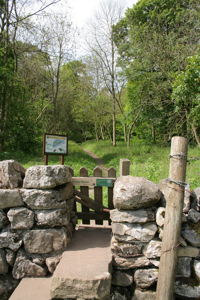
Grass Wood, Wharfedale
Grass Wood is an ancient woodland of 88 hectares (220 acres) in Wharfedale, North Yorkshire, England, that has an exceptional ground flora of woodland...

Upper Wharfedale School
Upper Wharfedale School is a coeducational secondary school located in Threshfield, North Yorkshire, England. The school is named after Wharfedale, one...

Grassington
Grassington is a village and civil parish in North Yorkshire, England. The population of the parish at the 2011 Census was 1,126. Historically part of...
Grassington & Threshfield railway station
Grassington & Threshfield railway station (or Threshfield station) was a railway station that served the town of Grassington and village of Threshfield...
Threshfield
Threshfield is a small village and civil parish in the Craven district of North Yorkshire, England with a population of 980 residents, reducing to 968...

Conistone
Conistone is a small village in the Craven district of North Yorkshire, England. It lies 3 miles (5 km) north of Grassington, 3 miles (5 km) south of Kettlewell...

Conistone with Kilnsey
Conistone with Kilnsey is a civil parish in Wharfedale in the district of Craven, North Yorkshire, England. It contains the villages of Kilnsey and Conistone...

St Mary's Church, Conistone
St Mary's Church is in the village of Conistone, North Yorkshire, England. It is an active Anglican parish church in the deanery of Skipton, the archdeaconry...
Nearby Amenities
Located within 500m of 54.088325,-2.0060643Have you been to Lea Green?
Leave your review of Lea Green below (or comments, questions and feedback).