Cracoe Fell

Downs, Moorland in Yorkshire Craven

England

Cracoe Fell

The Devonshire Arms - Cracoe
The Devonshire Arms - Cracoe Credit: Anthony Parkes

Cracoe Fell is a prominent hill located in the Yorkshire Dales National Park, North Yorkshire, England. It is part of the larger Craven district and sits within the Cracoe and Rylstone civil parish. Rising to an elevation of 507 meters (1,663 feet), Cracoe Fell offers magnificent views of the surrounding countryside.

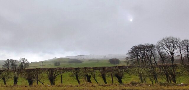
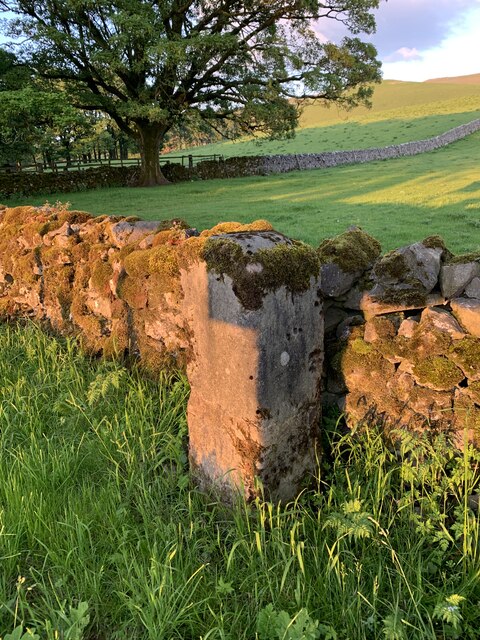
The landscape of Cracoe Fell is characterized by its mixture of rolling downs and expansive moorland. The upper reaches of the hill are covered in heather and grasses, creating a distinct purple and green hue during the summer months. The lower slopes are adorned with scattered limestone outcrops, adding a dramatic touch to the scenery.

The hill is a popular destination for hikers and walkers, who are drawn to its tranquil and unspoiled beauty. Several footpaths and trails crisscross the area, providing opportunities for outdoor enthusiasts to explore the diverse flora and fauna that call Cracoe Fell home. Wildlife such as curlews, lapwings, and red grouse can often be spotted in the region.

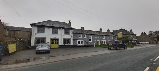
Cracoe Fell is also steeped in history, with evidence of prehistoric settlements and ancient burial mounds dotting its landscape. The nearby village of Cracoe offers a glimpse into the traditional rural life of Yorkshire, with charming stone houses and a rich cultural heritage.

Overall, Cracoe Fell is a stunning natural landmark in Yorkshire, offering visitors a chance to immerse themselves in the beauty of the Yorkshire Dales and experience the rich history and diverse wildlife that the area has to offer.

If you have any feedback on the listing, please let us know in the comments section below.

Cracoe Fell Images

Images are sourced within 2km of 54.030876/-2.0137194 or Grid Reference SD9959. Thanks to Geograph Open Source API. All images are credited.

The Devonshire Arms - Cracoe
Fields at Cracoe Green
Old Milestone by B6265, North of Cracoe at Junction with Thorpe Lane The milestone is located on the verge behind the chevron sign on the south east side of the road.  Parish of Cracoe (Craven District). Carved stone post, erected in the 18th Century. Broken across 50cm from base, now cemented together; was to north of lane, demolished, repaired twice, so resited on south east side. An earlier photograph can be found here: <a title="https://www.geograph.org.uk/photo/6738011" href="https://www.geograph.org.uk/photo/6738011">Link</a> 

Inscription reads:-  
To / Grassingt(on) / (3) / K(ettle)well / To / Skipton / 6 miles 

Milestone Society National ID: YN_SKKT06
Old Milestone by B6265, North of Cracoe at Junction with Thorpe Lane
The milestone is located on the verge behind the chevron sign on the south east side of the road.  Parish of Cracoe (Craven District). Carved stone post, erected in the 18th Century. Broken across 50cm from base, now cemented together; was to north of lane, demolished, repaired twice, so resited on south east side. An earlier photograph can be found here: Link  Inscription reads:- To / Grassingt(on) / (3) / K(ettle)well / To / Skipton / 6 miles Milestone Society National ID: YN_SKKT06
Trig point at summit of Thorpe Fell Flat slabs of rock at the hill summit with a damaged trig point occupying the highest of them.
The view is to the north where Buckden Pike and Great Whernside lie, one either side of the pillar.
Trig point at summit of Thorpe Fell
Flat slabs of rock at the hill summit with a damaged trig point occupying the highest of them. The view is to the north where Buckden Pike and Great Whernside lie, one either side of the pillar.
Field on south side of B6265 The sunlit field is at the eastern end of Cracoe just as the B6265 enters.
The slope beginning at the field rises continually to the shadowed upper slopes and summit of Cracoe Fell which is topped by an obelisk, the village war memorial.
Field on south side of B6265
The sunlit field is at the eastern end of Cracoe just as the B6265 enters. The slope beginning at the field rises continually to the shadowed upper slopes and summit of Cracoe Fell which is topped by an obelisk, the village war memorial.
Access road for Langerton Farm The farm road leaves Thorpe Lane, a minor road connecting the villages at Thorpe and Cracoe.
Access road for Langerton Farm
The farm road leaves Thorpe Lane, a minor road connecting the villages at Thorpe and Cracoe.
Path approaching stile in wall The path leaves the minor road at Far Langerton to approach the 'colour-coded' steps, post and gate which indicate the continuing way.
Elbolton Hill is in the distance.
Path approaching stile in wall
The path leaves the minor road at Far Langerton to approach the 'colour-coded' steps, post and gate which indicate the continuing way. Elbolton Hill is in the distance.
The Devonshire Arms Country Inn - Cracoe
The Devonshire Arms, Cracoe
A wall and tree-lined Thorpe Lane approaching Threapland Looking north-eastward.
A wall and tree-lined Thorpe Lane approaching Threapland
Looking north-eastward.
A wall -lined Thorpe Lane between Threapland and Langerton Looking eastward.
A wall -lined Thorpe Lane between Threapland and Langerton
Looking eastward.
Thorpe Lane at Far Langerton Looking north-eastward.
Thorpe Lane at Far Langerton
Looking north-eastward.
Road (B6265) beside The Devonshire Arms, Cracoe Looking north-eastward.
Road (B6265) beside The Devonshire Arms, Cracoe
Looking north-eastward.
Trig Point on Thorpe Fell Top near Grassington This trig point is looking past it's best.
Trig Point on Thorpe Fell Top near Grassington
This trig point is looking past it's best.
Thorpe Fell Top Highest point of the moor, but the Cracoe cross runs it close. Trig pillar built on solid gritstone.
Thorpe Fell Top
Highest point of the moor, but the Cracoe cross runs it close. Trig pillar built on solid gritstone.
Burnsall & Thorpe Fell Near the edge of Barden Moor, overlooking Wharfedale. Grimwith Reservoir can just be seen in the distance to the right of centre.
Burnsall & Thorpe Fell
Near the edge of Barden Moor, overlooking Wharfedale. Grimwith Reservoir can just be seen in the distance to the right of centre.
Bell pit The remains of coal mining on Thorpe Fell.
Bell pit
The remains of coal mining on Thorpe Fell.
Grey Mare Stone, Yethersgill A large whiteish boulder which marks the point where the boundaries of Rylstone, Cracoe, Barden and Embsay meet. There are several carvings for each pair of parishes. The photo shows the Cracor/Rylstone boundary.
Grey Mare Stone, Yethersgill
A large whiteish boulder which marks the point where the boundaries of Rylstone, Cracoe, Barden and Embsay meet. There are several carvings for each pair of parishes. The photo shows the Cracor/Rylstone boundary.
Show me another place!

Cracoe Fell is located at Grid Ref: SD9959 (Lat: 54.030876, Lng: -2.0137194)

Division: West Riding

Administrative County: North Yorkshire

District: Craven

Police Authority: North Yorkshire

What 3 Words

///monopoly.scoop.intervals. Near Grassington, North Yorkshire

Nearby Locations

Cracoe Fell In Fell

Related Wikis

Thorpe Fell Top

Thorpe Fell Top is the top of the hill of Burnsall and Thorpe Fell in the Yorkshire Dales, itself forming part of a larger wedge of ground between Wharfedale...

St Peter's Church, Rylstone

St Peter's Church is in the village of Rylstone, North Yorkshire, England. It is an active Anglican parish church in the deanery of Skipton, the archdeaconry...

Rylstone

Rylstone is a village and civil parish in the former Craven district of North Yorkshire, England. It is situated very near to Cracoe and about 6 miles...

Swinden Quarry

Swinden Quarry is 0.62 miles (1 km) north of the village of Cracoe, and 1.9 miles (3 km) south-west of Grassington in North Yorkshire, England. It is owned...

Nearby Amenities

Located within 500m of 54.030876,-2.0137194
Cracoe Fell
Natural: fell
Source: NPE
Lat/Long: 54.0277327/-2.0170763
In Fell
Natural: fell
Source: NPE
Lat/Long: 54.0326228/-2.0138147
Cracoe Fell
Place: locality
Source: OS 1:25k
Lat/Long: 54.0292918/-2.0109782
Three Thorn Well
Natural: spring
Source: OS Yorkshire CLI.NW, publ. 1910
Lat/Long: 54.0336415/-2.0107805
Abraham's Hill
Place: locality
Source: OS Yorkshire CLI.NW, publ. 1910
Lat/Long: 54.0321538/-2.011082
The data included in this document is from www.openstreetmap.org. The data is made available under ODbL.

Have you been to Cracoe Fell?

Leave your review of Cracoe Fell below (or comments, questions and feedback).