Shepherd's Lodge Rough

Downs, Moorland in Yorkshire

England

Shepherd's Lodge Rough

Abel Cross A pair of wayside marker stones on the slopes above Crimsworth Dean
Abel Cross Credit: Kevin Waterhouse

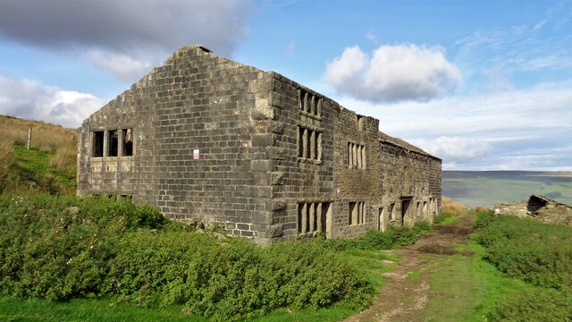
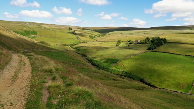
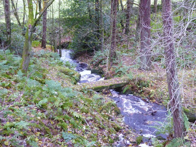
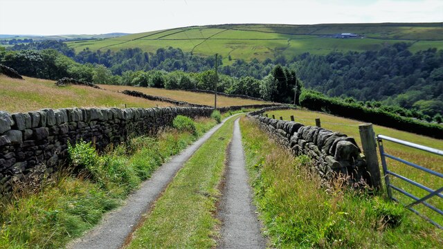
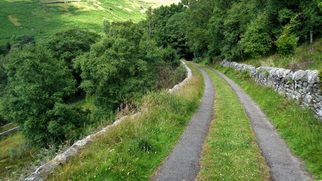
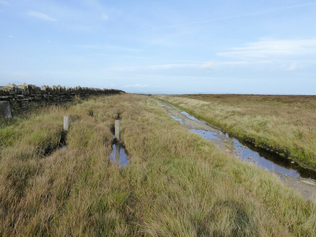
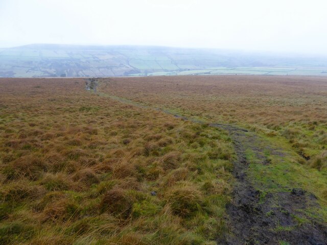
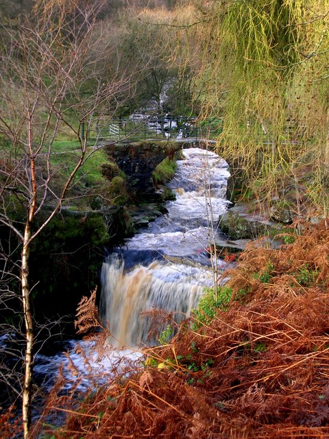
Shepherd's Lodge Rough is a picturesque area located in the breathtaking countryside of Yorkshire, England. Nestled amidst the Yorkshire Downs and Moorland, this enchanting landscape offers visitors a glimpse into the region's natural beauty and tranquility.

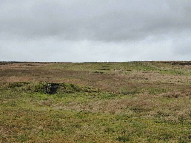
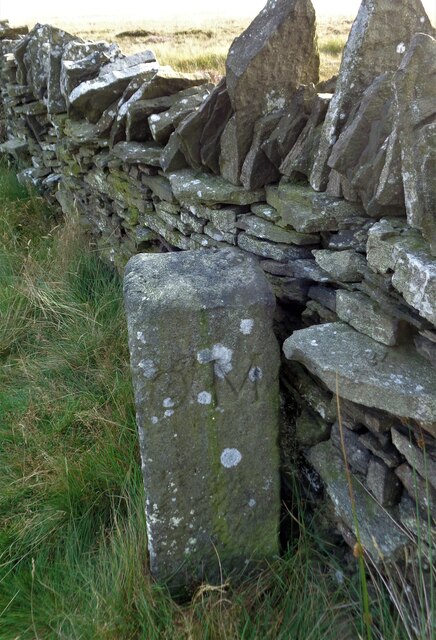
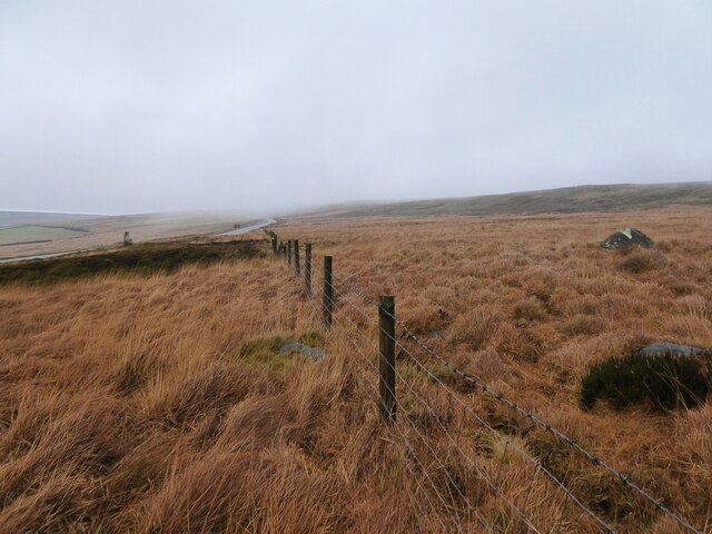
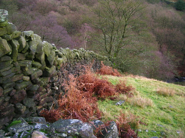
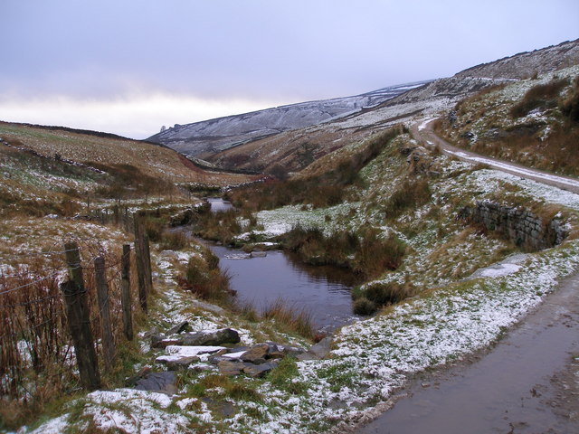
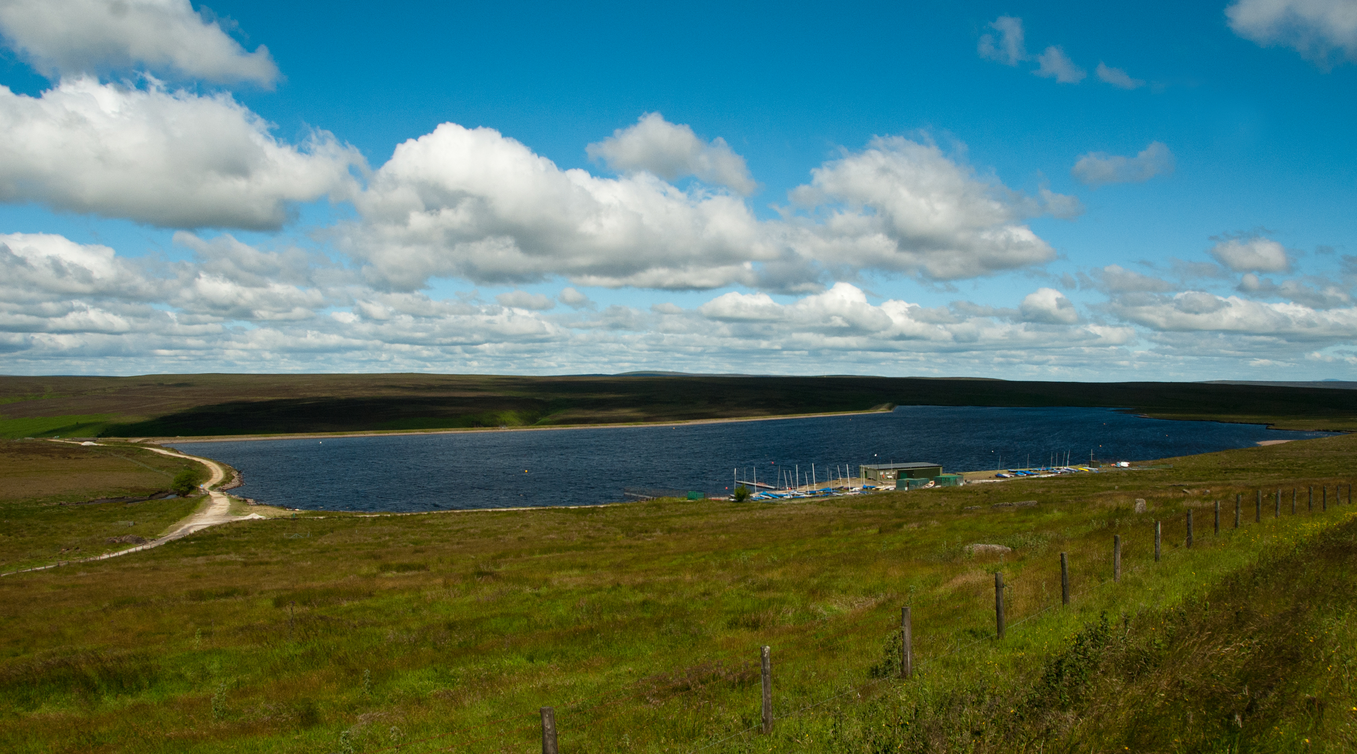
The area is characterized by rolling hills, vast open spaces, and lush greenery, creating a serene and idyllic atmosphere. Shepherd's Lodge Rough is known for its rugged terrain, dotted with heather-covered moorlands and scattered rocky outcrops, which add a touch of dramatic beauty to the landscape.

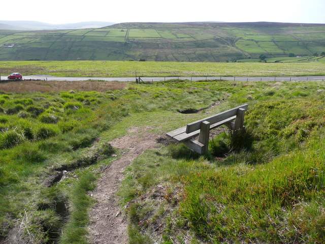
Visitors to Shepherd's Lodge Rough can enjoy a variety of outdoor activities, including hiking, cycling, and birdwatching. The extensive network of walking trails allows nature enthusiasts to explore the area's diverse flora and fauna, including rare species such as curlews and red grouse. The tranquil moorlands also provide an ideal habitat for a variety of wildlife, including deer, rabbits, and foxes.

The area's charm lies in its simplicity and unspoiled nature. It offers a peaceful retreat from the hustle and bustle of city life, inviting visitors to relax and unwind in the midst of stunning natural surroundings. Whether it's admiring the panoramic views from the hilltops or wandering through the heather-clad moors, Shepherd's Lodge Rough offers a truly immersive experience in the beauty of Yorkshire's countryside.

If you have any feedback on the listing, please let us know in the comments section below.

Shepherd's Lodge Rough Images

Images are sourced within 2km of 53.788332/-2.0154145 or Grid Reference SD9932. Thanks to Geograph Open Source API. All images are credited.

Abel Cross A pair of wayside marker stones on the slopes above Crimsworth Dean
Abel Cross
A pair of wayside marker stones on the slopes above Crimsworth Dean
Helliwell Wood Farmhouse In Crimsworth Dean
Helliwell Wood Farmhouse
In Crimsworth Dean
Barker Cote Farmhouse Converted to residential
Barker Cote Farmhouse
Converted to residential
Nook Farmhouse Named Nook on modern OS maps but originally Upper Sunny Bank Farmhouse with a lower Sunny Bank nearby
Nook Farmhouse
Named Nook on modern OS maps but originally Upper Sunny Bank Farmhouse with a lower Sunny Bank nearby
Head of Crimsworth Dean The track is descending to Grain Water Bridge
Head of Crimsworth Dean
The track is descending to Grain Water Bridge
Grouse butts on Hare Edge A sign in the lowest butt names this range as Bigland Way. These butts will be serviced from the small hamlet of Walshaw a short distance south.
Grouse butts on Hare Edge
A sign in the lowest butt names this range as Bigland Way. These butts will be serviced from the small hamlet of Walshaw a short distance south.
Outbuildings at Walshaw These appear to be dog kennels with four railed yards in front of small rooms. Walshaw is a centre for grouse shooting and perhaps these outbuildings were in connection with that sport rather than hunting.
Outbuildings at Walshaw
These appear to be dog kennels with four railed yards in front of small rooms. Walshaw is a centre for grouse shooting and perhaps these outbuildings were in connection with that sport rather than hunting.
Clam bridge in Rowshaw Clough This appears to be on an old Victorian track that led to Horseshoe Cascade in Rowshaw Clough which was a popular attraction. The paths if they still exist are now in private woodland.
Clam bridge in Rowshaw Clough
This appears to be on an old Victorian track that led to Horseshoe Cascade in Rowshaw Clough which was a popular attraction. The paths if they still exist are now in private woodland.
Small Shaw Lane Descending into Crimsworth Dean and approaching the first of two hairpin bends to reach the valley bottom
Small Shaw Lane
Descending into Crimsworth Dean and approaching the first of two hairpin bends to reach the valley bottom
Small Shaw Lane Descending into Crimsworth Dean and approaching the second of two hairpin bends to reach the valley bottom
Small Shaw Lane
Descending into Crimsworth Dean and approaching the second of two hairpin bends to reach the valley bottom
Stone Heap Stoop At the top of Stairs Lane, a boundary stone
Stone Heap Stoop
At the top of Stairs Lane, a boundary stone
Stairs Lane Passing the Stone Heap Stoop at Top of Stairs
Stairs Lane
Passing the Stone Heap Stoop at Top of Stairs
Limers Gate The bridleway descending off Naze Hill towards the A6033 Hebden Bridge Road
Limers Gate
The bridleway descending off Naze Hill towards the A6033 Hebden Bridge Road
Robin Delph Flat Rough moorland rising up to Clattering Edge from a disused quarry. There is a gate behind the camera through the fence line in this open access land.
Robin Delph Flat
Rough moorland rising up to Clattering Edge from a disused quarry. There is a gate behind the camera through the fence line in this open access land.
Seat on Limers Gate Overlooking the junction with the A6033 and the Crimsworth Dean valley.
Seat on Limers Gate
Overlooking the junction with the A6033 and the Crimsworth Dean valley.
Waterfall and bridge at Lumb Hole
Drystone wall in Crimsworth Dean
Crimsworth Dean
Crimsworth Dean
Show me another place!

Shepherd's Lodge Rough is located at Grid Ref: SD9932 (Lat: 53.788332, Lng: -2.0154145)

Division: West Riding

Unitary Authority: Calderdale

Police Authority: West Yorkshire

What 3 Words

///digested.slimmer.floating. Near Oxenhope, West Yorkshire

Related Wikis

Walshaw Dean Reservoirs

Walshaw Dean Reservoirs are three reservoirs situated above Hebden Bridge, West Yorkshire, England. They are between Hebden Bridge and Top Withins, a ruined...

Top Withens

Top Withens (SD981353) (also known as Top Withins) is a ruined farmhouse near Haworth, West Yorkshire, England, which is said to have been the inspiration...

Blake Dean Railway

The Blake Dean Railway was an approximately 5.5 miles (9 km) long 3 ft (914 mm) gauge narrow gauge railway on the edge of Hardcastle Crags Valley in West...

Hardcastle Crags

Hardcastle Crags is a wooded Pennine valley in West Yorkshire, England, owned by the National Trust. Historically part of the West Riding of Yorkshire...

Wainsgate Baptist Church

Wainsgate Baptist Church is a redundant chapel standing in an elevated position above the town of Hebden Bridge, West Yorkshire, England (grid reference...

Warley Moor Reservoir

Warley Moor Reservoir, also known as Fly Flatts Reservoir, is a drinking water reservoir in West Yorkshire, England, owned and operated by Yorkshire Water...

Old Town, West Yorkshire

Old Town is a village in Calderdale, West Yorkshire, England. It is situated on a hilltop above Hebden Bridge and across the Hebden valley from Heptonstall...

Heptonstall

Heptonstall is a small village and civil parish within the Calderdale borough of West Yorkshire, England, historically part of the West Riding of Yorkshire...

Nearby Amenities

Located within 500m of 53.788332,-2.0154145
Power: pole
Lat/Long: 53.7852569/-2.0102738
Power: pole
Lat/Long: 53.7859391/-2.0100685
Power: pole
Lat/Long: 53.7864399/-2.0099282
Power: pole
Lat/Long: 53.7870831/-2.0097529
Power: pole
Lat/Long: 53.7877169/-2.0095703
Power: pole
Lat/Long: 53.7885948/-2.009235
Power: pole
Lat/Long: 53.7889798/-2.0089029
Power: pole
Lat/Long: 53.7894539/-2.0085149
Parking
Lat/Long: 53.7879994/-2.0082693
The data included in this document is from www.openstreetmap.org. The data is made available under ODbL.

Have you been to Shepherd's Lodge Rough?

Leave your review of Shepherd's Lodge Rough below (or comments, questions and feedback).