West Bolton Moor

Downs, Moorland in Yorkshire Richmondshire

England

West Bolton Moor

Above Carperby One of several Landrover tracks which make for easy walking over bleak moorlands.
Above Carperby Credit: Colin Gregory

West Bolton Moor is a picturesque area located in the county of Yorkshire, England. Situated in the heart of the Yorkshire Downs, this moorland region offers a stunning natural landscape filled with rolling hills, vast moors, and breathtaking views.

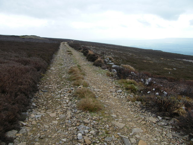
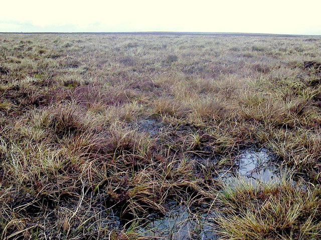
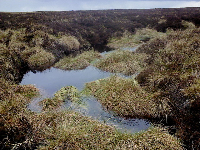
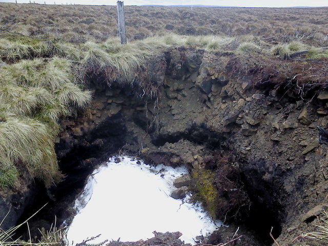
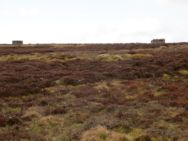
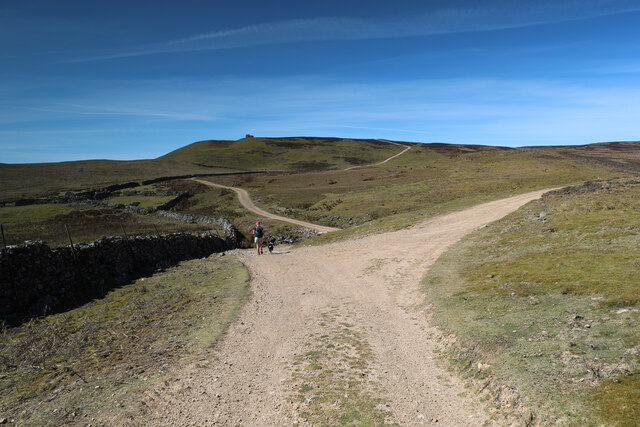
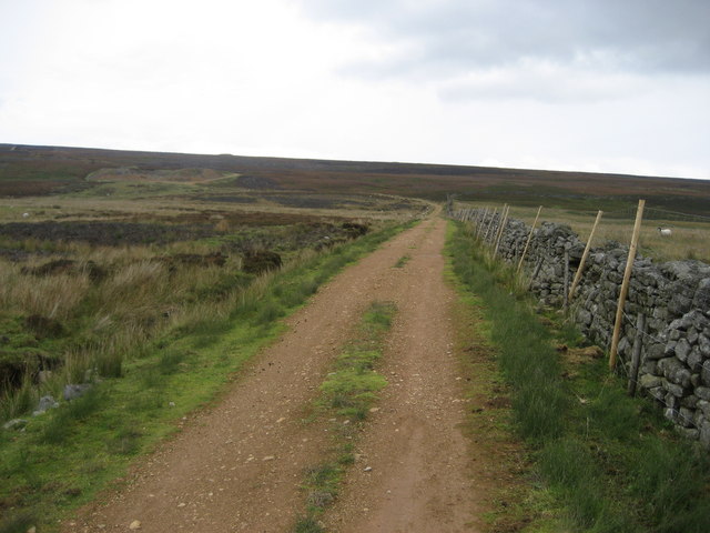
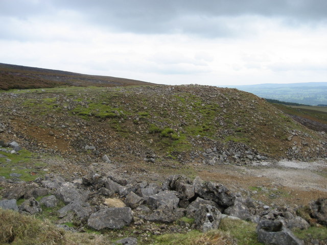
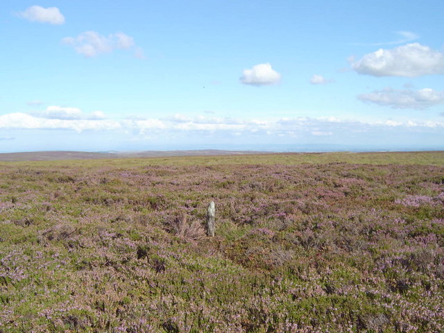
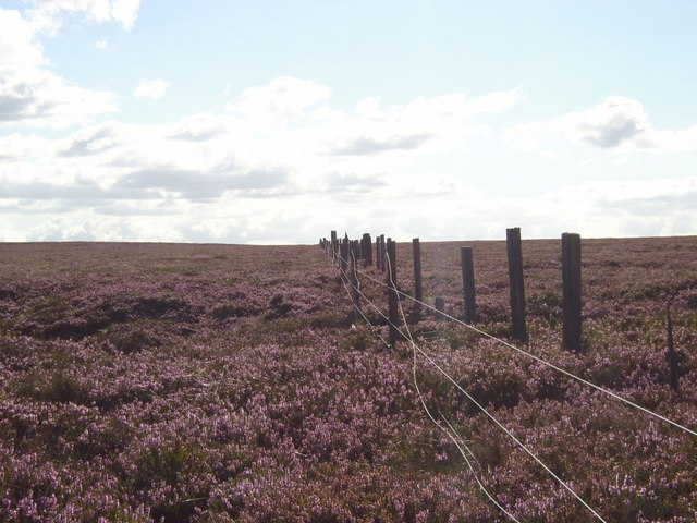
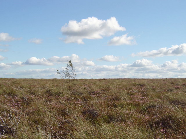
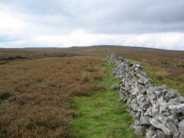
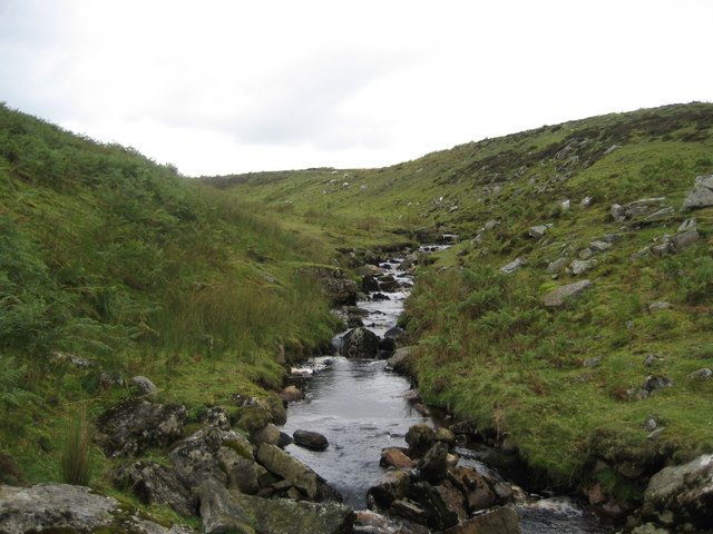
Covering an area of approximately 10 square miles, West Bolton Moor is known for its rugged terrain, characterized by open heather-clad moorland, scattered with patches of peat and rocky outcrops. The area is home to a variety of flora and fauna, including heather, bilberry, and cotton grass, as well as birds such as curlews, lapwings, and red grouse.

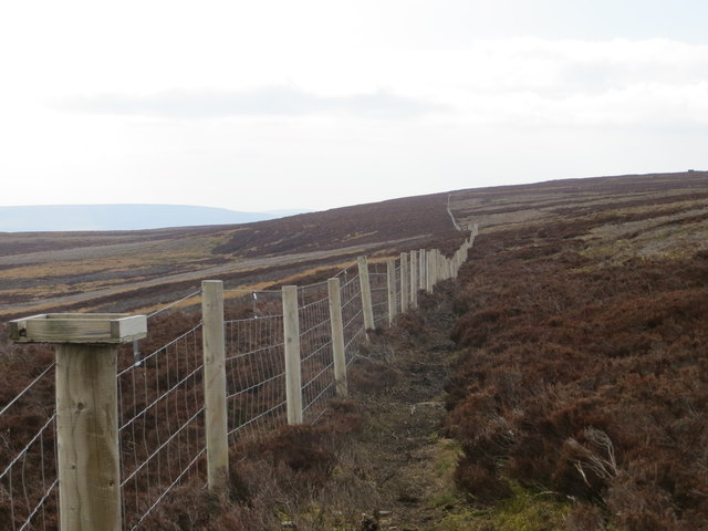
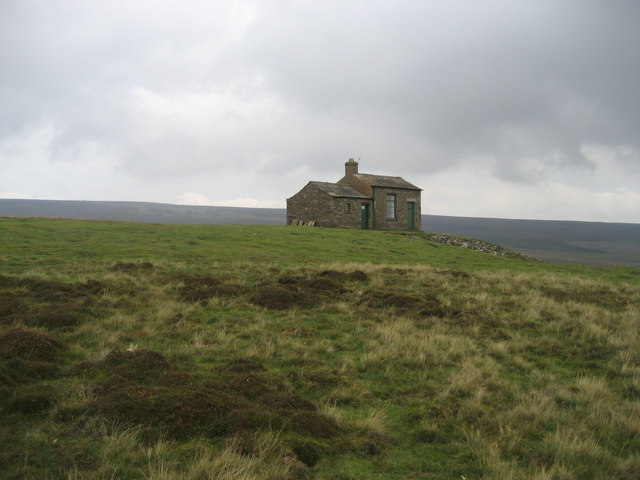
The moorland is crisscrossed by a network of footpaths and bridleways, making it a popular destination for hikers, cyclists, and horse riders. The paths wind their way through the moors, offering visitors the chance to explore the area's natural beauty and enjoy its tranquility.

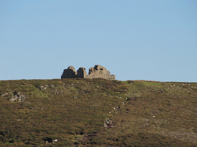
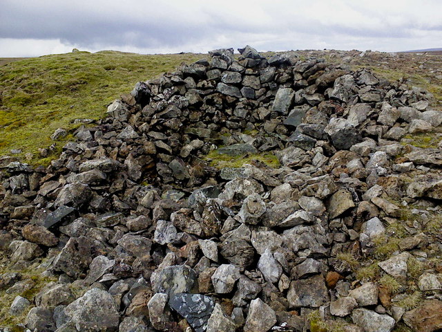
West Bolton Moor also holds historical significance, with remnants of prehistoric settlements and ancient burial sites scattered throughout the moorland. These archaeological sites provide a glimpse into the area's past, dating back thousands of years.

In addition to its natural and historical attractions, West Bolton Moor offers visitors a chance to escape the hustle and bustle of urban life. The peacefulness and solitude of this remote moorland make it an ideal place for those seeking a retreat into nature.

Overall, West Bolton Moor in Yorkshire is a captivating destination that showcases the beauty of the Yorkshire Downs, offering visitors the opportunity to immerse themselves in a stunning natural landscape rich in history and tranquility.

If you have any feedback on the listing, please let us know in the comments section below.

West Bolton Moor Images

Images are sourced within 2km of 54.337721/-2.025589 or Grid Reference SD9893. Thanks to Geograph Open Source API. All images are credited.

Above Carperby One of several Landrover tracks which make for easy walking over bleak moorlands.
Above Carperby
One of several Landrover tracks which make for easy walking over bleak moorlands.
Greets Shooting House ruin
Across the bog A whole lot of splashing & squelching in this area of Virgin Moss.
Across the bog
A whole lot of splashing & squelching in this area of Virgin Moss.
Beginning to flow downhill A small stream begins in the boggy waste of Virgin Moss at the head of Apedale.
Beginning to flow downhill
A small stream begins in the boggy waste of Virgin Moss at the head of Apedale.
Snow! A disused mine shaft on Virgin Moss hides a patch of snow from last winter. This mine shaft seems to be actively collapsing in on itself and has the remains of a very old fence around it.
Snow!
A disused mine shaft on Virgin Moss hides a patch of snow from last winter. This mine shaft seems to be actively collapsing in on itself and has the remains of a very old fence around it.
Lunch spot A stone shelter has been built into the side of this old lead mine; with a flat stone utilised as a seat it was quite pleasant.
Lunch spot
A stone shelter has been built into the side of this old lead mine; with a flat stone utilised as a seat it was quite pleasant.
Fence Line Looking south-east along the edge of Woodhall Greets.
Fence Line
Looking south-east along the edge of Woodhall Greets.
Grouse Butts Looking west from the path along the edge of Woodhall Greets.
Grouse Butts
Looking west from the path along the edge of Woodhall Greets.
Estate track dropping to cross Beldon Beck The track turning right here heads for old lead mining workings, the original reason for the existence of these ways. Ahead, the track drops to cross Beldon Beck before climbing to Carperby Moor on its way down to Carperby in Wensleydale. Unlike many of the lead mine access routes in Swaledale, these in Wensleydale (where lead mining failed earlier) have not become public rights of way under the Countryside Act 1949, but the area is all Access Land under the more recent CROW Act, so walkers are free to roam. They are kept in good condition to facilitate access supporting the grouse shooting interests on the moor, which enable the nineteenth century industrial scars on the landscape to be supplemented by ugly burn scars in the heather moorland.
Estate track dropping to cross Beldon Beck
The track turning right here heads for old lead mining workings, the original reason for the existence of these ways. Ahead, the track drops to cross Beldon Beck before climbing to Carperby Moor on its way down to Carperby in Wensleydale. Unlike many of the lead mine access routes in Swaledale, these in Wensleydale (where lead mining failed earlier) have not become public rights of way under the Countryside Act 1949, but the area is all Access Land under the more recent CROW Act, so walkers are free to roam. They are kept in good condition to facilitate access supporting the grouse shooting interests on the moor, which enable the nineteenth century industrial scars on the landscape to be supplemented by ugly burn scars in the heather moorland.
Track near Tewfit Mires This good track - not marked on my map - I presume is maintained by the shooting fraternity.  It connects Greenhaw Hut to the vast expanse of moorland that separates Wensleydale from Swaledale.
Track near Tewfit Mires
This good track - not marked on my map - I presume is maintained by the shooting fraternity. It connects Greenhaw Hut to the vast expanse of moorland that separates Wensleydale from Swaledale.
Collier Gate Spoil Heaps from mining activities in this remote part of Bolton Moor
Collier Gate
Spoil Heaps from mining activities in this remote part of Bolton Moor
Summit of Pickerstone Ridge Hardly a ridge, more a flat heather moorland.
565m above sea level
Summit of Pickerstone Ridge
Hardly a ridge, more a flat heather moorland. 565m above sea level
Fences through the heather A part complete new fence and an old one alongside.
They run dead straight for about 2km on the flat top of Whitaside Moor.
Fences through the heather
A part complete new fence and an old one alongside. They run dead straight for about 2km on the flat top of Whitaside Moor.
Solitary shrub near summit of Pickerstone ridge In this dense heather undergrowth, a deciduous shrub seems to have maintained a precarious existence.  Sometimes (and I don't know if this applies here), shrubs are planted in unusual remote places to mark a much loved location where ashes have been scattered
Solitary shrub near summit of Pickerstone ridge
In this dense heather undergrowth, a deciduous shrub seems to have maintained a precarious existence. Sometimes (and I don't know if this applies here), shrubs are planted in unusual remote places to mark a much loved location where ashes have been scattered
Greenhaw Hut At an elevation of about 1500ft on an exposed hilltop, this stands in a truly bleak and wild location on moors high above Wensleydale - there is beauty in this hopeless environment
Greenhaw Hut
At an elevation of about 1500ft on an exposed hilltop, this stands in a truly bleak and wild location on moors high above Wensleydale - there is beauty in this hopeless environment
Carperby Moor This is west of the dominant feature on these moors - namely the Greenhaw Hut.  Lines of shooting butts cover this moor, until recently their exclusive preserve.  Now walkers are slowly beginning to discover this wild area due to the new Access Agreements
Carperby Moor
This is west of the dominant feature on these moors - namely the Greenhaw Hut. Lines of shooting butts cover this moor, until recently their exclusive preserve. Now walkers are slowly beginning to discover this wild area due to the new Access Agreements
Wall on Carperby Moor One of the few features on this wild but beautiful landscape
Wall on Carperby Moor
One of the few features on this wild but beautiful landscape
Upper Reaches of Beldon Beck Rising on West Bolton Moor it tumbles down into Wensleydale to reach the River Ure near Redmire Force
Upper Reaches of Beldon Beck
Rising on West Bolton Moor it tumbles down into Wensleydale to reach the River Ure near Redmire Force
Show me another place!

West Bolton Moor is located at Grid Ref: SD9893 (Lat: 54.337721, Lng: -2.025589)

Division: North Riding

Administrative County: North Yorkshire

District: Richmondshire

Police Authority: North Yorkshire

What 3 Words

///landlords.windmills.lion. Near Leyburn, North Yorkshire

Nearby Locations

West Bolton Moor

Related Wikis

Crackpot, North Yorkshire

Crackpot is a village in Swaledale, North Yorkshire, England. Its name derives from the Old English kraka (crow) and the Viking word pot (usually a pit...

Nappa Hall

Nappa Hall is a fortified manor house in Wensleydale, North Yorkshire, England, described by English Heritage as "probably the finest and least-spoilt...

Woodhall, North Yorkshire

Woodhall is a small hamlet in Wensleydale, North Yorkshire, England. It is about 2 miles (3 km) away from Askrigg and 3 miles (5 km) north west of Aysgarth...

Newbiggin, Askrigg

Newbiggin is a hamlet very close to Askrigg, North Yorkshire, England. Another Newbiggin is only about 7 miles (11 km) away. The hamlet consists of eight...

Low Row

Low Row is a village in Swaledale, in the Yorkshire Dales, North Yorkshire, England. It lies about 3 miles west of Reeth and is between Healaugh and Gunnerside...
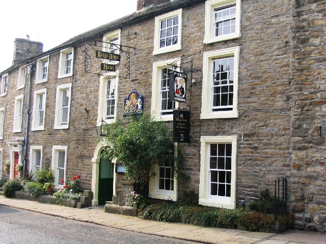
Kings Arms Hotel

The Kings Arms Hotel is a public house and inn in the English village of Askrigg, North Yorkshire. A Grade II listed building, standing on the northern...

Askrigg

Askrigg is a small village and civil parish in Wensleydale in the Yorkshire Dales National Park. It was formerly a part of the Richmondshire district of...

Carperby-cum-Thoresby

Carperby-cum-Thoresby is a civil parish in the Richmondshire district of North Yorkshire, England. The parish contains the village of Carperby and the...

Nearby Amenities

Located within 500m of 54.337721,-2.025589
Disused: yes
Historic: mine_shaft
Man Made: mineshaft
Mineral: lead
Source: NPE
Lat/Long: 54.3410791/-2.0209151
Disused: yes
Historic: mine_shaft
Man Made: mineshaft
Mineral: lead
Source: NPE
Lat/Long: 54.3405537/-2.0210867
Disused: yes
Historic: mine_shaft
Man Made: mineshaft
Mineral: lead
Source: NPE
Lat/Long: 54.3394779/-2.0202284
Disused: yes
Historic: mine_shaft
Man Made: mineshaft
Mineral: lead
Source: NPE
Lat/Long: 54.3396781/-2.0210009
Disused: yes
Historic: mine_shaft
Man Made: mineshaft
Mineral: lead
Source: NPE
Lat/Long: 54.3398031/-2.0219021
The data included in this document is from www.openstreetmap.org. The data is made available under ODbL.

Have you been to West Bolton Moor?

Leave your review of West Bolton Moor below (or comments, questions and feedback).