Harman's Cross

Settlement in Dorset

England

Harman's Cross

Crack Lane Cemetery Crack Lane Cemetery outside of Langton Matravers
Crack Lane Cemetery Credit: Shaun Ferguson

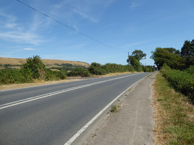
Harman's Cross is a small village located in the county of Dorset, England. Situated in the Isle of Purbeck, it lies approximately 4 miles west of Swanage and 2 miles south of Corfe Castle. The village gets its name from a local landmark, Harman's Cross, a stone cross that stands at a junction in the center of the village.

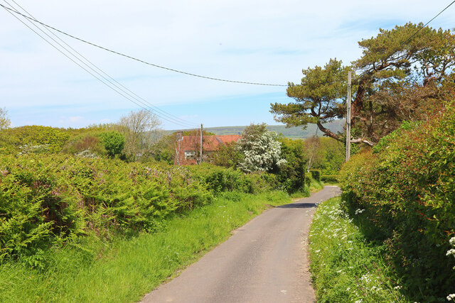
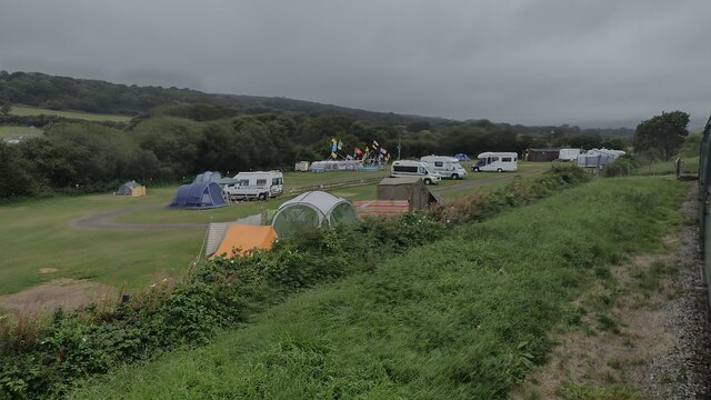
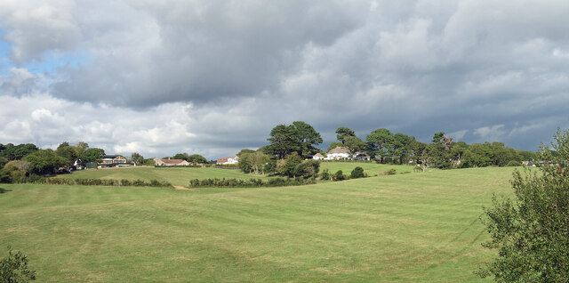
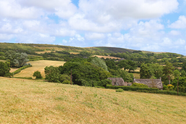
Despite its small size, Harman's Cross has a close-knit and vibrant community. The village is primarily residential, with a mix of traditional cottages and newer houses. The surrounding countryside offers picturesque views and several walking trails, making it a popular destination for nature enthusiasts and hikers.

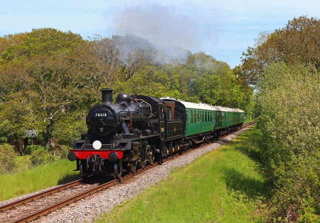
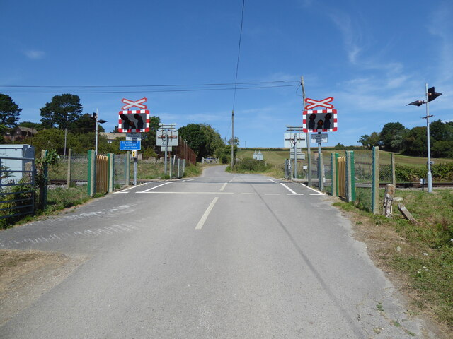
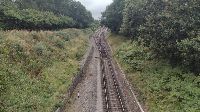
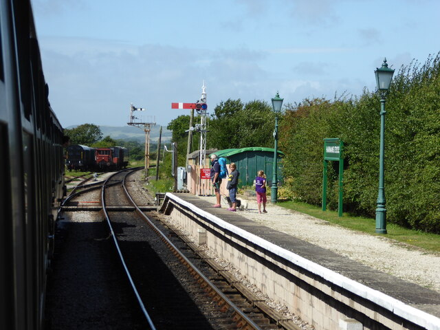
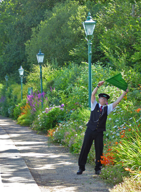
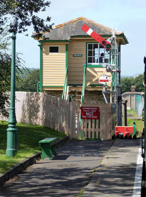
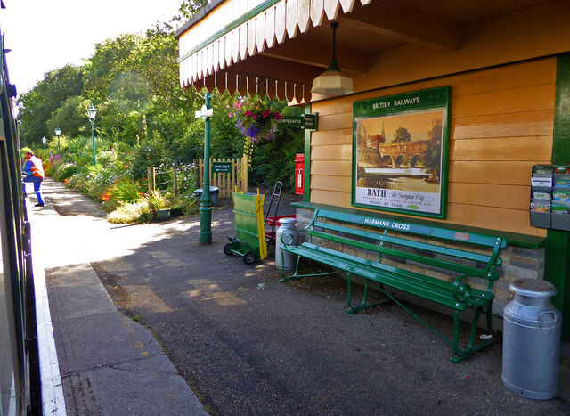
The village is also home to the Swanage Railway, a heritage steam railway that runs from Swanage to Norden, passing through Harman's Cross. The railway station in the village provides a convenient transport link for both residents and tourists, connecting them to nearby towns and attractions.

In terms of amenities, Harman's Cross has a local village hall, which hosts various community activities and events throughout the year. Additionally, there is a charming village pub that serves traditional British food and drinks, providing a social hub for locals and visitors alike.

Overall, Harman's Cross offers a tranquil and picturesque setting, with its beautiful countryside, welcoming community, and convenient access to nearby attractions, making it an attractive place to live or visit in Dorset.

If you have any feedback on the listing, please let us know in the comments section below.

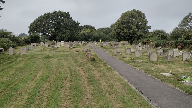
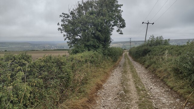
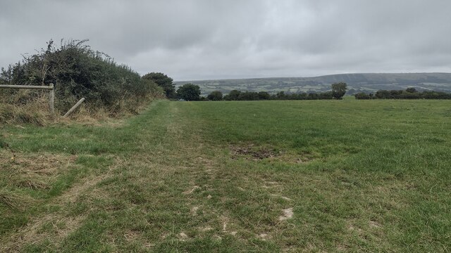
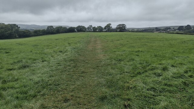
Harman's Cross Images

Images are sourced within 2km of 50.622061/-2.0238518 or Grid Reference SY9880. Thanks to Geograph Open Source API. All images are credited.

Crack Lane Cemetery Crack Lane Cemetery outside of Langton Matravers
Crack Lane Cemetery
Crack Lane Cemetery outside of Langton Matravers
Bridleway heading to Corfe Castle From Langton Road the Purbeck Way bridleway heading to Corfe Castle
Bridleway heading to Corfe Castle
From Langton Road the Purbeck Way bridleway heading to Corfe Castle
Bridleway heading to A351 From Langton Road the bridleway heading to A351
Bridleway heading to A351
From Langton Road the bridleway heading to A351
Path heading towards Woodhyde Campsite From Haycrafts Lane the path heading towards Woodhyde Campsite
Path heading towards Woodhyde Campsite
From Haycrafts Lane the path heading towards Woodhyde Campsite
Haycraft's Lane Minor road near Harman's Cross.
Haycraft's Lane
Minor road near Harman's Cross.
Level Crossing Steam train near Harman's Cross.
Level Crossing
Steam train near Harman's Cross.
Level crossing, Quarr Farm
New Barn Bridge New Barn Bridge on Knitson Lane
New Barn Bridge
New Barn Bridge on Knitson Lane
The double track at Harman's Cross Station From Haycrafts Lane bridge looking to the double track at Harman's Cross Station
The double track at Harman's Cross Station
From Haycrafts Lane bridge looking to the double track at Harman's Cross Station
Woodhyde Campsite Woodhyde Campsite beside the Swanage Railway
Woodhyde Campsite
Woodhyde Campsite beside the Swanage Railway
Swanage Railway - Harman's Cross Station
Swanage Railway - all clear at Harman's Cross Station The guard giving the all clear to the driver of the steam locomotive on this preserved railway.
Swanage Railway - all clear at Harman's Cross Station
The guard giving the all clear to the driver of the steam locomotive on this preserved railway.
Swanage Railway - signal box at Harman's Cross On this preserved railway at the end of the station.
Swanage Railway - signal box at Harman's Cross
On this preserved railway at the end of the station.
Swanage Railway - Harman's Cross Station  On this preserved railway. Very nicely presented but on this occasion the lighting was tricky.
Swanage Railway - Harman's Cross Station
On this preserved railway. Very nicely presented but on this occasion the lighting was tricky.
Main road to Swanage at Instow
View near Harman's Cross Fields north of the railway with houses in Harman's Cross on the horizon.
View near Harman's Cross
Fields north of the railway with houses in Harman's Cross on the horizon.
Purbeck Way at Brenscombe Hill
Little Woolgarston Cottages near Corfe Castle.
Little Woolgarston
Cottages near Corfe Castle.
Show me another place!

Harman's Cross is located at Grid Ref: SY9880 (Lat: 50.622061, Lng: -2.0238518)

Unitary Authority: Dorset

Police Authority: Dorset

What 3 Words

///canoe.standard.moats. Near Corfe Castle, Dorset

Related Wikis

Harman's Cross

Harman's Cross is a small village on the Isle of Purbeck in Dorset, England. It is situated on the A351 road between Swanage and Corfe Castle. The village...

Harman's Cross railway station

Harman's Cross railway station is a railway station located in the village of Harman's Cross, on the Isle of Purbeck in the English county of Dorset. It...

Woolgarston

Woolgarston is a village in Dorset, England. == External links == Media related to Woolgarston at Wikimedia Commons

Acton, Dorset

Acton is a hamlet in the parish of Langton Matravers, on the Isle of Purbeck, in the county of Dorset in the south of England. The hamlet of Acton was...

Nearby Amenities

Located within 500m of 50.622061,-2.0238518
Harman's Cross
Naptan AtcoCode: 940GZZSRHMC
Platforms: 2
Public Transport: station
Railway: station
Usage: tourism
Wikidata: Q5659026
Lat/Long: 50.6197911/-2.0265551
Turning Circle
Source: bing
Lat/Long: 50.6205606/-2.018277
Harman's Cross
Place: village
Wikidata: Q1585570
Lat/Long: 50.6223641/-2.0229766
North Instow
Place: hamlet
Lat/Long: 50.6223212/-2.0168818
South Instow
Place: hamlet
Lat/Long: 50.6212425/-2.0177162
Material: wood
Power: pole
Source: bing
Lat/Long: 50.6227343/-2.01753
Material: wood
Power: pole
Source: bing
Lat/Long: 50.6232921/-2.0173527
Railway: switch
Lat/Long: 50.6199384/-2.0289435
Railway: switch
Lat/Long: 50.6197898/-2.0250076
Railway: switch
Lat/Long: 50.6199628/-2.0288715
Railway: switch
Lat/Long: 50.6198853/-2.0282711
Material: wood
Power: pole
Source: bing
Lat/Long: 50.625635/-2.0251294
Post Box
Post Box Type: lamp
Ref: BH19 137
Ref GB Uprn: 10015391844
Royal Cypher: EIIR
Royal Cypher Wikidata: Q33102113
Lat/Long: 50.6231775/-2.0238286
Direction: 105
Generator Method: photovoltaic
Generator Output Electricity: yes
Generator Source: solar
Generator Type: solar_photovoltaic_panel
Location: roof
Power: generator
Lat/Long: 50.6222014/-2.0172486
Direction: 195
Generator Method: photovoltaic
Generator Output Electricity: yes
Generator Solar Modules: 7
Generator Source: solar
Generator Type: solar_photovoltaic_panel
Location: roof
Power: generator
Lat/Long: 50.6222068/-2.0172066
Railway: signal
Railway Signal Direction: forward
Lat/Long: 50.6200158/-2.0291703
Railway: level_crossing
Lat/Long: 50.6198645/-2.0280164
Railway: level_crossing
Lat/Long: 50.6198933/-2.0280102
Generator Method: photovoltaic
Generator Output Electricity: yes
Generator Source: solar
Generator Type: solar_photovoltaic_panel
Power: generator
Lat/Long: 50.622617/-2.0235487
Harman's Cross
Public Transport: stop_position
Train: yes
Lat/Long: 50.6198201/-2.0269384
Harman's Cross
Public Transport: stop_position
Train: yes
Lat/Long: 50.6197929/-2.0269585
unknown helipad
Aeroway: helipad
Lat/Long: 50.6222769/-2.0295573
Bicycle Parking
Bicycle Parking: rack
Capacity: 2
Covered: no
Fee: no
Lat/Long: 50.6198792/-2.0266661
Bicycle Parking
Bicycle Parking: stands
Capacity: 8
Covered: no
Lat/Long: 50.6201117/-2.0241715
The data included in this document is from www.openstreetmap.org. The data is made available under ODbL.

Have you been to Harman's Cross?

Leave your review of Harman's Cross below (or comments, questions and feedback).