Codford Down
Downs, Moorland in Wiltshire
England
Codford Down

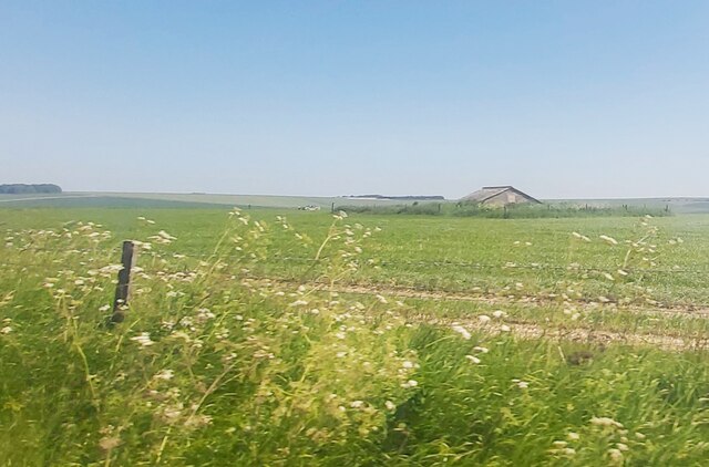
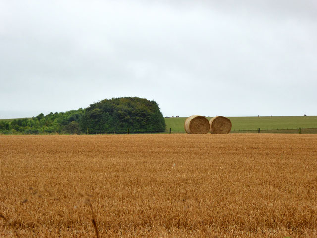
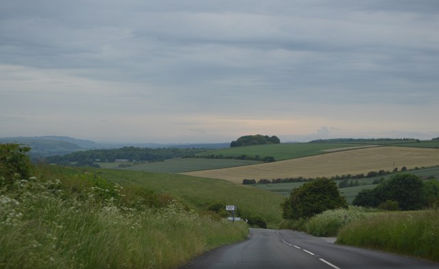
Codford Down is a vast expanse of open grassland located in Wiltshire, England. It is situated in the southern part of the Salisbury Plain, covering an area of approximately 2,500 acres. The Down is characterized by its gently rolling hills, offering breathtaking panoramic views of the surrounding countryside.
The landscape of Codford Down is predominantly covered by a mixture of grasses and heather, creating a patchwork of vibrant colors throughout the seasons. The area is abundant in wildlife, with various species of birds, such as skylarks and meadow pipits, making it their home. Additionally, the Down provides a natural habitat for small mammals, including rabbits and voles.
The Down holds historical significance as it is dotted with several Bronze Age burial mounds, known as barrows. These ancient monuments add an air of mystery and intrigue to the area, attracting archaeologists and history enthusiasts alike. Furthermore, the Down was used as a training ground during World War II, and remnants of military structures, such as old tank tracks and gun emplacements, can still be seen today.
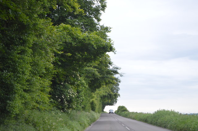
Codford Down offers a tranquil and peaceful environment, making it a popular destination for walkers, hikers, and nature lovers. The area is crisscrossed by a network of footpaths and bridleways, providing ample opportunities to explore and appreciate the natural beauty of the Down. Visitors can enjoy long walks, picnics, or simply sit back and admire the stunning views that stretch across the plains.
In conclusion, Codford Down is a picturesque and historically significant area in Wiltshire, characterized by its rolling grassland, abundant wildlife, and ancient burial mounds. It serves as a haven for nature enthusiasts and offers a serene escape from the hustle and bustle of everyday life.
If you have any feedback on the listing, please let us know in the comments section below.
Codford Down Images
Images are sourced within 2km of 51.185106/-2.0393393 or Grid Reference ST9742. Thanks to Geograph Open Source API. All images are credited.


![Chitterne features [3] The Chitterne Brook, looking downstream.
Chitterne village lies in the middle of Salisbury Plain. Much of the parish is owned by the Ministry of Defence within the Salisbury Plain Training Area. The Imber firing range is to the north and the Copehill Down training area to the east. The Chitterne Brook, a small tributary of the River Wylye, flows through the village. There is a fine history of the village at: <span class="nowrap"><a title="http://www.chitterne.com/history/index.html" rel="nofollow ugc noopener" href="http://www.chitterne.com/history/index.html">Link</a><img style="margin-left:2px;" alt="External link" title="External link - shift click to open in new window" src="https://s1.geograph.org.uk/img/external.png" width="10" height="10"/></span>](https://s2.geograph.org.uk/geophotos/06/39/51/6395158_96892275.jpg)
![Chitterne houses [1] The Old Malt House is 18th century with a bay added to the right in the early 19th century and an extension added to the left in the 20th century. Beer was brewed here and sold in the King&#039;s Head public house opposite. Listed, grade II, with details at: <span class="nowrap"><a title="https://historicengland.org.uk/listing/the-list/list-entry/1364313" rel="nofollow ugc noopener" href="https://historicengland.org.uk/listing/the-list/list-entry/1364313">Link</a><img style="margin-left:2px;" alt="External link" title="External link - shift click to open in new window" src="https://s1.geograph.org.uk/img/external.png" width="10" height="10"/></span>
Chitterne village lies in the middle of Salisbury Plain. Much of the parish is owned by the Ministry of Defence within the Salisbury Plain Training Area. The Imber firing range is to the north and the Copehill Down training area to the east. The Chitterne Brook, a small tributary of the River Wylye, flows through the village. There is a fine history of the village at: <span class="nowrap"><a title="http://www.chitterne.com/history/index.html" rel="nofollow ugc noopener" href="http://www.chitterne.com/history/index.html">Link</a><img style="margin-left:2px;" alt="External link" title="External link - shift click to open in new window" src="https://s1.geograph.org.uk/img/external.png" width="10" height="10"/></span>](https://s3.geograph.org.uk/geophotos/06/39/51/6395159_323ff0bb.jpg)
![Chitterne features [4] Snowdrops on the bank of Chitterne Brook.
Chitterne village lies in the middle of Salisbury Plain. Much of the parish is owned by the Ministry of Defence within the Salisbury Plain Training Area. The Imber firing range is to the north and the Copehill Down training area to the east. The Chitterne Brook, a small tributary of the River Wylye, flows through the village. There is a fine history of the village at: <span class="nowrap"><a title="http://www.chitterne.com/history/index.html" rel="nofollow ugc noopener" href="http://www.chitterne.com/history/index.html">Link</a><img style="margin-left:2px;" alt="External link" title="External link - shift click to open in new window" src="https://s1.geograph.org.uk/img/external.png" width="10" height="10"/></span>](https://s0.geograph.org.uk/geophotos/06/39/51/6395160_c3eb1365.jpg)
![Chitterne ways [1] From the B390 road, the track, a public footpath, leads to the chapel of St Mary. The footpath continues to the village centre and to Manor Farm.
Chitterne village lies in the middle of Salisbury Plain. Much of the parish is owned by the Ministry of Defence within the Salisbury Plain Training Area. The Imber firing range is to the north and the Copehill Down training area to the east. The Chitterne Brook, a small tributary of the River Wylye, flows through the village. There is a fine history of the village at: <span class="nowrap"><a title="http://www.chitterne.com/history/index.html" rel="nofollow ugc noopener" href="http://www.chitterne.com/history/index.html">Link</a><img style="margin-left:2px;" alt="External link" title="External link - shift click to open in new window" src="https://s1.geograph.org.uk/img/external.png" width="10" height="10"/></span>](https://s1.geograph.org.uk/geophotos/06/39/51/6395161_be4c421b.jpg)
Codford Down is located at Grid Ref: ST9742 (Lat: 51.185106, Lng: -2.0393393)
Unitary Authority: Wiltshire
Police Authority: Wiltshire
What 3 Words
///decorator.news.tributes. Near Codford, Wiltshire
Nearby Locations
Related Wikis

Aston Valley Barrow Cemetery
The Aston Valley Barrow Cemetery, or Ashton Valley Barrow Cemetery, is a group of Bronze Age bowl barrow and bell barrow tumuli on the south facing edge...

Knook Castle
Knook Castle is the site of an Iron Age univallate hillfort on Knook Down, near the village of Knook in Wiltshire, England, but largely within the civil...

Chitterne
Chitterne is a village and civil parish in the county of Wiltshire, in the south west of England. The village lies in the middle of Salisbury Plain, about...
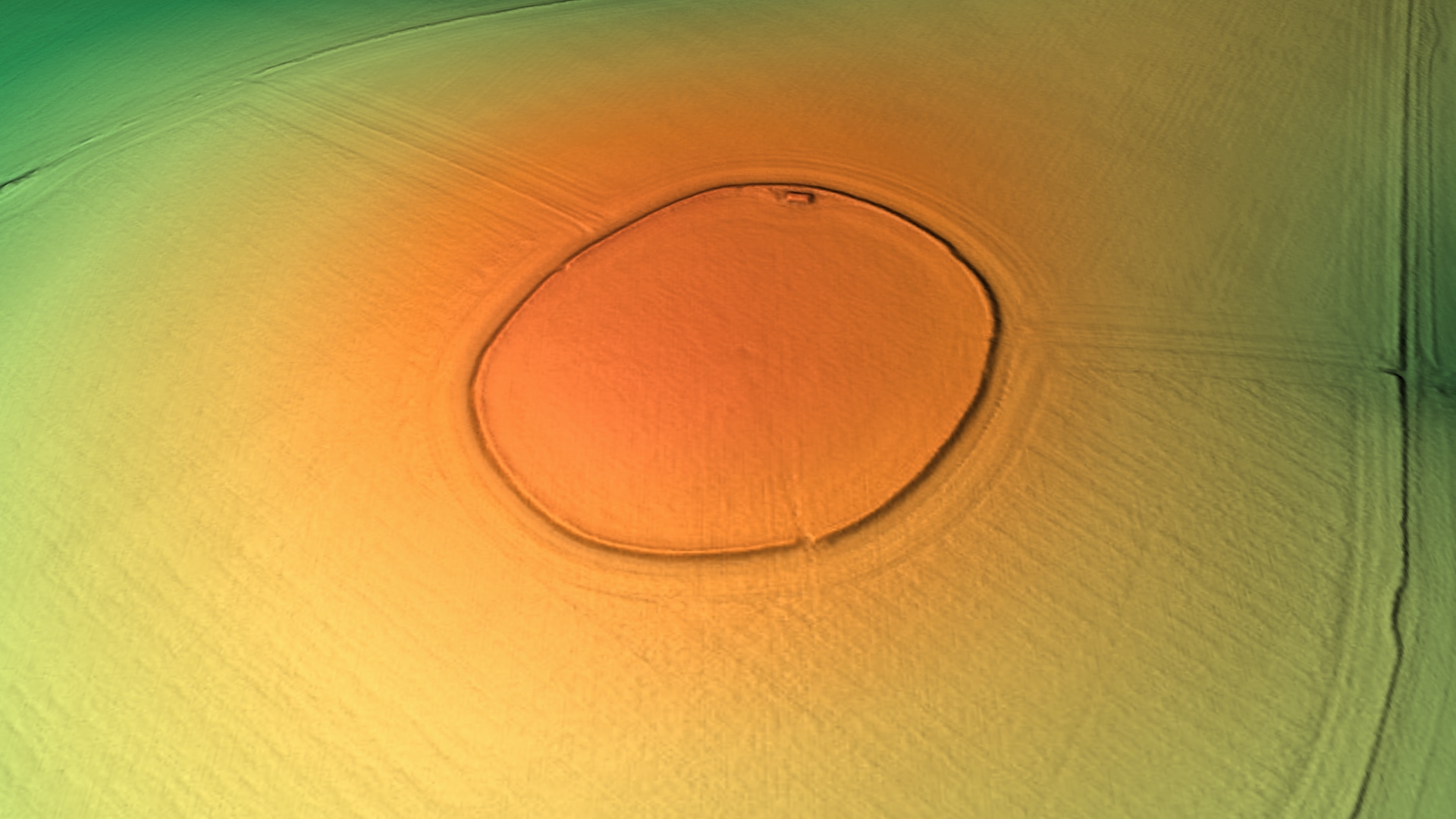
Codford Circle
Codford Circle, also known as Wilsbury Ring, Woldsbury, and possibly Oldbury Camp, is a neolithic hill top enclosure or possible hillfort located on the...
Greenways School
Greenways School, also known as Greenways Preparatory School, was an English prep school, founded at Bognor Regis, Sussex, before the Second World War...

Codford
Codford is a civil parish south of Salisbury Plain in the Wylye Valley in Wiltshire, England. Its settlements are the adjacent villages of Codford St Peter...

Woolstore Theatre
The Woolstore Theatre is a theatre in the village of Codford, Wiltshire, England. The theatre has been operating since 1928, when it was built by Colonel...
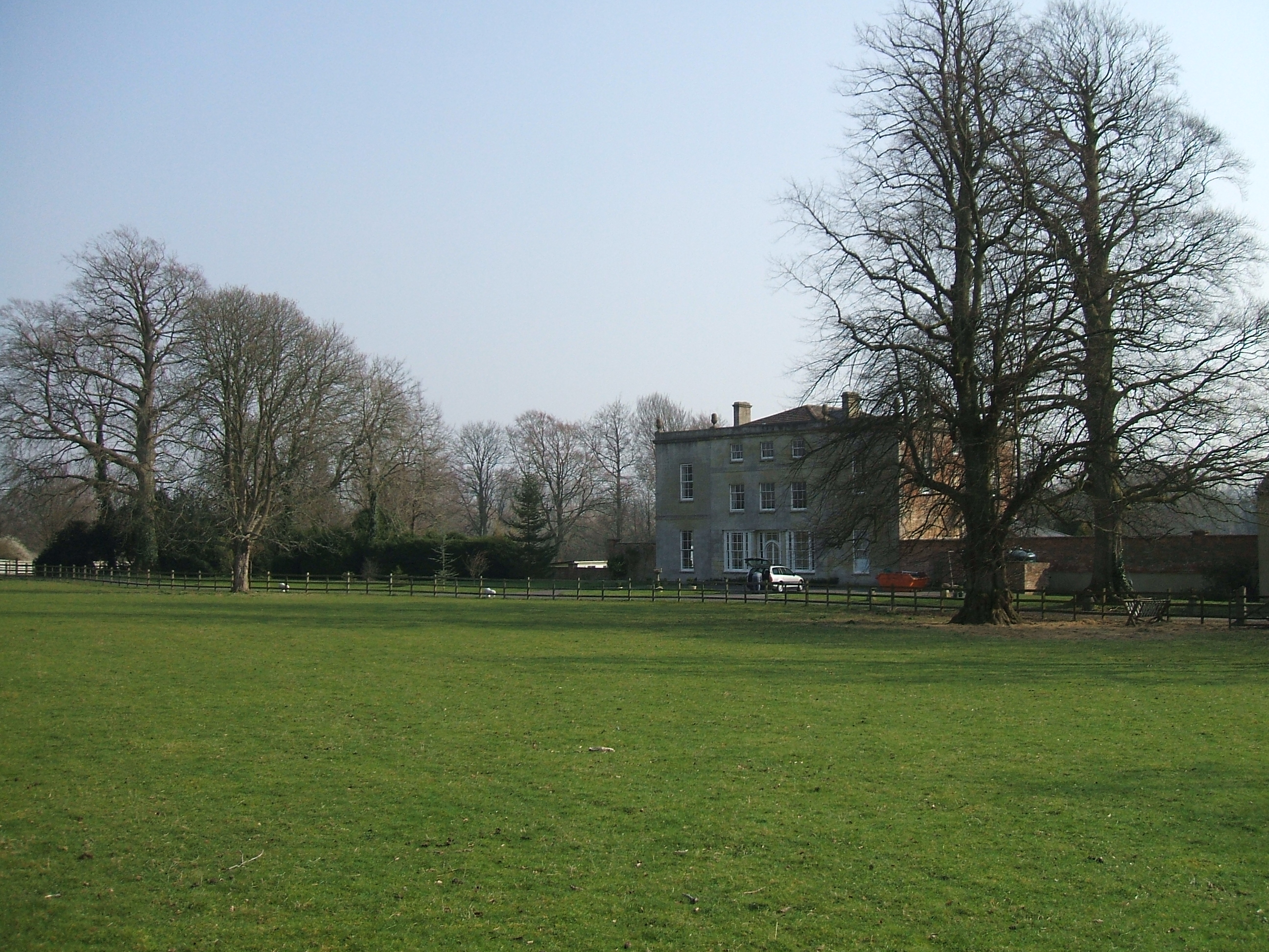
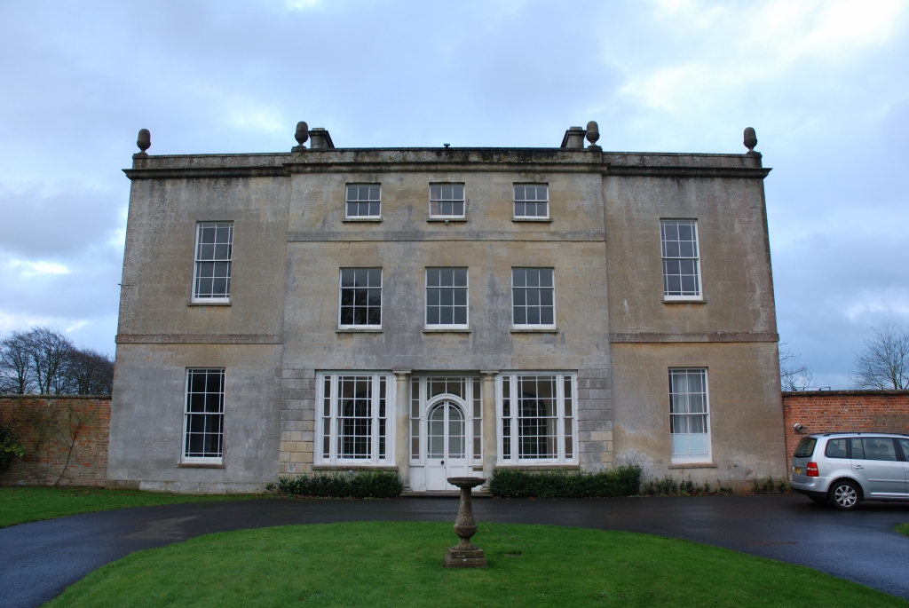
Ashton Gifford House
Ashton Gifford House is a Grade II listed country house in the hamlet of Ashton Gifford, part of the civil parish of Codford in the English county of Wiltshire...
Have you been to Codford Down?
Leave your review of Codford Down below (or comments, questions and feedback).