Low Row Pasture
Downs, Moorland in Yorkshire Richmondshire
England
Low Row Pasture
Low Row Pasture is a picturesque region located in Yorkshire, England. Nestled in the heart of Yorkshire Dales National Park, it showcases a stunning landscape that encompasses both downs and moorland. With its diverse terrain, this area offers a unique blend of natural beauty and rural charm.
The downs of Low Row Pasture are characterized by gentle slopes and rolling hills covered in lush green grass. The undulating landscape provides a perfect backdrop for scenic walks and hikes, allowing visitors to enjoy breathtaking panoramic views of the surrounding countryside. These downs are also home to a variety of flora and fauna, including wildflowers, grazing sheep, and occasional sightings of birds of prey.
On the other hand, the moorland of Low Row Pasture presents a more rugged and wild environment. Thick heather blankets the vast expanses of this terrain, creating a vibrant purple hue that is particularly striking during the summer months. Moorland streams meander through the landscape, adding to its natural beauty and offering a peaceful ambiance to those exploring the area.
Low Row Pasture is a haven for outdoor enthusiasts, providing ample opportunities for activities such as hiking, cycling, and horseback riding. The region is crisscrossed with well-maintained trails that cater to all levels of fitness and experience. It is also a popular destination for nature lovers and photographers, as the ever-changing light and colors of the landscape offer endless possibilities for capturing stunning images.
Overall, Low Row Pasture in Yorkshire is a captivating destination that showcases the beauty of both downs and moorland. Its idyllic scenery, combined with its tranquil atmosphere, makes it a true gem within the Yorkshire Dales.
If you have any feedback on the listing, please let us know in the comments section below.
Low Row Pasture Images
Images are sourced within 2km of 54.381834/-2.0436921 or Grid Reference SD9798. Thanks to Geograph Open Source API. All images are credited.


![Gill crossed by drystone wall On the western side of Mill Gill [aka Old Gang Beck].](https://s1.geograph.org.uk/geophotos/02/86/67/2866773_1357b302.jpg)


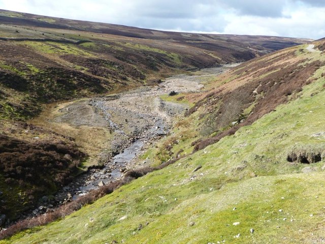
![View along Mill Gill Mill Gill [aka Old Gang Beck] is one of the many feeder streams for the Swale, although on this July day it is contributing very little water thanks to weeks of drought conditions.](https://s2.geograph.org.uk/geophotos/05/84/42/5844214_f4e3849e.jpg)
![Tipped twice! There's a huge long pile of waste material from the two levels just above Old Gang smelt mill, but look carefully and you will notice grassed over 'fingers' of much older tips emerging from beneath the rubble indicating that there was once a level on this side of the beck [true right bank] that was covered over by later workings.](https://s2.geograph.org.uk/geophotos/05/84/42/5844234_70f4bdf4.jpg)


![Track to Old Gang The track from Surrender bridge to the Old Gang smelt mill [in distance]. This is now part of the Coast to Coast long distance walk.](https://s3.geograph.org.uk/photos/33/98/339887_97c4bb99.jpg)


Low Row Pasture is located at Grid Ref: SD9798 (Lat: 54.381834, Lng: -2.0436921)
Division: North Riding
Administrative County: North Yorkshire
District: Richmondshire
Police Authority: North Yorkshire
What 3 Words
///handfuls.probably.taker. Near Bowes, Co. Durham
Nearby Locations
Related Wikis

Low Row
Low Row is a village in Swaledale, in the Yorkshire Dales, North Yorkshire, England. It lies about 3 miles west of Reeth and is between Healaugh and Gunnerside...

Feetham
Feetham is a hamlet opposite Low Row in the Yorkshire Dales, North Yorkshire, England. The origin of the place-name is from Old Norse and means place...

Crackpot, North Yorkshire
Crackpot is a village in Swaledale, North Yorkshire, England. Its name derives from the Old English kraka (crow) and the Viking word pot (usually a pit...

Gunnerside
Gunnerside is a village in North Yorkshire, England. It is situated in Swaledale, on the B6270 road, 3 miles (5 km) east of Muker and 6 miles (10 km) west...
Nearby Amenities
Located within 500m of 54.381834,-2.0436921Have you been to Low Row Pasture?
Leave your review of Low Row Pasture below (or comments, questions and feedback).