Thrasher's Heath

Downs, Moorland in Dorset

England

Thrasher's Heath

National Cycle Track This is where the track to Studland leaves the minor road that runs between Corfe and Arne.
National Cycle Track Credit: Nigel Mykura

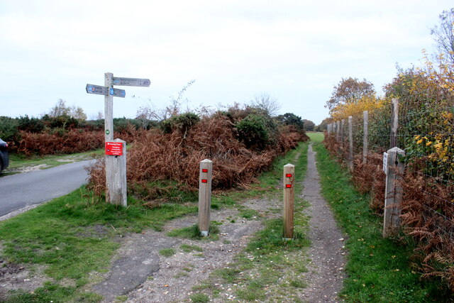
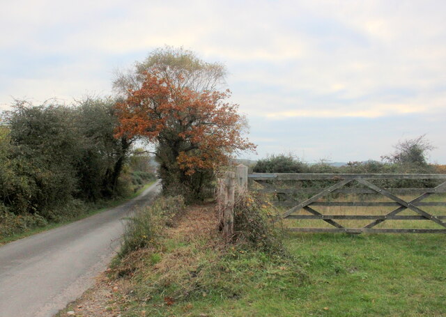
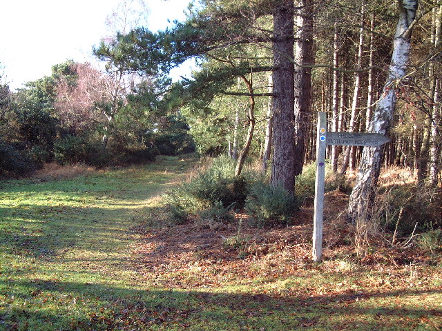
Thrasher's Heath is a picturesque area located in Dorset, England. Situated on the outskirts of the village of Cranborne, it is renowned for its stunning landscape, characterized by a combination of downs and moorland. This unique terrain creates a diverse and captivating environment for both locals and visitors alike.

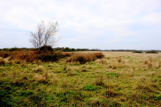
The downs of Thrasher's Heath are emblematic of the region, boasting rolling hills and expansive grasslands. These open spaces provide breathtaking panoramic views, making it a popular destination for nature enthusiasts and hikers. The heath is abundant with a variety of flora and fauna, including vibrant wildflowers, grazing livestock, and an array of bird species.

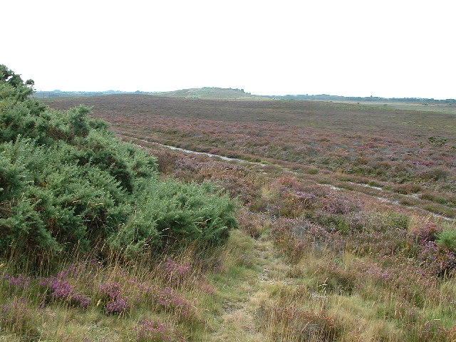
Adjacent to the downs, the moorland of Thrasher's Heath offers a contrasting landscape. With its rugged terrain, heather-covered hills, and scattered patches of woodland, this area provides a more secluded and atmospheric experience. Moorland birds, such as the iconic Dartford warbler, can be spotted here, adding to the area's natural charm.

Thrasher's Heath also holds historical significance, with evidence of prehistoric settlements and burial mounds dating back thousands of years. This rich heritage is preserved and celebrated through various archaeological sites and walking trails, allowing visitors to delve into the area's past.

With its enchanting scenery, abundant wildlife, and historical importance, Thrasher's Heath is a captivating destination for outdoor enthusiasts, history buffs, and those seeking tranquility in the heart of Dorset.

If you have any feedback on the listing, please let us know in the comments section below.

Thrasher's Heath Images

Images are sourced within 2km of 50.65522/-2.0437017 or Grid Reference SY9783. Thanks to Geograph Open Source API. All images are credited.

National Cycle Track This is where the track to Studland leaves the minor road that runs between Corfe and Arne.
National Cycle Track
This is where the track to Studland leaves the minor road that runs between Corfe and Arne.
New Mills Heath Quite rough pasture land with few bushes or trees
New Mills Heath
Quite rough pasture land with few bushes or trees
Bridleway on New Mills Heath In between the road and the gate there is a narrow bridle path which does not appear to be used much but leads to New Line Farm
Bridleway on New Mills Heath
In between the road and the gate there is a narrow bridle path which does not appear to be used much but leads to New Line Farm
Ruined keep, Corfe Castle (2022) Little changed from my previous visit 37 years ago <a href="https://www.geograph.org.uk/photo/2086287">SY9582 : Ruined keep, Corfe Castle (1985)</a>
Ruined keep, Corfe Castle (2022)
Little changed from my previous visit 37 years ago SY9582 : Ruined keep, Corfe Castle (1985)
Corfe Castle at sunset c.1960
Welcome seat
Welcome seat
Old Milestone by the A351, Corfe Castle Carved stone post by the A351, in parish of CORFE CASTLE (PURBECK District), foot of Corfe castle, on grass verge next to turning to Church Knowle, on South side of road. Dorset 2 (limestone), erected by the Wareham (North, South & West Branches) turnpike trust in the 19th century. 

Inscription reads:-
IV
MILES FROM
WAREHAM 

Grade II Listed. List Entry Number:1228623 <span class="nowrap"><a title="https://historicengland.org.uk/listing/the-list/list-entry/1228623" rel="nofollow ugc noopener" href="https://historicengland.org.uk/listing/the-list/list-entry/1228623">Link</a><img style="margin-left:2px;" alt="External link" title="External link - shift click to open in new window" src="https://s1.geograph.org.uk/img/external.png" width="10" height="10"/></span>

Milestone Society National ID: DO_WASW04
Old Milestone by the A351, Corfe Castle
Carved stone post by the A351, in parish of CORFE CASTLE (PURBECK District), foot of Corfe castle, on grass verge next to turning to Church Knowle, on South side of road. Dorset 2 (limestone), erected by the Wareham (North, South & West Branches) turnpike trust in the 19th century. Inscription reads:- IV MILES FROM WAREHAM Grade II Listed. List Entry Number:1228623 LinkExternal link Milestone Society National ID: DO_WASW04
Corfe Castle Railway Station Swanage Railway
Corfe Castle Railway Station
Swanage Railway
Corfe Castle - View of Village from Castle
Hartland Moor National Nature Reserve View looking east towards Middlebere Heath
Hartland Moor National Nature Reserve
View looking east towards Middlebere Heath
Swanage Railway Norden Station & Corfe Castle in distance

Link to Swanage Railway <span class="nowrap"><a title="http://www.swanagerailway.co.uk/" rel="nofollow ugc noopener" href="http://www.swanagerailway.co.uk/">Link</a><img style="margin-left:2px;" alt="External link" title="External link - shift click to open in new window" src="https://s1.geograph.org.uk/img/external.png" width="10" height="10"/></span>
Swanage Railway
Norden Station & Corfe Castle in distance Link to Swanage Railway LinkExternal link
Brenscombe Outdoor Centre, Corfe Castle, Dorset The centre offers a wide range of outdoor activities and farmhouse accommodation.
<span class="nowrap"><a title="http://www.brenscombeoutdoor.co.uk/index.html" rel="nofollow ugc noopener" href="http://www.brenscombeoutdoor.co.uk/index.html">Link</a><img style="margin-left:2px;" alt="External link" title="External link - shift click to open in new window" src="https://s1.geograph.org.uk/img/external.png" width="10" height="10"/></span>
Brenscombe Outdoor Centre, Corfe Castle, Dorset
The centre offers a wide range of outdoor activities and farmhouse accommodation. LinkExternal link
Wytch Lake Jetty There are relatively few points of access to the southern (quiet) half of Poole Harbour. This is mainly because the harbour on this side is fractured into a series of inlets which have marshy banks. One access point however is just north of Wytch Farm, this jetty being reached across a reed bed at the end of a track. This arm of the sea, which is fed by the Corfe River, is known as Wytch Lake.
Wytch Lake Jetty
There are relatively few points of access to the southern (quiet) half of Poole Harbour. This is mainly because the harbour on this side is fractured into a series of inlets which have marshy banks. One access point however is just north of Wytch Farm, this jetty being reached across a reed bed at the end of a track. This arm of the sea, which is fed by the Corfe River, is known as Wytch Lake.
Wytch Lake Looking west (ie upstream) at high tide. After about 500 metres this arm of Poole Harbour narrows considerably to the point where it is fed by the Corfe River.
Wytch Lake
Looking west (ie upstream) at high tide. After about 500 metres this arm of Poole Harbour narrows considerably to the point where it is fed by the Corfe River.
Wytch Farm This typically rural view belies the fact that this is the farm that has given its name to the largest onshore oilfield in Europe.
Wytch Farm
This typically rural view belies the fact that this is the farm that has given its name to the largest onshore oilfield in Europe.
Wytch Heath The path straight ahead is signed "Scotland" - not the northern part of Britain but a farm where old horse drawn carts and waggons are restored. To the right is Hartland Moor National Nature Reserve.
Wytch Heath
The path straight ahead is signed "Scotland" - not the northern part of Britain but a farm where old horse drawn carts and waggons are restored. To the right is Hartland Moor National Nature Reserve.
Sharford Bridge This ancient two arch stone packhorse bridge is the lowest crossing point of the Corfe River. Note the gates at each end.
Sharford Bridge
This ancient two arch stone packhorse bridge is the lowest crossing point of the Corfe River. Note the gates at each end.
South Middlebere This stretch of National Trust owned open space is on the south eastern flank of Hartland Moor National Nature Reserve.
South Middlebere
This stretch of National Trust owned open space is on the south eastern flank of Hartland Moor National Nature Reserve.
Show me another place!

Thrasher's Heath is located at Grid Ref: SY9783 (Lat: 50.65522, Lng: -2.0437017)

Unitary Authority: Dorset

Police Authority: Dorset

What 3 Words

///makeup.glow.cups. Near Corfe Castle, Dorset

Related Wikis

Wytch Farm

Wytch Farm is an oil field and processing facility in the Purbeck district of Dorset, England. It is the largest onshore oil field in western Europe. The...

Purbeck Mineral and Mining Museum

The Purbeck Mining Museum exists to preserve and interpret the historic extractive industries in ball clay mining in the Isle of Purbeck. The museum is...

Norden railway station (England)

Norden railway station is a railway station located one mile to the north of the village of Corfe Castle, on the Isle of Purbeck in the English county...
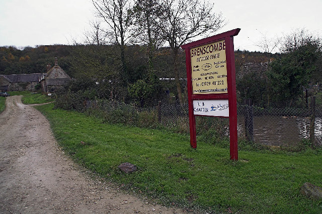
Brenscombe Heath

Brenscombe Heath (grid reference SY985829) is a 34.7 hectare biological Site of Special Scientific Interest in Corfe Castle, Dorset, notified in 1985....

Corfe Castle Hundred

Corfe Castle Hundred was a hundred in the county of Dorset, England, containing only the parish of Corfe Castle. It was sometimes also referred to as Corfe...

Corfe Castle

Corfe Castle is a fortification standing above the village of the same name on the Isle of Purbeck peninsula in the English county of Dorset. Built by...

Corfe Castle railway station

Corfe Castle railway station is a railway station located in the village of Corfe Castle, in the English county of Dorset. Originally an intermediate...

Corfe Castle (village)

Corfe Castle is a village and civil parish in the English county of Dorset. It is the site of a ruined castle of the same name. The village and castle...

Nearby Amenities

Located within 500m of 50.65522,-2.0437017
Material: wood
Power: pole
Ref: 71
Source: bing
Source Ref: interpolation
Lat/Long: 50.6525004/-2.0387127
Material: wood
Power: pole
Source: bing
Lat/Long: 50.6525846/-2.0395772
Material: wood
Poles: bipole
Power: pole
Source: bing
Lat/Long: 50.653064/-2.0416617
Material: wood
Poles: bipole
Power: pole
Ref: 69
Source: bing
Source Ref: interpolation
Lat/Long: 50.6531919/-2.0417227
Material: wood
Power: pole
Source: bing
Lat/Long: 50.6535992/-2.0440151
Material: wood
Power: pole
Ref: 68
Source: bing
Source Ref: interpolation
Lat/Long: 50.6537099/-2.043916
Material: wood
Power: pole
Source: bing
Lat/Long: 50.6547983/-2.0457487
Material: wood
Power: pole
Ref: 67
Source: bing
Source Ref: interpolation
Lat/Long: 50.6548741/-2.0456424
Material: wood
Power: pole
Source: bing
Lat/Long: 50.6558317/-2.0472387
Material: wood
Power: pole
Ref: 66
Source: bing
Source Ref: interpolation
Lat/Long: 50.6558489/-2.0470485
Marker: pipeline
Source: survey
Lat/Long: 50.6565219/-2.0385513
Power: pole
Ref: 65
Source: bing
Source Ref: interpolation
Lat/Long: 50.656738/-2.0483299
Power: pole
Source: bing
Lat/Long: 50.6566887/-2.048462
Power: pole
Ref: 70
Source: bing
Source Ref: interpolation
Lat/Long: 50.6529391/-2.0406273
The data included in this document is from www.openstreetmap.org. The data is made available under ODbL.

Have you been to Thrasher's Heath?

Leave your review of Thrasher's Heath below (or comments, questions and feedback).