Meadus's Plantation

Wood, Forest in Dorset

England

Meadus's Plantation

National Cycle Track This is where the track to Studland leaves the minor road that runs between Corfe and Arne.
National Cycle Track Credit: Nigel Mykura

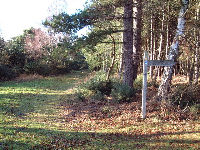
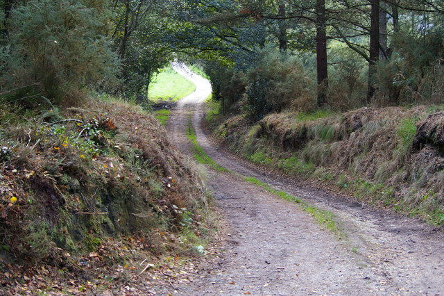
Meadus's Plantation, located in Dorset, England, is a picturesque wooded area that holds immense historical and ecological significance. Covering a vast expanse of land, this plantation is a thriving forest ecosystem that is home to a diverse range of flora and fauna.

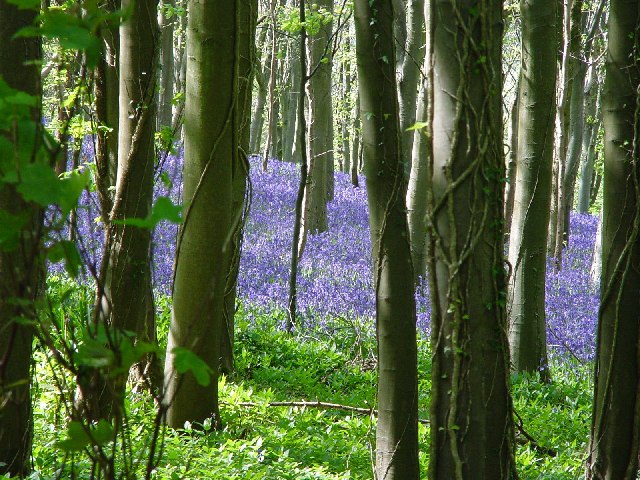
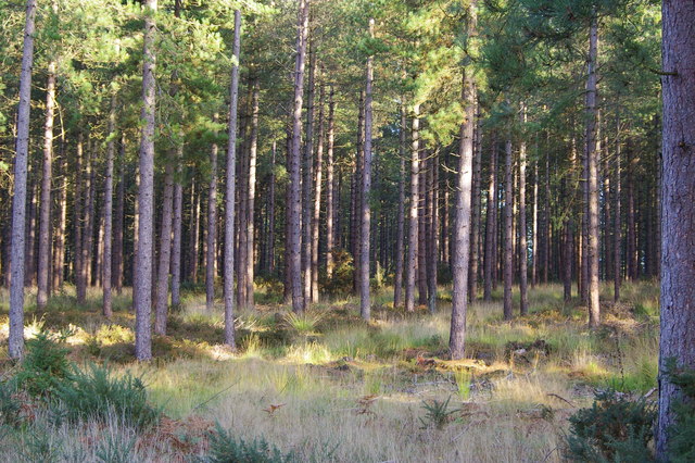
The plantation is primarily composed of deciduous trees such as oak, beech, and ash, which provide a lush green canopy during the summer months. These trees also offer a habitat for various bird species, including woodpeckers, owls, and songbirds, making it a popular spot for birdwatchers.

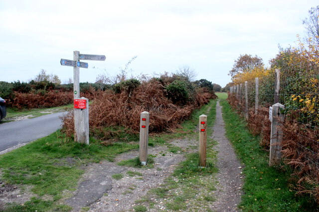
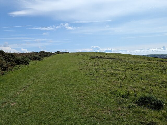
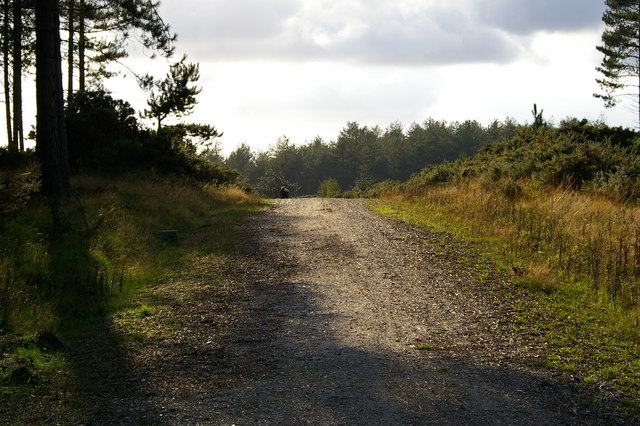
Meadus's Plantation is renowned for its well-maintained walking trails that wind through the forest, allowing visitors to immerse themselves in the natural beauty of the surroundings. The trails are suitable for all ages and provide an excellent opportunity for nature enthusiasts to explore and appreciate the diverse plant life that thrives within the plantation.

The plantation is also of historical significance, as it was once owned by the Meadus family, who were prominent landowners in the region during the 19th century. Several remnants of their estate, including a dilapidated mansion and a small chapel, can still be found within the plantation, adding an intriguing historical element to the overall experience.

Overall, Meadus's Plantation in Dorset is a captivating destination for nature lovers and history enthusiasts alike. With its scenic beauty, diverse wildlife, and historical charm, it offers a unique opportunity to connect with nature and explore the rich heritage of the area.

If you have any feedback on the listing, please let us know in the comments section below.

Meadus's Plantation Images

Images are sourced within 2km of 50.652589/-2.0321141 or Grid Reference SY9783. Thanks to Geograph Open Source API. All images are credited.

National Cycle Track This is where the track to Studland leaves the minor road that runs between Corfe and Arne.
National Cycle Track
This is where the track to Studland leaves the minor road that runs between Corfe and Arne.
Purbeck Way
Purbeck Way
Welcome seat
Welcome seat
Corfe Castle Railway Station Swanage Railway
Corfe Castle Railway Station
Swanage Railway
Corfe Castle - View of Village from Castle
Brenscombe Outdoor Centre, Corfe Castle, Dorset The centre offers a wide range of outdoor activities and farmhouse accommodation.
<span class="nowrap"><a title="http://www.brenscombeoutdoor.co.uk/index.html" rel="nofollow ugc noopener" href="http://www.brenscombeoutdoor.co.uk/index.html">Link</a><img style="margin-left:2px;" alt="External link" title="External link - shift click to open in new window" src="https://s1.geograph.org.uk/img/external.png" width="10" height="10"/></span>
Brenscombe Outdoor Centre, Corfe Castle, Dorset
The centre offers a wide range of outdoor activities and farmhouse accommodation. LinkExternal link
Wytch Farm This typically rural view belies the fact that this is the farm that has given its name to the largest onshore oilfield in Europe.
Wytch Farm
This typically rural view belies the fact that this is the farm that has given its name to the largest onshore oilfield in Europe.
Wytch Heath The path straight ahead is signed "Scotland" - not the northern part of Britain but a farm where old horse drawn carts and waggons are restored. To the right is Hartland Moor National Nature Reserve.
Wytch Heath
The path straight ahead is signed "Scotland" - not the northern part of Britain but a farm where old horse drawn carts and waggons are restored. To the right is Hartland Moor National Nature Reserve.
Sharford Bridge This ancient two arch stone packhorse bridge is the lowest crossing point of the Corfe River. Note the gates at each end.
Sharford Bridge
This ancient two arch stone packhorse bridge is the lowest crossing point of the Corfe River. Note the gates at each end.
South Middlebere This stretch of National Trust owned open space is on the south eastern flank of Hartland Moor National Nature Reserve.
South Middlebere
This stretch of National Trust owned open space is on the south eastern flank of Hartland Moor National Nature Reserve.
Scotland Farm The Purbeck centre for the restoration of horse drawn carts and waggons.
Scotland Farm
The Purbeck centre for the restoration of horse drawn carts and waggons.
Corfe River Valley A view looking south westwards across the Corfe River valley to the Purbeck Hills beyond.
Corfe River Valley
A view looking south westwards across the Corfe River valley to the Purbeck Hills beyond.
Bluebells at Brenscombe Hill
Forestry plantation, Rempstone Forest Photo taken from the adjacent bridleway
Forestry plantation, Rempstone Forest
Photo taken from the adjacent bridleway
Bridleway over forest road, Rempstone Forest
Bridleway, Rempstone Forest This route crosses the north west corner of the square, from a track through forestry plantations to a road between enclosed fields, near a farm to the north of Bushey.
Bridleway, Rempstone Forest
This route crosses the north west corner of the square, from a track through forestry plantations to a road between enclosed fields, near a farm to the north of Bushey.
Lane and farm north of Bushey
Lane and field sw of Lower Bushy Farm Location is to the south of the grid square.
Lane and field sw of Lower Bushy Farm
Location is to the south of the grid square.
Show me another place!

Meadus's Plantation is located at Grid Ref: SY9783 (Lat: 50.652589, Lng: -2.0321141)

Unitary Authority: Dorset

Police Authority: Dorset

What 3 Words

///yards.puppy.scanty. Near Corfe Castle, Dorset

Related Wikis

Wytch Farm

Wytch Farm is an oil field and processing facility in the Purbeck district of Dorset, England. It is the largest onshore oil field in western Europe. The...
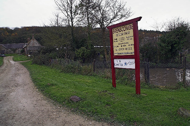
Brenscombe Heath

Brenscombe Heath (grid reference SY985829) is a 34.7 hectare biological Site of Special Scientific Interest in Corfe Castle, Dorset, notified in 1985....

Purbeck Mineral and Mining Museum

The Purbeck Mining Museum exists to preserve and interpret the historic extractive industries in ball clay mining in the Isle of Purbeck. The museum is...

Rempstone Stone Circle

Rempstone Stone Circle (grid reference SY994820) is a stone circle located near to Corfe Castle on the Isle of Purbeck in the south-western English county...

Corfe Castle railway station

Corfe Castle railway station is a railway station located in the village of Corfe Castle, in the English county of Dorset. Originally an intermediate...

Corfe Castle Hundred

Corfe Castle Hundred was a hundred in the county of Dorset, England, containing only the parish of Corfe Castle. It was sometimes also referred to as Corfe...

Corfe Castle

Corfe Castle is a fortification standing above the village of the same name on the Isle of Purbeck peninsula in the English county of Dorset. Built by...

Norden railway station (England)

Norden railway station is a railway station located one mile to the north of the village of Corfe Castle, on the Isle of Purbeck in the English county...

Nearby Amenities

Located within 500m of 50.652589,-2.0321141
Material: wood
Power: pole
Source: bing
Lat/Long: 50.6487837/-2.0342902
Material: wood
Power: pole
Source: bing
Lat/Long: 50.6499696/-2.026644
Material: wood
Power: pole
Source: bing
Lat/Long: 50.649968/-2.0346339
Material: wood
Power: pole
Source: bing
Lat/Long: 50.6501267/-2.0281227
Material: wood
Power: pole
Source: bing
Lat/Long: 50.6502661/-2.0282993
Material: wood
Power: pole
Source: bing
Lat/Long: 50.6504576/-2.0344899
Material: wood
Poles: bipole
Power: pole
Source: bing
Lat/Long: 50.6506447/-2.0309258
Material: wood
Power: pole
Source: bing
Lat/Long: 50.6508802/-2.0316625
Material: wood
Power: pole
Source: bing
Lat/Long: 50.6513661/-2.0343873
Material: wood
Power: pole
Ref: 74 2
Source: bing
Source Ref: survey
Lat/Long: 50.6514136/-2.0342553
Material: wood
Power: pole
Ref: 72
Source: bing
Source Ref: interpolation
Lat/Long: 50.6521765/-2.0373225
Material: wood
Power: pole
Ref: 71
Source: bing
Source Ref: interpolation
Lat/Long: 50.6525004/-2.0387127
Material: wood
Power: pole
Lat/Long: 50.6493881/-2.0324607
Material: wood
Power: pole
Lat/Long: 50.6499536/-2.0302817
Material: wood
Power: pole
Source: survey;bing
Transformer: distribution
Lat/Long: 50.6501799/-2.0307299
Material: wood
Power: pole
Lat/Long: 50.6504314/-2.0312035
Material: wood
Power: pole
Lat/Long: 50.6504686/-2.0264226
Material: wood
Power: pole
Lat/Long: 50.6507528/-2.0295684
Material: wood
Power: pole
Lat/Long: 50.6508038/-2.0275206
Material: wood
Power: pole
Source: bing
Lat/Long: 50.6508728/-2.0343735
Material: wood
Power: pole
Lat/Long: 50.6511678/-2.0286658
Material: wood
Power: pole
Transformer: distribution
Lat/Long: 50.6513189/-2.034251
Poles: bipole
Power: pole
Switch: yes
Lat/Long: 50.6514778/-2.0342225
Power: transformer
Source: survey;bing
Voltage Primary: 33000
Voltage Secondary: 11000
Lat/Long: 50.6515453/-2.0342017
Man Made: mast
Source: survey
Lat/Long: 50.6515659/-2.0341176
Material: wood
Power: pole
Source: bing
Lat/Long: 50.6538144/-2.0283885
Material: wood
Power: pole
Source: bing
Transformer: distribution
Lat/Long: 50.654508/-2.0280718
Material: wood
Power: pole
Source: bing
Lat/Long: 50.6559364/-2.028565
Bushey
Place: hamlet
Source: OS OpenData StreetView
Lat/Long: 50.6506917/-2.0318749
Speedwell
Addr Housename: Speedwell
Building: house
Source: OS-OpenData_StreetView
Lat/Long: 50.6493719/-2.0298134
Meadus Lane Cottage
Addr Housename: Meadus Lane Cottage
Building: house
Source: Mapbox
Source Name: OS-OpenData_StreetView
Lat/Long: 50.6545398/-2.0289286
Homestead
Addr Housename: Homestead
Building: house
Source: Mapbox
Source Name: OS-OpenData_StreetView
Wikidata: Q26413482
Lat/Long: 50.654499/-2.0261307
Poles: bipole
Power: pole
Lat/Long: 50.6515121/-2.0342031
Power: pole
Source: bing
Lat/Long: 50.6536576/-2.0284769
Power: pole
Source: bing
Lat/Long: 50.6527861/-2.0284729
Power: pole
Source: bing
Lat/Long: 50.651605/-2.0286244
Power: pole
Source: bing
Lat/Long: 50.6505651/-2.0298904
Power: pole
Source: bing
Lat/Long: 50.6509545/-2.0325927
Power: pole
Source: bing
Lat/Long: 50.6510498/-2.032582
Power: pole
Ref: 73
Source: bing
Source Ref: interpolation
Lat/Long: 50.6518499/-2.0359643
Power: pole
Source: bing
Lat/Long: 50.651747/-2.0360206
Power: pole
Source: bing
Lat/Long: 50.6491884/-2.0350269
The data included in this document is from www.openstreetmap.org. The data is made available under ODbL.

Have you been to Meadus's Plantation?

Leave your review of Meadus's Plantation below (or comments, questions and feedback).