Cross Fields

Downs, Moorland in Yorkshire Craven

England

Cross Fields

Path & wall descending southeast from Old Cote Moor Top A reasonable path runs along the ridge on the north eastern side of the wall. It is not shown on Ordnance Survey Maps.
Path & wall descending southeast from Old Cote Moor Top Credit: Colin Park

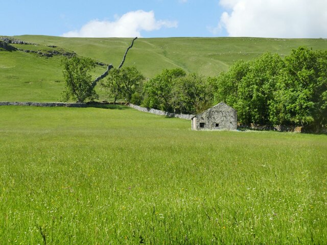
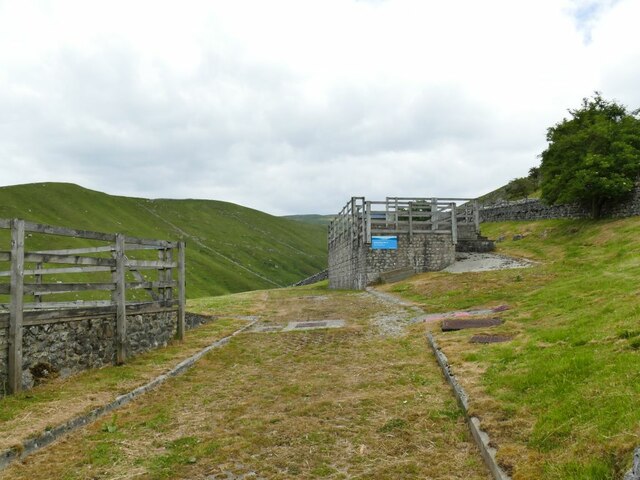
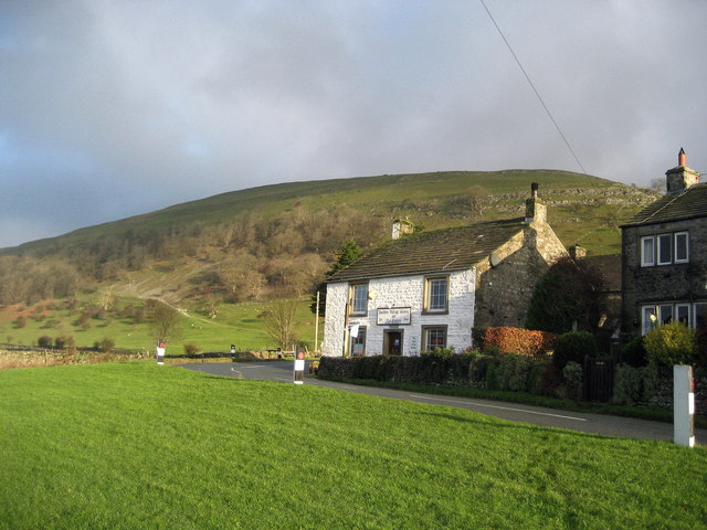
Cross Fields is a picturesque region located in Yorkshire, England, encompassing both the Yorkshire Downs and Moorland. Stretching across a vast expanse of rolling hills, dense forests, and open fields, this area offers visitors a captivating blend of natural beauty and rural charm.

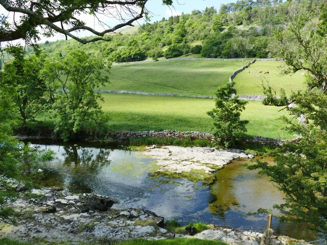
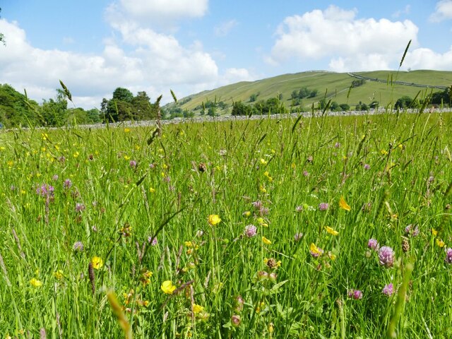
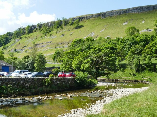
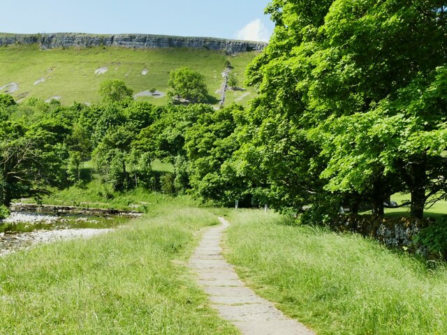
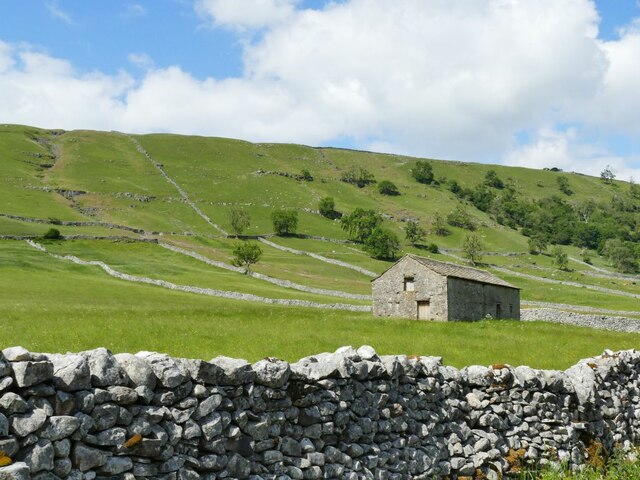
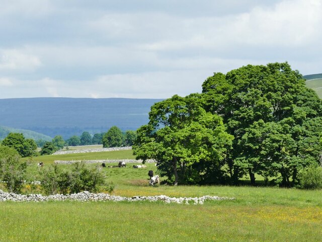
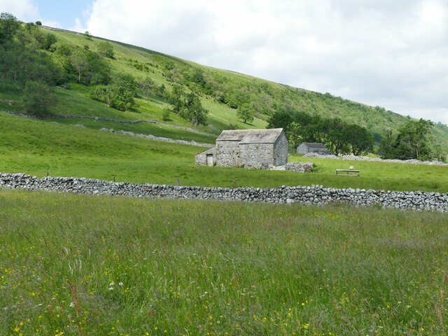
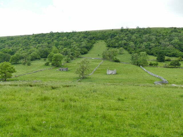
The Yorkshire Downs in Cross Fields are characterized by their sweeping landscapes, carpeted with emerald-green grass and dotted with grazing sheep. These hills provide breathtaking vistas, with their undulating slopes offering panoramic views of the surrounding countryside. The Downs are also home to a rich array of wildlife, including hares, foxes, and various bird species, making it a paradise for nature enthusiasts.

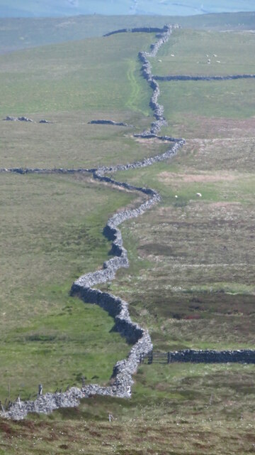
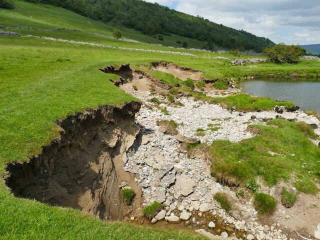
In contrast, the Moorland in Cross Fields offers a rugged and wild terrain. Characterized by its vast expanses of heather, this area is known for its unique flora and fauna. Visitors can explore the winding paths that meander through the Moorland, immersing themselves in the untamed beauty of this untamed landscape.

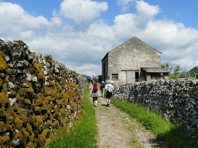
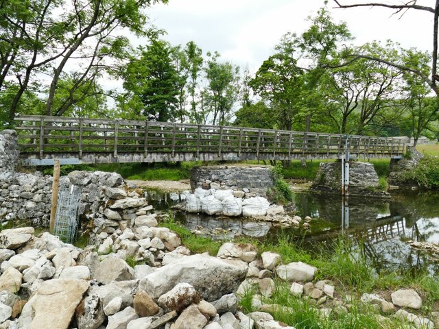
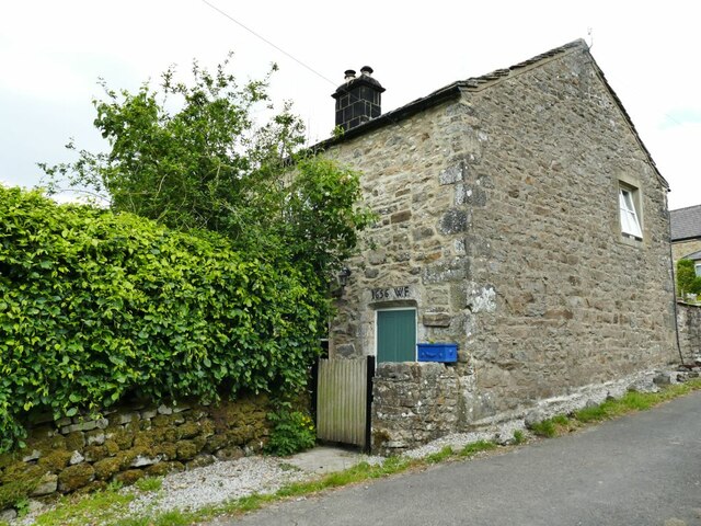
Cross Fields is also steeped in history and heritage, with numerous ancient landmarks and historical sites scattered throughout the region. From ancient stone circles to medieval castles, there is much to discover for those interested in the area's rich past.

Overall, Cross Fields in Yorkshire is a captivating destination that offers a diverse range of natural landscapes, from the gentle slopes of the Downs to the rugged beauty of the Moorland. Whether one seeks tranquility in nature, a glimpse into history, or simply a peaceful escape from the hustle and bustle of city life, Cross Fields is an idyllic location to explore.

If you have any feedback on the listing, please let us know in the comments section below.

Cross Fields Images

Images are sourced within 2km of 54.156892/-2.0627016 or Grid Reference SD9673. Thanks to Geograph Open Source API. All images are credited.

Path & wall descending southeast from Old Cote Moor Top A reasonable path runs along the ridge on the north eastern side of the wall. It is not shown on Ordnance Survey Maps.
Path & wall descending southeast from Old Cote Moor Top
A reasonable path runs along the ridge on the north eastern side of the wall. It is not shown on Ordnance Survey Maps.
Boundary wall along Middlesmoor Pasture above Kettlewell
Shallows in the river Wharfe The river flows over a shallow step in the limestone bed at this point, and at low summer flow levels leaves some of the bedrock exposed. Roughly the same location as <a href="https://www.geograph.org.uk/photo/5416111">SD9771 : River Wharfe</a>.
Shallows in the river Wharfe
The river flows over a shallow step in the limestone bed at this point, and at low summer flow levels leaves some of the bedrock exposed. Roughly the same location as SD9771 : River Wharfe.
Meadow flowers near Kettlewell These limestone pastures are rich in spring and summer flowers.
Meadow flowers near Kettlewell
These limestone pastures are rich in spring and summer flowers.
Confluence of Dowber Gill and the river Wharfe There was little flow in the gill in a dry summer, but it can run in spate after a downpour on the slopes of Great Whernside.
Confluence of Dowber Gill and the river Wharfe
There was little flow in the gill in a dry summer, but it can run in spate after a downpour on the slopes of Great Whernside.
Bend in the river Wharfe at Kettlewell On the hillside behind is Gate Cote Scar.
Bend in the river Wharfe at Kettlewell
On the hillside behind is Gate Cote Scar.
Riverside path at Kettlewell This section of the path, forming part of the Dales Way, is paved.
Riverside path at Kettlewell
This section of the path, forming part of the Dales Way, is paved.
Stone laithe above Kettlewell One of many such structures in Upper Wharfedale, where there is still a network of small fields.  This laithe looks in better condition than most others.
Stone laithe above Kettlewell
One of many such structures in Upper Wharfedale, where there is still a network of small fields. This laithe looks in better condition than most others.
Stone laithe by the Dales Way One of many such structures in Upper Wharfedale, where there is still a network of small fields.  This laithe appears still to be in active use.
Stone laithe by the Dales Way
One of many such structures in Upper Wharfedale, where there is still a network of small fields. This laithe appears still to be in active use.
Haw Fields Laithe  One of many such structures in Upper Wharfedale, where there is still a network of small fields.  This laithe is one of the few to be shown on maps with a name.
Haw Fields Laithe
One of many such structures in Upper Wharfedale, where there is still a network of small fields. This laithe is one of the few to be shown on maps with a name.
Cows by the river Wharfe The cows are on the far side of the river from the photographer, the nearest one being at a point where they come down to the river to drink.
Cows by the river Wharfe
The cows are on the far side of the river from the photographer, the nearest one being at a point where they come down to the river to drink.
Stone laithe below Moor End One of many such structures in Upper Wharfedale, where there is still a network of small fields.
Stone laithe below Moor End
One of many such structures in Upper Wharfedale, where there is still a network of small fields.
Continuing erosion of the riverbank  Roughly the same location as <a href="https://www.geograph.org.uk/photo/4254500">SD9573 : Another landslip on the Wharfe</a> taken seven years earlier, looking in the opposite direction.
Continuing erosion of the riverbank
Roughly the same location as SD9573 : Another landslip on the Wharfe taken seven years earlier, looking in the opposite direction.
Bounty Barns, Starbotton Two of many such structures in Upper Wharfedale, where there is still a network of small fields; the name is given on old maps.
Bounty Barns, Starbotton
Two of many such structures in Upper Wharfedale, where there is still a network of small fields; the name is given on old maps.
Starbotton footbridge The bridge on a bridleway is the only crossing point of the river between Kettlewell and Buckden. One of the pillars had recently been given temporary protection following flood damage the previous winter (see <a href="https://www.geograph.org.uk/photo/3193993">SD9574 : The Dales Way</a> for a 'before' view).  See also <a href="https://www.geograph.org.uk/photo/249353">SD9574 : Bridge over the Wharfe, Starbotton</a>.
Starbotton footbridge
The bridge on a bridleway is the only crossing point of the river between Kettlewell and Buckden. One of the pillars had recently been given temporary protection following flood damage the previous winter (see SD9574 : The Dales Way for a 'before' view). See also SD9574 : Bridge over the Wharfe, Starbotton.
Lilac Cottage, Starbotton  One of the oldest properties in the village, dated 1656. Listed grade II (list entry 1295854).
Lilac Cottage, Starbotton
One of the oldest properties in the village, dated 1656. Listed grade II (list entry 1295854).
Starbotton waterworks (1) The installation alongside Starbotton Cam Road is shown on one online map as a 'sewage pumping station' which given its location high above the village seems most unlikely. Rather, it's a reservoir and treatment works for the village water supply.
Starbotton waterworks (1)
The installation alongside Starbotton Cam Road is shown on one online map as a 'sewage pumping station' which given its location high above the village seems most unlikely. Rather, it's a reservoir and treatment works for the village water supply.
Starbotton waterworks (2) The installation alongside Starbotton Cam Road is shown on one online map as a 'sewage pumping station' which given its location high above the village seems most unlikely. Rather, it's a reservoir and treatment works for the village water supply.
Starbotton waterworks (2)
The installation alongside Starbotton Cam Road is shown on one online map as a 'sewage pumping station' which given its location high above the village seems most unlikely. Rather, it's a reservoir and treatment works for the village water supply.
Show me another place!

Cross Fields is located at Grid Ref: SD9673 (Lat: 54.156892, Lng: -2.0627016)

Division: West Riding

Administrative County: North Yorkshire

District: Craven

Police Authority: North Yorkshire

What 3 Words

///digit.damp.lurching. Near Grassington, North Yorkshire

Nearby Locations

Cross Fields Cross Wood

Related Wikis

Kettlewell with Starbotton

Kettlewell with Starbotton is a civil parish in the Craven district of North Yorkshire, England. Kettlewell is a village in Upper Wharfedale, North Yorkshire...

Starbotton

Starbotton is a village of around 60 houses in Upper Wharfedale in the Craven district of North Yorkshire, England. It is situated in the Yorkshire Dales...

Kettlewell

Kettlewell is a village in Upper Wharfedale, North Yorkshire, England. Historically part of the West Riding of Yorkshire, it lies 6 miles (10 km) north...

Hawkswick

Hawkswick is a hamlet and civil parish in the Craven district of North Yorkshire, England. Situated in the Yorkshire Dales, it lies in Littondale on the...

Scargill House

Scargill House is a Christian conference Centre run by the Scargill Movement and located in Wharfedale, in the county of North Yorkshire, England. Scargill...

Arncliffe, North Yorkshire

Arncliffe is a small village and civil parish in Littondale, one of the Yorkshire Dales in England. Littondale is a small valley beside Upper Wharfedale...

Great Whernside

Great Whernside is a fell in the Yorkshire Dales, England, not to be confused with Whernside, some 17 miles (27 km) to the west. Its summit is the highest...

Buckden, North Yorkshire

Buckden is a village and civil parish in the Craven district of North Yorkshire, England. Historically part of the West Riding of Yorkshire, Buckden is...

Nearby Amenities

Located within 500m of 54.156892,-2.0627016
Historic: mine_shaft
Source: Bing
Lat/Long: 54.1589507/-2.0566038
Natural: spring
Source: OS 6", Yorkshore 98,1862
Lat/Long: 54.1590324/-2.0600144
Historic: mine_shaft
Source: EsriWorldImageryClarity
Lat/Long: 54.158822/-2.0561746
Power: pole
Lat/Long: 54.1611384/-2.0635897
Power: pole
Lat/Long: 54.1598993/-2.0625275
Power: pole
Lat/Long: 54.1591753/-2.0621654
Power: pole
Lat/Long: 54.1575937/-2.061452
Power: pole
Lat/Long: 54.1571398/-2.0608082
Power: pole
Lat/Long: 54.1566058/-2.0599982
Power: pole
Lat/Long: 54.1555236/-2.058515
Power: pole
Lat/Long: 54.1547948/-2.0573992
Ford: yes
Lat/Long: 54.1528721/-2.0618479
The data included in this document is from www.openstreetmap.org. The data is made available under ODbL.

Have you been to Cross Fields?

Leave your review of Cross Fields below (or comments, questions and feedback).