Whittaker Moor

Downs, Moorland in Lancashire

England

Whittaker Moor

A58 ascending Blackstone Edge Moor
A58 ascending Blackstone Edge Moor Credit: Colin Pyle

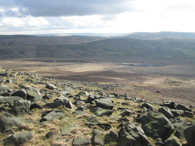
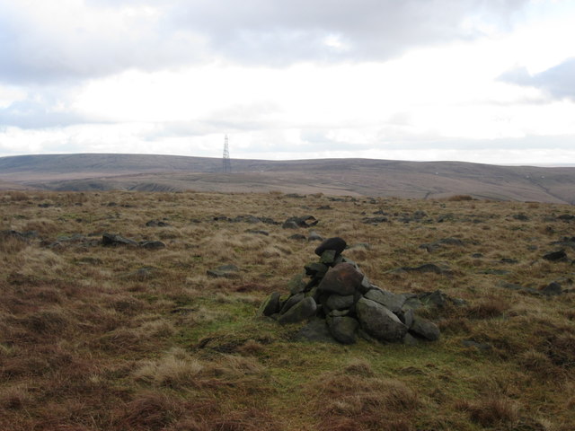
Whittaker Moor is a pristine moorland located in Lancashire, England. This vast expanse of natural beauty is situated in the charming village of Whittaker, just a few miles away from Rochdale. Spread across an area of approximately 500 acres, Whittaker Moor attracts nature enthusiasts, hikers, and birdwatchers alike.

The moorland boasts a diverse habitat that includes heather-covered hills, peat bogs, and scattered woodlands. This rich tapestry of landscapes provides a perfect haven for a variety of flora and fauna. Visitors can witness an array of wildflowers, such as purple heather, bilberries, and cotton grass, dotting the moorland in vibrant colors during the summer months.

Whittaker Moor is also famous for its thriving bird population. Birdwatchers can spot an abundance of species, including the rare short-eared owl, red grouse, and curlew. The tranquil atmosphere and undisturbed environment make it an ideal place for bird nesting and breeding.

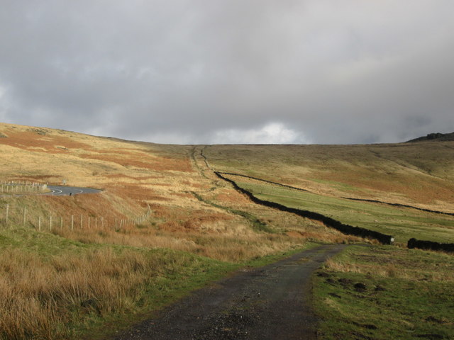
In addition to its natural wonders, Whittaker Moor offers several walking trails that allow visitors to explore its breathtaking scenery. The trails wind their way through the moorland, offering stunning panoramic views of the surrounding Lancashire countryside.

Whittaker Moor is a cherished local treasure, managed by the Lancashire Wildlife Trust, ensuring its preservation and conservation for future generations. With its unspoiled landscapes, diverse wildlife, and peaceful ambiance, Whittaker Moor is a must-visit destination for nature lovers seeking solace in the heart of Lancashire's countryside.

If you have any feedback on the listing, please let us know in the comments section below.

Whittaker Moor Images

Images are sourced within 2km of 53.636676/-2.065781 or Grid Reference SD9515. Thanks to Geograph Open Source API. All images are credited.

A58 ascending Blackstone Edge Moor
Hollingworth Lake with the elevated M62 beyond
Pennine Way, Blackstone Edge Taken just to the south of the trig pillar. Looking out over littleborough and Rochdale.
Pennine Way, Blackstone Edge
Taken just to the south of the trig pillar. Looking out over littleborough and Rochdale.
Blackstone Edge trig pillar On the Pennine Way at 472 metres above sea level.
Blackstone Edge trig pillar
On the Pennine Way at 472 metres above sea level.
Looking down Great Hoar Edge to the M62 motorway
Low House Moor The mast on Windy Hill in the distance
Low House Moor
The mast on Windy Hill in the distance
Broad Head Drain
Broad Head Drain
The old road towards Blackstone Edge Moor
Blackstone Edge Moor, Broad Head Drain
Stone Bridge over Broad Head Drain, Blackstone Edge Moor
Blackstone Edge Moor
Pennine Way, Broad Head Drain
'Roman' Road over Blackstone Edge Blackstone Edge Long Causeway also known as Blackstone Edge Roman is a cobbled ‘road’ surface crossing the bleak moorland for about 2 miles along Blackstone Edge on the Lancashire-West Yorkshire border. The road has a deep groove running down the centre. 

It is a Scheduled monument (List entry Number: 1003746 <span class="nowrap"><a title="https://historicengland.org.uk/listing/the-list/list-entry/1003746" rel="nofollow ugc noopener" href="https://historicengland.org.uk/listing/the-list/list-entry/1003746">Link</a><img style="margin-left:2px;" alt="External link" title="External link - shift click to open in new window" src="https://s1.geograph.org.uk/img/external.png" width="10" height="10"/></span>  Historic England). Initially thought to be of Roman Origin, this road is still marked on Ordnance Survey maps as a ‘Roman Road’ but many historians have argued over whether or not the paved road over Blackstone Edge was built by the Romans, with no firm conclusion ever being reached but nowadays the most widely accepted theory is that it is an early turnpike road from circa 1735. Indeed, in 1965 James Leonard Maxim reported the discovery of a medieval pack-horse track that passed under part of the road and that therefore must pre-date it (Maxim, James L., A Lancashire Lion, J.L. Maxim Trustees: Leeds 1965). 

Others believe that it may be even more modern being constructed in connection with stone gathering or quarrying activity on the moor. It is, however, likely that a Roman road did once cross the Pennines hereabouts before the medieval pack-horse tracks and the 1735 turnpike road were constructed.
'Roman' Road over Blackstone Edge
Blackstone Edge Long Causeway also known as Blackstone Edge Roman is a cobbled ‘road’ surface crossing the bleak moorland for about 2 miles along Blackstone Edge on the Lancashire-West Yorkshire border. The road has a deep groove running down the centre. It is a Scheduled monument (List entry Number: 1003746 LinkExternal link Historic England). Initially thought to be of Roman Origin, this road is still marked on Ordnance Survey maps as a ‘Roman Road’ but many historians have argued over whether or not the paved road over Blackstone Edge was built by the Romans, with no firm conclusion ever being reached but nowadays the most widely accepted theory is that it is an early turnpike road from circa 1735. Indeed, in 1965 James Leonard Maxim reported the discovery of a medieval pack-horse track that passed under part of the road and that therefore must pre-date it (Maxim, James L., A Lancashire Lion, J.L. Maxim Trustees: Leeds 1965). Others believe that it may be even more modern being constructed in connection with stone gathering or quarrying activity on the moor. It is, however, likely that a Roman road did once cross the Pennines hereabouts before the medieval pack-horse tracks and the 1735 turnpike road were constructed.
Broad Head Drain, Blackstone Edge Moor Looking back from the pack horse road over Blackstone Edge.
Broad Head Drain, Blackstone Edge Moor
Looking back from the pack horse road over Blackstone Edge.
Blackstone Edge Blackstone Edge is a gritstone escarpment at 1549 feet (472 m) above sea level in the Pennine hills surrounded by moorland on the boundary between Greater Manchester and West Yorkshire.
Blackstone Edge
Blackstone Edge is a gritstone escarpment at 1549 feet (472 m) above sea level in the Pennine hills surrounded by moorland on the boundary between Greater Manchester and West Yorkshire.
Blackstone Edge Escarpment Blackstone Edge is a gritstone escarpment at 1549 feet (472 m) above sea level in the Pennine hills surrounded by moorland overlooking Littleborough and Rochdale on the boundary between Greater Manchester and West Yorkshire.
Blackstone Edge Escarpment
Blackstone Edge is a gritstone escarpment at 1549 feet (472 m) above sea level in the Pennine hills surrounded by moorland overlooking Littleborough and Rochdale on the boundary between Greater Manchester and West Yorkshire.
Pennine Way, Blackstone Edge
Blackstone Edge Trig Pillar Approached here from the north, the triangulation pillar at Blackstone Edge sits spectacularly on a large gritstone boulder high above the town of Littleborough.
Blackstone Edge Trig Pillar
Approached here from the north, the triangulation pillar at Blackstone Edge sits spectacularly on a large gritstone boulder high above the town of Littleborough.
Show me another place!

Whittaker Moor is located at Grid Ref: SD9515 (Lat: 53.636676, Lng: -2.065781)

Unitary Authority: Rochdale

Police Authority: Greater Manchester

What 3 Words

///reverses.reap.liberated. Near Littleborough, Manchester

Nearby Locations

Whittaker Moor Dry Mere

Related Wikis

Whittaker Wood

Whittaker Wood is a woodland in Greater Manchester, England, near Littleborough. It covers a total area of 1.88 hectares (4.65 acres). It is owned and...
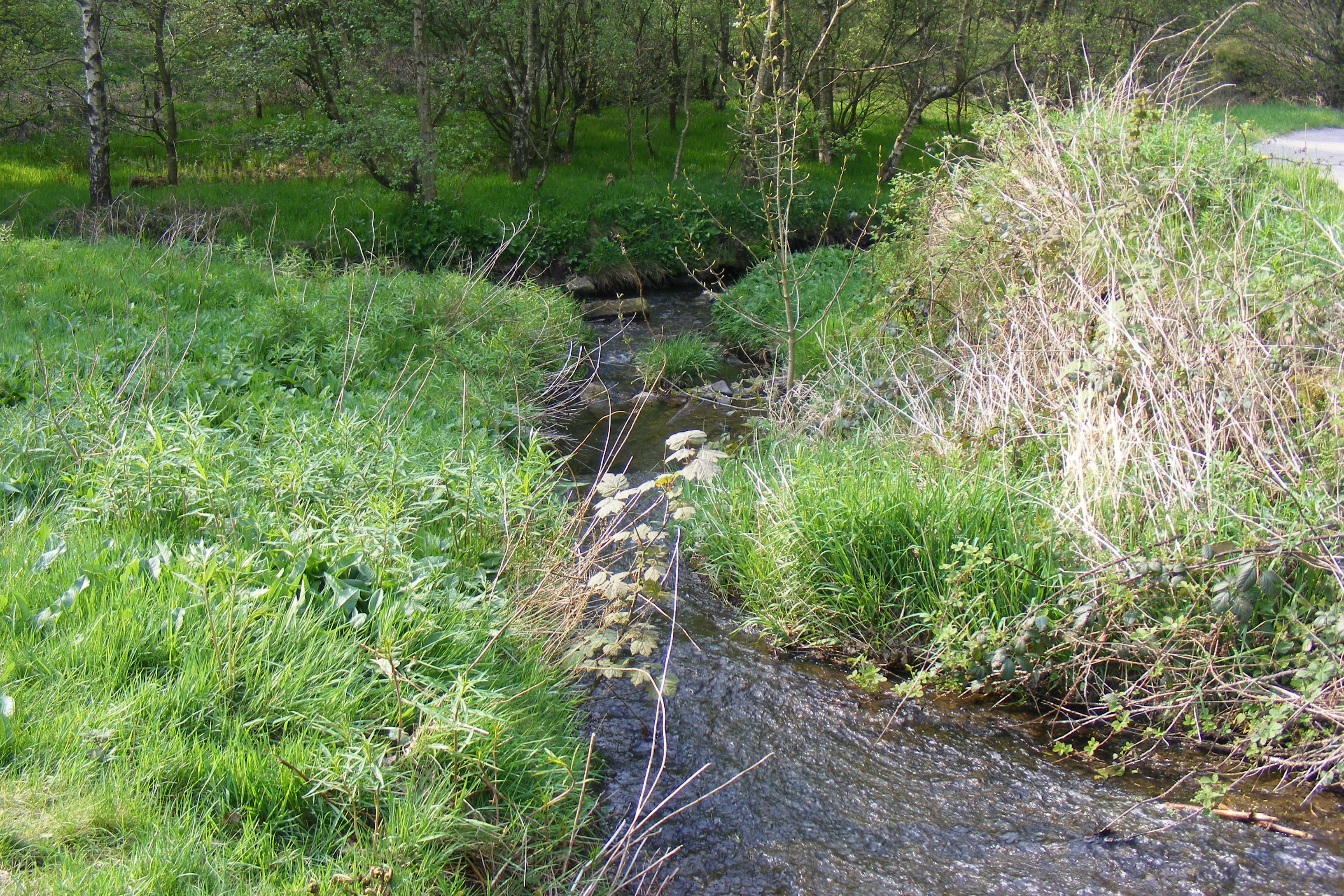
Shore Lane Brook

Shore Lane Brook is a water course in Greater Manchester and a tributary of Ealees Brook in Littleborough.

Hollingworth Brook

Hollingworth Brook is a water course in Greater Manchester which originates at Hollingworth Lake and flows through the Ealees Valley where it merges with...

Brearley Brook

Brearley Brook is a watercourse in Greater Manchester and a tributary of Hollingworth Brook. The original source was on Low House Moor but this has been...

Nearby Amenities

Located within 500m of 53.636676,-2.065781
Power: tower
Lat/Long: 53.6390288/-2.0696566
Power: tower
Lat/Long: 53.6368223/-2.0698596
Power: tower
Lat/Long: 53.6342947/-2.0701303
The data included in this document is from www.openstreetmap.org. The data is made available under ODbL.

Have you been to Whittaker Moor?

Leave your review of Whittaker Moor below (or comments, questions and feedback).