Middleton Common

Downs, Moorland in Durham

England

Middleton Common

Fence rising over moorland rising to Outberry Plain The fence here follows the watershed between Weardale and Teesdale; the summit of the vague rise ahead, Outberry Plain, is very hard to identify.
Fence rising over moorland rising to Outberry Plain Credit: Trevor Littlewood

Middleton Common, located in Durham, is a picturesque and diverse natural area that encompasses downs, moorland, and other unique landscapes. Spanning over a vast area, it offers a range of habitats for various plant and animal species, making it a haven for wildlife enthusiasts and nature lovers.

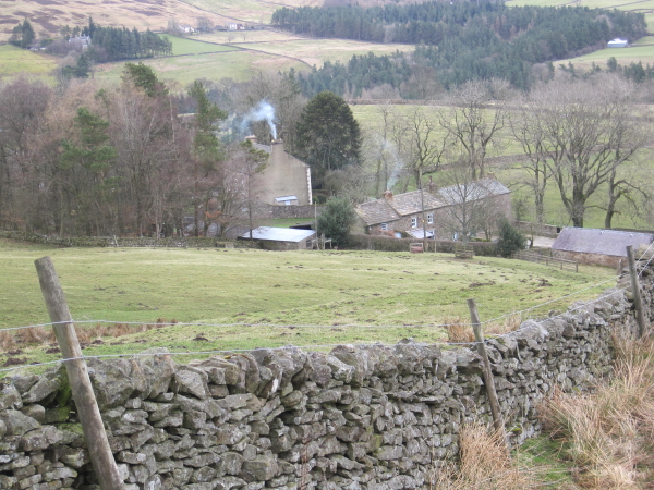
The downs of Middleton Common are characterized by gently rolling hills and open grasslands. These areas provide ample grazing opportunities for livestock and are often dotted with grazing sheep and cattle. The downs also offer stunning panoramic views of the surrounding countryside, attracting hikers and photographers alike.

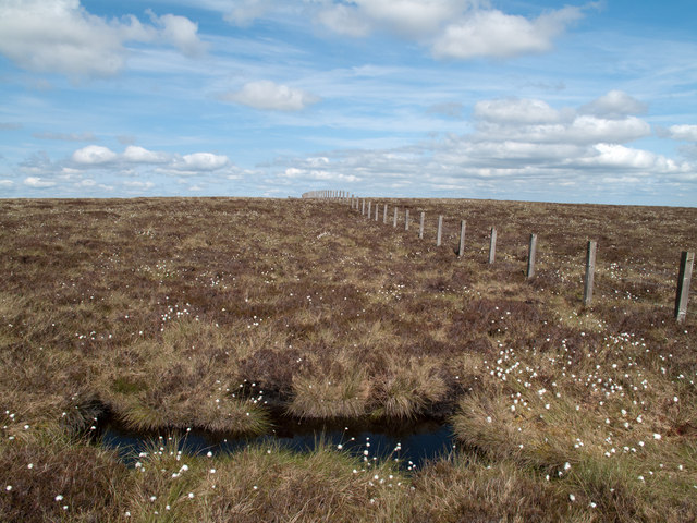
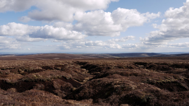
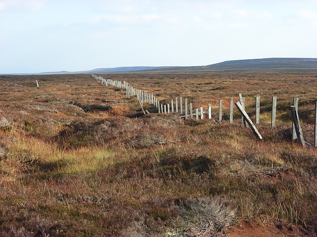
Moving towards the moorland, visitors can experience a different kind of scenery. Moorland is characterized by its heather-covered hills and peat bogs. This type of habitat supports a variety of bird species, including the iconic red grouse, which is often seen darting across the moorland. The area is also rich in flora, with vibrant purple heather and delicate wildflowers adding color to the landscape.

Middleton Common is not only a haven for wildlife but also a place of historical and cultural significance. It is home to several ancient archaeological sites, including burial mounds and stone circles, providing a glimpse into the area's past. These sites attract archaeology enthusiasts and history buffs who wish to delve into the region's rich heritage.

Overall, Middleton Common in Durham offers a diverse and captivating natural environment, with its downs, moorland, and historical sites providing a unique and enriching experience for visitors.

If you have any feedback on the listing, please let us know in the comments section below.

Middleton Common Images

Images are sourced within 2km of 54.678506/-2.0811702 or Grid Reference NY9431. Thanks to Geograph Open Source API. All images are credited.

Fence rising over moorland rising to Outberry Plain The fence here follows the watershed between Weardale and Teesdale; the summit of the vague rise ahead, Outberry Plain, is very hard to identify.
Fence rising over moorland rising to Outberry Plain
The fence here follows the watershed between Weardale and Teesdale; the summit of the vague rise ahead, Outberry Plain, is very hard to identify.
Estate road on south side of Carr's Hill Sunshine illuminates the grass of the moorland beside the road whilst Monk's Moor, beyond, is shadowed; the wall appearing to act as a dividing line.
Estate road on south side of Carr's Hill
Sunshine illuminates the grass of the moorland beside the road whilst Monk's Moor, beyond, is shadowed; the wall appearing to act as a dividing line.
Snowed heather moor south of Harnisha Hill Fresh snow covers thinly the heather on the south side of Harnisha Hill. The view beyond is across Great Eggleshope to the moorland block of Monk's Moor.
Snowed heather moor south of Harnisha Hill
Fresh snow covers thinly the heather on the south side of Harnisha Hill. The view beyond is across Great Eggleshope to the moorland block of Monk's Moor.
Stream grooves at Great Eggleshope Head The desolate upper reaches of Great Eggleshope close to Outberry Plain.
The heather covered hill in the distance and to the left is Harnisha Hill.
Stream grooves at Great Eggleshope Head
The desolate upper reaches of Great Eggleshope close to Outberry Plain. The heather covered hill in the distance and to the left is Harnisha Hill.
Mine level and old railway goods van by Hudeshope Beck
Mine level by Hudeshope Beck
Inside the mine level by Hudeshope Beck See <a href="https://www.geograph.org.uk/photo/7511839">NY9429 : Mine level by Hudeshope Beck</a>.
Inside the mine level by Hudeshope Beck
Old railway goods van by Hudeshope Beck
Mine level and old railway goods van by Hudeshope Beck (2) TransPennine Express, previously known as TransPennine Express <span class="nowrap"><a title="https://en.wikipedia.org/wiki/TransPennine_Express" rel="nofollow ugc noopener" href="https://en.wikipedia.org/wiki/TransPennine_Express">Link</a><img style="margin-left:2px;" alt="External link" title="External link - shift click to open in new window" src="https://s1.geograph.org.uk/img/external.png" width="10" height="10"/></span> , would like to inform passengers waiting on Platform 2 for the 08:57 to Middleton-in-Teesdale that although this service won't be running, it wasn't officially cancelled because we pulled it from the timetable before 10 pm last night. Oh, and we have no idea when your next train will arrive - but, as you might suspect from the slightly dilapidated state of the rolling stock in the nearby siding, you could be in for quite a long wait.
Mine level and old railway goods van by Hudeshope Beck (2)
TransPennine Express, previously known as TransPennine Express LinkExternal link , would like to inform passengers waiting on Platform 2 for the 08:57 to Middleton-in-Teesdale that although this service won't be running, it wasn't officially cancelled because we pulled it from the timetable before 10 pm last night. Oh, and we have no idea when your next train will arrive - but, as you might suspect from the slightly dilapidated state of the rolling stock in the nearby siding, you could be in for quite a long wait.
Hudes Hope Looking north west from near the <a href="https://www.geograph.org.uk/photo/7513545">NY9429 : Mine level and old railway goods van by Hudeshope Beck (2)</a> towards Newberry Scar on the far side of Hudeshope Beck in <a href="https://www.geograph.org.uk/gridref/NY9330">NY9330</a>.
Hudes Hope
Looking north west from near the NY9429 : Mine level and old railway goods van by Hudeshope Beck (2) towards Newberry Scar on the far side of Hudeshope Beck in NY9330.
Earth parapet of small dam The grassed-over parapet of the dam is close to the col between Carrs Hill and Monk's Moor. The valleys to both sides of the col have been mined extensively. It's probable then that the dam was used to retain a small reservoir for hushing purposes.
There's further mining evidence in the middle distance beyond the earthwork and the valley of Hudes Hope where the Coldberry Mine complex can be seen.
Earth parapet of small dam
The grassed-over parapet of the dam is close to the col between Carrs Hill and Monk's Moor. The valleys to both sides of the col have been mined extensively. It's probable then that the dam was used to retain a small reservoir for hushing purposes. There's further mining evidence in the middle distance beyond the earthwork and the valley of Hudes Hope where the Coldberry Mine complex can be seen.
Hudeshope Low Level Old lead mine level close to Hudeshope Beck. This is the Hudeshope Low Level dating from 1833 and large enough to be a horse level. The level cut into lead bearing veins after 250 yards, with almost 4,400 tons of lead being extracted in a 50 year period from 1833.
Hudeshope Low Level
Old lead mine level close to Hudeshope Beck. This is the Hudeshope Low Level dating from 1833 and large enough to be a horse level. The level cut into lead bearing veins after 250 yards, with almost 4,400 tons of lead being extracted in a 50 year period from 1833.
Harnisha Hill On the 584 metre hill.
Harnisha Hill
On the 584 metre hill.
Hudeshope burn Body from an old mine wagon washed down the Hudeshope Burn.
Hudeshope burn
Body from an old mine wagon washed down the Hudeshope Burn.
Newberry Scar Newberry Scar and the tips from Racketgill Hushes
Newberry Scar
Newberry Scar and the tips from Racketgill Hushes
Level mouth Old lead mine adit in upper Hudeshope
Level mouth
Old lead mine adit in upper Hudeshope
Toddsike Head Harnisha Hill is to the right of picture.
Toddsike Head
Harnisha Hill is to the right of picture.
Great Eggleshope Head Amid a tangle of heather a few sikes come together to form Great Eggleshope Beck.
Great Eggleshope Head
Amid a tangle of heather a few sikes come together to form Great Eggleshope Beck.
Show me another place!

Middleton Common is located at Grid Ref: NY9431 (Lat: 54.678506, Lng: -2.0811702)

Unitary Authority: County Durham

Police Authority: Durham

What 3 Words

///simulator.dished.glider. Near Newbiggin, Co. Durham

Related Wikis

Teesdale Allotments

Teesdale Allotments is a Site of Special Scientific Interest in the Teesdale district of County Durham, England. It consists of two large upland areas...

Fairy Holes Cave

Fairy Holes Cave is a Site of Special Scientific Interest in the Wear Valley district of west County Durham, England. It is located on the western flanks...

Snaisgill

Snaisgill is a hamlet in County Durham, in England. It is situated to the north of Middleton-in-Teesdale. The surrounding area was extensively mined for...

Aukside

Aukside is a small village in County Durham, in England. It is situated on the north side of Teesdale, a short distance from Middleton-in-Teesdale. It...

Nearby Amenities

Located within 500m of 54.678506,-2.0811702
Racketgill Head
Natural: peak
Source: OS 1:25k
Lat/Long: 54.6756432/-2.0822969
Hunting Stand
Hunting Stand: grouse_butt
Lat/Long: 54.6772832/-2.0740476
Hunting Stand
Hunting Stand: grouse_butt
Lat/Long: 54.6770847/-2.0747986
Hunting Stand
Hunting Stand: grouse_butt
Lat/Long: 54.6768769/-2.0755979
Hunting Stand
Hunting Stand: grouse_butt
Lat/Long: 54.6767373/-2.0761344
Hunting Stand
Hunting Stand: grouse_butt
Lat/Long: 54.6765884/-2.0766842
Hunting Stand
Hunting Stand: grouse_butt
Lat/Long: 54.6764427/-2.07721
Hunting Stand
Hunting Stand: grouse_butt
Lat/Long: 54.6763/-2.0777893
Hunting Stand
Hunting Stand: grouse_butt
Lat/Long: 54.6760875/-2.0785752
Hunting Stand
Hunting Stand: grouse_butt
Lat/Long: 54.6759014/-2.0793369
Hunting Stand
Hunting Stand: grouse_butt
Lat/Long: 54.6757184/-2.080088
Hunting Stand
Hunting Stand: grouse_butt
Lat/Long: 54.6755013/-2.0809785
The data included in this document is from www.openstreetmap.org. The data is made available under ODbL.

Have you been to Middleton Common?

Leave your review of Middleton Common below (or comments, questions and feedback).