Elslack Moor

Downs, Moorland in Yorkshire Craven

England

Elslack Moor

Sheep on the hillside above Lothersdale Viewed from the Pennine Way as it climbs out of the dale.
Sheep on the hillside above Lothersdale Credit: Stephen Craven

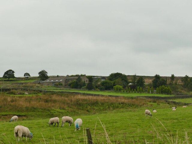
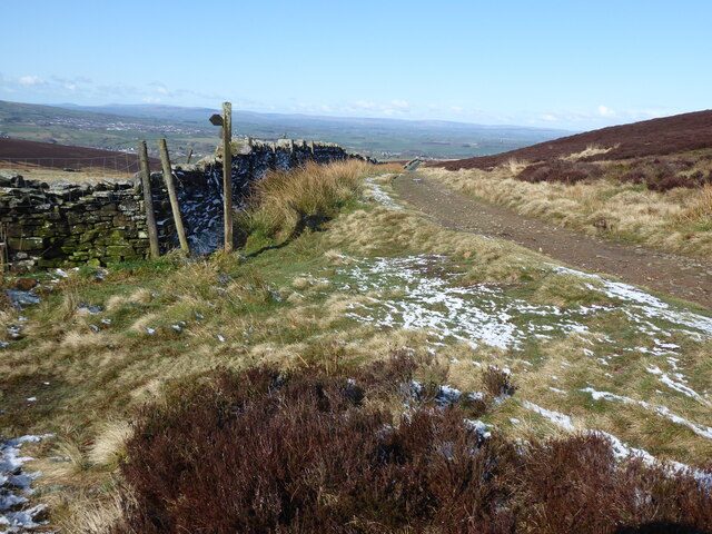
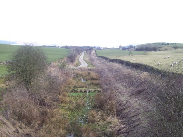
Elslack Moor is a picturesque area located in Yorkshire, England. It is characterized by its rolling hills, vast expanses of moorland, and stunning views of the surrounding countryside. Situated near the village of Elslack, the moor covers an area of approximately 1,000 acres.

The moorland is predominantly made up of heather, grasses, and bracken, creating a beautiful tapestry of colors that change throughout the seasons. This diverse landscape is home to a variety of wildlife, including birds such as curlews, lapwings, and meadow pipits, as well as mammals like hares and foxes.

Elslack Moor offers numerous walking and hiking trails, allowing visitors to explore the area and take in its natural beauty. The paths wind through the heather-covered hills, offering breathtaking views of the Yorkshire Dales National Park and the Pendle Hill in the distance. The moorland also contains several ancient archaeological sites, including burial mounds and stone circles, providing a glimpse into the area's rich history.

Additionally, Elslack Moor is known for its role in local folklore, with tales of mythical creatures and ancient legends adding to its allure. The area is often used by outdoor enthusiasts for activities such as birdwatching, photography, and picnicking.

Overall, Elslack Moor is a stunning and tranquil location, offering visitors the chance to immerse themselves in the natural beauty of Yorkshire's countryside and experience its rich history and wildlife.

If you have any feedback on the listing, please let us know in the comments section below.

Elslack Moor Images

Images are sourced within 2km of 53.924837/-2.0845844 or Grid Reference SD9447. Thanks to Geograph Open Source API. All images are credited.

Sheep on the hillside above Lothersdale Viewed from the Pennine Way as it climbs out of the dale.
Sheep on the hillside above Lothersdale
Viewed from the Pennine Way as it climbs out of the dale.
Stile and gate on the Pennine Way above Lothersdale The gate has an unusual arrangement of cross-bracing.
Stile and gate on the Pennine Way above Lothersdale
The gate has an unusual arrangement of cross-bracing.
Stansfield Beck below White Hill Lane
Kirk Sykes Farm See <a href="https://www.geograph.org.uk/photo/2641695">SD9547 : Kirk Sykes Farm</a> for a view from a different angle.
Kirk Sykes Farm
See SD9547 : Kirk Sykes Farm for a view from a different angle.
Sheep pens alongside White Hill Lane
Cross Green Farm The farm is at an altitude of 315m, near the summit of the road from Lothersdale to Carleton-in-Craven.
Cross Green Farm
The farm is at an altitude of 315m, near the summit of the road from Lothersdale to Carleton-in-Craven.
Rose hips by the road side
Cyclists on Herd Stock Hill Just past the junction with White Hill Lane.
Cyclists on Herd Stock Hill
Just past the junction with White Hill Lane.
Disturbed pheasants I was about to take this view from the roadside into a conifer plantation when I startled a covey of pheasants that flew away noisily. At least five are in this view.
Disturbed pheasants
I was about to take this view from the roadside into a conifer plantation when I startled a covey of pheasants that flew away noisily. At least five are in this view.
Small disused quarry There was a much larger one the other side of the road.
Small disused quarry
There was a much larger one the other side of the road.
The Pennine Way near Low Hill
The Pennine Way near Clogger Lane
The Pennine Way near Cripple Hole Hill
The Pennine Way near Pinhaw
The Pennine Way near Robert Wilson's Grave
The Pennine Way near Kirk Sykes Farm
The Pennine Way near Green Gill
The view towards Lothersdale from the Pennine Way
Show me another place!

Elslack Moor is located at Grid Ref: SD9447 (Lat: 53.924837, Lng: -2.0845844)

Division: West Riding

Administrative County: North Yorkshire

District: Craven

Police Authority: North Yorkshire

What 3 Words

///baths.stockpile.expanded. Near Earby, Lancashire

Related Wikis

Lothersdale

Lothersdale is a small village and civil parish in the former Craven district of North Yorkshire, England, near Skipton and within the triangle formed...

Elslack

Elslack is a village and civil parish in the Craven district of North Yorkshire, England, close to the border with Lancashire and 4 miles west of Skipton...

Elslack railway station

Elslack railway station once served the small village of Elslack in North Yorkshire, England. The station was built by the Leeds and Bradford Extension...

Staincliffe Wapentake

Staincliffe, also known as Staincliff, was a wapentake of the West Riding of Yorkshire, England. The wapentake was named from a place called Staincliffe...

Nearby Amenities

Located within 500m of 53.924837,-2.0845844
Pinhaw Beacon
Historic: beacon
Man Made: survey_point
Natural: peak
Source: NPE
Source Man Made: survey
Lat/Long: 53.9209461/-2.0862819
Description: Old lump of stone with writing on it
Fixme: Feel free to retag as something more appropriate
Historic: boundary_stone
Lat/Long: 53.9207476/-2.0873242
Elslack Moor
Natural: moor
Source: OS 1:25k
Lat/Long: 53.9259731/-2.0896745
Historic: memorial
Information: map
Map Type: toposcope
Tourism: information
Lat/Long: 53.920929/-2.086253
The data included in this document is from www.openstreetmap.org. The data is made available under ODbL.

Have you been to Elslack Moor?

Leave your review of Elslack Moor below (or comments, questions and feedback).