Sweethope Moss
Downs, Moorland in Northumberland
England
Sweethope Moss
Sweethope Moss is a picturesque area located in Northumberland, England. Nestled between the downs and moorland, this landscape offers a diverse range of natural features and habitats.
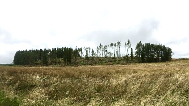
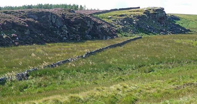
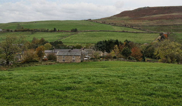
Covering an expansive area, Sweethope Moss is characterized by its rolling hills, heather moorland, and lush green fields. The downs provide a stunning backdrop with their gently sloping hills and occasional rocky outcrops. These downs are home to a variety of native flora and fauna, including wildflowers, grasses, and small mammals.
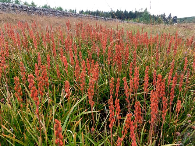
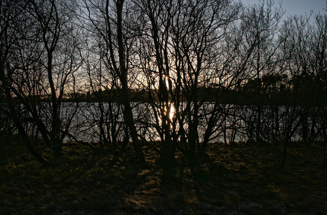
The moorland in Sweethope Moss is a unique feature, offering a contrast to the surrounding landscape. The moorland is covered in heather, creating a vibrant purple carpet during the summer months. This habitat provides a sanctuary for numerous bird species, such as curlews, grouse, and skylarks.
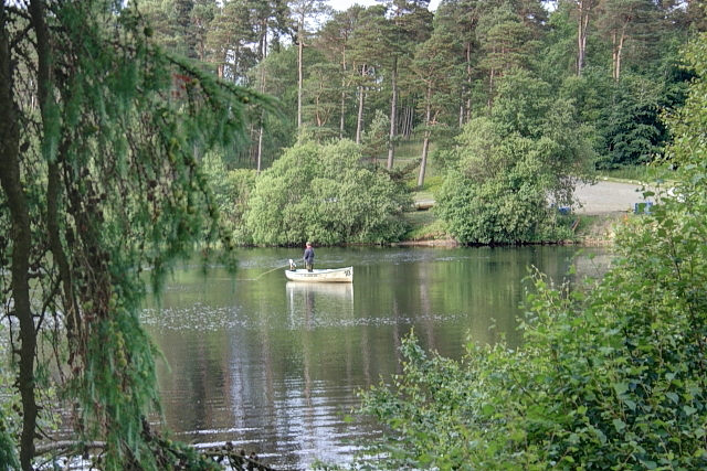
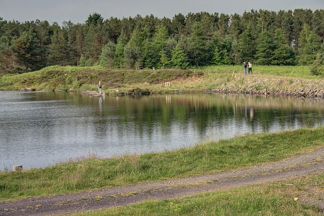
Sweethope Moss is also known for its freshwater habitats, with several small lakes and ponds scattered throughout the area. These water bodies attract a range of aquatic wildlife, including ducks, swans, and various fish species. The lakes and ponds are also popular for recreational activities such as fishing and boating.
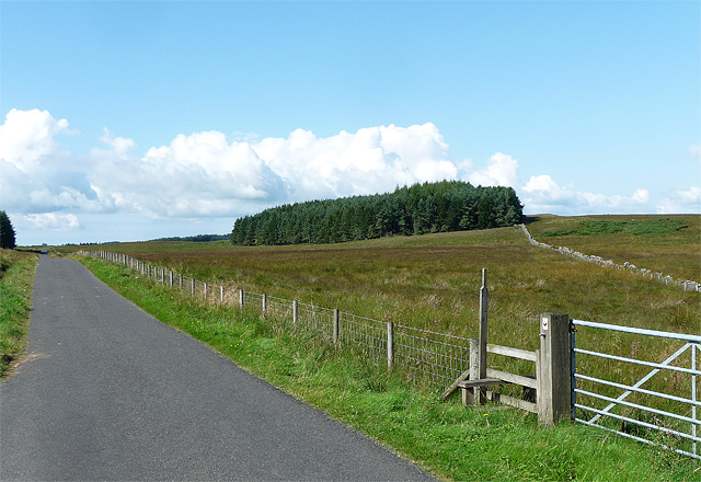
Visitors to Sweethope Moss can enjoy the beauty of the natural surroundings by exploring the numerous walking trails and paths that crisscross the area. These trails offer breathtaking views of the downs, moorland, and surrounding countryside. Sweethope Moss truly is a haven for nature lovers and outdoor enthusiasts, offering a diverse and captivating landscape to explore.
If you have any feedback on the listing, please let us know in the comments section below.
Sweethope Moss Images
Images are sourced within 2km of 55.130779/-2.0921725 or Grid Reference NY9481. Thanks to Geograph Open Source API. All images are credited.


![Lumps and Bumps of an Ancient Homestead The modern Sweethope farm is behind ([<a href="https://www.geograph.org.uk/gridref/NY9581">NY9581</a>]).](https://s2.geograph.org.uk/geophotos/04/16/64/4166462_edc62410.jpg)


Sweethope Moss is located at Grid Ref: NY9481 (Lat: 55.130779, Lng: -2.0921725)
Unitary Authority: Northumberland
Police Authority: Northumbria
What 3 Words
///mixing.songs.splints. Near Corsenside, Northumberland
Nearby Locations
Related Wikis

Sweethope Loughs
Sweethope Loughs are two freshwater lakes almost 1 mile (1.6 km) in length, the smaller one just east of the larger, in the southern part of Northumberland...

Thockrington
Thockrington is a village and former civil parish, now in the parish of Bavington, in Northumberland, England. The village lies about 10 miles (16 km)...

Colt Crag Reservoir
Colt Crag Reservoir is a relatively shallow reservoir in Northumberland, England adjacent to the A68 road, and 9 miles (14 km) north of Corbridge. The...
Bavington Crags
Bavington Crags is a Site of Special Scientific Interest (SSSI) in north Northumberland, England. The site is an outcropping of the Whin Sill which gives...
Little Swinburne Reservoir
Little Swinburne Reservoir is a small reservoir in Northumberland, England less than 1 mile (1.6 km) northeast of the A68 road, and about 9 miles (14 km...

Bavington Hall
Bavington Hall is a 17th-century privately owned country house at Little Bavington in Northumberland. It is a Grade II* listed building.A tower house...
Little Harle Tower
Little Harle Tower is a Grade II* listed privately owned country house with 15th-century origins, located at Little Harle, Kirkwhelpington, Northumberland...
East Woodburn
East Woodburn is a village located in Northumberland, England. Located on the A68 road just south of Darney Crag, it was created in conjunction with the...
Nearby Amenities
Located within 500m of 55.130779,-2.0921725Have you been to Sweethope Moss?
Leave your review of Sweethope Moss below (or comments, questions and feedback).