Blean High Pasture

Downs, Moorland in Yorkshire Richmondshire

England

Blean High Pasture

Higher than Addlebrough The top of Stake Road is higher than the more dramatic Addlebrough.
Higher than Addlebrough Credit: T Eyre

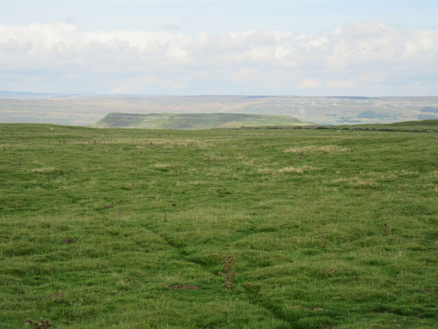
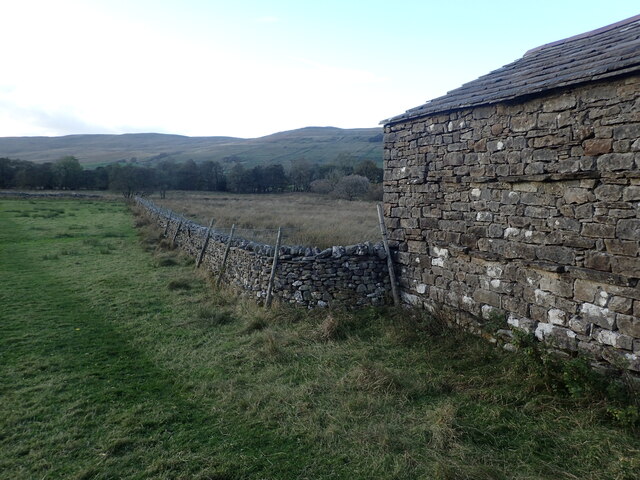
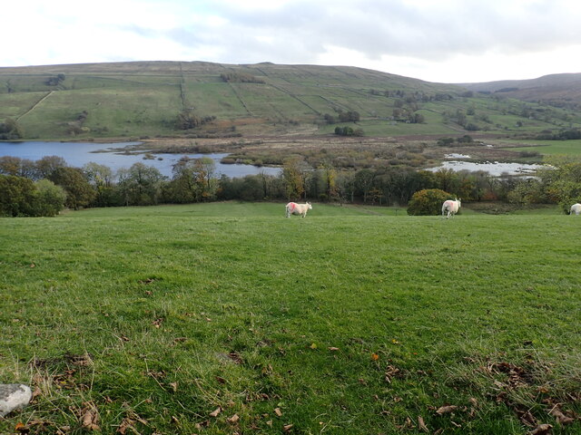
Blean High Pasture is a vast expanse of land situated in the beautiful county of Yorkshire, England. Nestled amidst the picturesque surroundings of the Yorkshire Downs and Moorland, it covers a substantial area of approximately 2,000 acres. This expansive pasture is known for its diverse ecological and archaeological significance.

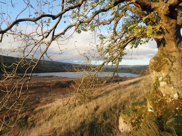
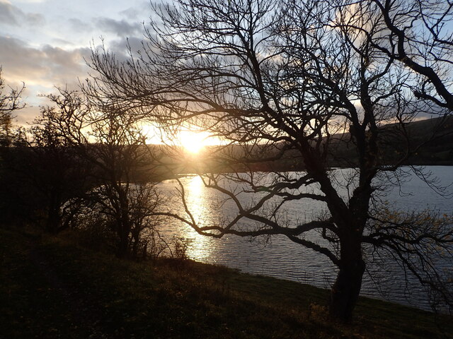
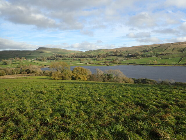
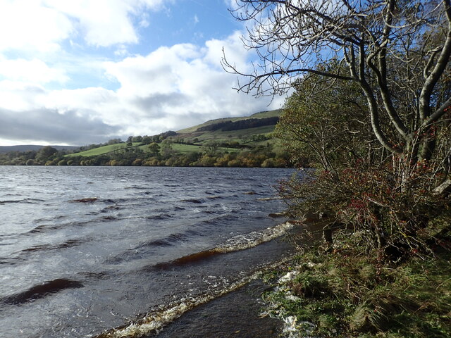
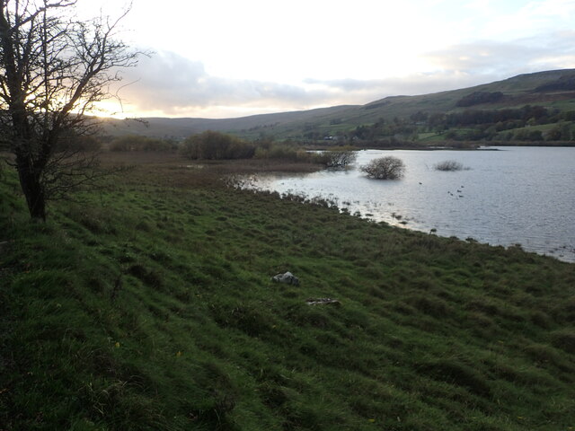
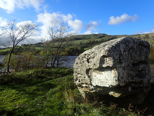
As an area of outstanding natural beauty, Blean High Pasture boasts a rich biodiversity. The land is home to a variety of plant and animal species, including heather, bilberry, curlew, and skylark. The undulating moorland terrain, punctuated by small streams and tarns, adds to the scenic charm of the area.

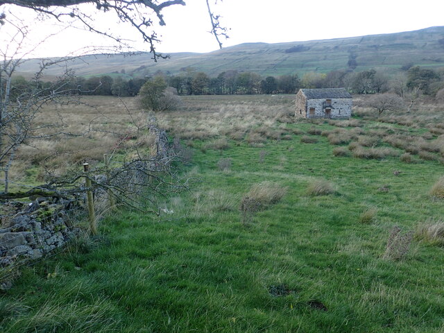
Apart from its natural beauty, Blean High Pasture holds great archaeological importance. The site is dotted with numerous ancient monuments, including burial mounds, stone circles, and cairns. These remnants of the past provide valuable insights into the region's history and cultural heritage, with some dating back to the Neolithic era.

The land is also known for its extensive network of footpaths and trails, making it a popular destination for hikers, nature enthusiasts, and history buffs alike. Visitors can enjoy long walks, observing the wildlife and admiring the breathtaking vistas of the Yorkshire countryside.

Blean High Pasture is a protected site, managed by conservation organizations and local authorities. Efforts are made to preserve the natural habitat and maintain the historical integrity of the area. As a result, it offers a unique and serene experience for those seeking to immerse themselves in the beauty of Yorkshire's Downs and Moorland.

If you have any feedback on the listing, please let us know in the comments section below.

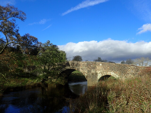
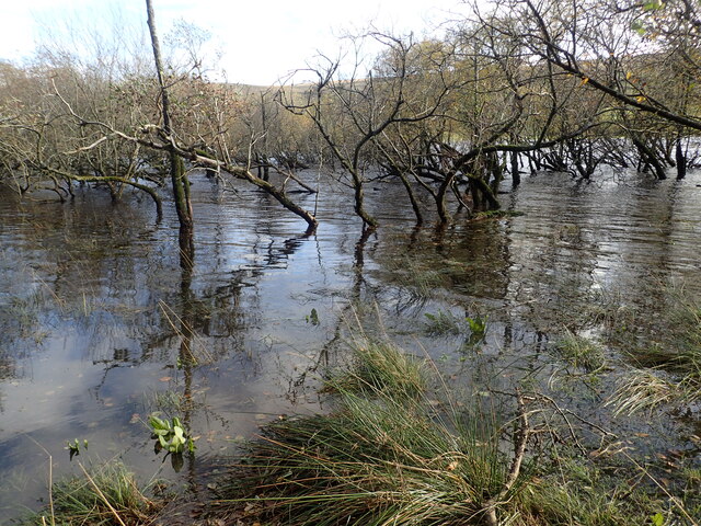
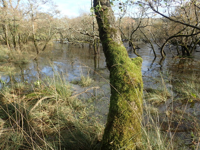
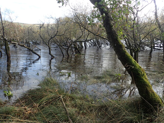
Blean High Pasture Images

Images are sourced within 2km of 54.271852/-2.1089122 or Grid Reference SD9386. Thanks to Geograph Open Source API. All images are credited.

Higher than Addlebrough The top of Stake Road is higher than the more dramatic Addlebrough.
Higher than Addlebrough
The top of Stake Road is higher than the more dramatic Addlebrough.
Busk Lane Busk Lane descending towards Carpley Green.
Busk Lane
Busk Lane descending towards Carpley Green.
Carpley Green & Addlebrough Looking north down Busk Lane towards Carpley Green with Addlebrough behind.
Carpley Green & Addlebrough
Looking north down Busk Lane towards Carpley Green with Addlebrough behind.
Addlebrough Looking towards Addlebrough from Carpley Green Road.
Addlebrough
Looking towards Addlebrough from Carpley Green Road.
Path down to Semer Water There are only two lakes in the Yorkshire Dales, Malham Tarn and Semer Water. Semer Water was formed during the last Ice Age by a moraine which effectively dammed the valley. The lake today is a shadow of its former self but is still three miles in circumference and 45 feet deep. This is the footpath back down to Semer Water in evening sunlight.
Path down to Semer Water
There are only two lakes in the Yorkshire Dales, Malham Tarn and Semer Water. Semer Water was formed during the last Ice Age by a moraine which effectively dammed the valley. The lake today is a shadow of its former self but is still three miles in circumference and 45 feet deep. This is the footpath back down to Semer Water in evening sunlight.
Semer Water at sunset There are only two lakes in the Yorkshire Dales, Malham Tarn and Semer Water. Semer Water was formed during the last Ice Age by a moraine which effectively dammed the valley. The lake today is a shadow of its former self but is still three miles in circumference and 45 feet deep. Legend has it that there is a drowned village under the water.
Semer Water at sunset
There are only two lakes in the Yorkshire Dales, Malham Tarn and Semer Water. Semer Water was formed during the last Ice Age by a moraine which effectively dammed the valley. The lake today is a shadow of its former self but is still three miles in circumference and 45 feet deep. Legend has it that there is a drowned village under the water.
View from a footpath above Semer Water There are only two lakes in the Yorkshire Dales, Malham Tarn and Semer Water. Semer Water was formed during the last Ice Age by a moraine which effectively dammed the valley. The lake today is a shadow of its former self but is still three miles in circumference and 45 feet deep. Legend has it that there is a drowned village under the water. The hill in the distance is Addlebrough.
View from a footpath above Semer Water
There are only two lakes in the Yorkshire Dales, Malham Tarn and Semer Water. Semer Water was formed during the last Ice Age by a moraine which effectively dammed the valley. The lake today is a shadow of its former self but is still three miles in circumference and 45 feet deep. Legend has it that there is a drowned village under the water. The hill in the distance is Addlebrough.
Semer Water There are only two lakes in the Yorkshire Dales, Malham Tarn and Semer Water. Semer Water was formed during the last Ice Age by a moraine which effectively dammed the valley. The lake today is a shadow of its former self but is still three miles in circumference and 45 feet deep. Legend has it that there is a drowned village under the water. The River Bain, which flows out of Semer Water, at two and half miles is the shortest river in England.
Semer Water
There are only two lakes in the Yorkshire Dales, Malham Tarn and Semer Water. Semer Water was formed during the last Ice Age by a moraine which effectively dammed the valley. The lake today is a shadow of its former self but is still three miles in circumference and 45 feet deep. Legend has it that there is a drowned village under the water. The River Bain, which flows out of Semer Water, at two and half miles is the shortest river in England.
A barn in Raydale This view is from a meeting of footpaths downhill from Stelling Busk on the way to Cragdale Water.
A barn in Raydale
This view is from a meeting of footpaths downhill from Stelling Busk on the way to Cragdale Water.
The head of Semer Water at sunset There are only two lakes in the Yorkshire Dales, Malham Tarn and Semer Water. Semer Water was formed during the last Ice Age by a moraine which effectively dammed the valley. The lake today is a shadow of its former self but is still three miles in circumference and 45 feet deep. This is the view from the footpath looking back to the head of Semer Water at sunset.
The head of Semer Water at sunset
There are only two lakes in the Yorkshire Dales, Malham Tarn and Semer Water. Semer Water was formed during the last Ice Age by a moraine which effectively dammed the valley. The lake today is a shadow of its former self but is still three miles in circumference and 45 feet deep. This is the view from the footpath looking back to the head of Semer Water at sunset.
Erratic at Semer Water Semer Water was formed during the last Ice Age by a moraine which effectively dammed the valley and leaving erratic boulders like this one behind. The lake today is a shadow of its former self but is still three miles in circumference and 45 feet deep.
Erratic at Semer Water
Semer Water was formed during the last Ice Age by a moraine which effectively dammed the valley and leaving erratic boulders like this one behind. The lake today is a shadow of its former self but is still three miles in circumference and 45 feet deep.
Semer Water Bridge The River Bain flows from Semer Water under the bridge here. As a tributary of the River Ure, it is one of the shortest, named rivers in England.
Semer Water Bridge
The River Bain flows from Semer Water under the bridge here. As a tributary of the River Ure, it is one of the shortest, named rivers in England.
Part of Semer water There are only two lakes in the Yorkshire Dales, Malham Tarn and Semer Water. This is Semer Water in Wensleydale. It was clearly fuller than normal making this look like a mangrove swamp. Legend has it that there is a drowned village under the water.
Part of Semer water
There are only two lakes in the Yorkshire Dales, Malham Tarn and Semer Water. This is Semer Water in Wensleydale. It was clearly fuller than normal making this look like a mangrove swamp. Legend has it that there is a drowned village under the water.
Semer Water There are only two lakes in the Yorkshire Dales, Malham Tarn and Semer Water. This is Semer Water in Wensleydale. It was clearly fuller than normal making this look like a mangrove swamp. Legend has it that there is a drowned village under the water.
Semer Water
There are only two lakes in the Yorkshire Dales, Malham Tarn and Semer Water. This is Semer Water in Wensleydale. It was clearly fuller than normal making this look like a mangrove swamp. Legend has it that there is a drowned village under the water.
Semer Water seen from Marsett Lane There are only two lakes in the Yorkshire Dales, Malham Tarn and Semer Water. Semer Water was formed during the last Ice Age by a moraine which effectively dammed the valley. The lake today is a shadow of its former self but is still three miles in circumference and 45 feet deep. Legend has it that there is a drowned village under the water.
Semer Water seen from Marsett Lane
There are only two lakes in the Yorkshire Dales, Malham Tarn and Semer Water. Semer Water was formed during the last Ice Age by a moraine which effectively dammed the valley. The lake today is a shadow of its former self but is still three miles in circumference and 45 feet deep. Legend has it that there is a drowned village under the water.
Isolated barn in a field The barns in the Yorkshire Dales are in varying stages of dilapidation. This one seems in quite good condition and it appears to have a decent roof. This view is from the footpath which leads from Busk Lane towards Semer Water.
Isolated barn in a field
The barns in the Yorkshire Dales are in varying stages of dilapidation. This one seems in quite good condition and it appears to have a decent roof. This view is from the footpath which leads from Busk Lane towards Semer Water.
Fading light near Stalling Busk This view is of the footpath which leads from Semer Water towards Busk Lane.
Fading light near Stalling Busk
This view is of the footpath which leads from Semer Water towards Busk Lane.
Show me another place!

Blean High Pasture is located at Grid Ref: SD9386 (Lat: 54.271852, Lng: -2.1089122)

Division: North Riding

Administrative County: North Yorkshire

District: Richmondshire

Police Authority: North Yorkshire

What 3 Words

///bath.disband.appointed. Near Leyburn, North Yorkshire

Related Wikis

Stalling Busk

Stalling Busk is one of three settlements around Semer Water in the Richmondshire district of North Yorkshire in the small dale of Raydale just off...

Semerwater

Semerwater () is the second largest natural lake in North Yorkshire, England, after Malham Tarn. It is half a mile (800 m) long, covers 100 acres (0.40...

St Matthew's Church, Stalling Busk

St Matthew's Church, Stalling Busk is a Grade II listed parish church in the Church of England in Stalling Busk, North Yorkshire. == History == The church...

Yorkshire Dales

The Yorkshire Dales are an upland area of the Pennines in England. Most of the area is in the county of North Yorkshire, but it extends into Cumbria and...

Nearby Amenities

Located within 500m of 54.271852,-2.1089122
Blean HighPasture
Place: locality
Source: NPE
Lat/Long: 54.2718482/-2.1099962
Source: os_25k_firstseries
Lat/Long: 54.2753054/-2.1124942
The data included in this document is from www.openstreetmap.org. The data is made available under ODbL.

Have you been to Blean High Pasture?

Leave your review of Blean High Pasture below (or comments, questions and feedback).