Northgate Fell

Downs, Moorland in Durham

England

Northgate Fell

Plantation east of Weather Hill This is a small rectangular plantation lying north of an area known as Heights Pasture which is in turn north of Heights Quarry, (a large excavation on the north side of the Wear valley). It's seen here from the local high point - Weather Hill - just a few tens of metres to the west.
Plantation east of Weather Hill Credit: Trevor Littlewood

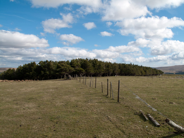
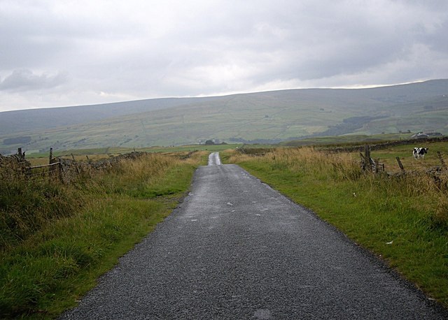
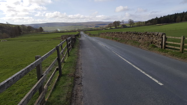
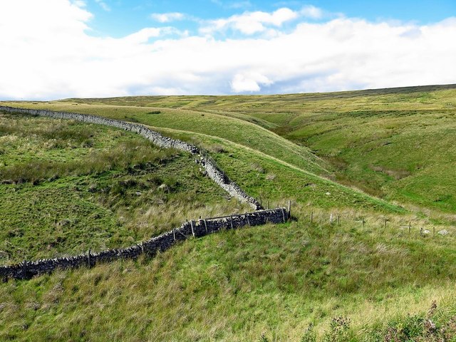
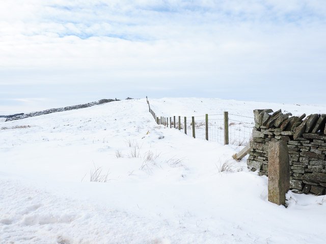
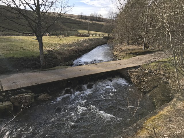
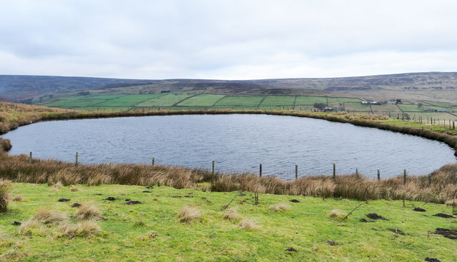
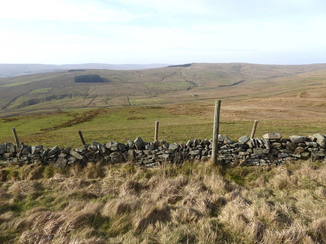
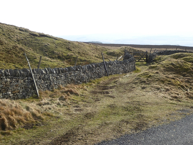
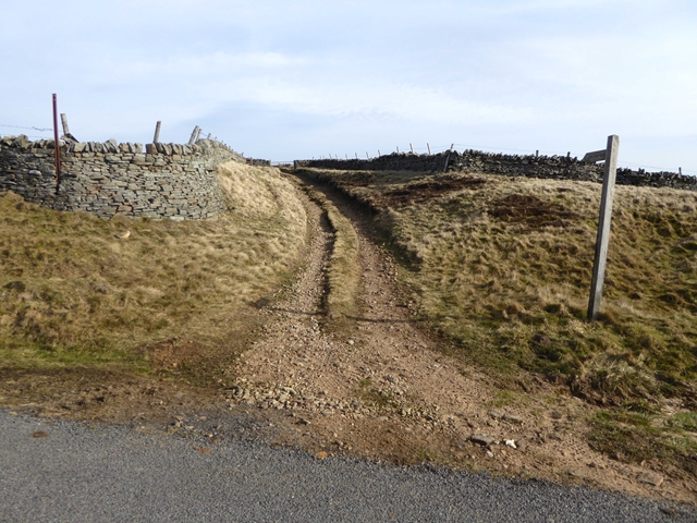
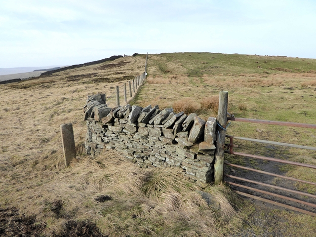
Northgate Fell is a picturesque area located in Durham, England. This stunning landscape is characterized by its rolling hills, open moorlands, and expansive downs. Sitting atop the Northern Pennines, Northgate Fell offers breathtaking panoramic views of the surrounding countryside.

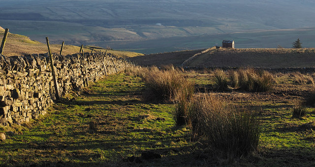
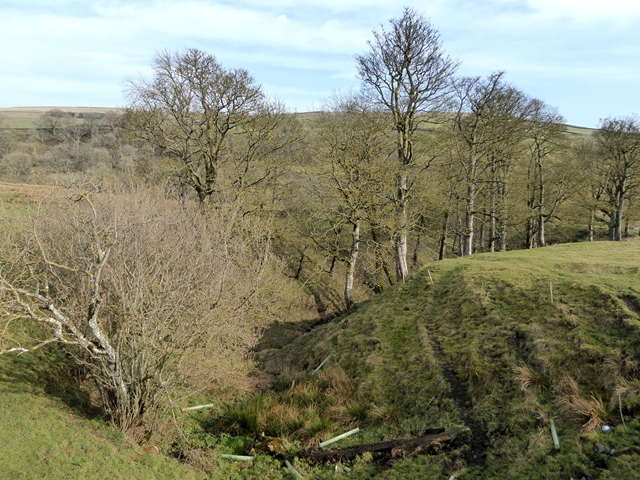
The fell is covered with a variety of vegetation, including heather, grasses, and scattered trees. This diverse ecosystem provides a habitat for many species of birds, such as curlews, lapwings, and red grouse, making it a popular spot for birdwatching enthusiasts.

The area is also rich in history, with several ancient settlements and burial grounds dotting the landscape. Archaeological excavations have revealed evidence of human occupation dating back to the Neolithic era, adding to the area's allure for history buffs.

Northgate Fell is a haven for outdoor enthusiasts, offering numerous walking trails and hiking routes. The terrain is varied, ranging from gentle slopes to steep inclines, providing a challenge for all levels of fitness. Visitors can explore the vast moorlands, enjoying the fresh air and stunning views along the way.

For those seeking a peaceful retreat, Northgate Fell offers a serene and tranquil atmosphere. The area is relatively untouched by modern development, allowing visitors to escape the hustle and bustle of daily life and immerse themselves in the beauty of nature.

In conclusion, Northgate Fell in Durham is a captivating landscape, with its rolling hills, open moorlands, and rich history. Whether it's for birdwatching, hiking, or simply enjoying the serenity of the surroundings, this natural gem is a must-visit destination in the region.

If you have any feedback on the listing, please let us know in the comments section below.

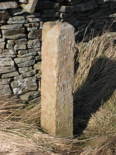
Northgate Fell Images

Images are sourced within 2km of 54.762332/-2.1154032 or Grid Reference NY9240. Thanks to Geograph Open Source API. All images are credited.

Plantation east of Weather Hill This is a small rectangular plantation lying north of an area known as Heights Pasture which is in turn north of Heights Quarry, (a large excavation on the north side of the Wear valley). It's seen here from the local high point - Weather Hill - just a few tens of metres to the west.
Plantation east of Weather Hill
This is a small rectangular plantation lying north of an area known as Heights Pasture which is in turn north of Heights Quarry, (a large excavation on the north side of the Wear valley). It's seen here from the local high point - Weather Hill - just a few tens of metres to the west.
Westgate Heights Pastures On the run down from Scarsike junction to Westgate.
Westgate Heights Pastures
On the run down from Scarsike junction to Westgate.
Dry stone wall near to Park Burn Park Burn is on the far side of the wall and descends close to the line of it into Weardale. The hillside in the distance is the southern slope of Weardale and there can be seen the now disused and landscaped quarry which once supplied limestone to the Blue Circle cement works at Eastgate. There's a working quarry - Heights Quarry - just out of view to the left side of the image; it's likely that the small building is connected with that or another extractive operation.
Dry stone wall near to Park Burn
Park Burn is on the far side of the wall and descends close to the line of it into Weardale. The hillside in the distance is the southern slope of Weardale and there can be seen the now disused and landscaped quarry which once supplied limestone to the Blue Circle cement works at Eastgate. There's a working quarry - Heights Quarry - just out of view to the left side of the image; it's likely that the small building is connected with that or another extractive operation.
Road between Rookhope and Eastgate
Boundary wall near Crow's Cleugh
Guide stone and fence line at Scarsike Head Scarsike Head is a crossing point of a minor road between Rook Hope and Weardale reaching 539 m.
The boundary stone there had been noted by the photographer many years ago; there were inscriptions on some of the faces, perhaps all of them. And then some time ago the stone was seen to be missing, perhaps stolen for use as a display ornament! On this visit however, the stone was found to have been replaced following an absence of many years. It appears to have been cleaned but perhaps too thoroughly; the inscriptions seem to be decidedly less clear than previously!
Guide stone and fence line at Scarsike Head
Scarsike Head is a crossing point of a minor road between Rook Hope and Weardale reaching 539 m. The boundary stone there had been noted by the photographer many years ago; there were inscriptions on some of the faces, perhaps all of them. And then some time ago the stone was seen to be missing, perhaps stolen for use as a display ornament! On this visit however, the stone was found to have been replaced following an absence of many years. It appears to have been cleaned but perhaps too thoroughly; the inscriptions seem to be decidedly less clear than previously!
Church House Farm Ford This irish bridge ford is found on the driveway to Church House Farm.
Church House Farm Ford
This irish bridge ford is found on the driveway to Church House Farm.
Circular reservoir above Rookhope village The small reservoir lies on the moorland of Smailsburn Common south-west of the village.
Circular reservoir above Rookhope village
The small reservoir lies on the moorland of Smailsburn Common south-west of the village.
Old Guide Stone by Scarsike Head, Stanhope parish Eggleston Guidestone by the UC road, in parish of Stanhope (Wear Valley District), Scarsike Head, North of Westgate; East of T-junction, at corner of first wall.

See listing for inscriptions.

Grade II listed.
List Entry Number: 1232200 <span class="nowrap"><a title="https://historicengland.org.uk/listing/the-list/list-entry/1232200" rel="nofollow ugc noopener" href="https://historicengland.org.uk/listing/the-list/list-entry/1232200">Link</a><img style="margin-left:2px;" alt="External link" title="External link - shift click to open in new window" src="https://s1.geograph.org.uk/img/external.png" width="10" height="10"/></span>

Surveyed

Milestone Society National ID: DU_XSSH
Old Guide Stone by Scarsike Head, Stanhope parish
Eggleston Guidestone by the UC road, in parish of Stanhope (Wear Valley District), Scarsike Head, North of Westgate; East of T-junction, at corner of first wall. See listing for inscriptions. Grade II listed. List Entry Number: 1232200 LinkExternal link Surveyed Milestone Society National ID: DU_XSSH
High above Weardale Looking west towards the valley of the Middlehope Burn.
High above Weardale
Looking west towards the valley of the Middlehope Burn.
Path into field near Scarsike Head
Start of the Red Road Leading to the disused Marden Quarry.
Start of the Red Road
Leading to the disused Marden Quarry.
Gully in the lower Rookhope valley Below South Hanging Wells Farm.
Gully in the lower Rookhope valley
Below South Hanging Wells Farm.
Bungalow at South Hanging Wells Farm
Footbridge over Rookhope Burn On the Weardale Way long distance path.
Footbridge over Rookhope Burn
On the Weardale Way long distance path.
Trees beside the Rookhope Burn
Mountain pansy, Whitley Hills
Show me another place!

Northgate Fell is located at Grid Ref: NY9240 (Lat: 54.762332, Lng: -2.1154032)

Unitary Authority: County Durham

Police Authority: Durham

What 3 Words

///bulge.unity.porridge. Near Stanhope, Co. Durham

Related Wikis

Lintzgarth

Lintzgarth is a village in the civil parish of Stanhope, in County Durham, England. It is situated to the west of Rookhope. The Lintzgarth smeltmill was...

Rookhope

Rookhope is a village in the civil parish of Stanhope, in County Durham, England. A former lead and fluorspar mining community, it first existed as a group...

West Rigg Open Cutting

West Rigg Open Cutting is a Site of Special Scientific Interest in the Wear Valley district of west County Durham, England. It is a disused ironstone...

Weardale campaign

The Weardale campaign, part of the First War of Scottish Independence, occurred during July and August 1327 in Weardale, England. A Scottish force under...

Nearby Amenities

Located within 500m of 54.762332,-2.1154032
The data included in this document is from www.openstreetmap.org. The data is made available under ODbL.

Have you been to Northgate Fell?

Leave your review of Northgate Fell below (or comments, questions and feedback).