West Fell

Downs, Moorland in Yorkshire Richmondshire

England

West Fell

Chapel Moor Following a drystone wall downhill.
Chapel Moor Credit: steven ruffles

West Fell is a picturesque village located in the heart of Yorkshire, England. Nestled between the sweeping Yorkshire Downs and the rugged Moorland, it offers residents and visitors alike a serene and idyllic setting. The village's natural beauty is unparalleled, with rolling hills, lush green valleys, and babbling brooks that create a tranquil atmosphere.

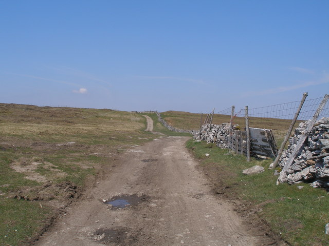
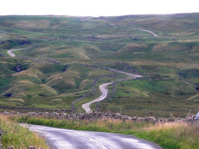
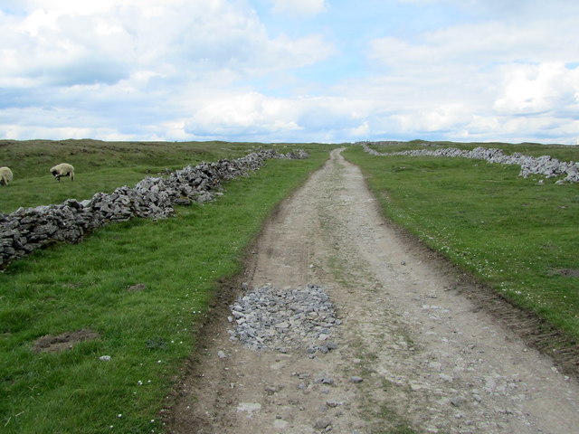
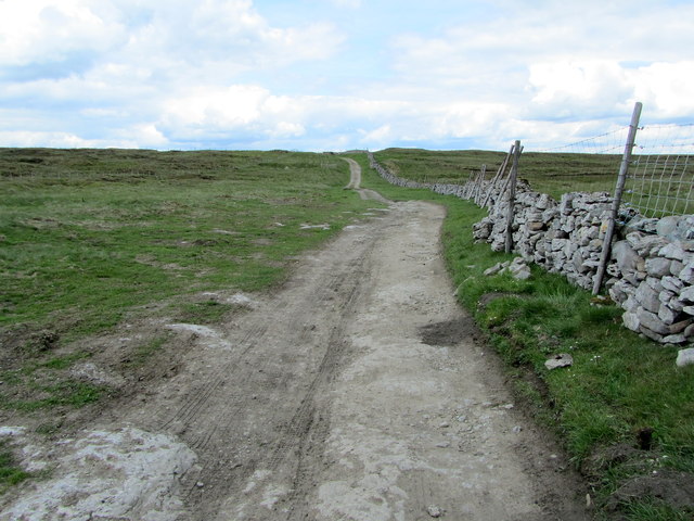
The Yorkshire Downs, which surround West Fell to the west, provide breathtaking panoramic views of the countryside. The expansive meadows are dotted with sheep grazing peacefully, and the occasional dry-stone wall adds to the charm of the landscape. Walking and hiking trails are abundant in this area, attracting outdoor enthusiasts who wish to explore the beauty of the region.

To the east of the village lies the Moorland, a wild and untamed expanse that is a delight for nature lovers. Heather-covered hills stretch as far as the eye can see, interrupted only by the occasional rocky outcrop. The moors are home to an array of wildlife, including red grouse, curlews, and hares, making it a popular spot for birdwatching and wildlife enthusiasts.

West Fell itself is a small, close-knit community with a charming village center. It boasts traditional stone houses, quaint cottages, and a lovely village green. The locals take great pride in their community, and there is a strong sense of community spirit evident in regular events and gatherings.

In summary, West Fell is a hidden gem in Yorkshire, offering visitors a chance to experience the natural beauty of the Yorkshire Downs and the Moorland. With its stunning landscapes, friendly community, and peaceful atmosphere, it is a haven for those seeking a peaceful retreat in the heart of nature.

If you have any feedback on the listing, please let us know in the comments section below.
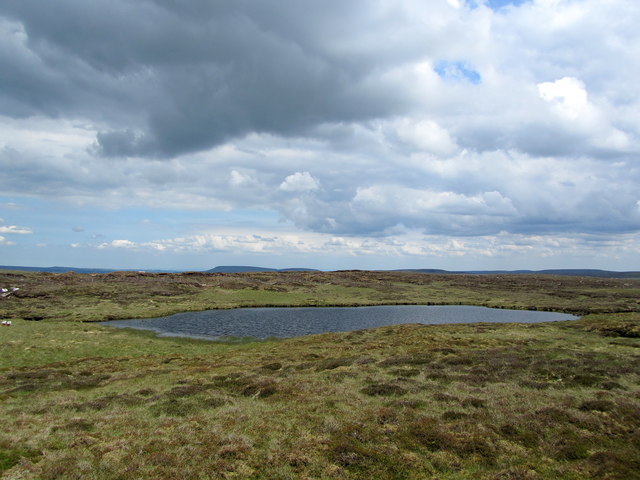
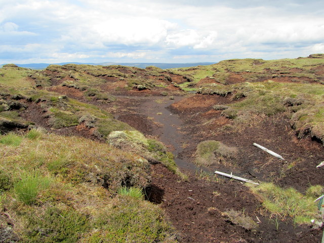
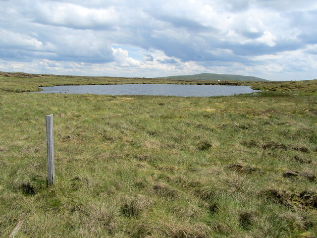
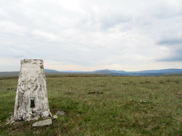
West Fell Images

Images are sourced within 2km of 54.236345/-2.1173488 or Grid Reference SD9282. Thanks to Geograph Open Source API. All images are credited.

Chapel Moor Following a drystone wall downhill.
Chapel Moor
Following a drystone wall downhill.
Triangulation pillar on Yockenthwaite Moor Heavily damaged trig pillar.
Triangulation pillar on Yockenthwaite Moor
Heavily damaged trig pillar.
Peat bogs on Yockenthwaite Moor Would not like to be up here on a wet day.
Peat bogs on Yockenthwaite Moor
Would not like to be up here on a wet day.
Yockenthwaite Moor Boundary fence on Yockenthwaite Moor.
Yockenthwaite Moor
Boundary fence on Yockenthwaite Moor.
Gilbert Lane
Gilbert Lane
Gilbert Lane on Stake Moss
Footpath leaves the track for Great Silky Top In more rugged areas, Great Silky Top would hardly merit a mention but the Ordnance Survey seem to prefer to put a name on the map rather than leave a large blank area - quite right too!
Footpath leaves the track for Great Silky Top
In more rugged areas, Great Silky Top would hardly merit a mention but the Ordnance Survey seem to prefer to put a name on the map rather than leave a large blank area - quite right too!
The long and winding road. Gilbert Lane at Causeway Moss
On Gilbert Lane Ancient route between Wharfedale and Wensleydale that crosses over Kidstones and Stake Moss - seen here close to its highest point.
On Gilbert Lane
Ancient route between Wharfedale and Wensleydale that crosses over Kidstones and Stake Moss - seen here close to its highest point.
Gilbert Lane The ancient track approaching its highest point on its journey between Wharfedale and Wensleydale.
Gilbert Lane
The ancient track approaching its highest point on its journey between Wharfedale and Wensleydale.
West Fell High rough pasture just on the Wensleydale side of the Ure/Wharfe watershed.
West Fell
High rough pasture just on the Wensleydale side of the Ure/Wharfe watershed.
South Grain Tarn Seldom visited body of water on Cray Moss on the Wensleydale/Wharfedale watershed.
South Grain Tarn
Seldom visited body of water on Cray Moss on the Wensleydale/Wharfedale watershed.
Peat Groughs near South Grain Tarn A hopeless landscape of peat groughs, making progress awkward and difficult on the watershed between Wharfedale and Wensleydale.
Peat Groughs near South Grain Tarn
A hopeless landscape of peat groughs, making progress awkward and difficult on the watershed between Wharfedale and Wensleydale.
South Grain Tarn on Cray Moss Lonely tarn high on the Wensleydale/Wharfedale watershed
South Grain Tarn on Cray Moss
Lonely tarn high on the Wensleydale/Wharfedale watershed
A Depleted Cray Tarn The tarn seems to have shrunk - and it cannot be from lack of rain, because there has been plenty of it.
A Depleted Cray Tarn
The tarn seems to have shrunk - and it cannot be from lack of rain, because there has been plenty of it.
Descending off Cray Moss Difficult terrain, but with great views of Upper Wharfedale far below.
Descending off Cray Moss
Difficult terrain, but with great views of Upper Wharfedale far below.
Stone Men of Yockenthwaite Moor These are not ancient cairns - more like someone has had a bit of fun constructing them out of the remains of a convenient dry stone wall.
Stone Men of Yockenthwaite Moor
These are not ancient cairns - more like someone has had a bit of fun constructing them out of the remains of a convenient dry stone wall.
Trig Point on Yockenthwaite Moor Showing signs of deterioration. I replaced a lump of fallen concrete on its eastern side.
Sited in a very inaccessable location I presume this trig point will eventually crumble.  The 3 Peaks are all visible here - as was the Lake District in the extreme distance.
Trig Point on Yockenthwaite Moor
Showing signs of deterioration. I replaced a lump of fallen concrete on its eastern side. Sited in a very inaccessable location I presume this trig point will eventually crumble. The 3 Peaks are all visible here - as was the Lake District in the extreme distance.
Show me another place!

West Fell is located at Grid Ref: SD9282 (Lat: 54.236345, Lng: -2.1173488)

Division: North Riding

Administrative County: North Yorkshire

District: Richmondshire

Police Authority: North Yorkshire

What 3 Words

///dreams.blush.both. Near Grassington, North Yorkshire

Nearby Locations

West Fell

Related Wikis

Bishopdale, North Yorkshire

Bishopdale is a dale in the Yorkshire Dales National Park in North Yorkshire, England. The dale is a side dale on the south side of Wensleydale, and extends...

Cray, North Yorkshire

Cray is a hamlet on the B6160 road on a steep hill above Wharfedale in the Yorkshire Dales, North Yorkshire, England. It is near Buckden and the River...

Stalling Busk

Stalling Busk is one of three settlements around Semer Water in the Richmondshire district of North Yorkshire in the small dale of Raydale just off...

St Matthew's Church, Stalling Busk

St Matthew's Church, Stalling Busk is a Grade II listed parish church in the Church of England in Stalling Busk, North Yorkshire. == History == The church...

Nearby Amenities

Located within 500m of 54.236345,-2.1173488
West Fell
Natural: fell
Source: NPE
Lat/Long: 54.2343458/-2.115273
The data included in this document is from www.openstreetmap.org. The data is made available under ODbL.

Have you been to West Fell?

Leave your review of West Fell below (or comments, questions and feedback).