Middleton Down

Downs, Moorland in Wiltshire

England

Middleton Down

Bowls Barrow, Wiltshire Bowls Barrow, taken from Tinkers Track. This area is within the Imber Range on the Salisbury Plain Training Area.
Bowls Barrow, Wiltshire Credit: Rebecca A Wills

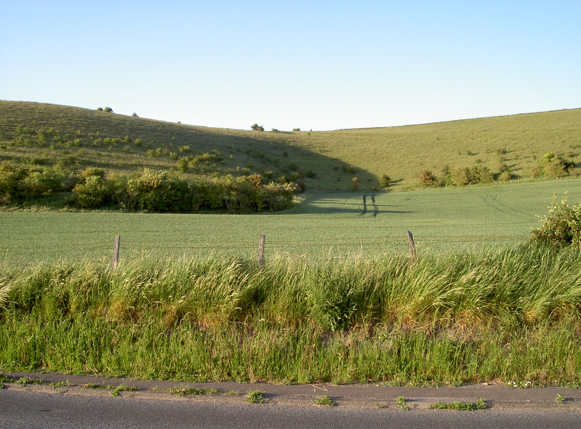
Middleton Down is a picturesque area located in Wiltshire, England. It is a captivating expanse of downs and moorland that offers visitors a unique blend of natural beauty and historical significance. Spanning approximately 10 square kilometers, Middleton Down is renowned for its rolling hills, open grasslands, and diverse wildlife.

The downs, characterized by their gently sloping hills, are covered with a patchwork of vibrant green grasses and wildflowers, creating a stunning landscape that stretches as far as the eye can see. This area is a haven for nature lovers, as it is home to a wide variety of flora and fauna. Visitors can spot numerous species of birds, such as skylarks and meadow pipits, soaring above the open fields. Additionally, the downs are frequented by rabbits, foxes, and deer, providing ample opportunities for wildlife enthusiasts to observe these creatures in their natural habitats.

Beyond its natural beauty, Middleton Down also boasts historical significance. The area is dotted with ancient monuments, including burial mounds and barrows, which serve as reminders of its rich heritage. These prehistoric sites offer a glimpse into the lives of the people who once inhabited this land thousands of years ago.

Middleton Down is a popular destination for outdoor activities such as hiking, cycling, and horseback riding. The network of trails that crisscross the downs and moorland provides ample opportunities for exploration and adventure. Moreover, the breathtaking vistas that unfold at every turn make it an ideal spot for photographers and artists seeking inspiration.

In summary, Middleton Down in Wiltshire is a captivating blend of natural beauty and historical significance. With its rolling downs, diverse wildlife, and ancient monuments, it offers visitors a unique and enriching experience in the heart of the English countryside.

If you have any feedback on the listing, please let us know in the comments section below.

Middleton Down Images

Images are sourced within 2km of 51.218555/-2.1104432 or Grid Reference ST9246. Thanks to Geograph Open Source API. All images are credited.

Bowls Barrow, Wiltshire Bowls Barrow, taken from Tinkers Track. This area is within the Imber Range on the Salisbury Plain Training Area.
Bowls Barrow, Wiltshire
Bowls Barrow, taken from Tinkers Track. This area is within the Imber Range on the Salisbury Plain Training Area.
Bowls Barrow, Wiltshire Looking north from Tinkers Track from a position to the west of Bowls Barrow. This area is within the Imber Range on the Salisbury Plain Training Area.
Bowls Barrow, Wiltshire
Looking north from Tinkers Track from a position to the west of Bowls Barrow. This area is within the Imber Range on the Salisbury Plain Training Area.
South Down Sleight, Wiltshire Looking north-northeast along a track running from Tinkers track between South Slight Down to the north and Middleton Down to the south. This area is within the Imber Range on the Salisbury Plain Training Area.
South Down Sleight, Wiltshire
Looking north-northeast along a track running from Tinkers track between South Slight Down to the north and Middleton Down to the south. This area is within the Imber Range on the Salisbury Plain Training Area.
Middleton Down, Wiltshire Looking southwest along a track from Tinkers Track. This area is within the Imber Range on the Salisbury Plain Training Area.
Middleton Down, Wiltshire
Looking southwest along a track from Tinkers Track. This area is within the Imber Range on the Salisbury Plain Training Area.
Middleton Down, Wiltshire Looking west-southwest along a track on Middleton Down from Tinkers Track. This area is within the Imber Range on the Salisbury Plain Training Area.
Middleton Down, Wiltshire
Looking west-southwest along a track on Middleton Down from Tinkers Track. This area is within the Imber Range on the Salisbury Plain Training Area.
Middleton Down, Wiltshire Badger paw prints on Middleton Down. This area is within the Imber Range on the Salisbury Plain Training Area.
Middleton Down, Wiltshire
Badger paw prints on Middleton Down. This area is within the Imber Range on the Salisbury Plain Training Area.
Boreham Down, Wiltshire Looking southwest along Boreham Down. This area is within the Imber Range on the Salisbury Plain Training Area.
Boreham Down, Wiltshire
Looking southwest along Boreham Down. This area is within the Imber Range on the Salisbury Plain Training Area.
Road across Imber Range
Derelict tank on Imber Range Just to the north of the <a href="https://www.geograph.org.uk/photo/7681154">ST9248 : Road across Imber Range</a>.
Derelict tank on Imber Range
Just to the north of the ST9248 : Road across Imber Range.
Fire power demonstration area, Imber Range
Line of posts, Imber Range Not exactly a fence, but clearly demarcating a line across the landscape.
Line of posts, Imber Range
Not exactly a fence, but clearly demarcating a line across the landscape.
Road across Imber Range Looking towards Warminster.
Road across Imber Range
Looking towards Warminster.
Track across the landscape, Imber Range
'Danger no public access' This type of barrier and sign is very frequent along the road to Imber across the tank ranges. It was raining.
'Danger no public access'
This type of barrier and sign is very frequent along the road to Imber across the tank ranges. It was raining.
Tank tracks, Imber ranges Looking from the occasionally open road to Imber.
Tank tracks, Imber ranges
Looking from the occasionally open road to Imber.
The road to Imber The occasionally open to the public route across tank ranges to the ghost village of Imber. Note derelict target tanks to right and left of the road.
The road to Imber
The occasionally open to the public route across tank ranges to the ghost village of Imber. Note derelict target tanks to right and left of the road.
Derelict tank, Imber ranges Not far from the occasionally open to the public route across tank ranges to the ghost village of Imber
Derelict tank, Imber ranges
Not far from the occasionally open to the public route across tank ranges to the ghost village of Imber
Boreham, warning sign On the military road to Warminster, open a few times a year at the discretion of MoD: <span class="nowrap"><a title="https://www.gov.uk/government/uploads/system/uploads/attachment_data/file/625489/August__2017_Newsletter.pdf" rel="nofollow ugc noopener" href="https://www.gov.uk/government/uploads/system/uploads/attachment_data/file/625489/August__2017_Newsletter.pdf">Link</a><img style="margin-left:2px;" alt="External link" title="External link - shift click to open in new window" src="https://s1.geograph.org.uk/img/external.png" width="10" height="10"/></span>
Boreham, warning sign
On the military road to Warminster, open a few times a year at the discretion of MoD: LinkExternal link
Show me another place!

Middleton Down is located at Grid Ref: ST9246 (Lat: 51.218555, Lng: -2.1104432)

Unitary Authority: Wiltshire

Police Authority: Wiltshire

What 3 Words

///perusing.sketches.camera. Near Bishopstrow, Wiltshire

Nearby Locations

Norton Down Middleton Down

Related Wikis

Scratchbury Camp

Scratchbury Camp is the site of an Iron Age univallate hillfort on Scratchbury Hill, overlooking the Wylye valley about 1 km northeast of the village of...

Battlesbury Camp

Battlesbury Camp is the site of an Iron Age bivallate hill fort on Battlesbury Hill near the town of Warminster in Wiltshire, South West England. Excavations...

Scratchbury and Cotley Hills SSSI

Scratchbury & Cotley Hills SSSI (grid reference ST915437) is a 53.5 hectare biological Site of Special Scientific Interest at Norton Bavant in Wiltshire...

Bishopstrow House

Bishopstrow Hotel & Spa is a late-Georgian English country house standing near the B3414 (Salisbury road) in the parish of Bishopstrow, about a mile east...

Nearby Amenities

Located within 500m of 51.218555,-2.1104432
Middleton Down
Place: locality
Lat/Long: 51.2182898/-2.1132398
The data included in this document is from www.openstreetmap.org. The data is made available under ODbL.

Have you been to Middleton Down?

Leave your review of Middleton Down below (or comments, questions and feedback).