Ammerby Green

Downs, Moorland in Yorkshire Richmondshire

England

Ammerby Green

Old Bridge Marker on Oxnop Bridge, Muker parish Bridge Marker inscribed in the coping stones on the south parapet of Oxnop Bridge, on Oxnop Beck. On the B6270 Guning Lane. Muker parish. Inscribed OXNOP (effaced) BRIDGE.

Milestone Society National ID: YN_MUKER01br
Old Bridge Marker on Oxnop Bridge, Muker parish Credit: D Phillips

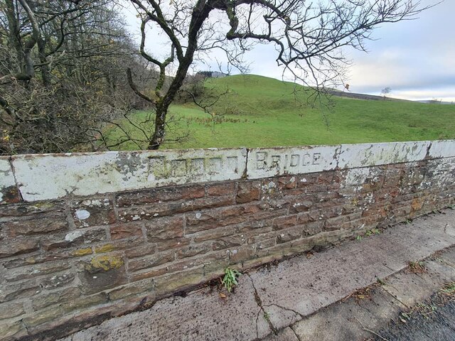
Ammerby Green is a picturesque village nestled in the heart of Yorkshire, England. Situated on the edge of the stunning Yorkshire Downs and surrounded by vast stretches of breathtaking moorland, it offers a truly idyllic setting for those seeking a peaceful and scenic retreat.

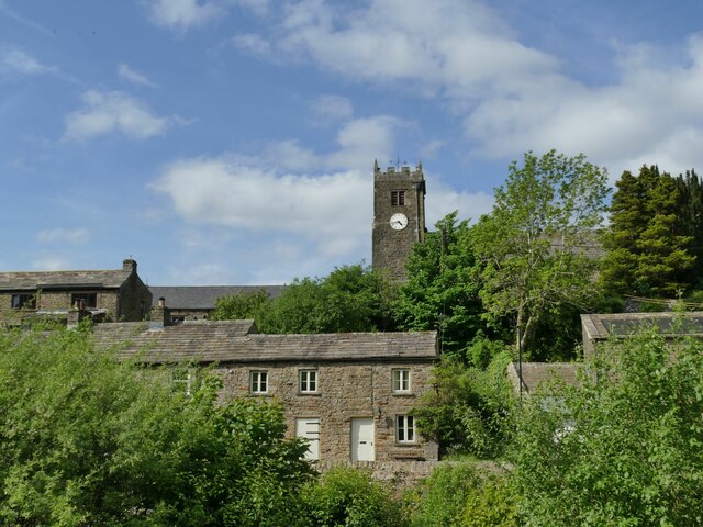
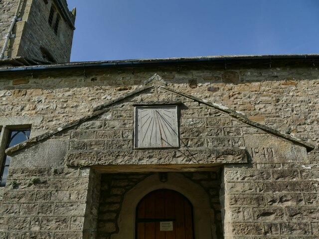
The village itself is small, with a close-knit community that prides itself on its friendly and welcoming atmosphere. Traditional stone cottages line the quaint streets, adding to the charm and character of the area. The local pub, The Green Lion, serves as a social hub for residents and visitors alike, offering hearty Yorkshire fare and a selection of fine ales.

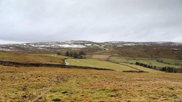
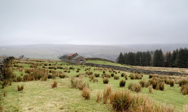
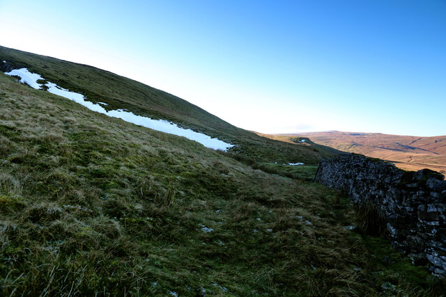
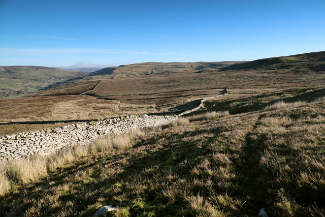
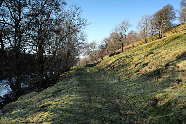
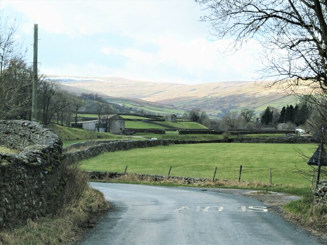
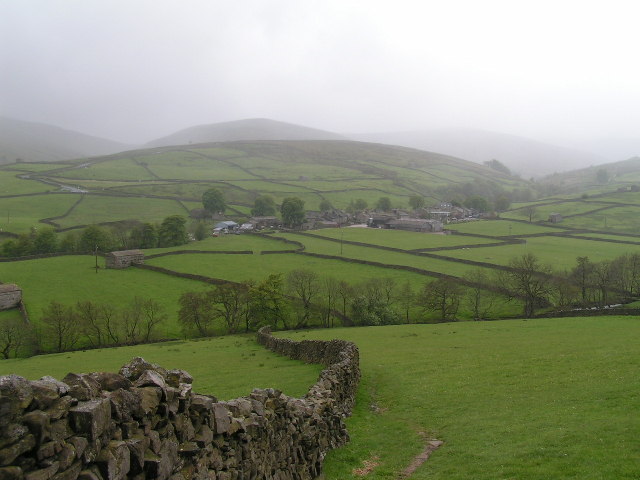
One of the main attractions of Ammerby Green is its proximity to the Yorkshire Downs, which provides ample opportunities for outdoor enthusiasts. Hiking and cycling trails crisscross the rolling hills, offering breathtaking views of the surrounding countryside. The Downs are also home to an abundance of wildlife, making it a haven for nature lovers.

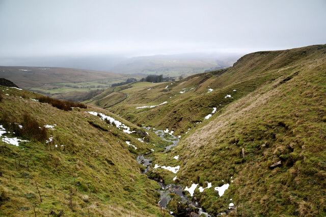
Beyond the Downs lies the vast expanse of moorland, with its wild and rugged beauty. Visitors can explore the winding footpaths that meander through the heather-clad hills, or simply enjoy the tranquility and solitude of this untouched landscape.

For those seeking a taste of history, Ammerby Green is within easy reach of several historic sites. The nearby ruins of Ammerby Abbey, a medieval monastery, offer a glimpse into the area's past. Additionally, the market town of Yorkshire Downs is a short drive away, boasting a wealth of historical buildings and a bustling market.

In summary, Ammerby Green offers a unique blend of natural beauty, tranquility, and historical charm, making it a must-visit destination for anyone seeking an authentic Yorkshire experience.

If you have any feedback on the listing, please let us know in the comments section below.

Ammerby Green Images

Images are sourced within 2km of 54.365039/-2.1200093 or Grid Reference SD9296. Thanks to Geograph Open Source API. All images are credited.
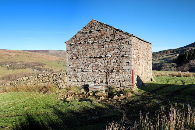
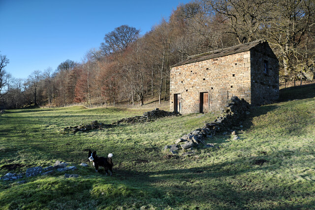
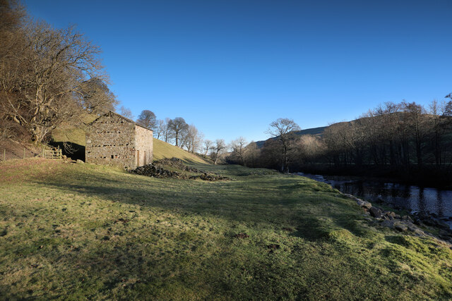
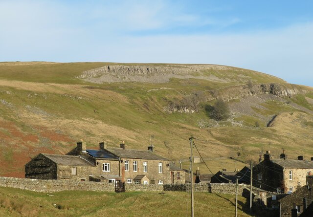
Old Bridge Marker on Oxnop Bridge, Muker parish Bridge Marker inscribed in the coping stones on the south parapet of Oxnop Bridge, on Oxnop Beck. On the B6270 Guning Lane. Muker parish. Inscribed OXNOP (effaced) BRIDGE.

Milestone Society National ID: YN_MUKER01br
Old Bridge Marker on Oxnop Bridge, Muker parish
Bridge Marker inscribed in the coping stones on the south parapet of Oxnop Bridge, on Oxnop Beck. On the B6270 Guning Lane. Muker parish. Inscribed OXNOP (effaced) BRIDGE. Milestone Society National ID: YN_MUKER01br
Hill Top There must be a viewpoint in the main dale (Swaledale) below, from where this farmhouse appears to be on top of a hill, but from each of the roads on either side of Oxnop Gill, it seems to be down in the valley and since these are the only ways to get to the farm, the name seems somehow wrong. The tops of the moors, Oxnop Common in the view, and Crackpot Moor behind the photographer, are 150 to 200m higher than Hill Top.
Hill Top
There must be a viewpoint in the main dale (Swaledale) below, from where this farmhouse appears to be on top of a hill, but from each of the roads on either side of Oxnop Gill, it seems to be down in the valley and since these are the only ways to get to the farm, the name seems somehow wrong. The tops of the moors, Oxnop Common in the view, and Crackpot Moor behind the photographer, are 150 to 200m higher than Hill Top.
Stotter Gill The number of gates to open and close on the tiny and rather sketchy minor road on the south side of the Oxnop Gill valley, give ample opportunity to be out and taking photos. The view down Stotter Gill was therefore as obvious to me as to the previous contributor <a href="https://www.geograph.org.uk/photo/6629777">SD9395 : Stotter Gill</a>. The farmhouse, less visible in low contrast lighting than in the previous view, is <a href="https://www.geograph.org.uk/photo/7066397">SD9396 : Hill Top</a>.
Stotter Gill
The number of gates to open and close on the tiny and rather sketchy minor road on the south side of the Oxnop Gill valley, give ample opportunity to be out and taking photos. The view down Stotter Gill was therefore as obvious to me as to the previous contributor SD9395 : Stotter Gill. The farmhouse, less visible in low contrast lighting than in the previous view, is SD9396 : Hill Top.
Barn on Oxnop Side The bottom of the valley of Oxnop Gill is unsuited for livestock farming and is densely wooded, including plantings of conifers, but above the dark forest, pasture is not a great deal better - being heavily infested with soft rush (Juncus effusus) indicating poor, wet soil. Sheep make a living here, but it's hardly a hay meadow and the field barn seems out of place.
Barn on Oxnop Side
The bottom of the valley of Oxnop Gill is unsuited for livestock farming and is densely wooded, including plantings of conifers, but above the dark forest, pasture is not a great deal better - being heavily infested with soft rush (Juncus effusus) indicating poor, wet soil. Sheep make a living here, but it's hardly a hay meadow and the field barn seems out of place.
Snow in Duckingdub Gill Snow still lies on the east-facing bank of Duckingdub Gill just above the intake wall on Muker Common. The steep north-facing slope is never touched by the sun in winter and despite apparently glorious weather in the dale, here it is noticeably colder than on the sunlit fells. There is a gamekeeper's path along the wall from Greenseat Gate towards a shooting hut half a mile ESE of this point, which makes for fairly easy walking until the drainage of Routin Gill where it gets a little boggier.
Snow in Duckingdub Gill
Snow still lies on the east-facing bank of Duckingdub Gill just above the intake wall on Muker Common. The steep north-facing slope is never touched by the sun in winter and despite apparently glorious weather in the dale, here it is noticeably colder than on the sunlit fells. There is a gamekeeper's path along the wall from Greenseat Gate towards a shooting hut half a mile ESE of this point, which makes for fairly easy walking until the drainage of Routin Gill where it gets a little boggier.
Descending to Routin Gill The gamekeeper's path along the south side of the intake wall starts to get a bit vague here as it starts to descend into the drainage of Routin Gill. Partly that's because it now has two destinations:- traps laid on bridges over the small gills and sikes close to the wall (where it gets boggy) and a shooting hut further up the hillside. We stuck quite close to the wall, which may not have been the easiest option, and definitely didn't reach the track to the shooting hut shown on the 1:25000 map, but was at least the shortest way down to the minor road above Oxnop Gill.
Descending to Routin Gill
The gamekeeper's path along the south side of the intake wall starts to get a bit vague here as it starts to descend into the drainage of Routin Gill. Partly that's because it now has two destinations:- traps laid on bridges over the small gills and sikes close to the wall (where it gets boggy) and a shooting hut further up the hillside. We stuck quite close to the wall, which may not have been the easiest option, and definitely didn't reach the track to the shooting hut shown on the 1:25000 map, but was at least the shortest way down to the minor road above Oxnop Gill.
Field barn above Low Oxnop Swaledale is known for its plethora of field barns, and this one seems to be both still in use, and in very good condition. It lies above Low Oxnop at Ivelet, and the slope behind drops down into woodland around Oxnop Beck. The hamlet of Ivelet lies among the trees on the far side of the dale at the left of this view.
Field barn above Low Oxnop
Swaledale is known for its plethora of field barns, and this one seems to be both still in use, and in very good condition. It lies above Low Oxnop at Ivelet, and the slope behind drops down into woodland around Oxnop Beck. The hamlet of Ivelet lies among the trees on the far side of the dale at the left of this view.
Ivelet bridge Any way into or out of Ivelet involves narrow roads, but most people in anything bigger than a family car who know the place will choose to use the approach from Gunnerside rather than this bridge, which is also too weak to support anything heavy. I'd just watched a nervous driver of a Transit Van take the best part of a minute to edge his way across, watching both mirrors - clearly not a local. There's quite a sharp bend coming from the left, often many walkers on the bridge and road, and the turn out onto the main road has dreadful visibility so it really is better avoided !
Ivelet bridge
Any way into or out of Ivelet involves narrow roads, but most people in anything bigger than a family car who know the place will choose to use the approach from Gunnerside rather than this bridge, which is also too weak to support anything heavy. I'd just watched a nervous driver of a Transit Van take the best part of a minute to edge his way across, watching both mirrors - clearly not a local. There's quite a sharp bend coming from the left, often many walkers on the bridge and road, and the turn out onto the main road has dreadful visibility so it really is better avoided !
Walking from Ivelet bridge to Muker There's a choice of walking routes from Ivelet to Muker - this path follows the north bank of the River Swale most closely and is designated as part of "A Pennine Journey". It's very easy going, though the shortest way to Muker uses a ford to cross the river which is not well-marked and even with the level as low as today, didn't look especially appealing (even with wellies). So it will lead, more sensibly, to the Ramps Holme footbridge 600m north of Muker, from where it is a pleasant stroll through meadows (on a paved single-file path) to the village.
Walking from Ivelet bridge to Muker
There's a choice of walking routes from Ivelet to Muker - this path follows the north bank of the River Swale most closely and is designated as part of "A Pennine Journey". It's very easy going, though the shortest way to Muker uses a ford to cross the river which is not well-marked and even with the level as low as today, didn't look especially appealing (even with wellies). So it will lead, more sensibly, to the Ramps Holme footbridge 600m north of Muker, from where it is a pleasant stroll through meadows (on a paved single-file path) to the village.
Riverside barn Swaledale is known for its large population of field barns, several of which lie close the riverside path from Ivelet to Muker. This one sits below the woodland at the foot of the slope below Calvert Houses where the public footpath follows a narrow strip of flat grassland next to the north bank of the River Swale. Although it's in the sun, and it is getting on in the afternoon, there are still patches of frost on the grass and the path is surprisingly unmuddy considering the amount of foot traffic it gets, even in the winter.
Riverside barn
Swaledale is known for its large population of field barns, several of which lie close the riverside path from Ivelet to Muker. This one sits below the woodland at the foot of the slope below Calvert Houses where the public footpath follows a narrow strip of flat grassland next to the north bank of the River Swale. Although it's in the sun, and it is getting on in the afternoon, there are still patches of frost on the grass and the path is surprisingly unmuddy considering the amount of foot traffic it gets, even in the winter.
Footpath to Ivelet passes a riverside barn Swaledale is known for its large population of field barns, several of which lie close the riverside path from Ivelet to Muker. This one (<a href="https://www.geograph.org.uk/photo/7074081">SD9297 : Riverside barn</a>) sits below the woodland at the foot of the slope below Calvert Houses where the public footpath follows a narrow strip of flat grassland next to the north bank of the River Swale. Of a choice of several walking routes from Muker to Ivelet, this is the one followed by "A Pennine Journey" and leads, in about three quarters of a mile, to the picturesque Ivelet bridge <a href="https://www.geograph.org.uk/photo/7073977">SD9397 : Ivelet bridge</a>.
Footpath to Ivelet passes a riverside barn
Swaledale is known for its large population of field barns, several of which lie close the riverside path from Ivelet to Muker. This one (SD9297 : Riverside barn) sits below the woodland at the foot of the slope below Calvert Houses where the public footpath follows a narrow strip of flat grassland next to the north bank of the River Swale. Of a choice of several walking routes from Muker to Ivelet, this is the one followed by "A Pennine Journey" and leads, in about three quarters of a mile, to the picturesque Ivelet bridge SD9397 : Ivelet bridge.
B6270 towards Muker Heading west on the B6270 with a snow rimmed Great Shunner Fell in the distance.
B6270 towards Muker
Heading west on the B6270 with a snow rimmed Great Shunner Fell in the distance.
Cottages at Muker Stone built cottages at the 'back' of the village away from the main road. Kisdon Scar is the limestone outcrop on the hill beyond.
Cottages at Muker
Stone built cottages at the 'back' of the village away from the main road. Kisdon Scar is the limestone outcrop on the hill beyond.
Barns near Muker I've submitted a photo of the nearest barn before, but this view from a different angle shows at least 8 other field barns on the slopes of Kisdon in the background. A local farmer might refer to one of these barns as a 'cowass' [cow house], which was their original purpose, but these days any cattle are likely to be housed in one large barn close by the farmyard.
Barns near Muker
I've submitted a photo of the nearest barn before, but this view from a different angle shows at least 8 other field barns on the slopes of Kisdon in the background. A local farmer might refer to one of these barns as a 'cowass' [cow house], which was their original purpose, but these days any cattle are likely to be housed in one large barn close by the farmyard.
Muker St Mary - tower (1) Viewed from the public car park.
Muker St Mary - tower (1)
Viewed from the public car park.
Muker St Mary - tower (2) Viewed from the churchyard entrance. The tower dates from 1580, but the two bells within it are dated c.1275, perhaps saved from an earlier building on the site.
Muker St Mary - tower (2)
Viewed from the churchyard entrance. The tower dates from 1580, but the two bells within it are dated c.1275, perhaps saved from an earlier building on the site.
Muker St Mary - old font This small font stands outside the church entrance and is separately listed grade II (list entry 1317105). It may be original to the church building (1580).
Muker St Mary - old font
This small font stands outside the church entrance and is separately listed grade II (list entry 1317105). It may be original to the church building (1580).
Muker St Mary - sundial The sundial on the south porch is surprisingly modern (1997) although that could be the date of restoration of an older facility. The date of 1849 to the right of the doorway presumably refers to the construction of the porch.
Muker St Mary - sundial
The sundial on the south porch is surprisingly modern (1997) although that could be the date of restoration of an older facility. The date of 1849 to the right of the doorway presumably refers to the construction of the porch.
Show me another place!

Ammerby Green is located at Grid Ref: SD9296 (Lat: 54.365039, Lng: -2.1200093)

Division: North Riding

Administrative County: North Yorkshire

District: Richmondshire

Police Authority: North Yorkshire

What 3 Words

///shun.evolution.mattress. Near Bowes, Co. Durham

Nearby Locations

Ammerby Green

Related Wikis

Muker

Muker is a village and civil parish at the western end of Swaledale in North Yorkshire, England, within the Yorkshire Dales. The parish includes the hamlets...

Ivelet

Ivelet is a hamlet in the Yorkshire Dales, North Yorkshire, England about a mile west of Gunnerside in Swaledale. Ivelet Bridge crosses the River Swale...

Satron

Satron is a hamlet in Swaledale, North Yorkshire, England. It lies 0.6 miles (1 km) south west of Gunnerside on the opposite bank of the River Swale. It...

Arn Gill (North Yorkshire)

Arn Gill is a ravine or gully containing a beck of the same name, near the village of Muker in Swaledale, North Yorkshire, England. The ravine and beck...

Gunnerside

Gunnerside is a village in North Yorkshire, England. It is situated in Swaledale, on the B6270 road, 3 miles (5 km) east of Muker and 6 miles (10 km) west...

Thwaite, North Yorkshire

Thwaite is a small village in the Yorkshire Dales, North Yorkshire, England. It is in Swaledale and is part the district of Richmondshire and the civil...

Kisdon

Kisdon, also called Kisdon Hill, is a fell situated in upper Swaledale in the Yorkshire Dales National Park in North Yorkshire, England. == Geography... ==

Gunnerside Gill

Gunnerside Gill (or Ghyll) is a small valley in the Yorkshire Dales, England, which branches off Swaledale into moorland to the north of Gunnerside. The...

Have you been to Ammerby Green?

Leave your review of Ammerby Green below (or comments, questions and feedback).