Newbiggin Common

Downs, Moorland in Durham

England

Newbiggin Common

Sheepwash beside Wester Beck Wester Beck is a tributary of the River Tees which lies in the direction of the view. The sheepwash is a disused farming feature; water, (perhaps with 'additives') would be let into the trough and the sheep fed in from the high step at the far end of it. The remains of sheepfolds can be seen at the end of the trough where animals would be kept to await their turn; the river is eroding the bank below the folds and there's been some collapsing of their stonework.
Sheepwash beside Wester Beck Credit: Trevor Littlewood

Newbiggin Common is a picturesque area located in Durham, England. It is known for its stunning downs and moorland, which attract nature enthusiasts and outdoor lovers alike. With its diverse landscape, this common offers a wide range of activities and sights for visitors.

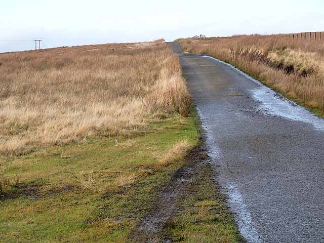
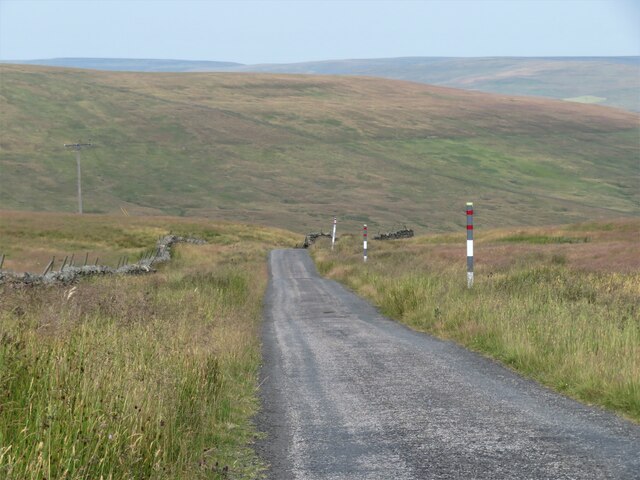
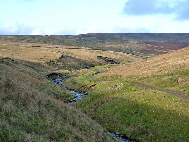
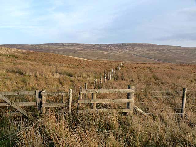
The downs of Newbiggin Common are characterized by their rolling hills and expansive grasslands. The area is ideal for hiking and walking, providing breathtaking views of the surrounding countryside. The downs are also home to various species of flora and fauna, making it a popular spot for nature photography and birdwatching.

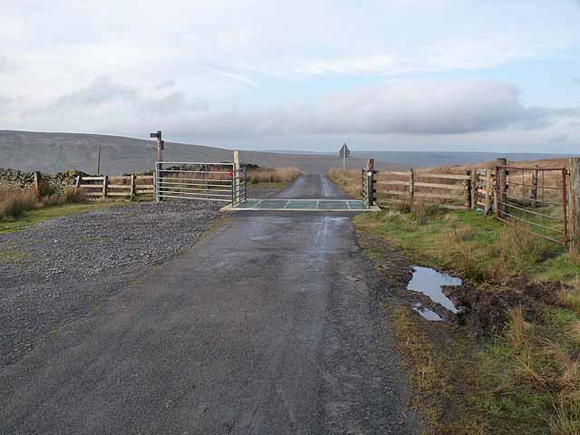
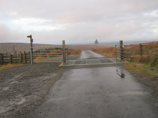
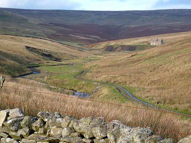
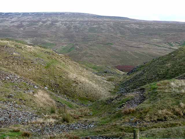
Adjacent to the downs, Newbiggin Common boasts extensive moorland. This rugged terrain is covered in heather and moss, creating a unique and wild atmosphere. The moorland is often frequented by hikers and nature enthusiasts who enjoy exploring the area's hidden valleys and ancient ruins.

In addition to its natural beauty, Newbiggin Common is rich in history. The area has been inhabited for centuries, and remnants of its past can still be seen today. Ancient stone circles and burial mounds dot the landscape, offering glimpses into the region's ancient past.

Overall, Newbiggin Common is a haven for those seeking tranquility and natural beauty. Its downs and moorland provide a range of outdoor activities, from hiking to wildlife spotting. Whether visitors are looking to immerse themselves in nature or delve into the area's history, this common offers a captivating experience for all.

If you have any feedback on the listing, please let us know in the comments section below.

Newbiggin Common Images

Images are sourced within 2km of 54.682541/-2.1403955 or Grid Reference NY9131. Thanks to Geograph Open Source API. All images are credited.
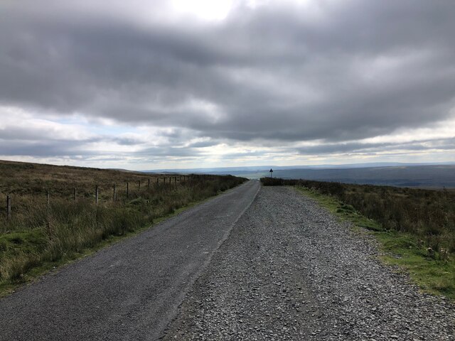
Sheepwash beside Wester Beck Wester Beck is a tributary of the River Tees which lies in the direction of the view. The sheepwash is a disused farming feature; water, (perhaps with 'additives') would be let into the trough and the sheep fed in from the high step at the far end of it. The remains of sheepfolds can be seen at the end of the trough where animals would be kept to await their turn; the river is eroding the bank below the folds and there's been some collapsing of their stonework.
Sheepwash beside Wester Beck
Wester Beck is a tributary of the River Tees which lies in the direction of the view. The sheepwash is a disused farming feature; water, (perhaps with 'additives') would be let into the trough and the sheep fed in from the high step at the far end of it. The remains of sheepfolds can be seen at the end of the trough where animals would be kept to await their turn; the river is eroding the bank below the folds and there's been some collapsing of their stonework.
Minor road on Newbiggin Common Just below the summit at Swinhope Head which, at 609 metres above sea level, I believe is the highest public motorable road in England.
Minor road on Newbiggin Common
Just below the summit at Swinhope Head which, at 609 metres above sea level, I believe is the highest public motorable road in England.
Road summit at Swinhope Head Cattle grid at the summit of the road from Newbiggin (Teesdale) to Westgate (Weardale) at Swinhope Head which, at 609 metres above sea level, I believe is the highest public motorable road in England.
Road summit at Swinhope Head
Cattle grid at the summit of the road from Newbiggin (Teesdale) to Westgate (Weardale) at Swinhope Head which, at 609 metres above sea level, I believe is the highest public motorable road in England.
Electric transmission line at Swinhope Head On the watershed between Teesdale (to the left) and Weardale.
Electric transmission line at Swinhope Head
On the watershed between Teesdale (to the left) and Weardale.
Moorland on Ettersgill Common
Cattle grid on minor road at Swinehope Head
Minor Road at Swinhope Head The road begins a long descent into the Upper Tees Valley from here.
Minor Road at Swinhope Head
The road begins a long descent into the Upper Tees Valley from here.
Road summit at Swinhope Head [2] Quite a contrast to the last time I took a photograph here [22/03/18] as the temperature on that occasion was only a little above freezing, but on this occasion it was 33°C, even at 2000ft. Taken on a day of record breaking temperatures across Britain. Not much point in coming up here to keep cool.
Road summit at Swinhope Head [2]
Quite a contrast to the last time I took a photograph here [22/03/18] as the temperature on that occasion was only a little above freezing, but on this occasion it was 33°C, even at 2000ft. Taken on a day of record breaking temperatures across Britain. Not much point in coming up here to keep cool.
The start of a long descent The minor road from Newbiggin to Westgate begins a long descent here from the 2000ft contour to below 1000ft in Weardale.
The start of a long descent
The minor road from Newbiggin to Westgate begins a long descent here from the 2000ft contour to below 1000ft in Weardale.
Moorland south of Swinhope Head Looking south west towards Mickle Fell (left) and Meldon Hill (right).
Moorland south of Swinhope Head
Looking south west towards Mickle Fell (left) and Meldon Hill (right).
Moorland around Hare Law Sike
Small covered reservoir above Watson's Bridge On the mountain road between Newbiggin (Teesdale) and Westgate (Weardale). A small wind turbine provides power for control and telemetry.
Small covered reservoir above Watson's Bridge
On the mountain road between Newbiggin (Teesdale) and Westgate (Weardale). A small wind turbine provides power for control and telemetry.
Flushiemere Beck A remote valley high on the northern flank of Teesdale. The track leads to the ruined Flushiemere House <a href="https://www.geograph.org.uk/gridref/NY9031">NY9031</a>.
Flushiemere Beck
A remote valley high on the northern flank of Teesdale. The track leads to the ruined Flushiemere House NY9031.
Flushiemere Beck A remote valley high on the northern flank of Teesdale. The track leads to the ruined Flushiemere House <a href="https://www.geograph.org.uk/gridref/NY9031">NY9031</a>. Westernhope Moor <a href="https://www.geograph.org.uk/gridref/NY9033">NY9033</a> on the skyline.
Flushiemere Beck
A remote valley high on the northern flank of Teesdale. The track leads to the ruined Flushiemere House NY9031. Westernhope Moor NY9033 on the skyline.
Descent to Newbiggin On the mountain road from Westgate (Weardale) to Newbiggin (Teesdale). Note signs of old mineral workings which dot the hillside.
Descent to Newbiggin
On the mountain road from Westgate (Weardale) to Newbiggin (Teesdale). Note signs of old mineral workings which dot the hillside.
Tributary valley above Flushiemere Beck Displaying signs of old mineral workings (probably for lead) which dot this hillside.
Tributary valley above Flushiemere Beck
Displaying signs of old mineral workings (probably for lead) which dot this hillside.
Fence on Black Hill Westernhope Moor <a href="https://www.geograph.org.uk/gridref/NY9133">NY9133</a> on the skyline.
Fence on Black Hill
Westernhope Moor NY9133 on the skyline.
Fence posts on Black Hill The transmission lines at Swinhope Head <a href="https://www.geograph.org.uk/gridref/NY8933">NY8933</a> can be seen on the skyline.
Fence posts on Black Hill
The transmission lines at Swinhope Head NY8933 can be seen on the skyline.
Show me another place!

Newbiggin Common is located at Grid Ref: NY9131 (Lat: 54.682541, Lng: -2.1403955)

Unitary Authority: County Durham

Police Authority: Durham

What 3 Words

///spud.hiring.quirky. Near Newbiggin, Co. Durham

Nearby Locations

Newbiggin Common

Related Wikis

Ettersgill

Ettersgill is a village in County Durham, England. It is situated at the top of Teesdale, on the north side of the Tees between Newbiggin and Forest-in...

Teesdale Allotments

Teesdale Allotments is a Site of Special Scientific Interest in the Teesdale district of County Durham, England. It consists of two large upland areas...

Bowlees and Friar House Meadows

Bowlees and Friar House Meadows is a Site of Special Scientific Interest in the Teesdale district of west County Durham, England. It consists of three...

Bowlees

Bowlees is a small village in County Durham, England. It is situated near Newbiggin, on the other side of Teesdale from Holwick. The visitor centre in...

Nearby Amenities

Located within 500m of 54.682541,-2.1403955
Newbiggin Common
Natural: moor
Source: NPE
Lat/Long: 54.6816901/-2.137315
Broadleyhill Low Level
Historic: mine_adit
Mineral: lead
Source: NPE;historical_research
Lat/Long: 54.6795812/-2.1420356
Flushie Mere
Natural: wetland
Source: OS OpenData StreetView
Lat/Long: 54.6827564/-2.1398008
Broadley Hill
Natural: peak
Source: OS OpenData StreetView
Lat/Long: 54.6820245/-2.1473432
Broadley Low Level
Historic: mine_adit
Mineral: lead
Source: OS OpenData StreetView
Lat/Long: 54.6806475/-2.1462059
Historic: mine_shaft
Mineral: lead
Source: Bing
Lat/Long: 54.6795999/-2.1405413
Historic: mine_shaft
Mineral: lead
Source: Bing
Lat/Long: 54.6818081/-2.143599
Historic: mine_shaft
Mineral: lead
Source: Bing
Lat/Long: 54.6818574/-2.1412923
Historic: mine_shaft
Mineral: lead
Source: Bing
Lat/Long: 54.6818081/-2.1433844
Historic: mine_shaft
Mineral: lead
Source: Bing
Lat/Long: 54.6794759/-2.1410026
Historic: mine_shaft
Mineral: lead
Source: Bing
Lat/Long: 54.6819693/-2.1410992
Historic: mine_shaft
Mineral: lead
Source: Bing
Lat/Long: 54.682/-2.143599
Historic: mine_shaft
Mineral: lead
Source: Bing
Lat/Long: 54.6824903/-2.1391358
Historic: mine_shaft
Mineral: lead
Source: Bing
Lat/Long: 54.6816775/-2.1425368
Historic: mine_shaft
Mineral: lead
Source: Bing
Lat/Long: 54.6790103/-2.1392646
Historic: mine_shaft
Mineral: lead
Source: Bing
Lat/Long: 54.6821303/-2.1406486
Historic: mine_shaft
Mineral: lead
Source: Bing
Lat/Long: 54.6781974/-2.1387295
Historic: mine_shaft
Mineral: lead
Source: Bing
Lat/Long: 54.6815221/-2.1472697
Historic: mine_shaft
Mineral: lead
Source: Bing
Lat/Long: 54.6806664/-2.1418623
Hunting Stand
Hunting Stand: grouse_butt
Lat/Long: 54.685297/-2.1344376
Man Made: sheepfold
Lat/Long: 54.6785215/-2.1434793
The data included in this document is from www.openstreetmap.org. The data is made available under ODbL.

Have you been to Newbiggin Common?

Leave your review of Newbiggin Common below (or comments, questions and feedback).