Redburn Common
Downs, Moorland in Durham
England
Redburn Common

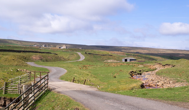
Redburn Common is a picturesque expanse of open land located in Durham, England. Stretching across an area of approximately 200 acres, it is a designated Site of Special Scientific Interest (SSSI), known for its diverse ecosystem and stunning natural beauty. The common is comprised of three distinct sections: Downs, Moorland, and Woodland.
The Downs area of Redburn Common features gently rolling hills, offering panoramic views of the surrounding countryside. It is characterized by its vibrant green grasslands and scattered patches of wildflowers, creating a visually captivating landscape. The area is home to a variety of bird species, such as skylarks and meadow pipits, which can often be seen soaring through the clear blue skies.
The Moorland section of Redburn Common presents a different landscape, with heather-covered hills and peat bogs. This unique habitat supports a range of plant species, including cotton grass and bilberry, which add splashes of color to the otherwise earthy tones. Moorland birds, such as curlews and lapwings, are frequently spotted here, adding to the area's natural charm.
The Woodland part of Redburn Common offers a tranquil retreat, with its dense canopy of trees providing shade and shelter. Ancient oak and birch trees dominate the area, forming a rich and diverse woodland ecosystem. Visitors can enjoy peaceful walks along the well-maintained paths, observing the abundant wildlife that thrives in this enchanting environment.
Redburn Common is a haven for nature enthusiasts, offering a captivating mix of landscapes and habitats to explore. Its natural beauty, combined with its ecological significance, makes it a cherished destination for both locals and tourists alike.
If you have any feedback on the listing, please let us know in the comments section below.
Redburn Common Images
Images are sourced within 2km of 54.795546/-2.1412075 or Grid Reference NY9144. Thanks to Geograph Open Source API. All images are credited.


Redburn Common is located at Grid Ref: NY9144 (Lat: 54.795546, Lng: -2.1412075)
Unitary Authority: County Durham
Police Authority: Durham
What 3 Words
///lyricism.lawn.graphic. Near Stanhope, Co. Durham
Nearby Locations
Related Wikis

Lintzgarth
Lintzgarth is a village in the civil parish of Stanhope, in County Durham, England. It is situated to the west of Rookhope. The Lintzgarth smeltmill was...

Rookhope
Rookhope is a village in the civil parish of Stanhope, in County Durham, England. A former lead and fluorspar mining community, it first existed as a group...

Ramshaw, Consett
Ramshaw is a small village in County Durham, in England. It is situated to the south of Hunstanworth, a few miles west of Consett. Lead mining was an important...

West Rigg Open Cutting
West Rigg Open Cutting is a Site of Special Scientific Interest in the Wear Valley district of west County Durham, England. It is a disused ironstone...
Slit Woods
Slitt Woods is a Site of Special Scientific Interest in the Wear Valley district of County Durham, England. It occupies the valley of Middlehope Burn,...

Allenheads
Allenheads is a former mining village in the Pennines to the north of Weardale in Northumberland, England. Lead extraction was the settlement's industry...
Townfield
Townfield is a village in County Durham, in England. It is situated just to the south of Hunstanworth and part of that parish, about 10 miles (16 km) west...

Hexhamshire Moors
Hexhamshire Moors is a Site of Special Scientific Interest covering an extensive area of moorland in the Wear Valley district of north-west County Durham...
Nearby Amenities
Located within 500m of 54.795546,-2.1412075Have you been to Redburn Common?
Leave your review of Redburn Common below (or comments, questions and feedback).