Cote Pasture

Downs, Moorland in Yorkshire Richmondshire

England

Cote Pasture

View across A684 north to fields 2 miles east of Hawes <a href="https://www.geograph.org.uk/photo/6742127">SD9089 : Replacement milestone on A684 near Burtersett</a> is a close-up image of the milestone which indicates Hawes 2 miles, Leyburn 15 miles
View across A684 north to fields 2 miles east of Hawes Credit: Roger Templeman

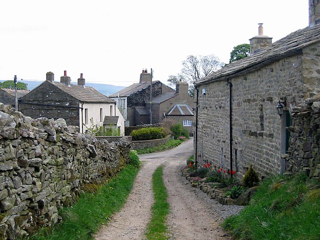
Cote Pasture, located in the picturesque region of Yorkshire, England, is an area renowned for its breathtaking natural beauty and diverse landscape. Nestled in the heart of the Yorkshire Downs and Moorland, Cote Pasture spans over hundreds of acres, offering visitors a unique and tranquil experience.

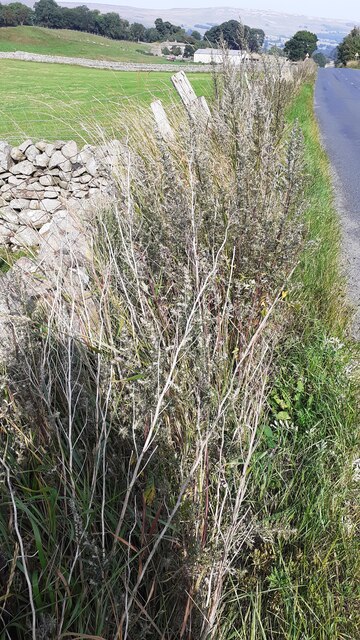
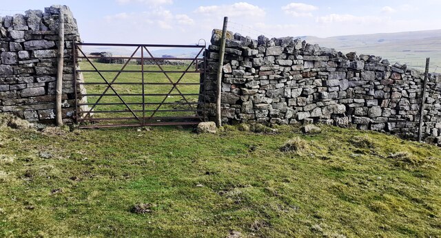
The terrain of Cote Pasture is characterized by rolling hills, vast open fields, and scattered woodlands, all contributing to its enchanting charm. The region is known for its rich biodiversity, with a wide array of flora and fauna calling it home. Visitors can expect to encounter various species of birds, mammals, and plant life, making it a haven for nature enthusiasts and wildlife lovers.

The Yorkshire Downs, which form a significant part of Cote Pasture, are known for their undulating hills and expansive vistas. These hills offer breathtaking panoramic views, particularly from the higher elevations, making it a popular spot for hikers, cyclists, and photographers. The moorland, on the other hand, presents a different landscape, characterized by vast stretches of open heather-covered land, creating a serene and peaceful atmosphere.

Cote Pasture is also steeped in history and cultural significance. The region has traces of ancient settlements and archaeological sites, providing a glimpse into its past. The area is dotted with charming villages and historic landmarks, adding to the allure of the surroundings.

Whether it's exploring the picturesque countryside, indulging in outdoor activities, or simply immersing oneself in the tranquility of nature, Cote Pasture offers a unique and enchanting experience for all who visit.

If you have any feedback on the listing, please let us know in the comments section below.
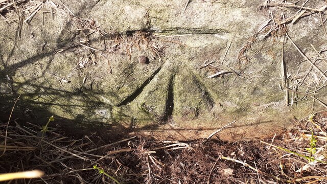
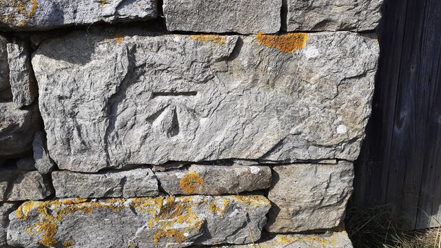
Cote Pasture Images

Images are sourced within 2km of 54.31593/-2.1396188 or Grid Reference SD9191. Thanks to Geograph Open Source API. All images are credited.

View across A684 north to fields 2 miles east of Hawes <a href="https://www.geograph.org.uk/photo/6742127">SD9089 : Replacement milestone on A684 near Burtersett</a> is a close-up image of the milestone which indicates Hawes 2 miles, Leyburn 15 miles
View across A684 north to fields 2 miles east of Hawes
SD9089 : Replacement milestone on A684 near Burtersett is a close-up image of the milestone which indicates Hawes 2 miles, Leyburn 15 miles
Barn on north side of A684 south of Borwins There are two Ordnance Survey benchmarks on the near corner of the barn
Barn on north side of A684 south of Borwins
There are two Ordnance Survey benchmarks on the near corner of the barn
Benchmark on top of north parapet of bridge over Hunger Hill Sike Ordnance Survey rivet benchmark levelled at 249.622m above Newlyn Datum in 1971. See <span class="nowrap"><a title="www.bench-marks.org.uk/bm27809" rel="nofollow ugc noopener" href="http://www.bench-marks.org.uk/bm27809">Link</a><img style="margin-left:2px;" alt="External link" title="External link - shift click to open in new window" src="https://s1.geograph.org.uk/img/external.png" width="10" height="10"/></span>
Benchmark on top of north parapet of bridge over Hunger Hill Sike
Ordnance Survey rivet benchmark levelled at 249.622m above Newlyn Datum in 1971. See LinkExternal link
View of Hunger Hill Sike over north parapet of A684 bridge There is an Ordnance Survey benchmark <a href="https://www.geograph.org.uk/photo/6958604">SD9089 : Benchmark on top of north parapet of bridge over Hunger Hill Sike</a> on top of the near (east) end of the parapet
View of Hunger Hill Sike over north parapet of A684 bridge
There is an Ordnance Survey benchmark SD9089 : Benchmark on top of north parapet of bridge over Hunger Hill Sike on top of the near (east) end of the parapet
Benchmark on barn on south side of A684 opposite Hunger Hill Ordnance Survey flush bracket (serial number 11593) benchmark levelled at 253.321m above Newlyn Datum in 1971 on NE corner of the barn. See <span class="nowrap"><a title="www.bench-marks.org.uk/bm22449" rel="nofollow ugc noopener" href="http://www.bench-marks.org.uk/bm22449">Link</a><img style="margin-left:2px;" alt="External link" title="External link - shift click to open in new window" src="https://s1.geograph.org.uk/img/external.png" width="10" height="10"/></span> . 
Ordnance Survey records also indicate that a benchmark was levelled at 830.704 feet above Liverpool Datum on the same corner of a barn at this location during the 1845 Kirkby Kendal to Thirsk 1GL Survey. The surveyor's description was 'No. 85. North-east corner of cow-house, at South side of road ; 3.0 ft. above centre of road'. See <span class="nowrap"><a title="www.bench-marks.org.uk/bm25373" rel="nofollow ugc noopener" href="http://www.bench-marks.org.uk/bm25373">Link</a><img style="margin-left:2px;" alt="External link" title="External link - shift click to open in new window" src="https://s1.geograph.org.uk/img/external.png" width="10" height="10"/></span>
Benchmark on barn on south side of A684 opposite Hunger Hill
Ordnance Survey flush bracket (serial number 11593) benchmark levelled at 253.321m above Newlyn Datum in 1971 on NE corner of the barn. See LinkExternal link . Ordnance Survey records also indicate that a benchmark was levelled at 830.704 feet above Liverpool Datum on the same corner of a barn at this location during the 1845 Kirkby Kendal to Thirsk 1GL Survey. The surveyor's description was 'No. 85. North-east corner of cow-house, at South side of road ; 3.0 ft. above centre of road'. See LinkExternal link
Barn on south side of A684 south of Hunger Hill There is an Ordnance Survey benchmark <a href="https://www.geograph.org.uk/photo/6958734">SD9089 : Benchmark on barn on south side of A684 opposite Hunger Hill</a> on the far corner, road face, of the barn
Barn on south side of A684 south of Hunger Hill
There is an Ordnance Survey benchmark SD9089 : Benchmark on barn on south side of A684 opposite Hunger Hill on the far corner, road face, of the barn
South parapet of Hungerhill Bridge taking A684 over Raygill Sike There is an Ordnance Survey benchmark levelled at 244.132m above Newlyn Datum in 1971 at the base of the parapet at its near end. See <span class="nowrap"><a title="www.bench-marks.org.uk/bm27811" rel="nofollow ugc noopener" href="http://www.bench-marks.org.uk/bm27811">Link</a><img style="margin-left:2px;" alt="External link" title="External link - shift click to open in new window" src="https://s1.geograph.org.uk/img/external.png" width="10" height="10"/></span>
South parapet of Hungerhill Bridge taking A684 over Raygill Sike
There is an Ordnance Survey benchmark levelled at 244.132m above Newlyn Datum in 1971 at the base of the parapet at its near end. See LinkExternal link
Benchmark (and small snail) on stone at base of wall on north side of A684 Ordnance Survey cut mark benchmark levelled at 238.755m above Newlyn Datum in 1971. See <span class="nowrap"><a title="www.bench-marks.org.uk/bm27812" rel="nofollow ugc noopener" href="http://www.bench-marks.org.uk/bm27812">Link</a><img style="margin-left:2px;" alt="External link" title="External link - shift click to open in new window" src="https://s1.geograph.org.uk/img/external.png" width="10" height="10"/></span>
Benchmark (and small snail) on stone at base of wall on north side of A684
Ordnance Survey cut mark benchmark levelled at 238.755m above Newlyn Datum in 1971. See LinkExternal link
Dry stone wall on north side of A684 on east side of road to Far Borwins There is an Ordnance Survey benchmark <a href="https://www.geograph.org.uk/photo/6958832">SD9189 : Benchmark (and small snail) on stone at base of wall on north side of A684</a> on the stone at the base of the wall below the middle wooden fence post
Dry stone wall on north side of A684 on east side of road to Far Borwins
There is an Ordnance Survey benchmark SD9189 : Benchmark (and small snail) on stone at base of wall on north side of A684 on the stone at the base of the wall below the middle wooden fence post
Benchmark on barn off north side of A684 beside road to Abattoir Ordnance Survey cut mark benchmark levelled at  230.698m above Newlyn Datum in 1971. See <span class="nowrap"><a title="www.bench-marks.org.uk/bm27814" rel="nofollow ugc noopener" href="http://www.bench-marks.org.uk/bm27814">Link</a><img style="margin-left:2px;" alt="External link" title="External link - shift click to open in new window" src="https://s1.geograph.org.uk/img/external.png" width="10" height="10"/></span>
Benchmark on barn off north side of A684 beside road to Abattoir
Ordnance Survey cut mark benchmark levelled at 230.698m above Newlyn Datum in 1971. See LinkExternal link
Stone barn off north side of A684 beside road to abattoir There is an Ordnance Survey benchmark <a href="https://www.geograph.org.uk/photo/6958852">SD9189 : Benchmark on barn off north side of A684 beside road to Abattoir</a> on a stone on the front of the barn on the left hand side of its door
Stone barn off north side of A684 beside road to abattoir
There is an Ordnance Survey benchmark SD9189 : Benchmark on barn off north side of A684 beside road to Abattoir on a stone on the front of the barn on the left hand side of its door
Junction of dry stone walls on NW side of A684 at Butter Hill Ordnance Survey records indicate that a benchmark was levelled at 228.910m above Newlyn Datum in 1971 on a bolt set in a concrete block buried at the wall junction
Junction of dry stone walls on NW side of A684 at Butter Hill
Ordnance Survey records indicate that a benchmark was levelled at 228.910m above Newlyn Datum in 1971 on a bolt set in a concrete block buried at the wall junction
Field gateway to field with cows on north side of A684 at Borwins
Moorland stream northwest of Litherskew
Gate in dry stone wall between fields at Maze Pasture
Gate in dry stone wall at wall corner on Maze Pasture The Ordnance Survey 6" 1888-1913 Map shows a benchmark levelled at 1202.8 feet above Liverpool Datum at the wall corner on the left hand face
Gate in dry stone wall at wall corner on Maze Pasture
The Ordnance Survey 6" 1888-1913 Map shows a benchmark levelled at 1202.8 feet above Liverpool Datum at the wall corner on the left hand face
Moorland track heading east between parallel dry stone walls
Benchmark on barn west of Sargill Gate Ordnance Survey cut mark benchmark levelled at 1175.7 feet above Liverpool Datum. Shown on the OS 6" 1888-1913 Map.
Benchmark on barn west of Sargill Gate
Ordnance Survey cut mark benchmark levelled at 1175.7 feet above Liverpool Datum. Shown on the OS 6" 1888-1913 Map.
Show me another place!

Cote Pasture is located at Grid Ref: SD9191 (Lat: 54.31593, Lng: -2.1396188)

Division: North Riding

Administrative County: North Yorkshire

District: Richmondshire

Police Authority: North Yorkshire

What 3 Words

///seaside.encroach.underway. Near Leyburn, North Yorkshire

Nearby Locations

Cote Pasture

Related Wikis

Low Abbotside

Low Abbotside is a civil parish in the Richmondshire district of North Yorkshire, England. It is a rural parish on the north side of Wensleydale. There...

Wensleydale

Wensleydale is the dale or upper valley of the River Ure on the east side of the Pennines, one of the Yorkshire Dales in North Yorkshire, England. It is...

Fors Abbey

Fors Abbey was an abbey in Low Abbotside, Askrigg, North Yorkshire, England.It was built in 1145 for the Savigniac order and converted to the Cistercian...

Bainbridge, North Yorkshire

Bainbridge is a village and civil parish in North Yorkshire, England. The population of the civil parish at the 2011 census was 480. The village is situated...

River Bain, North Yorkshire

The River Bain is a river in North Yorkshire, England. As a tributary of the River Ure, it is one of the shortest, named rivers in England. The river...

Sedbusk

Sedbusk is a hamlet near Hawes and Hardraw Force within the Yorkshire Dales in North Yorkshire, England. The hamlet is 1 mile (1.5 km) north of the town...

River Bain Hydro

The River Bain Hydro is a hydroelectric generator on the River Bain in the village of Bainbridge, North Yorkshire, England. Its screw turbine powers most...

Burtersett

Burtersett is a small village in the Yorkshire Dales, North Yorkshire, England. It lies approximately 1 mile (1.6 km) east from Hawes and Gayle. The village...

Nearby Amenities

Located within 500m of 54.31593,-2.1396188
Power: pole
Lat/Long: 54.3147484/-2.1337103
Power: pole
Lat/Long: 54.3149469/-2.1327223
Power: pole
Lat/Long: 54.3145503/-2.1346964
Power: pole
Lat/Long: 54.3144157/-2.1353669
Power: pole
Lat/Long: 54.3143367/-2.1360335
Power: pole
Lat/Long: 54.3142569/-2.1367188
Power: pole
Lat/Long: 54.3144948/-2.1412329
Power: pole
Lat/Long: 54.3143797/-2.1402097
Power: pole
Lat/Long: 54.3143062/-2.139625
Power: pole
Lat/Long: 54.3142374/-2.1390389
Power: pole
Lat/Long: 54.3141709/-2.1384542
Power: pole
Lat/Long: 54.3141767/-2.1373833
Power: pole
Lat/Long: 54.313865/-2.1367188
Power: pole
Lat/Long: 54.3132524/-2.1354581
The data included in this document is from www.openstreetmap.org. The data is made available under ODbL.

Have you been to Cote Pasture?

Leave your review of Cote Pasture below (or comments, questions and feedback).