Westernhope Moor

Downs, Moorland in Durham

England

Westernhope Moor

Minor Road at Swinhope Head The road begins a long descent into the Upper Tees Valley from here.
Minor Road at Swinhope Head Credit: Philip Cornwall

Westernhope Moor is a picturesque expanse of moorland located in County Durham, England. Situated near the village of Stanhope, it forms part of the larger North Pennines Area of Outstanding Natural Beauty. Covering an area of approximately 3,000 acres, the moorland boasts a diverse and unique landscape that attracts nature enthusiasts and hikers alike.

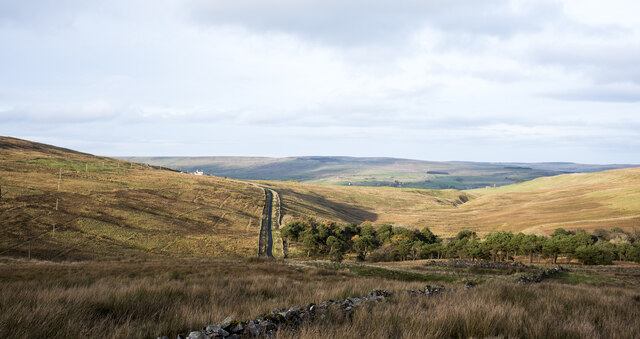
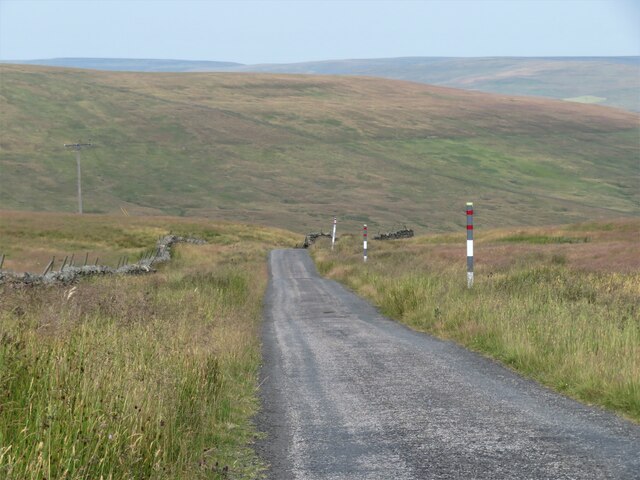
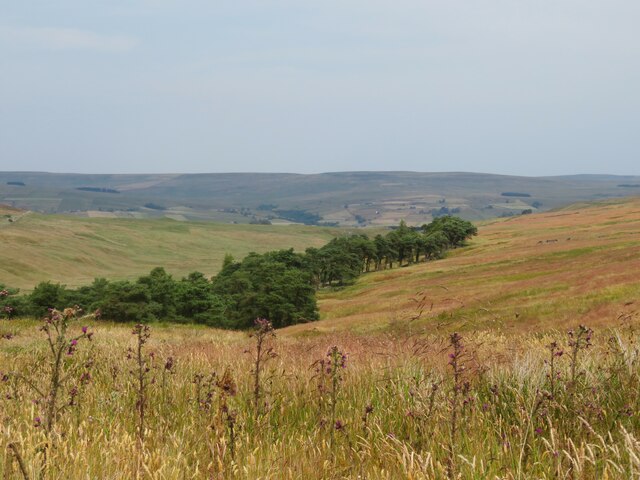
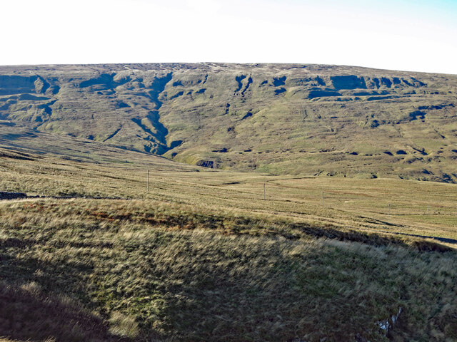
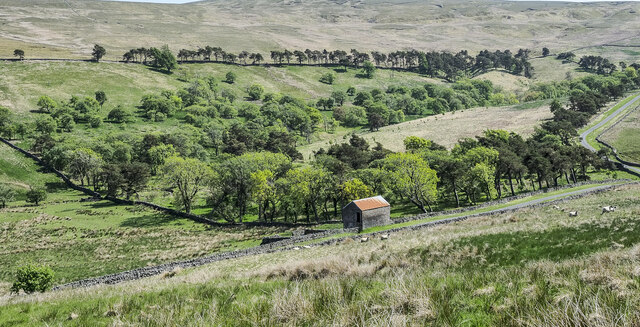
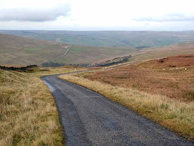
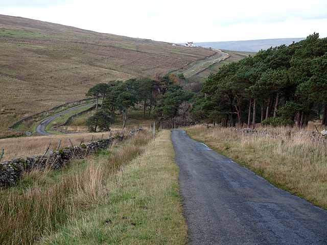
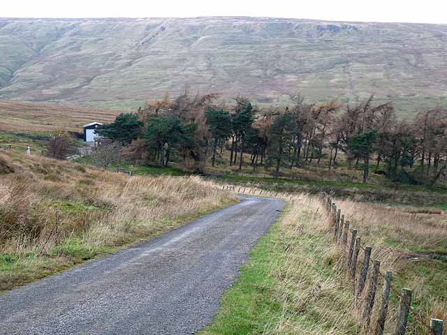
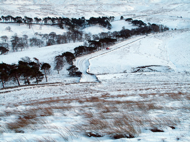
The terrain of Westernhope Moor is characterized by rolling hills, heather-covered moors, and expansive open spaces. The area is home to a wide variety of flora and fauna, including heather, bilberry, cotton grass, and a range of bird species such as curlews and lapwings. The moorland is also renowned for its stunning panoramic views, with sweeping vistas that stretch as far as the eye can see.

Visitors to Westernhope Moor can enjoy a range of outdoor activities, including hiking, birdwatching, and photography. There are several well-marked trails that crisscross the moorland, offering opportunities for both leisurely walks and challenging hikes. The area is also a popular destination for nature photographers, who are drawn to the unique beauty and tranquility of the landscape.

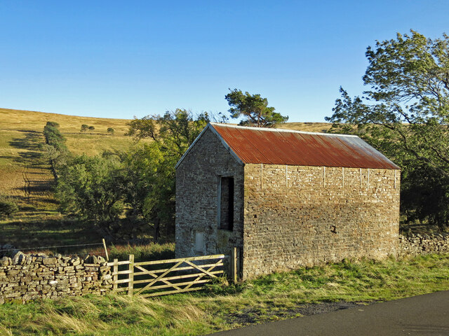
In addition to its natural wonders, Westernhope Moor has a rich cultural heritage. The remains of ancient settlements and stone circles can be found scattered across the moorland, providing a fascinating glimpse into the area's past. The moorland also holds historical significance as the site of lead mining activities in the 19th century.

Overall, Westernhope Moor is a hidden gem in the Durham countryside, offering visitors a chance to immerse themselves in the beauty of nature and explore the rich history of the region.

If you have any feedback on the listing, please let us know in the comments section below.

Westernhope Moor Images

Images are sourced within 2km of 54.700862/-2.1423675 or Grid Reference NY9033. Thanks to Geograph Open Source API. All images are credited.
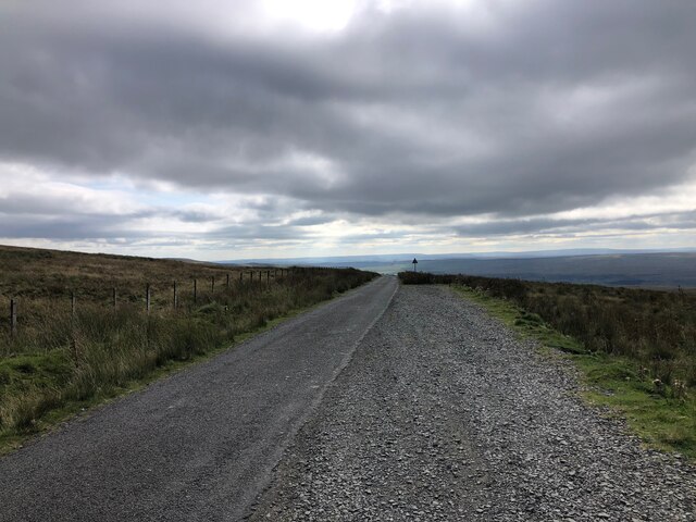
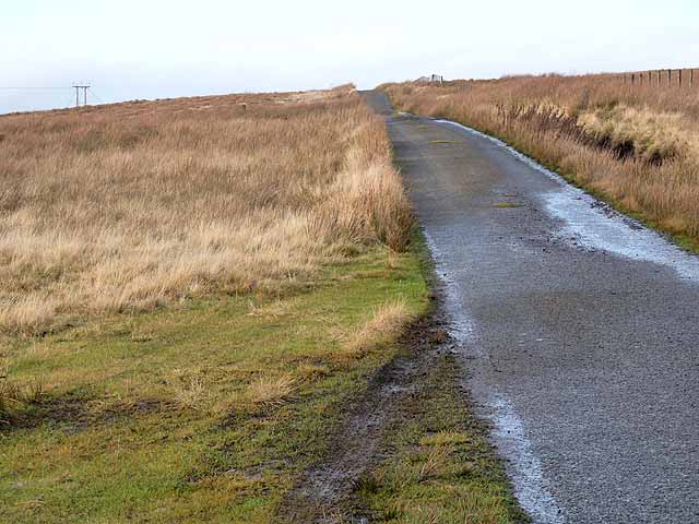
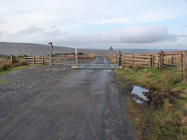
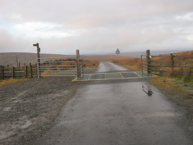
Minor Road at Swinhope Head The road begins a long descent into the Upper Tees Valley from here.
Minor Road at Swinhope Head
The road begins a long descent into the Upper Tees Valley from here.
Pine trees in Swin Hope Swin Hope is a tributary valley of the River Wear; it's seen here looking downhill towards the parent valley.
Pine trees in Swin Hope
Swin Hope is a tributary valley of the River Wear; it's seen here looking downhill towards the parent valley.
Road summit at Swinhope Head [2] Quite a contrast to the last time I took a photograph here [22/03/18] as the temperature on that occasion was only a little above freezing, but on this occasion it was 33°C, even at 2000ft. Taken on a day of record breaking temperatures across Britain. Not much point in coming up here to keep cool.
Road summit at Swinhope Head [2]
Quite a contrast to the last time I took a photograph here [22/03/18] as the temperature on that occasion was only a little above freezing, but on this occasion it was 33°C, even at 2000ft. Taken on a day of record breaking temperatures across Britain. Not much point in coming up here to keep cool.
The start of a long descent The minor road from Newbiggin to Westgate begins a long descent here from the 2000ft contour to below 1000ft in Weardale.
The start of a long descent
The minor road from Newbiggin to Westgate begins a long descent here from the 2000ft contour to below 1000ft in Weardale.
Swinhope Plantation First edition OS maps of the 1850's show an extensive area of trees around the upper reaches of the Swinhope Burn. This view shows the eastern edge of the wooded area with plenty of Scots pine in evidence. If the old OS map is accurate, then the wooded area is in decline as there are areas now without trees, but the question is, why was this area planted in the first place?
Swinhope Plantation
First edition OS maps of the 1850's show an extensive area of trees around the upper reaches of the Swinhope Burn. This view shows the eastern edge of the wooded area with plenty of Scots pine in evidence. If the old OS map is accurate, then the wooded area is in decline as there are areas now without trees, but the question is, why was this area planted in the first place?
Moorland south of Swinhope Head Looking south west towards Mickle Fell (left) and Meldon Hill (right).
Moorland south of Swinhope Head
Looking south west towards Mickle Fell (left) and Meldon Hill (right).
Swinhope Moor below Chapelfell Top
New House
New House
Swinhope Plantation The plantation is in the upper valley of Swin Hope, a tributary to the River Wear. The trees are well scattered and give the impression of an open, mixed woodland. The building with the rusting roof is known as New House.
Swinhope Plantation
The plantation is in the upper valley of Swin Hope, a tributary to the River Wear. The trees are well scattered and give the impression of an open, mixed woodland. The building with the rusting roof is known as New House.
Minor road on Newbiggin Common Just below the summit at Swinhope Head which, at 609 metres above sea level, I believe is the highest public motorable road in England.
Minor road on Newbiggin Common
Just below the summit at Swinhope Head which, at 609 metres above sea level, I believe is the highest public motorable road in England.
Road summit at Swinhope Head Cattle grid at the summit of the road from Newbiggin (Teesdale) to Westgate (Weardale) at Swinhope Head which, at 609 metres above sea level, I believe is the highest public motorable road in England.
Road summit at Swinhope Head
Cattle grid at the summit of the road from Newbiggin (Teesdale) to Westgate (Weardale) at Swinhope Head which, at 609 metres above sea level, I believe is the highest public motorable road in England.
Descent into the valley of the Swinhope Burn Dramatic descent on the road from Newbiggin (Teesdale) to Westgate (Weardale) from the summit at  Swinhope Head which, at 609 metres above sea level, I believe is the highest public motorable road in England. Swinside House <a href="https://www.geograph.org.uk/gridref/NY8935">NY8935</a> can be seen on the flank of the valley to the left.
Descent into the valley of the Swinhope Burn
Dramatic descent on the road from Newbiggin (Teesdale) to Westgate (Weardale) from the summit at Swinhope Head which, at 609 metres above sea level, I believe is the highest public motorable road in England. Swinside House NY8935 can be seen on the flank of the valley to the left.
Electric transmission line at Swinhope Head On the watershed between Teesdale (to the left) and Weardale.
Electric transmission line at Swinhope Head
On the watershed between Teesdale (to the left) and Weardale.
Descent to Swinhope Bridge On the mountain road between Newbiggin (Teesdale) and Westgate (Weardale). Swinside House <a href="https://www.geograph.org.uk/gridref/NY8935">NY8935</a> stands on the hillside beyond.
Descent to Swinhope Bridge
On the mountain road between Newbiggin (Teesdale) and Westgate (Weardale). Swinside House NY8935 stands on the hillside beyond.
Shelter belt above Swinhopehead House On the mountain road between Newbiggin (Teesdale) and Westgate (Weardale). Swinhopehead House lies at the downhill end of this small patch of woodland. Chapelfell Top <a href="https://www.geograph.org.uk/gridref/NY8734">NY8734</a> on the skyline.
Shelter belt above Swinhopehead House
On the mountain road between Newbiggin (Teesdale) and Westgate (Weardale). Swinhopehead House lies at the downhill end of this small patch of woodland. Chapelfell Top NY8734 on the skyline.
Road in Swinhope Swinhope is a tributary valley of Weardale, feeding it from the south. A minor road passes through the valley crossing to Teesdale by the pass at Swinhope Head virtually at 2000 feet. The road in this image is snowed and on the day this image was recorded, much travelled by members of the Weardale Ski Club which has an installation out of view to the right in the photograph. The scattered trees, many of them Scots pines are in what is known as Swinhope Plantation.
Road in Swinhope
Swinhope is a tributary valley of Weardale, feeding it from the south. A minor road passes through the valley crossing to Teesdale by the pass at Swinhope Head virtually at 2000 feet. The road in this image is snowed and on the day this image was recorded, much travelled by members of the Weardale Ski Club which has an installation out of view to the right in the photograph. The scattered trees, many of them Scots pines are in what is known as Swinhope Plantation.
Moorland on Ettersgill Common
Cattle grid on minor road at Swinehope Head
Show me another place!

Westernhope Moor is located at Grid Ref: NY9033 (Lat: 54.700862, Lng: -2.1423675)

Unitary Authority: County Durham

Police Authority: Durham

What 3 Words

///centrally.stub.fools. Near Newbiggin, Co. Durham

Related Wikis

Fairy Holes Cave

Fairy Holes Cave is a Site of Special Scientific Interest in the Wear Valley district of west County Durham, England. It is located on the western flanks...

Westgate, County Durham

Westgate is a village in the civil parish of Stanhope, in County Durham, England. It is situated in Weardale between St John's Chapel and Eastgate. In...

North Pennines

The North Pennines is the northernmost section of the Pennine range of hills which runs north–south through northern England. It lies between Carlisle...

Westgate-in-Weardale railway station

Westgate-in-Weardale railway station served the village of Westgate, County Durham, England, from 1895 to 1965 on the Weardale Railway. == History == The...

Westgate Methodist Chapel

Westgate Methodist Chapel stands on the A689 road in the village of Westgate, some 5 miles (8 km) west of Stanhope, County Durham, England (grid reference...

Brotherlee

Brotherlee is a small village in the civil parish of Stanhope, in County Durham, England situated on the south side of Weardale, between Stanhope and Daddry...

Westernhope Burn Wood

Westernhope Burn Wood is a Site of Special Scientific Interest in the Wear Valley district of south-west County Durham, England. It occupies the steeply...

Daddry Shield

Daddry Shield is a village in the civil parish of Stanhope, in County Durham, England. It is situated on the south side of the River Wear in Weardale,...

Nearby Amenities

Located within 500m of 54.700862,-2.1423675
The data included in this document is from www.openstreetmap.org. The data is made available under ODbL.

Have you been to Westernhope Moor?

Leave your review of Westernhope Moor below (or comments, questions and feedback).