Cartridge Pasture

Downs, Moorland in Lancashire Burnley

England

Cartridge Pasture

Burnley Way heading North West on Heald Moor The long distance footpath keeps mainly to the broad ridge across Heald Moor
Burnley Way heading North West on Heald Moor Credit: Chris Heaton

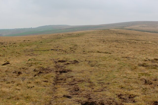
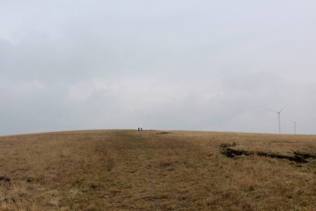
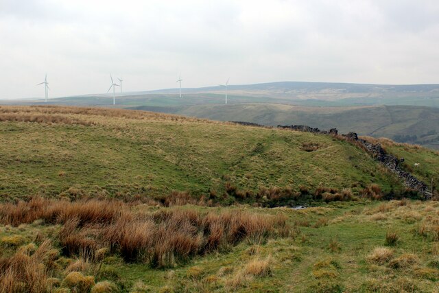
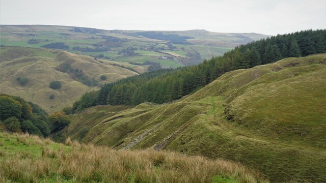
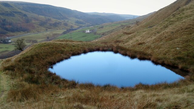
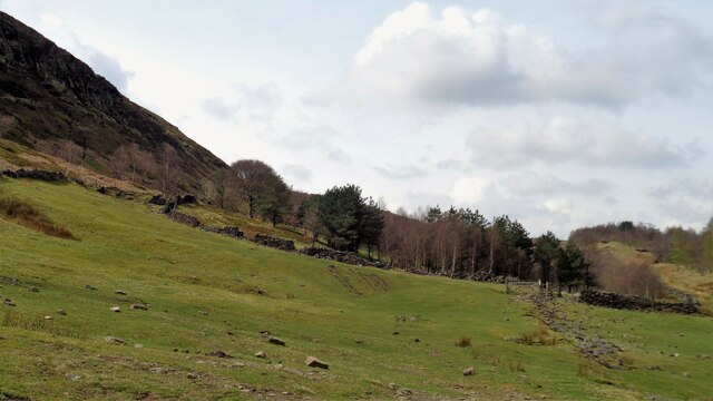
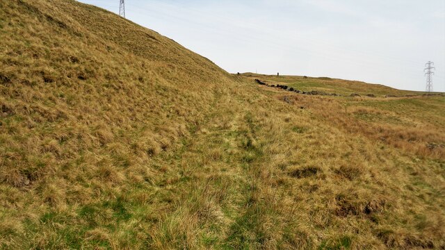
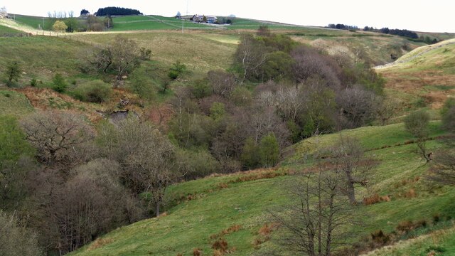
Cartridge Pasture is a picturesque area located in Lancashire, England. Situated amidst the stunning landscape of the Downs and Moorland, it offers a tranquil escape from the bustling city life. The pasture is characterized by its rolling hills, expansive meadows, and scattered clusters of trees, creating a beautiful and serene environment.

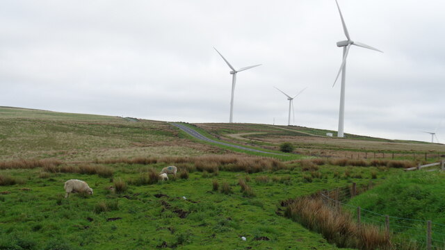
Covering a significant area, Cartridge Pasture is home to a diverse range of flora and fauna. The meadows showcase an array of wildflowers, creating a vibrant tapestry of colors during the spring and summer months. The area is also rich in wildlife, with various species of birds, small mammals, and insects found throughout the pasture. Visitors can often spot rabbits, foxes, and deer roaming freely, adding to the natural charm of the landscape.

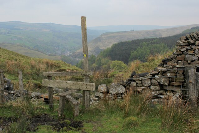
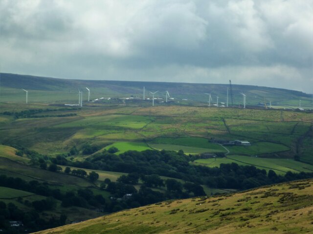
The Downs and Moorland surrounding Cartridge Pasture offer breathtaking panoramic views, providing a perfect backdrop for outdoor activities. Nature enthusiasts can explore the numerous trails and footpaths that crisscross the area, allowing for leisurely walks, hiking, and birdwatching. The undulating terrain also attracts cyclists and horse riders, who can enjoy the exhilarating experience of exploring the countryside.

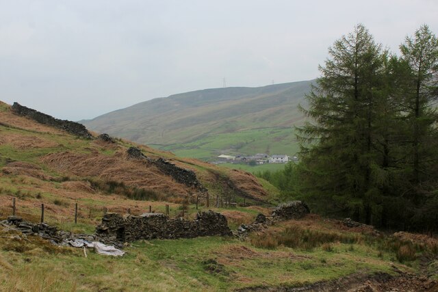
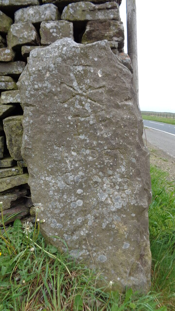
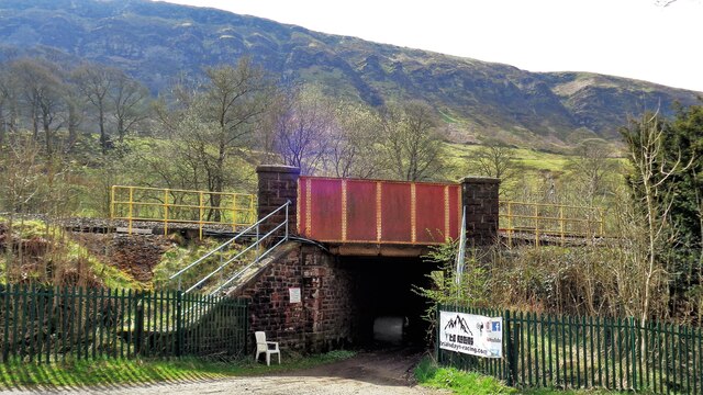
In addition to its natural beauty, Cartridge Pasture holds historical significance as well. The area is dotted with remnants of old farming settlements and ancient stone structures, hinting at its rich heritage.

Overall, Cartridge Pasture in Lancashire is a haven for those seeking tranquility and natural beauty. With its idyllic meadows, diverse wildlife, and stunning landscape, it offers a captivating experience for nature lovers and history enthusiasts alike.

If you have any feedback on the listing, please let us know in the comments section below.

Cartridge Pasture Images

Images are sourced within 2km of 53.744691/-2.1576837 or Grid Reference SD8927. Thanks to Geograph Open Source API. All images are credited.

Burnley Way heading North West on Heald Moor The long distance footpath keeps mainly to the broad ridge across Heald Moor
Burnley Way heading North West on Heald Moor
The long distance footpath keeps mainly to the broad ridge across Heald Moor
Burnley Way heading South East on Heald Moor The long distance footpath keeps mainly to the broad ridge across Heald Moor
Burnley Way heading South East on Heald Moor
The long distance footpath keeps mainly to the broad ridge across Heald Moor
Burnley Way about to descend into the Upper Calder Valley To make matters confusing there are two River Calders.
The one overlooked by the stile flows east through Halifax and Wakefield to eventually arrive at the North Sea via the Humber Estuary.
The other flows in the opposite direction to the Irish Sea via the River Ribble.
Their sources are around a mile apart.
Burnley Way about to descend into the Upper Calder Valley
To make matters confusing there are two River Calders. The one overlooked by the stile flows east through Halifax and Wakefield to eventually arrive at the North Sea via the Humber Estuary. The other flows in the opposite direction to the Irish Sea via the River Ribble. Their sources are around a mile apart.
Chatham Hill Plantation
Burnley Way on the Eastern Edge of Heald Moor A 40 km long footpath <span class="nowrap"><a title="https://en.wikipedia.org/wiki/Burnley_Way" rel="nofollow ugc noopener" href="https://en.wikipedia.org/wiki/Burnley_Way">Link</a><img style="margin-left:2px;" alt="External link" title="External link - shift click to open in new window" src="https://s1.geograph.org.uk/img/external.png" width="10" height="10"/></span>
Burnley Way on the Eastern Edge of Heald Moor
A 40 km long footpath LinkExternal link
Coal Clough Wind Farm Redevelopment View from the Singing Ringing Tree of the renewal of the wind farm with larger turbines
Coal Clough Wind Farm Redevelopment
View from the Singing Ringing Tree of the renewal of the wind farm with larger turbines
Maiden Cross Marker Stone The history of the Maiden Cross appears to be that of one of a series of way markers along the route of the Long Causeway. This crudely inscribed stone appears to just mark the site of a missing cross and has no Historic England listing unlike Stump Cross and Mount Cross.
Maiden Cross Marker Stone
The history of the Maiden Cross appears to be that of one of a series of way markers along the route of the Long Causeway. This crudely inscribed stone appears to just mark the site of a missing cross and has no Historic England listing unlike Stump Cross and Mount Cross.
Coal Clough Wind Farm View across the Long Causeway
Coal Clough Wind Farm
View across the Long Causeway
Beater Clough With a waterfall near the centre of the view
Beater Clough
With a waterfall near the centre of the view
Greens Clough With Hill Top Colliery on the skyline
Greens Clough
With Hill Top Colliery on the skyline
Line of Tramway in Green's and Beater Cloughs The incline up from Portsmouth and the flatter section into Green's Clough are visible
Line of Tramway in Green's and Beater Cloughs
The incline up from Portsmouth and the flatter section into Green's Clough are visible
Moorland Pond By the side of the track from High Gate down to Dean Farm. The Cliviger Gorge is beyond
Moorland Pond
By the side of the track from High Gate down to Dean Farm. The Cliviger Gorge is beyond
Railway climbing to Copy Pit Summit On the Todmorden to Burnley line viewed from the Dean Farm Bridge. The infant Yorkshire River Calder runs by the railway
Railway climbing to Copy Pit Summit
On the Todmorden to Burnley line viewed from the Dean Farm Bridge. The infant Yorkshire River Calder runs by the railway
Railway Bridge at Calder Head Used by the farmer to store baled sileage. Thieveley Scout is beyond the railway
Railway Bridge at Calder Head
Used by the farmer to store baled sileage. Thieveley Scout is beyond the railway
Track to Millennium Wood (Thieveley) An indistinct footpath to the gate for the wood on the flank of Thieveley Scout
Track to Millennium Wood (Thieveley)
An indistinct footpath to the gate for the wood on the flank of Thieveley Scout
Bradget Hey Bridleway This track leads to the remains of Coal Pit House and then the ridge of Black Scout
Bradget Hey Bridleway
This track leads to the remains of Coal Pit House and then the ridge of Black Scout
The wooded Green Clough
Old Wayside Cross beside the Long Causeway Maiden Cross, a Wayside Cross in the form of a rectangular stone inscribed with a cross pattée above the words MAIDEN / CROSS. Set in front of a walled-up gateway on the southwest side of the Long Causeway opposite a car park. Cliviger parish. In 2007 it was photographed set in a gateway at the joining of walls. The gateway was walled up in September 2020, obscuring the face of the stone, but at the request of the parish council it was removed and placed on view in front of the wall in October 2020. The top of the stone had unfortunately been cut down and the inscribed cross had been cut through. In 2022 it was recut by Cliviger Parish Council and put back in situ. See also <span class="nowrap"><a title="https://www.flickr.com/photos/48274996@N08/5266150850/" rel="nofollow ugc noopener" href="https://www.flickr.com/photos/48274996@N08/5266150850/">Link</a><img style="margin-left:2px;" alt="External link" title="External link - shift click to open in new window" src="https://s1.geograph.org.uk/img/external.png" width="10" height="10"/></span> ,  <a title="https://www.geograph.org.uk/photo/7228279" href="https://www.geograph.org.uk/photo/7228279">Link</a> and <a title="https://www.geograph.org.uk/photo/6652096" href="https://www.geograph.org.uk/photo/6652096">Link</a>.

Milestone Society National ID: LABU_CLI02
Old Wayside Cross beside the Long Causeway
Maiden Cross, a Wayside Cross in the form of a rectangular stone inscribed with a cross pattée above the words MAIDEN / CROSS. Set in front of a walled-up gateway on the southwest side of the Long Causeway opposite a car park. Cliviger parish. In 2007 it was photographed set in a gateway at the joining of walls. The gateway was walled up in September 2020, obscuring the face of the stone, but at the request of the parish council it was removed and placed on view in front of the wall in October 2020. The top of the stone had unfortunately been cut down and the inscribed cross had been cut through. In 2022 it was recut by Cliviger Parish Council and put back in situ. See also LinkExternal link , Link and Link. Milestone Society National ID: LABU_CLI02
Show me another place!

Cartridge Pasture is located at Grid Ref: SD8927 (Lat: 53.744691, Lng: -2.1576837)

Administrative County: Lancashire

District: Burnley

Police Authority: Lancashire

What 3 Words

///builds.showdown.grudging. Near Cornholme, West Yorkshire

Related Wikis

Coal Clough Wind Farm

Coal Clough Wind Farm is one of the oldest onshore wind farms in England. The wind farm, which was built for Scottish Power, produced electricity from...

Portsmouth (Lancs) railway station

Portsmouth railway station was on the Copy Pit line and served the village of Portsmouth, which was part of Lancashire, before being incorporated into...

Portsmouth, West Yorkshire

Portsmouth is a village on the A646 road in the Calderdale district, in the county of West Yorkshire, England. Nearby settlements include the towns of...

Cornholme

Cornholme is a village near Todmorden, in the metropolitan borough of Calderdale, in West Yorkshire, England. It lies at the edge of Calderdale, on the...

Pudsey, Calderdale

Pudsey is a neighbourhood in the village of Cornholme, Calderdale, West Yorkshire, England. It is near the town of Todmorden and the A646 Burnley Road...

Hill Top Colliery

The Hill Top Colliery in Sharneyford between Bacup and Todmorden was, until 2014, the last coal mine still in operation in Lancashire. == Foundation... ==

Holme Hall, Cliviger

Holme Hall (or The Holme) is a Grade II* listed manor house in Cliviger near Burnley, in Lancashire, England. The house dates back to at least the 15th...

Cornholme railway station

Cornholme railway station served the village of Cornholme in West Yorkshire, England on the Copy Pit line. The station was opened by the Lancashire and...

Nearby Amenities

Located within 500m of 53.744691,-2.1576837
Generator Method: wind_turbine
Generator Output Electricity: 2 MW
Generator Source: wind
Generator Type: horizontal_axis
Manufacturer: Vestas
Model: Windane 34
Power: generator
Source: Bing
Lat/Long: 53.7471928/-2.157043
Generator Method: wind_turbine
Generator Output Electricity: 2 MW
Generator Source: wind
Generator Type: horizontal_axis
Manufacturer: Vestas
Model: Windane 34
Power: generator
Source: Bing
Lat/Long: 53.7457293/-2.1521231
The data included in this document is from www.openstreetmap.org. The data is made available under ODbL.

Have you been to Cartridge Pasture?

Leave your review of Cartridge Pasture below (or comments, questions and feedback).