White Ground

Downs, Moorland in Durham

England

White Ground

Elmford Cleugh Snow lies deeply in Weardale and over its hills. Elmford Cleugh descends to join the main valley river from the south side of Black Hill which is on the north side of the valley.
Elmford Cleugh Credit: Trevor Littlewood

White Ground, Durham (Downs, Moorland) is a picturesque area located in the county of Durham, England. Situated in the northeastern part of the country, this beautiful landscape offers a diverse range of natural features and is a popular destination for locals and tourists alike.

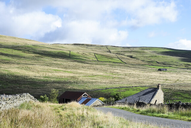
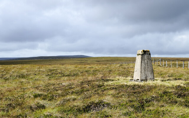
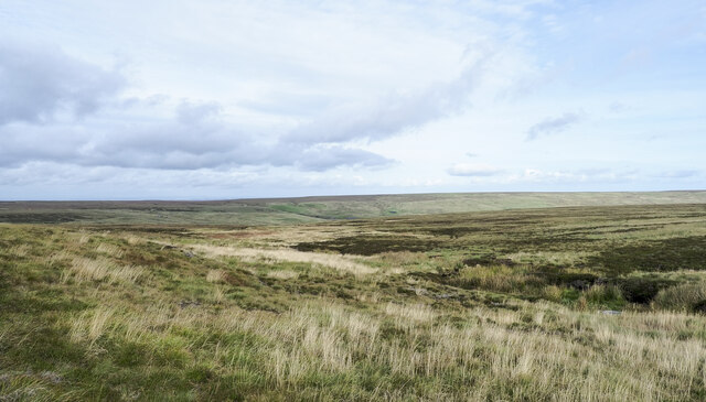
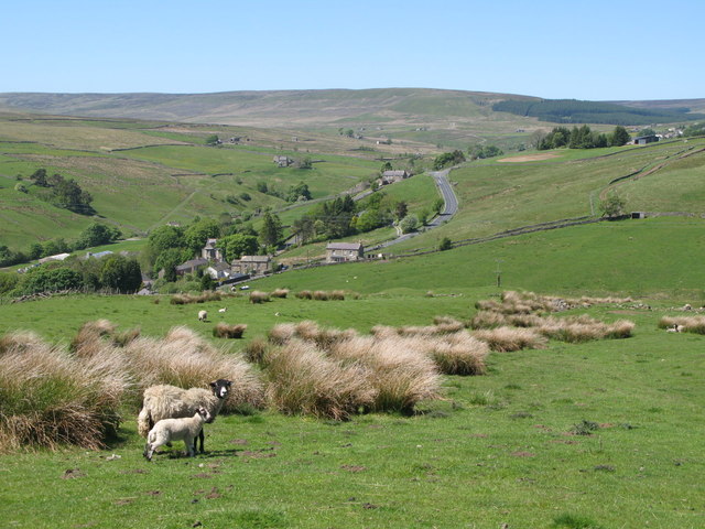
The area is predominantly characterized by its expansive downs and moorland, which provide a stunning backdrop of rolling hills and open spaces. These downs are covered in a lush carpet of green grass and are scattered with patches of heather and wildflowers, creating a vibrant and colorful panorama. The moorland, on the other hand, consists of vast stretches of open land, covered in heather and bracken, interspersed with small streams and rocky outcrops.

White Ground is known for its rich biodiversity and is home to a variety of plant and animal species. The downs and moorland support a wide range of wildlife, including birds such as curlews, lapwings, and grouse, as well as mammals like hares and deer.

Visitors to White Ground can enjoy a range of outdoor activities, including hiking, cycling, and birdwatching. The area offers numerous well-marked trails and paths, allowing visitors to explore its natural beauty at their own pace. The downs and moorland also provide ample opportunities for picnicking and photography, with breathtaking views around every corner.

Overall, White Ground, Durham (Downs, Moorland) is a must-visit location for nature enthusiasts and those seeking tranquility amidst stunning landscapes. Its diverse range of natural features and abundant wildlife make it a truly captivating destination.

If you have any feedback on the listing, please let us know in the comments section below.

White Ground Images

Images are sourced within 2km of 54.770156/-2.1897546 or Grid Reference NY8741. Thanks to Geograph Open Source API. All images are credited.

Elmford Cleugh Snow lies deeply in Weardale and over its hills. Elmford Cleugh descends to join the main valley river from the south side of Black Hill which is on the north side of the valley.
Elmford Cleugh
Snow lies deeply in Weardale and over its hills. Elmford Cleugh descends to join the main valley river from the south side of Black Hill which is on the north side of the valley.
Roofs of buildings at Middlehope Lodge Middlehope Lodge is an isolated dwelling in Middle Hope, a tributary valley of the River Wear.
Windy Hill is the high point at the centre of the image.
Roofs of buildings at Middlehope Lodge
Middlehope Lodge is an isolated dwelling in Middle Hope, a tributary valley of the River Wear. Windy Hill is the high point at the centre of the image.
Building at White Edge Quarry White Edge is the upper part of a slope above Middle Hope, a tributary valley of the River Wear; the location is close to the watershed with Rook Hope. White Edge Quarry is a small affair and well grassed-over now.
The distant high point is Black Hill, across Middle Hope.
Building at White Edge Quarry
White Edge is the upper part of a slope above Middle Hope, a tributary valley of the River Wear; the location is close to the watershed with Rook Hope. White Edge Quarry is a small affair and well grassed-over now. The distant high point is Black Hill, across Middle Hope.
Trig point on Burtree Fell The column stands at 607 m. on moorland which is not the hill's summit; that lies to the west, ahead in the image, and is five metres higher. The most distant location, well beyond the Burtree Fell summit, is Killhope Law.
Trig point on Burtree Fell
The column stands at 607 m. on moorland which is not the hill's summit; that lies to the west, ahead in the image, and is five metres higher. The most distant location, well beyond the Burtree Fell summit, is Killhope Law.
Upper groove of South Grain South Grain is a stream developing on the northern slope of Burtree Fell and flowing down into the head of Rook Hope and so to Rookhope Burn, the valley of which can be discerned in the distance.
Upper groove of South Grain
South Grain is a stream developing on the northern slope of Burtree Fell and flowing down into the head of Rook Hope and so to Rookhope Burn, the valley of which can be discerned in the distance.
Track to Race Head and Sedling Rake
Track at Race Head
Track at Race Head
Track at Sedling Rake
The view from Sedling Rake over West Blackdene Pasture Sedling Rake is the name given to the track and bridleway that crosses the moor at this part of upper Weardale.
The view from Sedling Rake over West Blackdene Pasture
Sedling Rake is the name given to the track and bridleway that crosses the moor at this part of upper Weardale.
Start of bridleway over Carr Brow Moor The bridleway leaves Middlehope Bank (the minor road from Rookhope to Ireshopeburn) on the left soon after it starts its descent towards Weardale. It doesn't seem to be used by farm vehicles and gives good walking, eventually turning into a more substantial walled track as it drops through Carr Brow Pastures, though by that stage it is muddier and harder going on foot.
Start of bridleway over Carr Brow Moor
The bridleway leaves Middlehope Bank (the minor road from Rookhope to Ireshopeburn) on the left soon after it starts its descent towards Weardale. It doesn't seem to be used by farm vehicles and gives good walking, eventually turning into a more substantial walled track as it drops through Carr Brow Pastures, though by that stage it is muddier and harder going on foot.
Fallen and cleared trees in plantation The small, triangular plantation is east of Race Head, high above the Wear Valley. Storms during the winter of 2021 to 2022 broke and uprooted trees in the plantation, a number of them falling along the hill road and bridleway at the north side. Those trees that blocked the road have been cleared.
Fallen and cleared trees in plantation
The small, triangular plantation is east of Race Head, high above the Wear Valley. Storms during the winter of 2021 to 2022 broke and uprooted trees in the plantation, a number of them falling along the hill road and bridleway at the north side. Those trees that blocked the road have been cleared.
The upper valley of Middlehope Burn A view looking west, further up the valley, is shown in <a href="https://www.geograph.org.uk/photo/6297932">NY8941 : The upper valley of Middlehope Burn (2)</a> (taken in April 2019). Shows the location of the <a href="https://www.geograph.org.uk/photo/7235938">NY8941 : Sheepfold by Middlehope Burn</a>.
The upper valley of Middlehope Burn
A view looking west, further up the valley, is shown in NY8941 : The upper valley of Middlehope Burn (2) (taken in April 2019). Shows the location of the NY8941 : Sheepfold by Middlehope Burn.
The site of Hodgson's House See <a href="https://www.geograph.org.uk/photo/5796002">NY8241 : Whitestone House</a>. In her book, Christine Ruskin gives records of occupation of Hodgson's House from the 1861 and 1871 censuses, but does not say when the house finally became vacant. Apparently, some of the stones were used to build a bungalow in Haswicks (on the south side of the River Wear opposite Westgate).
The site of Hodgson's House
See NY8241 : Whitestone House. In her book, Christine Ruskin gives records of occupation of Hodgson's House from the 1861 and 1871 censuses, but does not say when the house finally became vacant. Apparently, some of the stones were used to build a bungalow in Haswicks (on the south side of the River Wear opposite Westgate).
The site of Hodgson's House (2) See <a href="https://www.geograph.org.uk/photo/7235926">NY8941 : The site of Hodgson's House</a>.
The site of Hodgson's House (2)
The valley of Middlehope Burn above Middlehope Lodge Shows the location of the <a href="https://www.geograph.org.uk/photo/7235938">NY8941 : Sheepfold by Middlehope Burn</a>.
The valley of Middlehope Burn above Middlehope Lodge
Shows the location of the NY8941 : Sheepfold by Middlehope Burn.
The valley of Middlehope Burn above Middlehope Lodge (2) Shows the location of the <a href="https://www.geograph.org.uk/photo/7235938">NY8941 : Sheepfold by Middlehope Burn</a>.
The valley of Middlehope Burn above Middlehope Lodge (2)
Shows the location of the NY8941 : Sheepfold by Middlehope Burn.
Sheepfold by Middlehope Burn
Foxgloves and sheepfold by Middlehope Burn
Show me another place!

White Ground is located at Grid Ref: NY8741 (Lat: 54.770156, Lng: -2.1897546)

Unitary Authority: County Durham

Police Authority: Durham

What 3 Words

///bystander.between.smaller. Near Stanhope, Co. Durham

Nearby Locations

Black Hill White Ground

Related Wikis

Cowshill

Cowshill is a village in the civil parish of Stanhope, in County Durham, England. It is situated at the top of Weardale, between Lanehead and Wearhead...

Copthill

Copthill is a village in the civil parish of Stanhope, in County Durham, England. It is situated on the north side of Weardale, between Cowshill and Cornriggs...

West Blackdene

West Blackdene is a village in the civil parish of Stanhope, in County Durham, England. It is situated to the north of the River Wear, opposite Ireshopeburn...

Wearhead

Wearhead is a village in the civil parish of Stanhope, in County Durham, England. It is situated at the top of Weardale between Cowshill and Ireshopeburn...

Wearhead railway station

Wearhead railway station served the village of Wearhead, County Durham, England, from 1895 to 1961 on the Weardale Railway. == History == The station opened...

Lanehead

Lanehead is a hamlet in the civil parish of Stanhope, in County Durham, England. It lies at the head of Weardale, approximately 2 km west of Cowshill....

Cornriggs Meadows

Cornriggs Meadows is a Site of Special Scientific Interest in Upper Weardale in north-west County Durham, England. It consists of a group of fields, located...

Ireshopeburn

Ireshopeburn ( EYE-sup-burn ) is a village in the civil parish of Stanhope, in County Durham, England. It is situated on the south side of Weardale, between...

Nearby Amenities

Located within 500m of 54.770156,-2.1897546
Middlehope Moor
Natural: heath
Lat/Long: 54.7732936/-2.1890352
The data included in this document is from www.openstreetmap.org. The data is made available under ODbL.

Have you been to White Ground?

Leave your review of White Ground below (or comments, questions and feedback).