Kirkby Fell

Downs, Moorland in Yorkshire Craven

England

Kirkby Fell

The Settle to Kirkby Malham Road in the Evening
The Settle to Kirkby Malham Road in the Evening Credit: Andy Beecroft

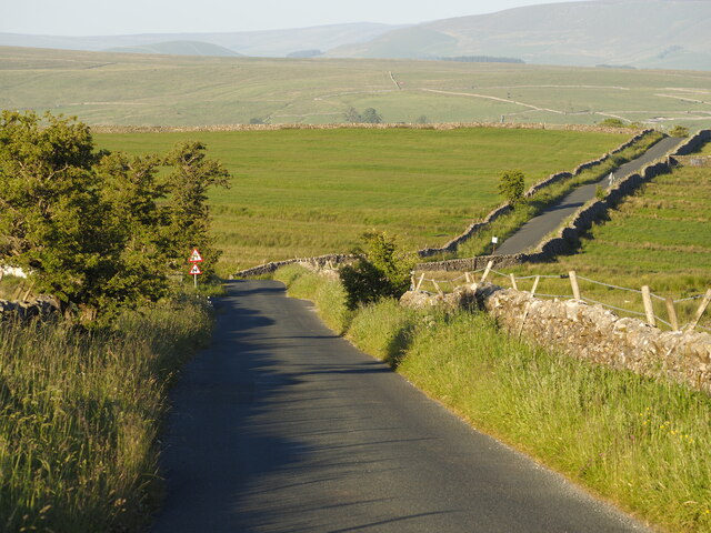
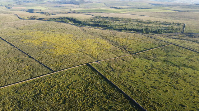
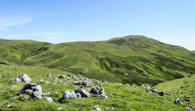
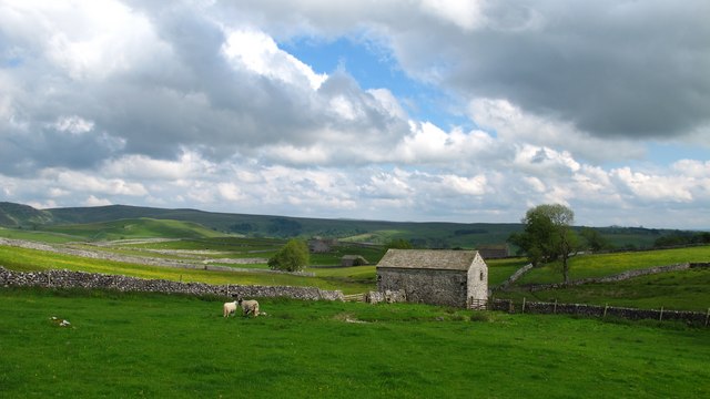
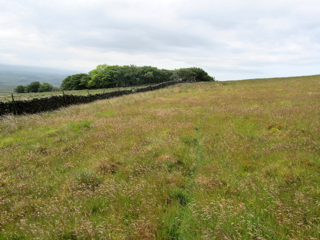
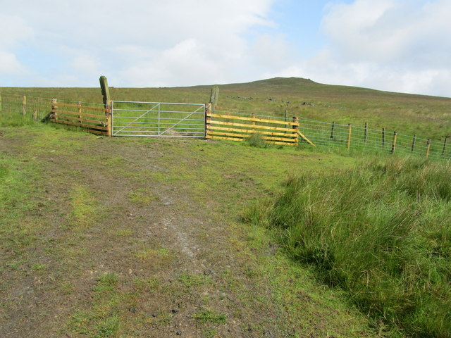
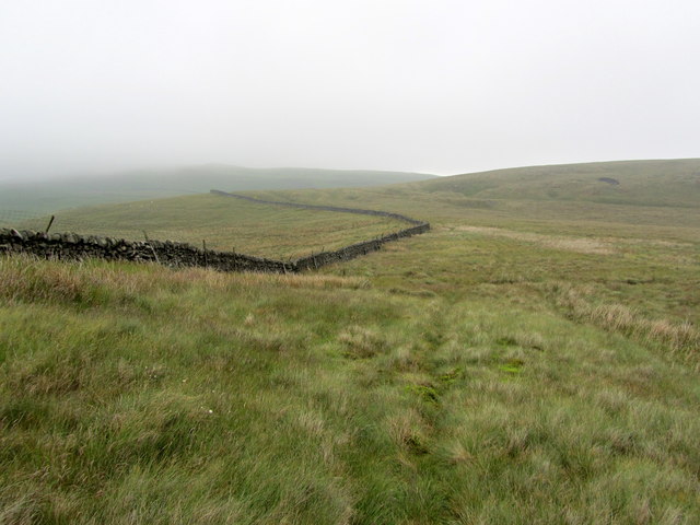
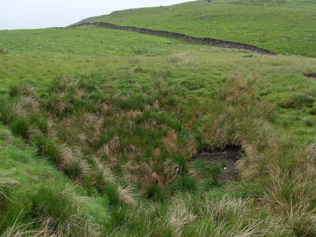
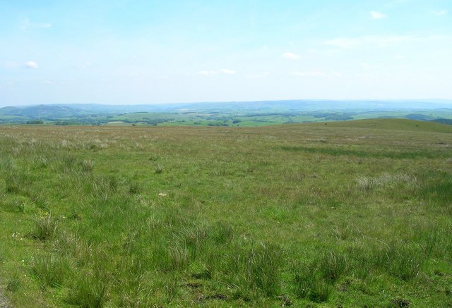
Kirkby Fell is a stunning expanse of moorland located in the Yorkshire Dales, England. Situated in the county of Yorkshire, this vast and untamed landscape spans across an area of approximately 5 square miles. The fell is characterized by its rolling hills, rocky outcrops, and expansive heather-covered moors.

The natural beauty of Kirkby Fell is truly breathtaking, with its rugged terrain and panoramic views that stretch for miles. The area is rich in biodiversity, hosting a variety of plant and animal species that thrive in this unique ecosystem. Visitors to Kirkby Fell may spot indigenous wildlife such as red grouse, curlews, and merlins, along with an array of wildflowers and mosses.

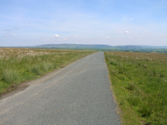
This moorland is a paradise for outdoor enthusiasts and nature lovers. It offers numerous walking trails and paths that wind through the hills, providing opportunities for exploration and adventure. The rough terrain of Kirkby Fell also attracts mountain bikers and horse riders looking for an adrenaline-fueled escapade in the great outdoors.

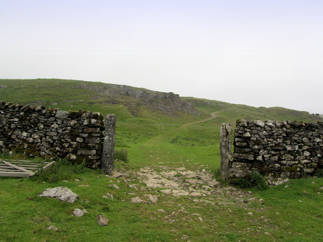
The history of Kirkby Fell is also worth noting. The area has been inhabited for centuries, with evidence of ancient settlements and stone circles scattered across the landscape. These historical remnants add an intriguing element to the natural beauty of the fell.

Overall, Kirkby Fell is a captivating destination for those seeking solace in nature or looking to immerse themselves in the unique charm of Yorkshire's moorland. Its picturesque scenery, diverse wildlife, and rich history make it a must-visit location for anyone exploring this part of England.

If you have any feedback on the listing, please let us know in the comments section below.

Kirkby Fell Images

Images are sourced within 2km of 54.066171/-2.1970692 or Grid Reference SD8763. Thanks to Geograph Open Source API. All images are credited.

The Settle to Kirkby Malham Road in the Evening
Aerial View of Moorland near Kirkby Malham
North face of Rye Loaf Hill Rye Loaf Hill seen across the valley of Stockdale Beck from the bridleway which is used as the route of two long distance trails - Pennine Bridleway and Dales High Way.
North face of Rye Loaf Hill
Rye Loaf Hill seen across the valley of Stockdale Beck from the bridleway which is used as the route of two long distance trails - Pennine Bridleway and Dales High Way.
Grassy slope north from Grizedales Grizedales appears to be the accepted name for the hill from which the image was made; it rises to 553 metres.
Pen-y-ghent and Fountains Fell are along the central horizon.
Grassy slope north from Grizedales
Grizedales appears to be the accepted name for the hill from which the image was made; it rises to 553 metres. Pen-y-ghent and Fountains Fell are along the central horizon.
Track and Wall on Langscar Part of the track that runs towards Langcliffe - adopted by the Pennine Bridleway just beyond the gap in the wall
Track and Wall on Langscar
Part of the track that runs towards Langcliffe - adopted by the Pennine Bridleway just beyond the gap in the wall
Pennine Bridleway between Langscar Gate and Langcliffe Large amounts of money must have been spent on upgrading this track - presumably because it now carries the Pennine Bridleway.
Pennine Bridleway between Langscar Gate and Langcliffe
Large amounts of money must have been spent on upgrading this track - presumably because it now carries the Pennine Bridleway.
Local Residents on Gorbeck Road Cattle on the Pennine Bridleway between Langscar Gate and Langcliffe, near Settle
Local Residents on Gorbeck Road
Cattle on the Pennine Bridleway between Langscar Gate and Langcliffe, near Settle
Butterlands Barn from the footpath to Pikedaw Hill It is a short uphill walk from Malham village to Pikedaw Hill. The gathering clouds preceded thunder and rain as we reached the summit.
Butterlands Barn from the footpath to Pikedaw Hill
It is a short uphill walk from Malham village to Pikedaw Hill. The gathering clouds preceded thunder and rain as we reached the summit.
Outcrops on Settle Scar Lines of limestone outcrops on Settle Scar, high above Stockdale Farm
Outcrops on Settle Scar
Lines of limestone outcrops on Settle Scar, high above Stockdale Farm
Stockdale Farm Remote farm below Rye Loaf Hill
Stockdale Farm
Remote farm below Rye Loaf Hill
On Scosthrop High Moor Approaching a small patch of windswept woodland on Scosthrop High Moor
On Scosthrop High Moor
Approaching a small patch of windswept woodland on Scosthrop High Moor
Gate on Scosthrop High Moor A track climbs up from Peart Lane to this gate - and then disappears onto the moor.
Gate on Scosthrop High Moor
A track climbs up from Peart Lane to this gate - and then disappears onto the moor.
Juicy Moor between Kirkby Fell and Rye Loaf Hill A soggy traverse towards the track that runs from Stockdale Farm and Malham
Juicy Moor between Kirkby Fell and Rye Loaf Hill
A soggy traverse towards the track that runs from Stockdale Farm and Malham
Bridleway between Stockdale Farm and Malham Excellent green track pursued by generations of walkers who have walked from Settle to Malham
Bridleway between Stockdale Farm and Malham
Excellent green track pursued by generations of walkers who have walked from Settle to Malham
Shake Hole near Great Scar There are quite a few of these features dotted around the vicinity of Great Scar
Shake Hole near Great Scar
There are quite a few of these features dotted around the vicinity of Great Scar
Grazing off Black Gill Lane
Black Gill Lane towards Airton
Highland cattle
Highland cattle
Show me another place!

Kirkby Fell is located at Grid Ref: SD8763 (Lat: 54.066171, Lng: -2.1970692)

Division: West Riding

Administrative County: North Yorkshire

District: Craven

Police Authority: North Yorkshire

What 3 Words

///officials.scoring.afternoon. Near Settle, North Yorkshire

Nearby Locations

Kirkby Fell Kirkby Fell

Related Wikis

Malham Cove

Malham Cove is a large curved limestone formation 0.6 miles (1 km) north of the village of Malham, North Yorkshire, England. It was formed by a waterfall...

Malham

Malham is a village and civil parish in the Craven district of North Yorkshire, England. Before 20th century boundary changes, the village was part of...

Friar Garth Farmhouse

Friar Garth Farmhouse is a Grade II listed building in Malham, North Yorkshire, England. It was listed as an historic site by English Heritage on 13 September...

Scaleber Force

Scaleber Force (also known as Scaleber Foss and Scaleber Waterfall), is a 40-foot (12 m) high waterfall on Stockdale Beck, later the Long Preston Beck...

Nearby Amenities

Located within 500m of 54.066171,-2.1970692
Kirby Fell
Ele: 545.0
Man Made: survey_point
Natural: peak
Source: NPE
Lat/Long: 54.0673673/-2.1936122
Kirkby Fell
Natural: fell
Source: OS_OpenData_StreetView
Lat/Long: 54.0664155/-2.1975005
mine
Archaeological Site: mineral_extraction
Historic: mine
Source: OS_OpenData_StreetView
Lat/Long: 54.069764/-2.2015485
Historic: mine_shaft
Source: EsriWorldImageryClarity
Lat/Long: 54.0696288/-2.2015126
Historic: mine_shaft
Source: EsriWorldImageryClarity
Lat/Long: 54.0694209/-2.2014048
Historic: mine_shaft
Source: EsriWorldImageryClarity
Lat/Long: 54.0695564/-2.2017593
Historic: mine_shaft
Source: EsriWorldImageryClarity
Lat/Long: 54.069487/-2.201534
Historic: mine_shaft
Source: EsriWorldImageryClarity
Lat/Long: 54.0696729/-2.2016896
Historic: mine_shaft
Source: EsriWorldImageryClarity
Lat/Long: 54.0696759/-2.2013409
Historic: mine_shaft
Source: EsriWorldImageryClarity
Lat/Long: 54.0671528/-2.2029703
Natural: sinkhole
Source: EsriWorldImageryClarity
Lat/Long: 54.066914/-2.1926392
Historic: mine_shaft
Source: EsriWorldImageryClarity
Lat/Long: 54.0693122/-2.1999021
Natural: sinkhole
Source: EsriWorldImageryClarity
Lat/Long: 54.0699291/-2.1980833
Natural: sinkhole
Source: EsriWorldImageryClarity
Lat/Long: 54.0698379/-2.1990382
Natural: sinkhole
Source: EsriWorldImageryClarity
Lat/Long: 54.0700897/-2.1985876
Natural: sinkhole
Source: EsriWorldImageryClarity
Lat/Long: 54.0693942/-2.1999877
Historic: mine_shaft
Source: EsriWorldImageryClarity
Lat/Long: 54.0691799/-2.1941086
Natural: sinkhole
Source: EsriWorldImageryClarity
Lat/Long: 54.0694917/-2.1997409
Natural: sinkhole
Source: EsriWorldImageryClarity
Lat/Long: 54.0694412/-2.1997034
Natural: sinkhole
Source: EsriWorldImageryClarity
Lat/Long: 54.0698002/-2.1992849
The data included in this document is from www.openstreetmap.org. The data is made available under ODbL.

Have you been to Kirkby Fell?

Leave your review of Kirkby Fell below (or comments, questions and feedback).