Dufton Moss

Downs, Moorland in Durham

England

Dufton Moss

Blocking boulders at old quarry The large rocks block access to a levelled area below the disused High Force Quarry on the north side of the B6277.
Blocking boulders at old quarry Credit: Trevor Littlewood

Dufton Moss is a picturesque area located in Durham County, England, known for its stunning downs and moorland landscapes. Situated near the village of Dufton, this natural gem offers visitors a unique and tranquil experience.

The downs of Dufton Moss are characterized by their rolling hills and vast open spaces. The area is covered in lush green grass and dotted with wildflowers, creating a vibrant and colorful scene. Walking along the downs, visitors can enjoy breathtaking views of the surrounding countryside and distant hills.

Beyond the downs, Dufton Moss showcases its stunning moorland. This rugged terrain is formed by heather-covered hills and rocky outcrops. The moorland is home to a variety of wildlife, including birds, mammals, and insects, making it a popular spot for nature enthusiasts and birdwatchers.

Dufton Moss offers many opportunities for outdoor activities and exploration. Visitors can embark on scenic walks or hikes, immersing themselves in the natural beauty of the area. The trails wind through the downs and moorland, allowing visitors to discover hidden gems and beautiful viewpoints.

The area surrounding Dufton Moss is rich in history and culture. Nearby, the village of Dufton offers traditional English charm, with its stone cottages, village green, and historic church. Visitors can also explore the nearby Pennine Way, a long-distance footpath that passes through the area, offering even more opportunities for adventure.

In summary, Dufton Moss in Durham is a stunning natural area that showcases the beauty of downs and moorland landscapes. With its picturesque scenery, abundant wildlife, and rich history, this area is a must-visit destination for nature lovers and outdoor enthusiasts.

If you have any feedback on the listing, please let us know in the comments section below.

Dufton Moss Images

Images are sourced within 2km of 54.657445/-2.2011017 or Grid Reference NY8729. Thanks to Geograph Open Source API. All images are credited.

Blocking boulders at old quarry The large rocks block access to a levelled area below the disused High Force Quarry on the north side of the B6277.
Blocking boulders at old quarry
The large rocks block access to a levelled area below the disused High Force Quarry on the north side of the B6277.
Access road to house at Gillett A sign at the gate adjacent to the camera position tells that this is the way to Gillett Farm House.
Access road to house at Gillett
A sign at the gate adjacent to the camera position tells that this is the way to Gillett Farm House.
School at Forest-in-Teesdale The school building is close to the Hanging Shaw car park just off the B6277 in Teesdale. The school has a very small roll and so in January 2021 it 'federated' with other similarly small ones - Rookhope, St John’s Chapel and Wearhead Primary Schools as the Upper Durham Dales Federation, all under one headteacher.  There was no activity at the school on this day; autumn term would begin on 6 September in 2021.
School at Forest-in-Teesdale
The school building is close to the Hanging Shaw car park just off the B6277 in Teesdale. The school has a very small roll and so in January 2021 it 'federated' with other similarly small ones - Rookhope, St John’s Chapel and Wearhead Primary Schools as the Upper Durham Dales Federation, all under one headteacher. There was no activity at the school on this day; autumn term would begin on 6 September in 2021.
Sunshine on field, Forest-in-Teesdale Sunshine gradually penetrating the gloom over fields close to Gillett Farm House.
Widdybank Fell is beyond the building, Cronkley Scar is at the left side of the image.
Sunshine on field, Forest-in-Teesdale
Sunshine gradually penetrating the gloom over fields close to Gillett Farm House. Widdybank Fell is beyond the building, Cronkley Scar is at the left side of the image.
High Force on the River Tees
Hag Sike flowing into the Tees below High Force
Ferns and lichens, High Force Gorge
High Force in autumn Taken from the viewpoint on the south bank, just off the Pennine Way.
High Force in autumn
Taken from the viewpoint on the south bank, just off the Pennine Way.
High Force A fine and warm day in November.
High Force
A fine and warm day in November.
High Force Giving an impression of the natural amphitheatre into which the water tumbles.
High Force
Giving an impression of the natural amphitheatre into which the water tumbles.
High Force Waterfall Impressive waterfall on the River Tees.
High Force Waterfall
Impressive waterfall on the River Tees.
River Tees and Quarry Buildings
Bleabeck Force Waterfall
Prehistoric settlement at Bracken Rigg Prehistoric roundhouse situated within a field system <span class="nowrap"><a title="https://historicengland.org.uk/listing/the-list/list-entry/1017119" rel="nofollow ugc noopener" href="https://historicengland.org.uk/listing/the-list/list-entry/1017119">Link</a><img style="margin-left:2px;" alt="External link" title="External link - shift click to open in new window" src="https://s1.geograph.org.uk/img/external.png" width="10" height="10"/></span>
Prehistoric settlement at Bracken Rigg
Prehistoric roundhouse situated within a field system LinkExternal link
Farm Bridge over the River Tees
West Moor Riggs
West Moor Riggs
Show me another place!

Dufton Moss is located at Grid Ref: NY8729 (Lat: 54.657445, Lng: -2.2011017)

Unitary Authority: County Durham

Police Authority: Durham

What 3 Words

///wider.grazes.studs. Near Holwick, Co. Durham

Related Wikis

Forest-in-Teesdale

Forest-in-Teesdale is a village in County Durham, England. It is situated in upper Teesdale, on the north side of the Tees between Newbiggin and Langdon...

High Force

High Force is a waterfall on the River Tees, near Middleton-in-Teesdale, Teesdale, England. The waterfall is within the North Pennines Area of Outstanding...

Ettersgill

Ettersgill is a village in County Durham, England. It is situated at the top of Teesdale, on the north side of the Tees between Newbiggin and Forest-in...

Langdon Beck

Langdon Beck is a village in County Durham, England. It is situated in upper Teesdale, between Forest-in-Teesdale and Harwood, halfway between Penrith...

Forest and Frith

Forest and Frith is a civil parish in the County Durham unitary authority, in the ceremonial county of Durham, England. In the 2011 census it had a population...

Bowlees and Friar House Meadows

Bowlees and Friar House Meadows is a Site of Special Scientific Interest in the Teesdale district of west County Durham, England. It consists of three...
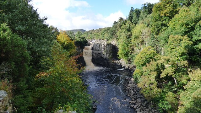
Low Force

Low Force is an 18-foot (5.5m) high set of falls on the River Tees, England, UK. Further upstream is the High Force waterfall. Low Force is also the site...

Bowlees

Bowlees is a small village in County Durham, England. It is situated near Newbiggin, on the other side of Teesdale from Holwick. The visitor centre in...

Nearby Amenities

Located within 500m of 54.657445,-2.2011017
Bus Stop
The Banks
Naptan AtcoCode: 13007850D
Naptan Bearing: SE
Naptan CommonName: The Banks
Naptan Indicator: south east bound
Naptan Landmark: Landmark not known
Naptan NaptanCode: durgajmw
Naptan Notes: The Banks- B6277- about 400m SE from Forest Methodist Chapel.
Naptan Street: Street not known
Naptan Verified: no
Source: naptan_import
Lat/Long: 54.657284/-2.1961786
Bus Stop
The Banks
Naptan AtcoCode: 13007850H
Naptan Bearing: NW
Naptan CommonName: The Banks
Naptan Indicator: north west bound
Naptan Landmark: Landmark not known
Naptan NaptanCode: durgajpa
Naptan Notes: The Banks- B6277- about 400m SE from Forest Methodist Chapel.
Naptan Street: Street not known
Naptan Verified: no
Source: naptan_import
Lat/Long: 54.6572121/-2.1962247
High Knott
Natural: peak
Source: OS_OpenData_StreetView
Lat/Long: 54.6554627/-2.2043022
Yearl Hill
Natural: peak
Source: OS_OpenData_StreetView
Lat/Long: 54.6536286/-2.1976814
Dufton Moss
Natural: wetland
Source: OS_OpenData_StreetView
Lat/Long: 54.656717/-2.1984228
Thompson's House
Place: farm
Source: OS 1:25k
Lat/Long: 54.6587399/-2.1956548
West Moor Riggs
Addr City: Barnard Castle
Addr Postcode: DL12 0EA
Place: farm
Source: OS 1:25k
Source Postcode: CodePoint Open
Lat/Long: 54.6595721/-2.1991524
Barrier: cattle_grid
Lat/Long: 54.6604222/-2.2019443
Information: guidepost
Tourism: information
Lat/Long: 54.6577916/-2.1977155
Abandoned Landuse: quarry
Fixme: Needs to be mapped as area
Lat/Long: 54.6574056/-2.1982095
Medieval farmstead at High Knott
HE Ref: 1017125
Designation: scheduled_monument
Historic: archaeological_site
Wikidata: Q17663232
Lat/Long: 54.6548059/-2.2006989
Barrier: stile
Lat/Long: 54.6572749/-2.1961325
Power: pole
Lat/Long: 54.6591922/-2.2078483
Power: pole
Lat/Long: 54.6589718/-2.2063395
Power: pole
Lat/Long: 54.6587694/-2.2049166
Power: pole
Lat/Long: 54.6589649/-2.2035487
Power: pole
Lat/Long: 54.6591549/-2.2022344
Power: pole
Lat/Long: 54.659352/-2.2008692
Power: pole
Lat/Long: 54.6587158/-2.200208
Power: pole
Lat/Long: 54.6580852/-2.1995509
Power: pole
Lat/Long: 54.6575281/-2.1989809
Power: pole
Lat/Long: 54.6570394/-2.1984807
Power: pole
Lat/Long: 54.6567508/-2.1972053
Power: pole
Lat/Long: 54.6564304/-2.1957663
Power: pole
Lat/Long: 54.6561007/-2.1943018
Barrier: entrance
Lat/Long: 54.6550029/-2.1955624
Barrier: entrance
Lat/Long: 54.6554816/-2.1946706
The data included in this document is from www.openstreetmap.org. The data is made available under ODbL.

Have you been to Dufton Moss?

Leave your review of Dufton Moss below (or comments, questions and feedback).