Hardley

Settlement in Hampshire New Forest

England

Hardley

Springfield Avenue
Springfield Avenue Credit: David Martin

Hardley is a small village located in the county of Hampshire, England. Situated in the New Forest district, it lies approximately 2 miles east of the town of Hythe and 8 miles southwest of the city of Southampton. With a population of around 1,500 people, it offers a tranquil and close-knit community atmosphere.

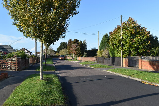
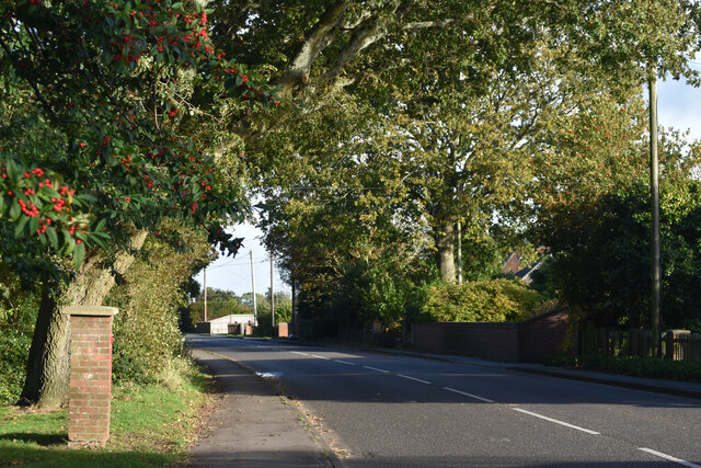
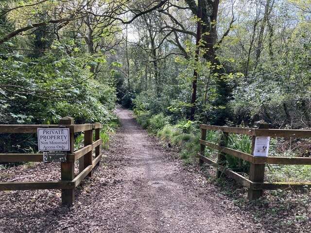
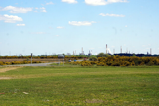
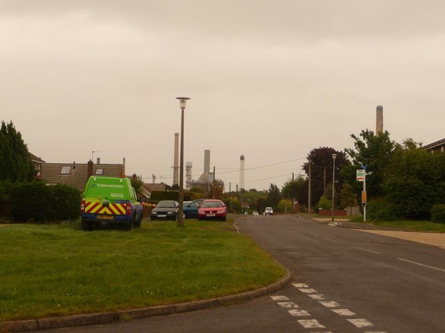
The village is surrounded by picturesque countryside, characterized by rolling hills, lush green fields, and dense woodlands. It benefits from its proximity to the New Forest National Park, providing residents and visitors with ample opportunities for outdoor activities such as walking, cycling, and horse riding.

Hardley has a rich history dating back centuries, with evidence of human habitation in the area since the Iron Age. The village is home to several historic landmarks, including the Grade II listed All Saints Church, which dates back to the 12th century and features a striking Norman doorway.

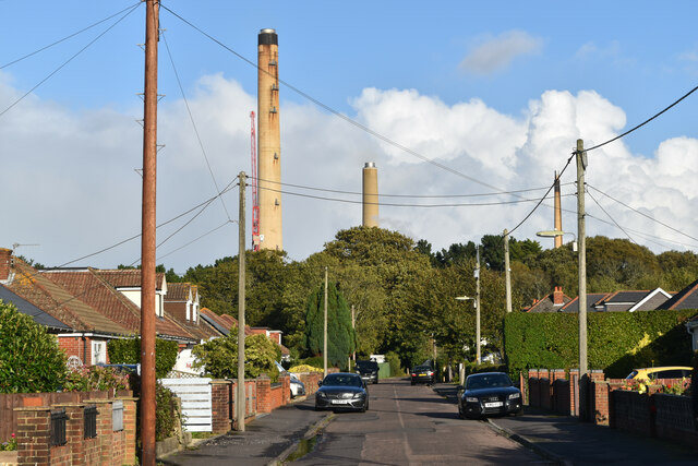
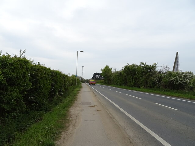
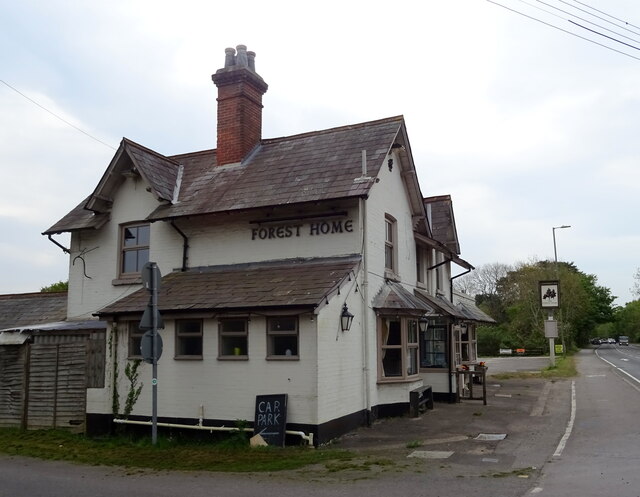
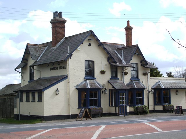
Amenities in Hardley include a primary school, a village hall, and a local pub, providing essential services and social spaces for the community. The village is well-connected to neighboring towns and cities through a network of roads, with easy access to major transport links such as the M27 motorway.

Hardley offers a peaceful and idyllic setting for those seeking a rural lifestyle, with its charming countryside, strong community spirit, and convenient location. Whether it's exploring the natural beauty of the New Forest or enjoying the tranquility of village life, Hardley has something to offer for residents and visitors alike.

If you have any feedback on the listing, please let us know in the comments section below.

Hardley Images

Images are sourced within 2km of 50.840521/-1.388694 or Grid Reference SU4304. Thanks to Geograph Open Source API. All images are credited.

Springfield Avenue
Springfield Avenue
Springfield Grove Fawley oil refinery chimneys beyond the belt of trees.
Springfield Grove
Fawley oil refinery chimneys beyond the belt of trees.
Rollestone Road The brick pillar box on the left has a distinct lean towards the road!
Rollestone Road
The brick pillar box on the left has a distinct lean towards the road!
Pinch point on Hart Hill A pinch point on Hart Hill, intended to discourage motor vehicles from proceeding south along the unsealed part of the road south of the Travellers' Rest public house. This is Hythe & Dibden restricted byway 126/3a/1. Formerly, Hart Hill was the key route south out of Hythe, but no more. The 'private property' sign is a bit of a cheek, seeing as the road is vested in the highway authority and has no registered title at the Land Registry.
Pinch point on Hart Hill
A pinch point on Hart Hill, intended to discourage motor vehicles from proceeding south along the unsealed part of the road south of the Travellers' Rest public house. This is Hythe & Dibden restricted byway 126/3a/1. Formerly, Hart Hill was the key route south out of Hythe, but no more. The 'private property' sign is a bit of a cheek, seeing as the road is vested in the highway authority and has no registered title at the Land Registry.
Hart Hill Part of Hart Hill, Hythe & Dibden restricted byway 126/3a/1.
Hart Hill
Part of Hart Hill, Hythe & Dibden restricted byway 126/3a/1.
A view towards Fawley Refinery from Hill Top The refinery stands between the New Forest and Southampton Water.
A view towards Fawley Refinery from Hill Top
The refinery stands between the New Forest and Southampton Water.
The Fountain Court Hotel
Frost lane near the Fountain Court Hotel
Furzedown Cottages
Furzedown Cottages
Houses on Butts Ash Lane
Houses on Beech Crescent
Fawley Road
Fawley Road
The Forest Home
The Forest Home
Sign for the Forest Home
Dual use path beside Long Lane (A326)
Lime Kiln Lane
Lime Kiln Lane
Long Lane (A326)
Long Lane (A326)
Courtyard Mews
Courtyard Mews
Show me another place!

Hardley is located at Grid Ref: SU4304 (Lat: 50.840521, Lng: -1.388694)

Administrative County: Hampshire

District: New Forest

Police Authority: Hampshire

What 3 Words

///lamp.called.token. Near Hythe, Hampshire

Nearby Locations

Hardley

Related Wikis

Hardley, Hampshire

Hardley is a suburb of the village of Holbury in the civil parish of Fawley in Hampshire, England. == History == The name Hardley means "hard clearing...

New Forest Academy

New Forest Academy is a coeducational secondary school and with academy status, located in Holbury in the English county of Hampshire.Previously known...

Fawley A.F.C.

Fawley Association Football Club is a football club based in Fawley, near Southampton, in Hampshire, England. They are currently members of Wessex League...

Holbury

Holbury is a village in Hampshire, England. It is part of the parish of Fawley. == Overview == Historically a small and scarcely populated village, Holbury...

Nearby Amenities

Located within 500m of 50.840521,-1.388694
Created By: osmeditor2
Lat/Long: 50.8376342/-1.3936049
Pub
The Forest Home
Addr City: Southampton
Addr Postcode: SO45 3FH
Addr Street: Long Lane
Addr Village: Hythe
Fhrs Id: 619315
Website: https://theforesthomehampshire.co.uk/
Lat/Long: 50.841969/-1.3913745
Hardley
Is In: Hampshire, England, UK
Place: village
Source: npe
Wikidata: Q5656215
Lat/Long: 50.8411142/-1.3907109
Bus Stop
Hardley Roundabout
Bench: no
Bus: yes
Lit: no
Naptan AtcoCode: 1900HA080433
Naptan Bearing: N
Naptan CommonName: Hardley Roundabout
Naptan NaptanCode: hamawgda
Naptan Street: Fawley Road
Naptan Verified: no
Public Transport: platform
Shelter: no
Source: naptan_import
Tactile Paving: no
Lat/Long: 50.8439526/-1.3927221
Bus Stop
Hardley Roundabout
Bench: no
Bus: yes
Lit: yes
Naptan AtcoCode: 1900HA080434
Naptan Bearing: S
Naptan CommonName: Hardley Roundabout
Naptan NaptanCode: hamawgdp
Naptan Street: Fawley Road
Naptan Verified: no
Public Transport: platform
Shelter: no
Source: naptan_import
Tactile Paving: no
Lat/Long: 50.8439676/-1.392529
Bus Stop
Lime Kiln Lane
Bus: yes
Naptan AtcoCode: 1900HA080435
Naptan Bearing: NW
Naptan CommonName: Lime Kiln Lane
Naptan Crossing: Long Lane
Naptan NaptanCode: hamawjaj
Naptan Street: Main Road
Naptan Verified: no
Public Transport: platform
Source: naptan_import
Lat/Long: 50.8397494/-1.3889578
Bus Stop
Lime Kiln Lane
Bench: no
Bus: yes
Lit: yes
Naptan AtcoCode: 1900HA080436
Naptan Bearing: SE
Naptan CommonName: Lime Kiln Lane
Naptan Crossing: Main Road
Naptan NaptanCode: hamawjap
Naptan Street: Long Lane
Naptan Verified: no
Public Transport: platform
Shelter: no
Source: naptan_import
Tactile Paving: no
Lat/Long: 50.8396942/-1.3887171
Bus Stop
New Forest Academy
Bench: yes
Bus: yes
Lit: yes
Naptan AtcoCode: 1900HA080437
Naptan Bearing: NW
Naptan CommonName: Hardley School
Naptan Crossing: Larch Avenue
Naptan NaptanCode: hamawjmp
Naptan Street: Cadlands Park Estate
Naptan Verified: no
Public Transport: platform
Shelter: yes
Source: naptan_import
Tactile Paving: no
Lat/Long: 50.8375427/-1.3865724
Bus Stop
Hardley School
Bus: yes
Fixme: Does this stop still exist?
Naptan AtcoCode: 1900HAA40469
Naptan Bearing: NW
Naptan BusStopType: CUS
Naptan CommonName: Hardley School
Naptan Crossing: Larch Avenue
Naptan Landmark: Hardley School
Naptan NaptanCode: hamjapma
Naptan Street: Long Lane
Naptan Verified: no
Public Transport: platform
Source: naptan_import
Lat/Long: 50.8376249/-1.3868127
Fire Station
Lat/Long: 50.8398559/-1.3907859
Post Box
Ref: SO45 52
Lat/Long: 50.8380248/-1.3871934
Post Box
Ref: SO45 711D
Lat/Long: 50.837774/-1.3929976
Travis Perkins
Brand: Travis Perkins
Brand Wikidata: Q2450664
Operator: Travis Perkins
Shop: doityourself
Lat/Long: 50.841171/-1.3919887
Communication Mobile Phone: yes
Man Made: mast
Operator: O2
Operator Wikidata: Q7072245
Tower Construction: lattice
Tower Type: communication
Lat/Long: 50.8414722/-1.3937686
Give Way
Direction: backward
Lat/Long: 50.8400379/-1.3891703
Barrier: lift_gate
Lat/Long: 50.8398716/-1.3834743
Crossing
Bicycle: yes
Crossing: unmarked
Crossing Island: yes
Crossing Markings: no
Note: crossing to be put on raised table & priority to cyclists
Tactile Paving: yes
Lat/Long: 50.8400647/-1.3891099
Turning Circle
Lat/Long: 50.8376044/-1.3857243
Barrier: lift_gate
Lat/Long: 50.839875/-1.3833296
Crossing
Crossing: unmarked
Crossing Island: no
Crossing Markings: no
Tactile Paving: yes
Lat/Long: 50.8422379/-1.3922789
Crossing
Crossing: unmarked
Crossing Island: no
Crossing Markings: no
Tactile Paving: yes
Lat/Long: 50.8426685/-1.3920934
Crossing
Bicycle: yes
Crossing: unmarked
Crossing Island: no
Crossing Markings: no
Note: crossing to be put on raised table & priority to cyclists
Tactile Paving: yes
Lat/Long: 50.839291/-1.3883304
Crossing
Crossing: unmarked
Crossing Island: no
Crossing Markings: no
Tactile Paving: yes
Lat/Long: 50.842803/-1.3921917
Give Way
Direction: backward
Lat/Long: 50.8400117/-1.3890539
Crossing
Bicycle: yes
Button Operated: yes
Crossing: traffic_signals
Crossing Island: no
Crossing Markings: dots
Crossing Ref: toucan
Kerb: flush
Tactile Paving: yes
Lat/Long: 50.839698/-1.3887995
Give Way
Direction: forward
Lat/Long: 50.8401311/-1.3892395
Crossing
Crossing: unmarked
Crossing Island: no
Crossing Markings: no
Tactile Paving: yes
Traffic Calming: table
Lat/Long: 50.8372426/-1.3865483
Crossing
Crossing: traffic_signals
Crossing Island: no
Tactile Paving: yes
Traffic Signals Sound: yes
Lat/Long: 50.8372589/-1.3864791
Post Box
Collection Times: Mo-Fr 17:30, Sa 10:30
Operator: Royal Mail
Operator Wikidata: Q638098
Post Box Type: pillar
Ref: SO45 347
Royal Cypher: EIIR
Royal Cypher Wikidata: Q33102113
Lat/Long: 50.8421212/-1.394054
Crossing
Lat/Long: 50.837839/-1.393738
Direction: SSE
Generator Method: photovoltaic
Generator Output Electricity: yes
Generator Solar Modules: 4
Generator Source: solar
Generator Type: solar_photovoltaic_panel
Location: roof
Power: generator
Lat/Long: 50.8381843/-1.3909832
Direction: 215
Generator Method: photovoltaic
Generator Output Electricity: yes
Generator Solar Modules: 14
Generator Source: solar
Generator Type: solar_photovoltaic_panel
Location: roof
Power: generator
Lat/Long: 50.8412659/-1.3912276
Direction: 215
Generator Method: photovoltaic
Generator Output Electricity: yes
Generator Solar Modules: 14
Generator Source: solar
Generator Type: solar_photovoltaic_panel
Location: roof
Power: generator
Lat/Long: 50.8413341/-1.3913718
Direction: WSW
Generator Method: photovoltaic
Generator Output Electricity: yes
Generator Solar Modules: 16
Generator Source: solar
Generator Type: solar_photovoltaic_panel
Location: roof
Power: generator
Lat/Long: 50.8372279/-1.3931944
Direction: SSE
Generator Method: photovoltaic
Generator Output Electricity: yes
Generator Solar Modules: 6
Generator Source: solar
Generator Type: solar_photovoltaic_panel
Location: roof
Power: generator
Lat/Long: 50.8384424/-1.3916561
Direction: 175
Generator Method: photovoltaic
Generator Output Electricity: yes
Generator Solar Modules: 12
Generator Source: solar
Generator Type: solar_photovoltaic_panel
Location: roof
Power: generator
Lat/Long: 50.8393187/-1.3932346
Direction: 145
Generator Method: photovoltaic
Generator Output Electricity: yes
Generator Solar Modules: 12
Generator Source: solar
Generator Type: solar_photovoltaic_panel
Location: roof
Power: generator
Lat/Long: 50.8400072/-1.3925855
Direction: 145
Generator Method: photovoltaic
Generator Output Electricity: yes
Generator Solar Modules: 96
Generator Source: solar
Generator Type: solar_photovoltaic_panel
Location: roof
Power: generator
Lat/Long: 50.8399837/-1.3906932
Direction: SSE
Generator Method: photovoltaic
Generator Output Electricity: yes
Generator Solar Modules: 16
Generator Source: solar
Generator Type: solar_photovoltaic_panel
Location: roof
Power: generator
Lat/Long: 50.8390238/-1.3885538
Direction: 190
Generator Method: photovoltaic
Generator Output Electricity: yes
Generator Solar Modules: 12
Generator Source: solar
Generator Type: solar_photovoltaic_panel
Location: roof
Power: generator
Lat/Long: 50.8390339/-1.3850743
Direction: SSE
Generator Method: photovoltaic
Generator Output Electricity: yes
Generator Solar Modules: 12
Generator Source: solar
Generator Type: solar_photovoltaic_panel
Location: roof
Power: generator
Lat/Long: 50.8373886/-1.3858505
Direction: SSE
Generator Method: photovoltaic
Generator Output Electricity: yes
Generator Solar Modules: 14
Generator Source: solar
Generator Type: solar_photovoltaic_panel
Location: roof
Power: generator
Lat/Long: 50.8374178/-1.3857549
Direction: 105
Generator Method: photovoltaic
Generator Output Electricity: yes
Generator Solar Modules: 16
Generator Source: solar
Generator Type: solar_photovoltaic_panel
Location: roof
Power: generator
Lat/Long: 50.8376579/-1.385418
Direction: SSE
Generator Method: photovoltaic
Generator Output Electricity: yes
Generator Solar Modules: 12
Generator Source: solar
Generator Type: solar_photovoltaic_panel
Location: roof
Power: generator
Lat/Long: 50.8378006/-1.3881381
Direction: WSW
Generator Method: photovoltaic
Generator Output Electricity: yes
Generator Solar Modules: 13
Generator Source: solar
Generator Type: solar_photovoltaic_panel
Location: roof
Power: generator
Lat/Long: 50.8382626/-1.3909326
Direction: WSW
Generator Method: photovoltaic
Generator Output Electricity: yes
Generator Solar Modules: 14
Generator Source: solar
Generator Type: solar_photovoltaic_panel
Location: roof
Power: generator
Lat/Long: 50.838204/-1.3910476
Direction: SSE
Generator Method: photovoltaic
Generator Output Electricity: yes
Generator Solar Modules: 12
Generator Source: solar
Generator Type: solar_photovoltaic_panel
Location: roof
Power: generator
Lat/Long: 50.837595/-1.392908
Direction: WSW
Generator Method: photovoltaic
Generator Output Electricity: yes
Generator Solar Modules: 16
Generator Source: solar
Generator Type: solar_photovoltaic_panel
Location: roof
Power: generator
Lat/Long: 50.8372355/-1.3919739
Crossing
Crossing: unmarked
Crossing Island: no
Crossing Markings: no
Tactile Paving: yes
Lat/Long: 50.8423196/-1.3921156
Give Way
Direction: forward
Lat/Long: 50.8423317/-1.393664
Give Way
Direction: forward
Lat/Long: 50.8416511/-1.395242
Give Way
Direction: backward
Lat/Long: 50.8382458/-1.387313
Give Way
Direction: forward
Lat/Long: 50.8381637/-1.3872533
Barrier: cycle_barrier
Lat/Long: 50.8373728/-1.3863373
Waste Basket
Lat/Long: 50.8371484/-1.3865618
Give Way
Direction: backward
Lat/Long: 50.8393118/-1.388269
Give Way
Direction: forward
Lat/Long: 50.838211/-1.387243
Information: guidepost
Tourism: information
Lat/Long: 50.8426498/-1.3920534
Information: guidepost
Tourism: information
Lat/Long: 50.8427757/-1.3922382
Information: guidepost
Tourism: information
Lat/Long: 50.839749/-1.3887182
Information: guidepost
Material: wood
Tourism: information
Lat/Long: 50.8427535/-1.3905436
Information: guidepost
Material: wood
Tourism: information
Lat/Long: 50.8449188/-1.3899762
Information: guidepost
Material: wood
Tourism: information
Lat/Long: 50.8425763/-1.3907194
Information: guidepost
Material: wood
Tourism: information
Lat/Long: 50.8401824/-1.3939543
Information: guidepost
Tourism: information
Lat/Long: 50.8436106/-1.3898466
Information: guidepost
Material: wood
Tourism: information
Lat/Long: 50.8392632/-1.3881643
Information: guidepost
Material: wood
Tourism: information
Lat/Long: 50.8404174/-1.3896665
Jon's Bike Repair
Addr Housenumber: Unit 19
Addr Street: Glenmore Business Park
Building: yes
Contact Facebook: https://www.facebook.com/jonsbikerepair
Opening Hours: Tu-Fr 09:15-17:30, Sa 09:15-15:00; Su-Mo off
Phone: +442380 890712
Service Bicycle Repair: yes
Service Bicycle Sales: yes
Shop: bicycle
Website: http://www.jonsbikerepair.co.uk
Lat/Long: 50.8406266/-1.392498
The data included in this document is from www.openstreetmap.org. The data is made available under ODbL.

Have you been to Hardley?

Leave your review of Hardley below (or comments, questions and feedback).