Horton Pasture

Downs, Moorland in Yorkshire Ribble Valley

England

Horton Pasture

Ordnance Survey Cut Mark This mark can be found on a field gatepost beside knot Lane at White Hill.
The benchmark has a recorded height of 153.6954 metres above sea level.
For more detail see : <span class="nowrap"><a title="https://www.bench-marks.org.uk/bm121976" rel="nofollow ugc noopener" href="https://www.bench-marks.org.uk/bm121976">Link</a><img style="margin-left:2px;" alt="External link" title="External link - shift click to open in new window" src="https://s1.geograph.org.uk/img/external.png" width="10" height="10"/></span>
Ordnance Survey Cut Mark Credit: Peter Wood

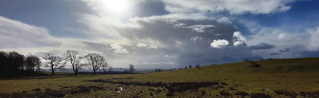
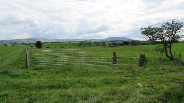
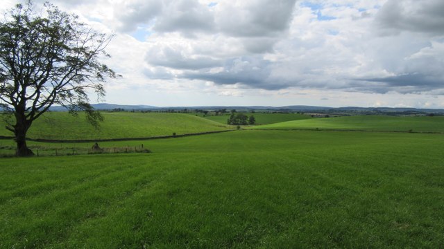
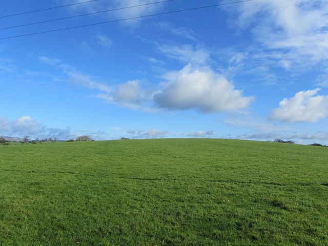
Horton Pasture is a picturesque and expansive area located in the county of Yorkshire, England. Nestled amidst the stunning landscape of the Yorkshire Downs and Moorland, this vast pasture offers breathtaking views and a tranquil atmosphere.

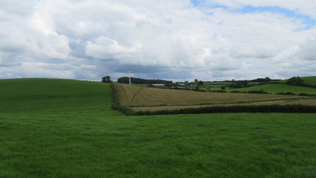
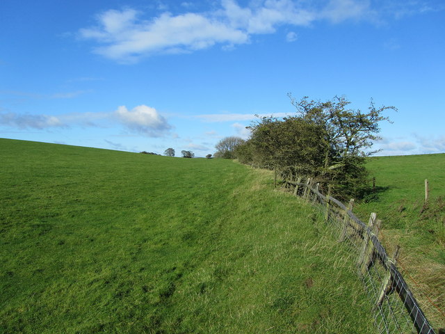
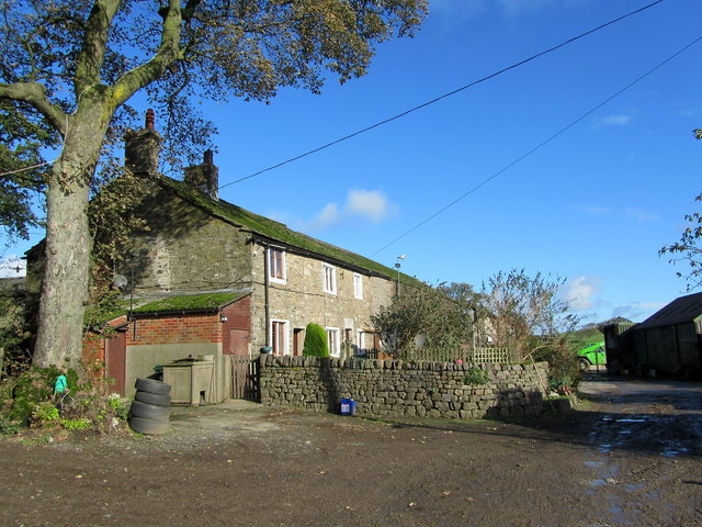
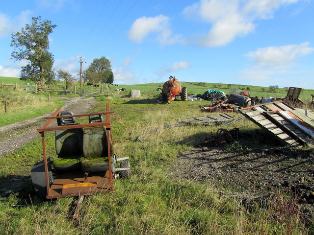
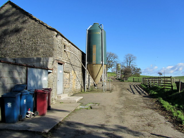
Covering a considerable area of land, Horton Pasture is predominantly characterized by rolling hills, green meadows, and scattered patches of woodland. The landscape is dotted with picturesque sheep farms and traditional stone walls, adding to the area's charm and rural appeal.

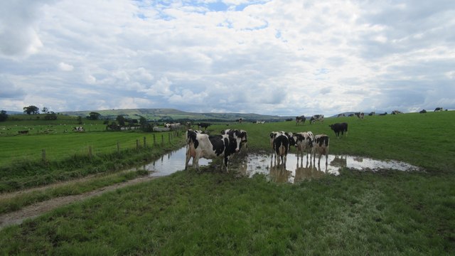
The pasture benefits from the region's temperate climate, with mild summers and cool winters. This makes it an ideal location for grazing livestock, particularly sheep, which can be seen dotting the landscape as they roam freely.

Horton Pasture also holds ecological significance, as it is home to a variety of plant and animal species. The rich biodiversity in the area includes an array of wildflowers, birds, and small mammals, making it an attractive destination for nature enthusiasts and birdwatchers.

Visitors to Horton Pasture can indulge in an array of outdoor activities, including walking, hiking, and picnicking. The area boasts several well-marked trails that allow visitors to explore and immerse themselves in the stunning natural surroundings.

The tranquility and beauty of Horton Pasture make it a popular spot for locals and tourists alike, seeking solace and a connection with nature. Its idyllic setting and diverse wildlife offer a memorable experience, showcasing the natural splendor of Yorkshire's Downs and Moorland.

If you have any feedback on the listing, please let us know in the comments section below.

Horton Pasture Images

Images are sourced within 2km of 53.954464/-2.217464 or Grid Reference SD8550. Thanks to Geograph Open Source API. All images are credited.

Ordnance Survey Cut Mark This mark can be found on a field gatepost beside knot Lane at White Hill.
The benchmark has a recorded height of 153.6954 metres above sea level.
For more detail see : <span class="nowrap"><a title="https://www.bench-marks.org.uk/bm121976" rel="nofollow ugc noopener" href="https://www.bench-marks.org.uk/bm121976">Link</a><img style="margin-left:2px;" alt="External link" title="External link - shift click to open in new window" src="https://s1.geograph.org.uk/img/external.png" width="10" height="10"/></span>
Ordnance Survey Cut Mark
This mark can be found on a field gatepost beside knot Lane at White Hill. The benchmark has a recorded height of 153.6954 metres above sea level. For more detail see : LinkExternal link
Bentha Hill Fields
Bentha Hill Fields
Public footpath East of Horton Looking East at public footpath crossing fields between Horton and Pasture House Farm.
Public footpath East of Horton
Looking East at public footpath crossing fields between Horton and Pasture House Farm.
Cows on Bridleway / footpath junction Looking South back towards footpath / bridleway junction near Horton
Cows on Bridleway / footpath junction
Looking South back towards footpath / bridleway junction near Horton
Gates tied across bridleway Looking South West down bridleway with tied gates across
Gates tied across bridleway
Looking South West down bridleway with tied gates across
Small copse on bridleway Looking West along bridleway at small copse West of Horton Pasture farm
Small copse on bridleway
Looking West along bridleway at small copse West of Horton Pasture farm
Horton bridge The benchmark is cut into the eastern parapet of the bridge.
Horton bridge
The benchmark is cut into the eastern parapet of the bridge.
Horton bridge There is a benchmark cut into the eastern parapet of the bridge. It is located to the right of the small concrete support seen in the centre of the picture.
Horton bridge
There is a benchmark cut into the eastern parapet of the bridge. It is located to the right of the small concrete support seen in the centre of the picture.
Gutteridge Farm
Gutteridge Farm
Railway Bridge at Nappa The A682 Gisburn/Long Preston Road at the scattered community of Nappa as it is crossed by a railway bridge.  It carries a mineral line that connects Clitheroe to Hellifield.
Railway Bridge at Nappa
The A682 Gisburn/Long Preston Road at the scattered community of Nappa as it is crossed by a railway bridge. It carries a mineral line that connects Clitheroe to Hellifield.
Knot Lane Narrow country lane from the hamlet of Horton leading towards the A682 at Newsholme
Knot Lane
Narrow country lane from the hamlet of Horton leading towards the A682 at Newsholme
White Hill Small drumlin off Knot Lane
White Hill
Small drumlin off Knot Lane
Boundary Fence between White and Hoober Hill Fence follows the saddle between the two drumlins of White Hill and Hoober Hill
Boundary Fence between White and Hoober Hill
Fence follows the saddle between the two drumlins of White Hill and Hoober Hill
Hoober Farmhouse at the foot of Hoober Hill
Hoober
Farmhouse at the foot of Hoober Hill
Unofficial Dump by Hoober Plantation Rather unsightly refuse encountered on a country walk
Unofficial Dump by Hoober Plantation
Rather unsightly refuse encountered on a country walk
Approaching Varley Field The farmyard appears abandoned, although the farmhouse is still occupied
Approaching Varley Field
The farmyard appears abandoned, although the farmhouse is still occupied
Track between Varley Field and Lower Paradise Muddy track connecting two farming operations - one now appearing to be abandoned
Track between Varley Field and Lower Paradise
Muddy track connecting two farming operations - one now appearing to be abandoned
Yorsdale Outbuildings attached to Lower Paradise Farm
Yorsdale
Outbuildings attached to Lower Paradise Farm
Show me another place!

Horton Pasture is located at Grid Ref: SD8550 (Lat: 53.954464, Lng: -2.217464)

Division: West Riding

Administrative County: Lancashire

District: Ribble Valley

Police Authority: Lancashire

What 3 Words

///cello.dragonfly.overheat. Near Barnoldswick, Lancashire

Related Wikis

Horton, Lancashire

Horton, historically known as Horton-in-Craven, is a village and a civil parish in the Ribble Valley district of the English county of Lancashire (historically...

A59 road

The A59 is a major road in England which is around 109 miles (175 km) long and runs from Wallasey, Merseyside to York, North Yorkshire. The alignment formed...

Newsholme, Lancashire

Newsholme is a small village and civil parish in the Ribble Valley, Lancashire, England, but lies within the historic West Riding of Yorkshire. According...

Newsholme railway station

Newsholme railway station was a railway station that served the small village of Newsholme in Lancashire. It was built by the Lancashire and Yorkshire...

Nappa, North Yorkshire

Nappa is a hamlet in the civil parish of Hellifield, in North Yorkshire, England. It is on the A682 road and 6 miles (9.7 km) north-west of Barnoldswick...

Bracewell and Brogden

Bracewell and Brogden is a civil parish in the West Craven area of the Borough of Pendle in Lancashire, England. According to the 2001 census it had a...

St Michael's Church, Bracewell

St Michael's Church is in Bracewell Lane, Bracewell, Lancashire, England. It is an active Anglican parish church in the deanery of Skipton, the archdeaconry...

Gledstone Hall

Gledstone Hall is a 20th-century country house in West Marton, near Skipton, North Yorkshire, England. Designed by Edwin Lutyens it stands in a 12-hectare...

Nearby Amenities

Located within 500m of 53.954464,-2.217464
Dumber Hill
Natural: peak
Source: OS 1:25k
Lat/Long: 53.9558509/-2.2237656
Place: farm
Lat/Long: 53.9542996/-2.2125018
The data included in this document is from www.openstreetmap.org. The data is made available under ODbL.

Have you been to Horton Pasture?

Leave your review of Horton Pasture below (or comments, questions and feedback).