Out Fell

Downs, Moorland in Yorkshire Craven

England

Out Fell

Marshy area south of Fountains Fell The marsh is less wet than it normally would be, following a relatively dry spell of weather. Cotton grass seed heads are plentiful; the even more numerous yellow flowers are possibly spearworts. The broad ridge extends to the north where lie the higher areas of Fountains Fell.
Marshy area south of Fountains Fell Credit: Trevor Littlewood

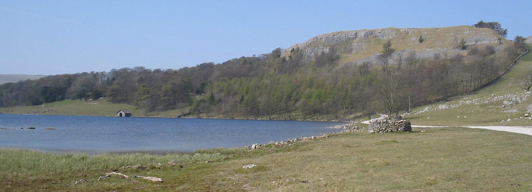
Out Fell is a picturesque area located in Yorkshire, England, known for its stunning natural landscapes comprising both downs and moorland. Situated in the heart of the Yorkshire Dales, Out Fell offers visitors a unique and diverse experience.

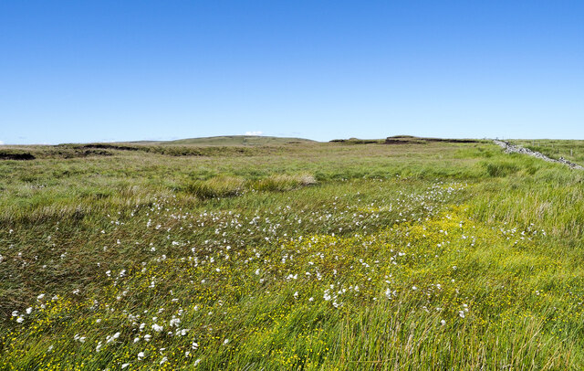
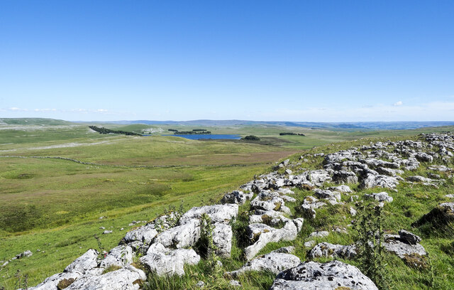
The downs of Out Fell are characterized by their gently rolling hills, covered in a lush carpet of grasses and wildflowers. These open spaces provide a tranquil setting for walking, picnicking, and enjoying the panoramic views of the surrounding countryside. The downs are also home to a variety of wildlife, including rabbits, hares, and a plethora of bird species, making it a haven for nature enthusiasts.

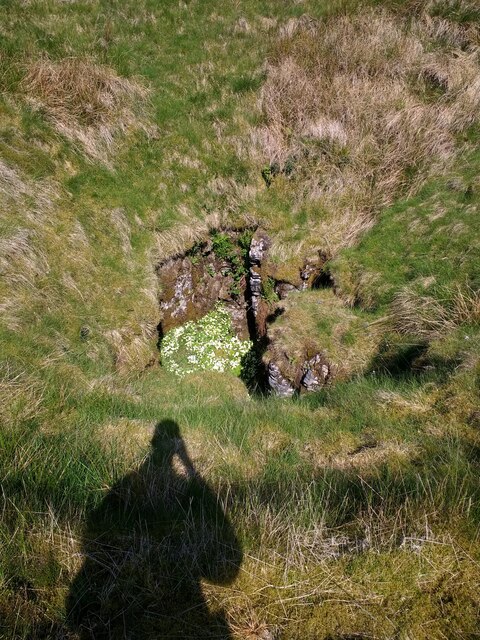
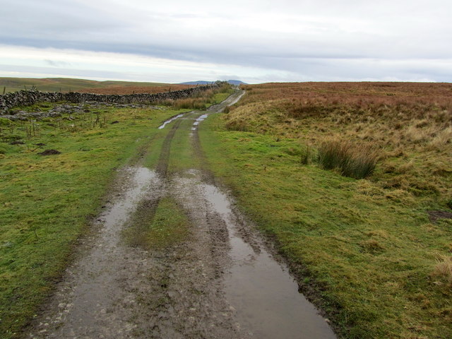
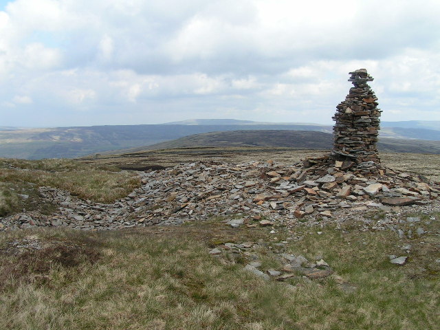
In contrast, the moorland of Out Fell presents a more rugged and wild terrain. Here, visitors can wander through vast expanses of heather, interspersed with rocky outcrops and scattered trees. The moorland is ideal for hikers and adventurers, who can explore the numerous footpaths and trails that crisscross the area. It is not uncommon to stumble upon ancient ruins or standing stones, adding an air of mystery and history to the landscape.

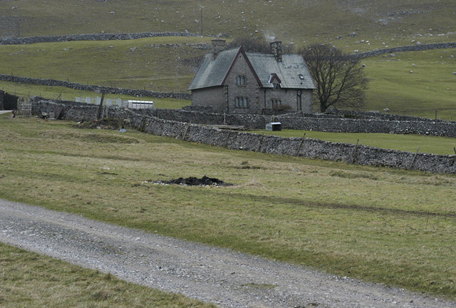
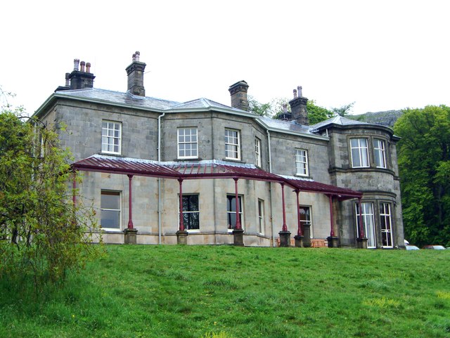
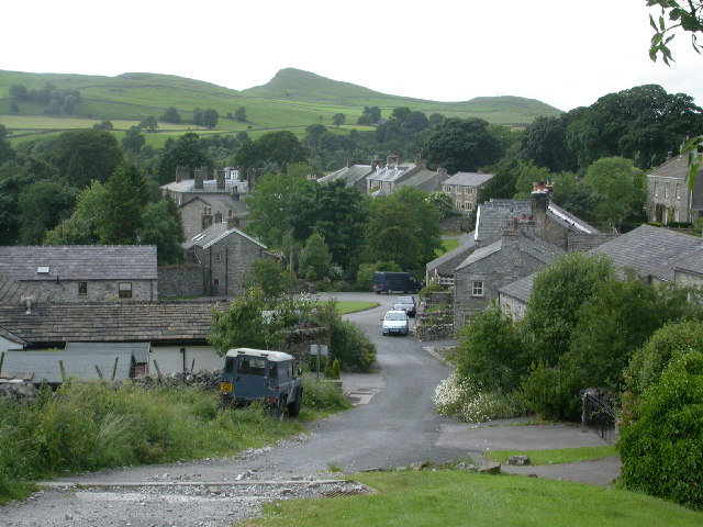
Out Fell is also renowned for its rich cultural heritage. The area is dotted with quaint villages and historic sites, such as medieval castles and stately homes, providing visitors with a glimpse into the region's past. The local communities are known for their warm hospitality, offering a range of amenities including traditional pubs, charming bed and breakfasts, and locally sourced cuisine.

In conclusion, Out Fell, Yorkshire, with its combination of downs and moorland, offers a captivating blend of natural beauty, outdoor activities, and cultural heritage. Whether it's exploring the rolling hills, venturing into the wild moorland, or immersing oneself in the local history, Out Fell is a destination that appeals to all.

If you have any feedback on the listing, please let us know in the comments section below.

Out Fell Images

Images are sourced within 2km of 54.118639/-2.2186601 or Grid Reference SD8569. Thanks to Geograph Open Source API. All images are credited.

Marshy area south of Fountains Fell The marsh is less wet than it normally would be, following a relatively dry spell of weather. Cotton grass seed heads are plentiful; the even more numerous yellow flowers are possibly spearworts. The broad ridge extends to the north where lie the higher areas of Fountains Fell.
Marshy area south of Fountains Fell
The marsh is less wet than it normally would be, following a relatively dry spell of weather. Cotton grass seed heads are plentiful; the even more numerous yellow flowers are possibly spearworts. The broad ridge extends to the north where lie the higher areas of Fountains Fell.
Minor summit with trig point at Knowe Fell The ground rises slightly to the trig point which is at the southern end of the ridge of Fountains Fell, part of which is visible in the distance.
Pen-y-ghent is also in the image.
Minor summit with trig point at Knowe Fell
The ground rises slightly to the trig point which is at the southern end of the ridge of Fountains Fell, part of which is visible in the distance. Pen-y-ghent is also in the image.
Limestone pavement at edge of steepening ground The area of pavement reaches the edge of the slope with the rock exposure extending on to it but in a fragmented way and not as a crag - easily passed through and of no real height.
Malham Tarn can be seen distantly.
Limestone pavement at edge of steepening ground
The area of pavement reaches the edge of the slope with the rock exposure extending on to it but in a fragmented way and not as a crag - easily passed through and of no real height. Malham Tarn can be seen distantly.
Grassy slope of Knowe Fell The limestone pavement is at the north end of a larger area south-east of the trig point of Knowe Fell. The central area of grass descends from there too.
The distant upland at the right side of the image is Great Whernside.
Grassy slope of Knowe Fell
The limestone pavement is at the north end of a larger area south-east of the trig point of Knowe Fell. The central area of grass descends from there too. The distant upland at the right side of the image is Great Whernside.
Sinkhole full of flowers The sinkhole is not currently a known cave entrance
Sinkhole full of flowers
The sinkhole is not currently a known cave entrance
Wall crossing summit of Fountains Fell south top Assessing the precise location of the highest point of the south top of Fountains Fell is not easy; it's somewhere in the vicinity of the walker in the image and the camera. Ingleborough is the distant mountain.
Wall crossing summit of Fountains Fell south top
Assessing the precise location of the highest point of the south top of Fountains Fell is not easy; it's somewhere in the vicinity of the walker in the image and the camera. Ingleborough is the distant mountain.
Bikers on the Silverdale Road Heading towards Stainforth. The road is very popular with conventions of old bikers, and the surrounding peace is frequently punctuated by the sound of two-strokes.
Bikers on the Silverdale Road
Heading towards Stainforth. The road is very popular with conventions of old bikers, and the surrounding peace is frequently punctuated by the sound of two-strokes.
Fountains Fell south 'top' Well, it's somewhere around here
Fountains Fell south 'top'
Well, it's somewhere around here
Western Flanks of Fountains Fell Lonely tracts of moorland on the fellside
Western Flanks of Fountains Fell
Lonely tracts of moorland on the fellside
Redundant Wall on the Flanks of Fountains Fell Following the wall over the rich russet colours of Fountains Fell towards Fornah Gill
Redundant Wall on the Flanks of Fountains Fell
Following the wall over the rich russet colours of Fountains Fell towards Fornah Gill
Shooting Hut above Fornah Gill Recently restored shooting hut on the western base of Fountains Fell
Shooting Hut above Fornah Gill
Recently restored shooting hut on the western base of Fountains Fell
Shooting Lodge at the base of Fountains Fell Rear view of the shooting hut above Fornah Gill
Shooting Lodge at the base of Fountains Fell
Rear view of the shooting hut above Fornah Gill
Track below Fountains Fell Part of the track between Henside Road and Silverdale Road - only the middle section is on Open Access Land and thus open to the public.
Track below Fountains Fell
Part of the track between Henside Road and Silverdale Road - only the middle section is on Open Access Land and thus open to the public.
Small tarn, Fountains Fell The peat bog on the south top.
Small tarn, Fountains Fell
The peat bog on the south top.
Fountains Fell South Top Not a very impressive 'summit' (2172'/662m).
Fountains Fell South Top
Not a very impressive 'summit' (2172'/662m).
Benchmark on stone in wall, Silverdale Road Ordnance Survey rivet benchmark described on the Bench Mark Database at <span class="nowrap"><a title="http://www.bench-marks.org.uk/bm69099" rel="nofollow ugc noopener" href="http://www.bench-marks.org.uk/bm69099">Link</a><img style="margin-left:2px;" alt="External link" title="External link - shift click to open in new window" src="https://s1.geograph.org.uk/img/external.png" width="10" height="10"/></span>
Benchmark on stone in wall, Silverdale Road
Ordnance Survey rivet benchmark described on the Bench Mark Database at LinkExternal link
Looking north along Silverdale Road towards Pen-y-Ghent There is an OS benchmark <a href="https://www.geograph.org.uk/photo/4734667">SD8470 : Benchmark on stone in wall, Silverdale Road</a> on a stone, marked by the blue notebook, in the wall
Looking north along Silverdale Road towards Pen-y-Ghent
There is an OS benchmark SD8470 : Benchmark on stone in wall, Silverdale Road on a stone, marked by the blue notebook, in the wall
Wall corner, Fountains Fell A useful landmark in this weather!
Wall corner, Fountains Fell
A useful landmark in this weather!
Show me another place!

Out Fell is located at Grid Ref: SD8569 (Lat: 54.118639, Lng: -2.2186601)

Division: West Riding

Administrative County: North Yorkshire

District: Craven

Police Authority: North Yorkshire

What 3 Words

///croutons.touchy.glides. Near Settle, North Yorkshire

Nearby Locations

Out Fell

Related Wikis

Fountains Fell Tarn

Fountains Fell Tarn, is an upland lake between the two peaks of Fountains Fell, in North Yorkshire, England. The tarn is close to the Pennine Way, some...

Fountains Fell

Fountains Fell is a mountain in the Yorkshire Dales, England. The main summit (SD864716) has a height of 668 metres (2,192 ft) and a relative height or...

Silverdale, North Yorkshire

Silverdale is a minor dale in the Yorkshire Dales in North Yorkshire, England. It is a side dale of Ribblesdale, and lies west of Fountains Fell. The dale...

Malham Moor

Malham Moor is a civil parish in the Craven district of North Yorkshire, England. Its population was estimated at 70 in 2015.It has a joint parish council...

Malham Tarn Field Studies Centre

FSC Malham Tarn, situated near Malham Tarn in the Yorkshire Dales National Park, North Yorkshire, England, occupies a large Georgian country house, leased...

Stainforth, North Yorkshire

Stainforth is a village and civil parish in the Craven district of North Yorkshire, England. It is situated north of Settle. Nearby there is a waterfall...

St Peter's Church, Stainforth

St Peter's Church is in the village of Stainforth, North Yorkshire, England. It is an active Anglican parish church in the deanery of Bowland, the archdeaconry...

Malham Tarn

Malham Tarn is a glacial lake near the village of Malham in the Yorkshire Dales, England. The lake is one of only eight upland alkaline lakes in Europe...

Related Videos

Pennine Way Gargrave to Horton

I park up in Gargrave and walk to Horton camping on Fountains Fell. Fall in the river trying to avoid b….. Cows, wet feet.

Fountains Fell and Darnbrook Fell

Set off early today to get on the hills, ended up probably getting a speeding ticket from one of those *ahem* "Safety" vans *ahem*.

G/NP-017 Fountains Fell 2M FM SOTA activation

Activation of G/NP-017 Fountains Fell for Summits on the Air using my Yaesu FT817ND on 2M FM running 2W to a MFD antenna.

Nearby Amenities

Located within 500m of 54.118639,-2.2186601
New Year Pot
Natural: cave_entrance
Note: exact location uncertain
Source: OS_OpenData_StreetView
Lat/Long: 54.1202605/-2.2186619
Rocky Pot
Natural: cave_entrance
Note: exact location uncertain
Source: OS_OpenData_StreetView
Lat/Long: 54.1200033/-2.2184512
Curtain Pot
Natural: cave_entrance
Lat/Long: 54.1187468/-2.2166277
Natural: sinkhole
Sinkhole: ponor
Lat/Long: 54.1186966/-2.2167337
Natural: sinkhole
Sinkhole: ponor
Lat/Long: 54.1184914/-2.2170017
Natural: sinkhole
Sinkhole: ponor
Lat/Long: 54.1185862/-2.2170837
Natural: sinkhole
Sinkhole: ponor
Lat/Long: 54.1186771/-2.2174138
Natural: sinkhole
Sinkhole: ponor
Lat/Long: 54.1186914/-2.2176109
Natural: sinkhole
Sinkhole: ponor
Lat/Long: 54.1187524/-2.2177483
Natural: sinkhole
Sinkhole: ponor
Lat/Long: 54.1188809/-2.2178125
Natural: sinkhole
Sinkhole: ponor
Lat/Long: 54.1189186/-2.2181581
Natural: sinkhole
Sinkhole: ponor
Lat/Long: 54.118855/-2.218054
Natural: sinkhole
Sinkhole: ponor
Lat/Long: 54.1189082/-2.218322
Natural: sinkhole
Sinkhole: ponor
Lat/Long: 54.118842/-2.2185568
Natural: sinkhole
Sinkhole: ponor
Lat/Long: 54.1188939/-2.2186875
Natural: sinkhole
Sinkhole: ponor
Lat/Long: 54.1189277/-2.2187185
Natural: sinkhole
Sinkhole: ponor
Lat/Long: 54.1190705/-2.2181891
Natural: sinkhole
Sinkhole: ponor
Lat/Long: 54.1190977/-2.2183663
Natural: sinkhole
Sinkhole: ponor
Lat/Long: 54.1192574/-2.2184128
Natural: sinkhole
Sinkhole: ponor
Lat/Long: 54.1190588/-2.2178014
Natural: sinkhole
Sinkhole: ponor
Lat/Long: 54.1191276/-2.2185767
Natural: sinkhole
Sinkhole: ponor
Lat/Long: 54.1192211/-2.2187384
Natural: sinkhole
Sinkhole: ponor
Lat/Long: 54.1193055/-2.2186986
Natural: sinkhole
Sinkhole: ponor
Lat/Long: 54.1192795/-2.2188426
Natural: sinkhole
Sinkhole: ponor
Lat/Long: 54.1191107/-2.2190242
Natural: sinkhole
Sinkhole: ponor
Lat/Long: 54.1196171/-2.2187384
Natural: sinkhole
Sinkhole: ponor
Lat/Long: 54.1197417/-2.2187761
Natural: sinkhole
Sinkhole: ponor
Lat/Long: 54.1187342/-2.2183153
Natural: sinkhole
Sinkhole: ponor
Lat/Long: 54.1187277/-2.2181359
Natural: sinkhole
Sinkhole: ponor
Lat/Long: 54.1186381/-2.2182046
Natural: sinkhole
Sinkhole: ponor
Lat/Long: 54.1185667/-2.2182112
Natural: sinkhole
Sinkhole: ponor
Lat/Long: 54.1185226/-2.2181337
Natural: sinkhole
Sinkhole: ponor
Lat/Long: 54.1185031/-2.2179964
Natural: sinkhole
Sinkhole: ponor
Lat/Long: 54.1184836/-2.2179188
Natural: sinkhole
Sinkhole: ponor
Lat/Long: 54.1183915/-2.2178081
Natural: sinkhole
Sinkhole: ponor
Lat/Long: 54.1184317/-2.2178701
Natural: sinkhole
Sinkhole: ponor
Lat/Long: 54.1184473/-2.2180096
Natural: sinkhole
Sinkhole: ponor
Lat/Long: 54.1184642/-2.2183331
Natural: sinkhole
Sinkhole: ponor
Lat/Long: 54.1183577/-2.2183353
Natural: sinkhole
Sinkhole: ponor
Lat/Long: 54.1181928/-2.217591
Natural: sinkhole
Sinkhole: ponor
Lat/Long: 54.118211/-2.2174581
Natural: sinkhole
Sinkhole: ponor
Lat/Long: 54.1183123/-2.2175267
Natural: sinkhole
Sinkhole: ponor
Lat/Long: 54.1183019/-2.2168998
Natural: sinkhole
Sinkhole: ponor
Lat/Long: 54.1182512/-2.2169729
Natural: sinkhole
Sinkhole: ponor
Lat/Long: 54.1181655/-2.2169331
Natural: sinkhole
Sinkhole: ponor
Lat/Long: 54.1181214/-2.2169685
Natural: sinkhole
Sinkhole: ponor
Lat/Long: 54.1180513/-2.2169375
Natural: sinkhole
Sinkhole: ponor
Lat/Long: 54.1179942/-2.2167869
Natural: sinkhole
Sinkhole: ponor
Lat/Long: 54.1178669/-2.2176043
Natural: sinkhole
Sinkhole: ponor
Lat/Long: 54.1179072/-2.217478
Natural: sinkhole
Sinkhole: ponor
Lat/Long: 54.1179046/-2.2164812
Natural: sinkhole
Sinkhole: ponor
Lat/Long: 54.1177163/-2.2165875
Natural: sinkhole
Sinkhole: ponor
Lat/Long: 54.1179981/-2.2159739
Natural: sinkhole
Sinkhole: ponor
Lat/Long: 54.1182642/-2.2159717
Natural: sinkhole
Sinkhole: ponor
Lat/Long: 54.1182902/-2.2160869
Natural: sinkhole
Sinkhole: ponor
Lat/Long: 54.1183486/-2.2161378
Natural: sinkhole
Sinkhole: ponor
Lat/Long: 54.118533/-2.2162774
Natural: sinkhole
Sinkhole: ponor
Lat/Long: 54.1185628/-2.2163881
Natural: sinkhole
Sinkhole: ponor
Lat/Long: 54.1185511/-2.2162131
Natural: sinkhole
Sinkhole: ponor
Lat/Long: 54.1186122/-2.2159961
Natural: sinkhole
Sinkhole: ponor
Lat/Long: 54.1179092/-2.2155573
Natural: sinkhole
Sinkhole: ponor
Lat/Long: 54.1177158/-2.2153883
Natural: sinkhole
Sinkhole: ponor
Lat/Long: 54.1172662/-2.2152113
Natural: sinkhole
Sinkhole: ponor
Lat/Long: 54.1174548/-2.2152434
Natural: sinkhole
Sinkhole: ponor
Lat/Long: 54.1172835/-2.2161178
Natural: sinkhole
Sinkhole: ponor
Lat/Long: 54.1173165/-2.2165041
Natural: sinkhole
Sinkhole: ponor
Lat/Long: 54.1172017/-2.2166945
Natural: sinkhole
Sinkhole: ponor
Lat/Long: 54.1172316/-2.2167857
Natural: sinkhole
Sinkhole: ponor
Lat/Long: 54.1173023/-2.216842
Natural: sinkhole
Sinkhole: ponor
Lat/Long: 54.1174124/-2.2171612
Natural: sinkhole
Sinkhole: ponor
Lat/Long: 54.1174611/-2.2170861
Natural: sinkhole
Sinkhole: ponor
Lat/Long: 54.1175004/-2.2171746
Natural: sinkhole
Sinkhole: ponor
Lat/Long: 54.1175539/-2.2172712
Natural: sinkhole
Sinkhole: ponor
Lat/Long: 54.1175523/-2.2174643
Natural: sinkhole
Sinkhole: ponor
Lat/Long: 54.1176183/-2.2175716
Natural: sinkhole
Sinkhole: ponor
Lat/Long: 54.1175067/-2.2177915
Natural: sinkhole
Sinkhole: ponor
Lat/Long: 54.1173039/-2.2174268
Natural: sinkhole
Sinkhole: ponor
Lat/Long: 54.1174234/-2.2160481
Natural: sinkhole
Sinkhole: ponor
Lat/Long: 54.1169235/-2.215796
Natural: sinkhole
Sinkhole: ponor
Lat/Long: 54.1183116/-2.2194786
Natural: sinkhole
Sinkhole: ponor
Lat/Long: 54.1182047/-2.219366
Natural: sinkhole
Sinkhole: ponor
Lat/Long: 54.1181654/-2.2192828
Natural: sinkhole
Sinkhole: ponor
Lat/Long: 54.1179893/-2.2197388
Natural: sinkhole
Sinkhole: ponor
Lat/Long: 54.1180334/-2.2189824
Natural: sinkhole
Sinkhole: ponor
Lat/Long: 54.1182047/-2.2188966
Natural: sinkhole
Sinkhole: ponor
Lat/Long: 54.1182535/-2.2188269
Natural: sinkhole
Sinkhole: ponor
Lat/Long: 54.1183022/-2.2187518
Natural: sinkhole
Sinkhole: ponor
Lat/Long: 54.1182189/-2.2183548
Natural: sinkhole
Sinkhole: ponor
Lat/Long: 54.1183494/-2.2185157
Natural: sinkhole
Sinkhole: ponor
Lat/Long: 54.1183981/-2.2185908
Natural: sinkhole
Sinkhole: ponor
Lat/Long: 54.118461/-2.2187276
Natural: sinkhole
Sinkhole: ponor
Lat/Long: 54.118516/-2.2188269
Natural: sinkhole
Sinkhole: ponor
Lat/Long: 54.1185616/-2.218902
Natural: sinkhole
Sinkhole: ponor
Lat/Long: 54.1186418/-2.2190119
Natural: sinkhole
Sinkhole: ponor
Lat/Long: 54.1186999/-2.2191487
Natural: sinkhole
Sinkhole: ponor
Lat/Long: 54.1187691/-2.2192238
Natural: sinkhole
Sinkhole: ponor
Lat/Long: 54.1187345/-2.2190012
Natural: sinkhole
Sinkhole: ponor
Lat/Long: 54.1188618/-2.220742
Natural: sinkhole
Sinkhole: ponor
Lat/Long: 54.1188163/-2.2204979
Natural: sinkhole
Sinkhole: ponor
Lat/Long: 54.1184657/-2.2206642
Natural: sinkhole
Sinkhole: ponor
Lat/Long: 54.1191024/-2.2211014
Natural: sinkhole
Sinkhole: ponor
Lat/Long: 54.1186685/-2.2215466
Natural: sinkhole
Sinkhole: ponor
Lat/Long: 54.1188115/-2.2215493
Natural: sinkhole
Sinkhole: ponor
Lat/Long: 54.1187141/-2.2217853
Natural: sinkhole
Sinkhole: ponor
Lat/Long: 54.118659/-2.2219141
Natural: sinkhole
Sinkhole: ponor
Lat/Long: 54.1186213/-2.2220107
Natural: sinkhole
Sinkhole: ponor
Lat/Long: 54.1186197/-2.2221287
Natural: sinkhole
Sinkhole: ponor
Lat/Long: 54.1186559/-2.2227885
Natural: sinkhole
Sinkhole: ponor
Lat/Long: 54.1188697/-2.2227644
Natural: sinkhole
Sinkhole: ponor
Lat/Long: 54.1190301/-2.2227536
Natural: sinkhole
Sinkhole: ponor
Lat/Long: 54.1189813/-2.2225712
Natural: sinkhole
Sinkhole: ponor
Lat/Long: 54.1198632/-2.2185613
Natural: sinkhole
Sinkhole: ponor
Lat/Long: 54.12/-2.218902
Natural: sinkhole
Sinkhole: ponor
Lat/Long: 54.1201855/-2.2185855
Natural: sinkhole
Sinkhole: ponor
Lat/Long: 54.1200582/-2.219256
Natural: sinkhole
Sinkhole: ponor
Lat/Long: 54.1203065/-2.217872
Natural: sinkhole
Sinkhole: ponor
Lat/Long: 54.120437/-2.217821
Natural: sinkhole
Sinkhole: ponor
Lat/Long: 54.120481/-2.2183763
Natural: sinkhole
Sinkhole: ponor
Lat/Long: 54.1205837/-2.2189819
Natural: sinkhole
Sinkhole: ponor
Lat/Long: 54.1205902/-2.2194139
Natural: sinkhole
Sinkhole: ponor
Lat/Long: 54.120794/-2.2188003
Natural: sinkhole
Sinkhole: ponor
Lat/Long: 54.1207235/-2.2204063
Natural: sinkhole
Sinkhole: ponor
Lat/Long: 54.120813/-2.220088
Natural: sinkhole
Sinkhole: ponor
Lat/Long: 54.1209767/-2.2202472
Natural: sinkhole
Sinkhole: ponor
Lat/Long: 54.1209881/-2.2203446
Natural: sinkhole
Sinkhole: ponor
Lat/Long: 54.1210909/-2.2201822
Natural: sinkhole
Sinkhole: ponor
Lat/Long: 54.120931/-2.2199549
Natural: sinkhole
Sinkhole: ponor
Lat/Long: 54.120931/-2.2198347
Natural: sinkhole
Sinkhole: ponor
Lat/Long: 54.1212588/-2.2184028
Natural: sinkhole
Sinkhole: ponor
Lat/Long: 54.1210861/-2.2190275
Natural: sinkhole
Sinkhole: ponor
Lat/Long: 54.1211549/-2.219229
Natural: sinkhole
Sinkhole: ponor
Lat/Long: 54.1212315/-2.2190961
Natural: sinkhole
Sinkhole: ponor
Lat/Long: 54.1211757/-2.219054
Natural: sinkhole
Sinkhole: ponor
Lat/Long: 54.12136/-2.2201085
Natural: sinkhole
Sinkhole: ponor
Lat/Long: 54.1212756/-2.2203632
Natural: sinkhole
Sinkhole: ponor
Lat/Long: 54.1212263/-2.22033
Natural: sinkhole
Sinkhole: ponor
Lat/Long: 54.1209706/-2.2176806
Natural: sinkhole
Sinkhole: ponor
Lat/Long: 54.1210004/-2.2178756
Natural: sinkhole
Sinkhole: ponor
Lat/Long: 54.1212159/-2.217654
Natural: sinkhole
Sinkhole: ponor
Lat/Long: 54.1209277/-2.2163404
Natural: sinkhole
Sinkhole: ponor
Lat/Long: 54.1208381/-2.2165398
Natural: sinkhole
Sinkhole: ponor
Lat/Long: 54.1207083/-2.2162541
Natural: sinkhole
Sinkhole: ponor
Lat/Long: 54.1206512/-2.2163648
Natural: sinkhole
Sinkhole: ponor
Lat/Long: 54.1205084/-2.2163914
Natural: sinkhole
Sinkhole: ponor
Lat/Long: 54.1204058/-2.2162873
Natural: sinkhole
Sinkhole: ponor
Lat/Long: 54.1203292/-2.216531
Natural: sinkhole
Sinkhole: ponor
Lat/Long: 54.120263/-2.2163227
Natural: sinkhole
Sinkhole: ponor
Lat/Long: 54.1202305/-2.2161499
Natural: sinkhole
Sinkhole: ponor
Lat/Long: 54.120189/-2.2159196
Natural: sinkhole
Sinkhole: ponor
Lat/Long: 54.1201929/-2.2160503
Natural: sinkhole
Sinkhole: ponor
Lat/Long: 54.1202331/-2.2158177
Natural: sinkhole
Sinkhole: ponor
Lat/Long: 54.1203188/-2.2158642
Natural: sinkhole
Sinkhole: ponor
Lat/Long: 54.1203344/-2.2157246
Natural: sinkhole
Sinkhole: ponor
Lat/Long: 54.1202877/-2.2156693
Natural: sinkhole
Sinkhole: ponor
Lat/Long: 54.1204214/-2.2157711
Natural: sinkhole
Sinkhole: ponor
Lat/Long: 54.1205214/-2.2157424
Natural: sinkhole
Sinkhole: ponor
Lat/Long: 54.1206369/-2.2158708
Natural: sinkhole
Sinkhole: ponor
Lat/Long: 54.1206278/-2.2155762
Natural: sinkhole
Sinkhole: ponor
Lat/Long: 54.1204954/-2.2152617
Natural: sinkhole
Sinkhole: ponor
Lat/Long: 54.1205408/-2.2152993
Natural: sinkhole
Sinkhole: ponor
Lat/Long: 54.1204383/-2.2152594
Natural: sinkhole
Sinkhole: ponor
Lat/Long: 54.1202708/-2.2152506
Natural: sinkhole
Sinkhole: ponor
Lat/Long: 54.1207031/-2.2150091
Natural: sinkhole
Sinkhole: ponor
Lat/Long: 54.116226/-2.2189676
Natural: sinkhole
Sinkhole: ponor
Lat/Long: 54.1156682/-2.2191838
Natural: sinkhole
Sinkhole: ponor
Lat/Long: 54.1156774/-2.218881
Natural: sinkhole
Sinkhole: ponor
Lat/Long: 54.1159494/-2.2185468
Natural: sinkhole
Sinkhole: ponor
Lat/Long: 54.1159586/-2.2182833
Natural: sinkhole
Sinkhole: ponor
Lat/Long: 54.1160208/-2.2177682
Natural: sinkhole
Sinkhole: ponor
Lat/Long: 54.1160831/-2.2173356
Natural: sinkhole
Sinkhole: ponor
Lat/Long: 54.1162346/-2.2200622
Natural: sinkhole
Sinkhole: ponor
Lat/Long: 54.1162918/-2.2201708
Natural: sinkhole
Sinkhole: ponor
Lat/Long: 54.1161788/-2.2197853
Natural: sinkhole
Sinkhole: ponor
Lat/Long: 54.1165112/-2.2204056
Natural: sinkhole
Sinkhole: ponor
Lat/Long: 54.1166644/-2.2205784
Natural: sinkhole
Sinkhole: ponor
Lat/Long: 54.1166371/-2.2205429
Natural: sinkhole
Sinkhole: ponor
Lat/Long: 54.1165255/-2.2207866
Natural: sinkhole
Sinkhole: ponor
Lat/Long: 54.1161567/-2.2209106
Natural: sinkhole
Sinkhole: ponor
Lat/Long: 54.1162178/-2.2211432
Natural: sinkhole
Sinkhole: ponor
Lat/Long: 54.1169085/-2.2204942
Natural: sinkhole
Sinkhole: ponor
Lat/Long: 54.1169332/-2.2206581
Natural: sinkhole
Sinkhole: ponor
Lat/Long: 54.1170487/-2.2206315
Natural: sinkhole
Sinkhole: ponor
Lat/Long: 54.1172941/-2.2204189
Natural: sinkhole
Sinkhole: ponor
Lat/Long: 54.117372/-2.220348
Natural: sinkhole
Sinkhole: ponor
Lat/Long: 54.1174512/-2.2202727
Natural: sinkhole
Sinkhole: ponor
Lat/Long: 54.1176343/-2.2202173
Natural: sinkhole
Sinkhole: ponor
Lat/Long: 54.1177667/-2.2200733
Natural: sinkhole
Sinkhole: ponor
Lat/Long: 54.1176901/-2.2204609
Natural: sinkhole
Sinkhole: ponor
Lat/Long: 54.117968/-2.220122
Natural: sinkhole
Sinkhole: ponor
Lat/Long: 54.1181095/-2.2202239
Natural: sinkhole
Sinkhole: ponor
Lat/Long: 54.1178459/-2.2206581
Natural: sinkhole
Sinkhole: ponor
Lat/Long: 54.117855/-2.2209527
Natural: sinkhole
Sinkhole: ponor
Lat/Long: 54.1178706/-2.2214312
Natural: sinkhole
Sinkhole: ponor
Lat/Long: 54.117929/-2.2210945
Natural: sinkhole
Sinkhole: ponor
Lat/Long: 54.1181952/-2.221141
Natural: sinkhole
Sinkhole: ponor
Lat/Long: 54.1181212/-2.2213625
Natural: sinkhole
Sinkhole: ponor
Lat/Long: 54.1183043/-2.2213736
The data included in this document is from www.openstreetmap.org. The data is made available under ODbL.

Have you been to Out Fell?

Leave your review of Out Fell below (or comments, questions and feedback).