Sneedham's Green

Downs, Moorland in Gloucestershire Gloucester

England

Sneedham's Green

Gloucester Services, Southbound On the M5 and operated by the same group that own Tebay Services on the M6. A quick breakfast stop.
Gloucester Services, Southbound Credit: Chris Allen

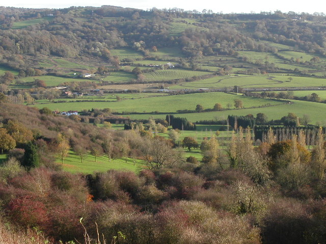
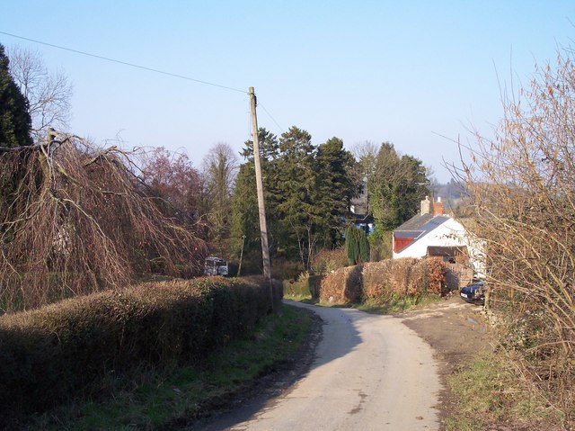
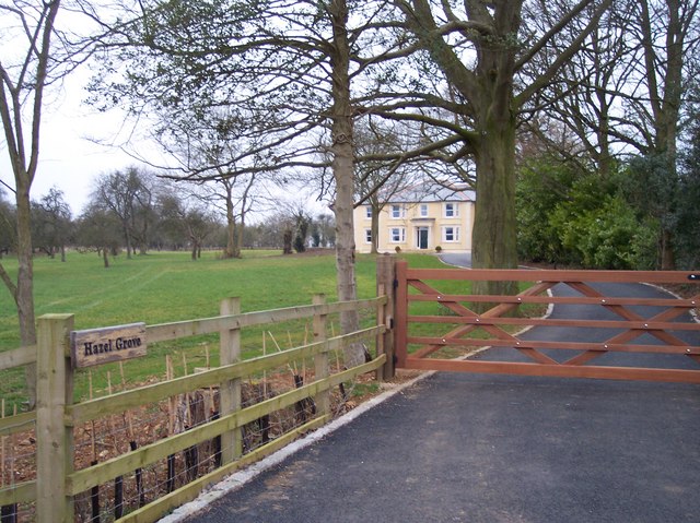
Sneedham's Green is a picturesque village located in the county of Gloucestershire, England. Situated amidst the stunning Downs and Moorland landscapes, it offers residents and visitors alike a unique and tranquil setting. The village is renowned for its natural beauty, with rolling green hills, expansive meadows, and a diverse range of flora and fauna.

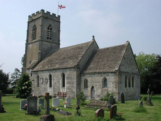
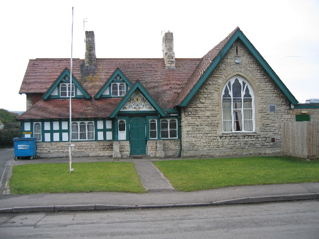
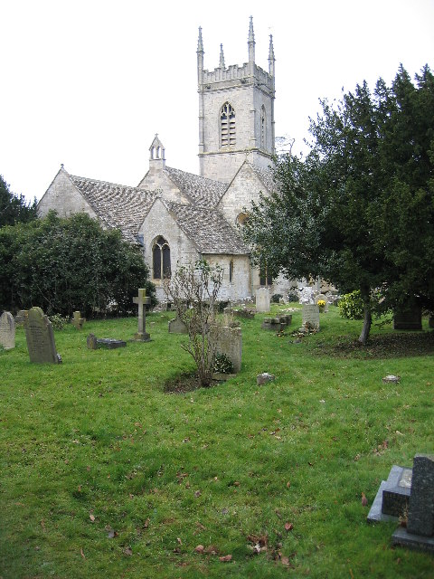
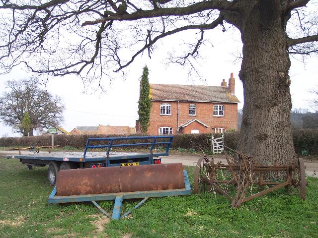
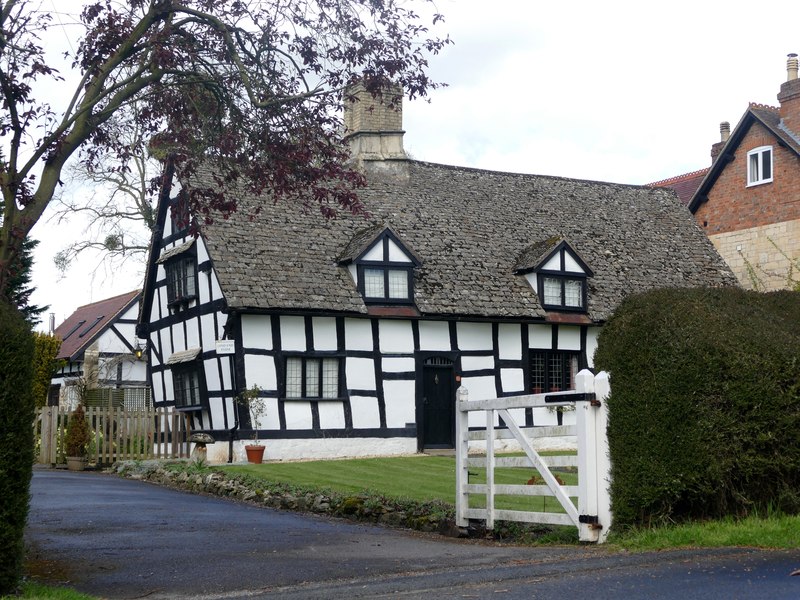
The village itself is small, with a population of around 500 residents. Its quaint and charming atmosphere is enhanced by a collection of traditional stone cottages and a historic church that dates back to the 12th century. The community is close-knit, with a strong sense of local pride and a welcoming spirit.

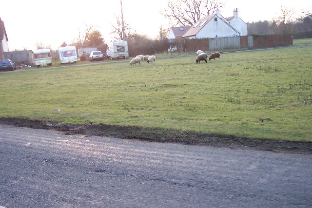
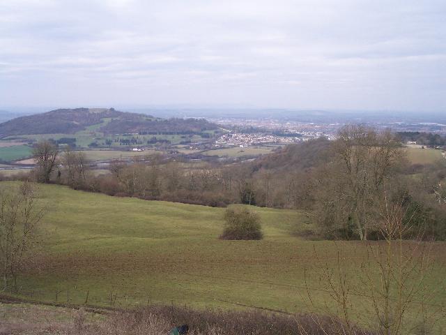
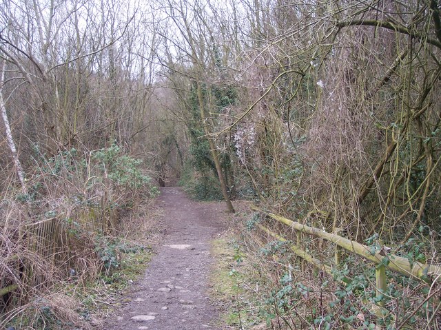
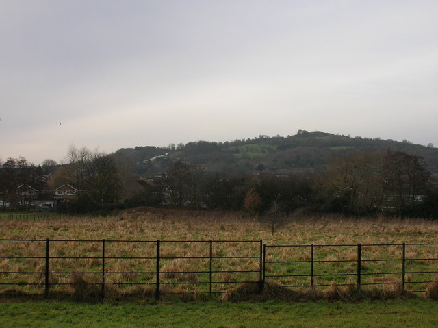
Nature enthusiasts are drawn to Sneedham's Green due to its proximity to the Downs and Moorland areas. These vast expanses of unspoiled wilderness offer endless opportunities for outdoor activities such as hiking, cycling, and bird watching. The landscape is rich in biodiversity, boasting a variety of plant and animal species, including rare orchids and birds of prey.

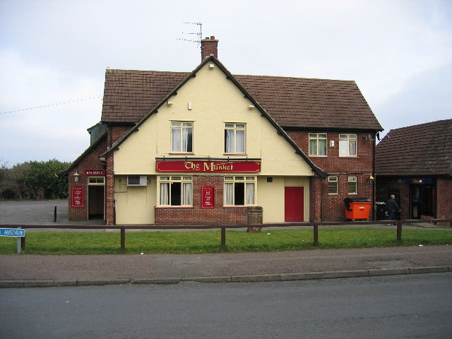
The village is also home to a number of small businesses, including a traditional pub serving locally sourced food and a village shop where residents can purchase daily essentials. While Sneedham's Green may not have large commercial centers, the nearby town of Gloucester provides easy access to a wider range of amenities and services.

In conclusion, Sneedham's Green offers a peaceful haven in the heart of Gloucestershire, surrounded by stunning Downs and Moorland landscapes. With its idyllic setting, close community, and abundant natural beauty, it is a place that holds great appeal to nature lovers and those seeking a tranquil retreat.

If you have any feedback on the listing, please let us know in the comments section below.

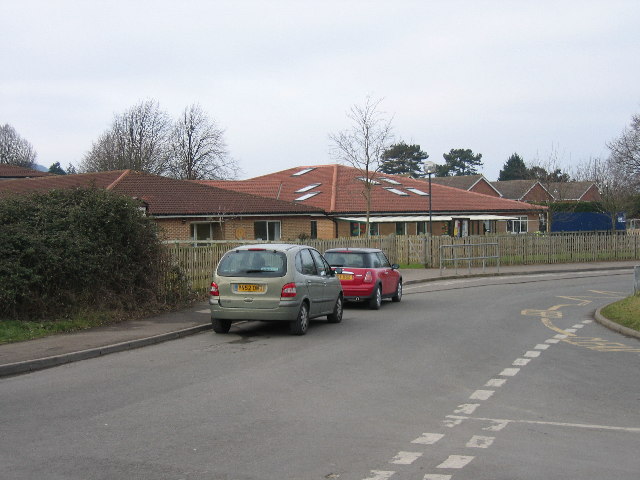
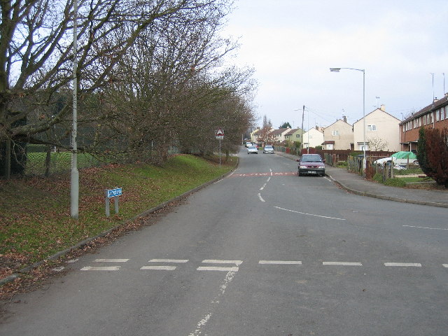
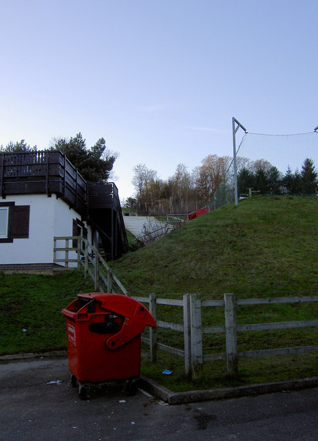
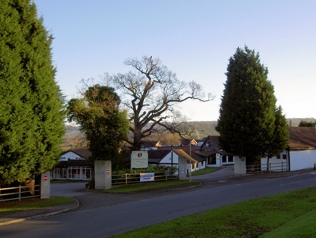
Sneedham's Green Images

Images are sourced within 2km of 51.826932/-2.2199859 or Grid Reference SO8414. Thanks to Geograph Open Source API. All images are credited.

Gloucester Services, Southbound On the M5 and operated by the same group that own Tebay Services on the M6. A quick breakfast stop.
Gloucester Services, Southbound
On the M5 and operated by the same group that own Tebay Services on the M6. A quick breakfast stop.
Trigpoint, Robinswood Hill, Gloucestershire This is the trigpoint at the top of Robinswood Hill, Gloucester and Cheltenham are visible in the distance. The beacon was used during the Golden Jubilee.
Trigpoint, Robinswood Hill, Gloucestershire
This is the trigpoint at the top of Robinswood Hill, Gloucester and Cheltenham are visible in the distance. The beacon was used during the Golden Jubilee.
Whaddon (Glos) St Margaret's Church
Sneedham's Green Sneedham's Green is common land with sheep grazing. These sheep have no fences or animal grids to enclose them. Apparently the flock has learned where it is allowed to go.
Sneedham's Green
Sneedham's Green is common land with sheep grazing. These sheep have no fences or animal grids to enclose them. Apparently the flock has learned where it is allowed to go.
The Musket Matson
The Musket Matson
Primary  School Upton St Leonards
Primary School Upton St Leonards
Matson Lane Looking North A large housing estate to the right and a country park to the left
Matson Lane Looking North
A large housing estate to the right and a country park to the left
The Village Institute Upton St Leonards
Parish Church Upton St Leonards
M5 motorway bisects Gloucestershire farmland Taken from Robinswood golf course looking south-east the M5 bisects the frame just above centre. This section is midway between Jct.12 and Jct.11A as it passes by Gloucester.
M5 motorway bisects Gloucestershire farmland
Taken from Robinswood golf course looking south-east the M5 bisects the frame just above centre. This section is midway between Jct.12 and Jct.11A as it passes by Gloucester.
Ongers Farm Viewed from the south-west with an interesting trio of farm equipment in the foreground.
Ongers Farm
Viewed from the south-west with an interesting trio of farm equipment in the foreground.
Piccadilly Wood Looking north-west from Cud Hill with Robins Wood Hill in the left distance.
Piccadilly Wood
Looking north-west from Cud Hill with Robins Wood Hill in the left distance.
Moorend near Upton St. Leonards Hamlet around Moorend Farm at the bottom of the dip. Looking NNE.
Moorend near Upton St. Leonards
Hamlet around Moorend Farm at the bottom of the dip. Looking NNE.
Hazel Grove Looking west south west up the drive.
Hazel Grove
Looking west south west up the drive.
Footpath up Robins Wood Hill Looking north east up the hill.
Footpath up Robins Wood Hill
Looking north east up the hill.
Robins Wood Hill Spring Cross The spring provided water to the city of Gloucester for more than 400 years. in the reign of Edward 3rd, it became the subject of a dispute between the Grey Friars and St Peters Abbey, concerning the quantity of water the former was to receive, which was settled by the King in 1350.
Robins Wood Hill Spring Cross
The spring provided water to the city of Gloucester for more than 400 years. in the reign of Edward 3rd, it became the subject of a dispute between the Grey Friars and St Peters Abbey, concerning the quantity of water the former was to receive, which was settled by the King in 1350.
Is this where they put the injured? The end of the slope on the dry ski run.
Is this where they put the injured?
The end of the slope on the dry ski run.
Ramada Jarvis hotel and resort Gloucester
Show me another place!

Sneedham's Green is located at Grid Ref: SO8414 (Lat: 51.826932, Lng: -2.2199859)

Administrative County: Gloucestershire

District: Gloucester

Police Authority: Gloucestershire

What 3 Words

///leaves.codes.stored. Near Barnwood, Gloucestershire

Nearby Locations

Sneedham's Green

Related Wikis

Matson, Gloucester

Matson is a suburb of Gloucester, in the county of Gloucestershire, England. In 1931 the parish had a population of 40. == History == Unlike neighbouring...
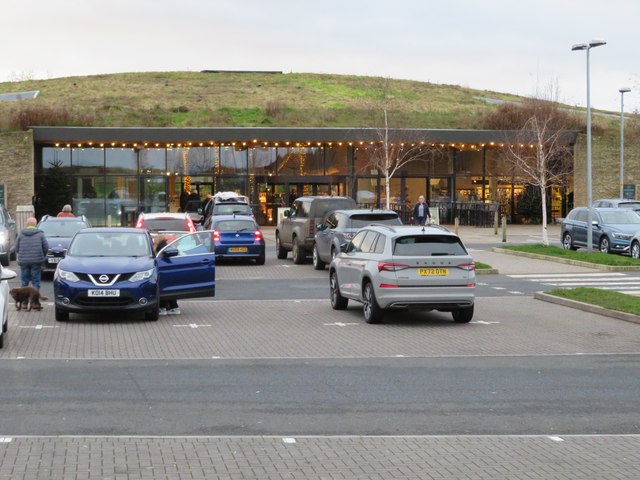
Gloucester Services

Gloucester Services are a pair of Motorway Service Areas (MSA) serving the northbound and southbound carriageways of the M5 between Junction 11A and Junction...
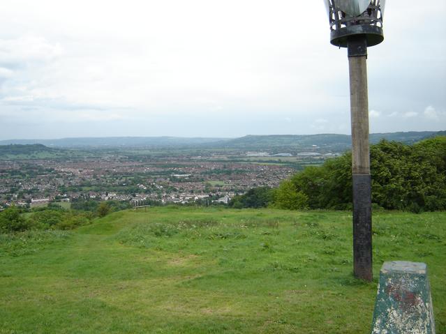
Robinswood Hill

Robinswood Hill (grid reference SO840150) is a hill and country park to the south of the city centre of Gloucester, close to the Stroud Road (A4173). It...

Gloucestershire Wildlife Trust

The Gloucestershire Wildlife Trust is the Gloucestershire local partner in a conservation network of 46 Wildlife Trusts. The Wildlife Trusts are local...

Range Farm Fields

Range Farm Fields (grid reference SO850130) is a 12.8-hectare (32-acre) biological Site of Special Scientific Interest in Gloucestershire, near to Gloucester...

Robin's Wood Hill Quarry

Robin's Wood Hill Quarry (grid reference SO836148) is a 1.67-hectare (4.1-acre) geological Site of Special Scientific Interest in Gloucestershire, on Robinswood...

Bondend

Bondend is a lane within the village of Upton St Leonards in Gloucestershire, England. == External links == Media related to Bondend at Wikimedia Commons

Wynstones School

Wynstones School was a Steiner Waldorf school in Gloucestershire, set on 11 acres near Gloucester. It took pupils from pre-school through to university...

Nearby Amenities

Located within 500m of 51.826932,-2.2199859
Source: Bing
Traffic Calming: hump
Lat/Long: 51.8293934/-2.220134
Barrier: stile
Lat/Long: 51.8272339/-2.2223316
Post Box
Collection Times: Mo-Fr 09:00; Sa 07:00; Su off
Operator: Royal Mail
Ref: GL4 111D
Source: survey
Lat/Long: 51.8313842/-2.2199175
Sneedhams Green
Created By: Potlatch 0.10f
Is In: Matson
Place: hamlet
Lat/Long: 51.828826/-2.2192609
Genus: Quercus
Genus En: Oak
Historic: tree
Note: Tree was destroyed by council in November 2009
Lat/Long: 51.8295922/-2.2186816
Barrier: stile
Lat/Long: 51.8277038/-2.2186861
Barrier: stile
Lat/Long: 51.8269271/-2.2128576
Barrier: stile
Ele: 54.6802979
Lat/Long: 51.8285975/-2.2141498
Barrier: stile
Ele: 55.6416016
Lat/Long: 51.8290638/-2.2181627
Barrier: stile
Ele: 53.9593506
Lat/Long: 51.8290197/-2.2164279
Place Of Worship
Brethren Meeting Room
Created By: Potlatch 0.10f
Denomination: exclusive_brethren
Note: Contact details are as follows: 01452 311957 or 302879, The Gospel Hall, PO Box 3153, Gloucester, GL2 5WD - note that this is not the address or postcode for this church.
Religion: christian
Lat/Long: 51.8290896/-2.2209526
Barrier: stile
Lat/Long: 51.8225622/-2.2193663
Barrier: stile
Lat/Long: 51.8228048/-2.2189005
Barrier: stile
Lat/Long: 51.8259662/-2.2245654
Addr City: Gloucester
Addr Housenumber: 12a
Addr Postcode: GL4 6HZ
Addr Street: Sneedhams Road
Lat/Long: 51.8294782/-2.2190318
Addr City: Gloucester
Addr Postcode: GL4 6HZ
Lat/Long: 51.8294716/-2.2189527
Wonderland
Landuse: residential
Source: survey
Lat/Long: 51.826964/-2.219661
Power: pole
Lat/Long: 51.8257414/-2.219597
Green Fm
Ele: 57.805
Lat/Long: 51.8242066/-2.2192713
Barrier: stile
Lat/Long: 51.8257922/-2.2226934
Power: substation
Ref: 5542
Source: survey
Lat/Long: 51.8295507/-2.2186226
Power: pole
Source: Bing
Lat/Long: 51.8278703/-2.219701
Power: pole
Source: Bing
Lat/Long: 51.8276494/-2.2183767
Power: pole
Source: Bing
Lat/Long: 51.8262391/-2.2191176
Power: pole
Source: Bing
Lat/Long: 51.8265201/-2.219351
Sneedhams Green
Power: pole
Source: Bing
Transformer: distribution
Voltage Primary: 11000
Lat/Long: 51.828327/-2.218028
Power: pole
Source: Bing
Lat/Long: 51.8269565/-2.2187388
Power: pole
Source: Bing
Lat/Long: 51.8260049/-2.2193604
Power: pole
Source: Bing
Lat/Long: 51.827532/-2.2199143
Power: pole
Source: Bing
Lat/Long: 51.8271757/-2.2201476
Snow & Caple Farm
Power: pole
Source: Bing
Transformer: distribution
Voltage Primary: 11000
Lat/Long: 51.8252213/-2.2201088
Power: pole
Source: Bing
Lat/Long: 51.8278309/-2.2187904
Power: pole
Source: Bing
Lat/Long: 51.827505/-2.218931
Power: pole
Source: Bing
Lat/Long: 51.828104/-2.2193067
Power: pole
Source: Bing
Lat/Long: 51.8282954/-2.2185812
Power: pole
Source: Bing
Lat/Long: 51.8254973/-2.2193792
Power: pole
Source: Bing
Lat/Long: 51.8258371/-2.2204279
Power: pole
Source: Bing
Lat/Long: 51.8296191/-2.219241
Barrier: stile
Source: survey
Lat/Long: 51.8251825/-2.2192932
Give Way
Direction: forward
Lat/Long: 51.8278897/-2.2188709
Note: not a traffic hump
Lat/Long: 51.8292843/-2.2183768
Street Lamp
Source: Bing + survey
Lat/Long: 51.8304846/-2.2197571
Street Lamp
Source: Bing + survey
Lat/Long: 51.8308886/-2.2197571
Street Lamp
Source: Bing + survey
Lat/Long: 51.8294208/-2.2201461
Street Lamp
Source: Bing + survey
Lat/Long: 51.8294067/-2.2192529
Street Lamp
Source: Bing + survey
Lat/Long: 51.8296703/-2.2197484
Power: pole
Source: Bing
Lat/Long: 51.8291183/-2.2203191
Street Lamp
Source: Bing
Lat/Long: 51.8293127/-2.2188573
Power: pole
Source: Bing
Lat/Long: 51.8296446/-2.2196358
Street Lamp
Source: Bing + survey
Lat/Long: 51.8300789/-2.2196412
Power: pole
Source: Bing
Lat/Long: 51.8310278/-2.2199737
Power: pole
Source: Bing
Lat/Long: 51.8293645/-2.2196432
Street Lamp
Source: Bing + survey
Lat/Long: 51.8293703/-2.2196887
Street Lamp
Source: Bing
Lat/Long: 51.8295798/-2.2179606
Street Lamp
Source: Bing
Lat/Long: 51.8303331/-2.2178417
Street Lamp
Source: Bing
Lat/Long: 51.830704/-2.217664
Street Lamp
Source: Bing
Lat/Long: 51.8310641/-2.2188085
Street Lamp
Source: Bing
Lat/Long: 51.830014/-2.2186737
Street Lamp
Source: Bing
Lat/Long: 51.8296693/-2.2188367
Street Lamp
Source: Bing
Lat/Long: 51.831377/-2.2189842
Street Lamp
Source: Bing
Lat/Long: 51.8310612/-2.2187006
Give Way
Direction: forward
Lat/Long: 51.8294268/-2.2196968
Give Way
Direction: backward
Lat/Long: 51.8293729/-2.2205117
Give Way
Direction: forward
Lat/Long: 51.8293734/-2.2188575
Give Way
Direction: forward
Lat/Long: 51.8292438/-2.2181509
Give Way
Direction: forward
Lat/Long: 51.8238836/-2.2195064
Waste Basket
Source: survey
Waste: dog_excrement
Lat/Long: 51.8293094/-2.2189839
Waste Basket
Operator: Gloucester City Council
Source: survey;gps
Waste: trash;dog_excrement
Lat/Long: 51.8310201/-2.2209631
Meeting Hall - RMU
Power: transformer
Transformer: distribution
Voltage Primary: 11000
Lat/Long: 51.8280617/-2.2217971
Hill View Cottages
Power: pole
Transformer: distribution
Voltage Primary: 11000
Lat/Long: 51.825816/-2.2218695
Power: pole
Lat/Long: 51.825932/-2.2212104
Caledonian Road
Power: transformer
Transformer: distribution
Voltage Primary: 11000
Lat/Long: 51.8295631/-2.2185952
Power: pole
Lat/Long: 51.8287936/-2.2177456
Location Transition: yes
Power: pole
Lat/Long: 51.8293195/-2.2174895
Power: pole
Lat/Long: 51.829772/-2.2170275
Location Transition: yes
Power: pole
Lat/Long: 51.8303683/-2.2164749
The data included in this document is from www.openstreetmap.org. The data is made available under ODbL.

Have you been to Sneedham's Green?

Leave your review of Sneedham's Green below (or comments, questions and feedback).