Hardham
Settlement in Sussex Horsham
England
Hardham
Hardham is a small village located in the district of Horsham, West Sussex, England. Situated approximately 4 miles northwest of Pulborough, it is surrounded by picturesque countryside and offers a peaceful retreat from the bustling city life. With a population of around 500 residents, Hardham exudes a quintessential English village charm.
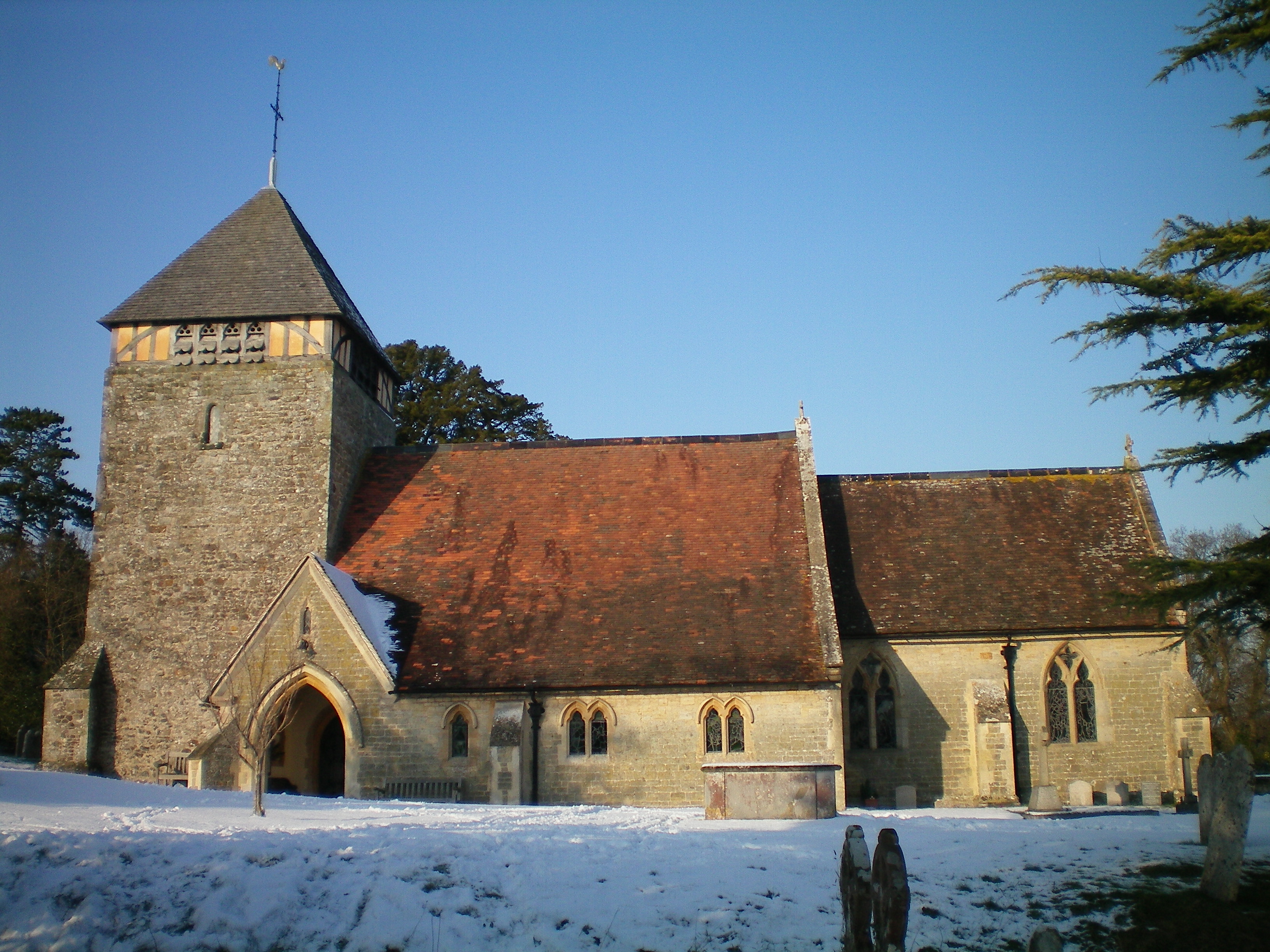
The village is best known for its historic Church of St. Botolph, which dates back to the 13th century and is recognized for its unique early medieval murals. Considered a hidden gem, these rare and well-preserved paintings depict scenes from the Bible and offer a glimpse into the religious art of the time.
Although small in size, Hardham has a strong sense of community. The village boasts a local pub, The Hardham Hare, where residents and visitors can enjoy traditional English fare and a friendly atmosphere. Additionally, a village hall provides a space for various community events, including meetings, clubs, and social gatherings.
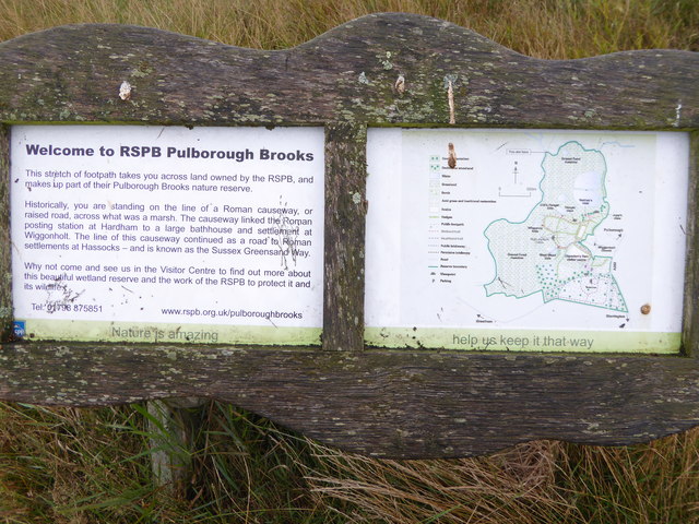
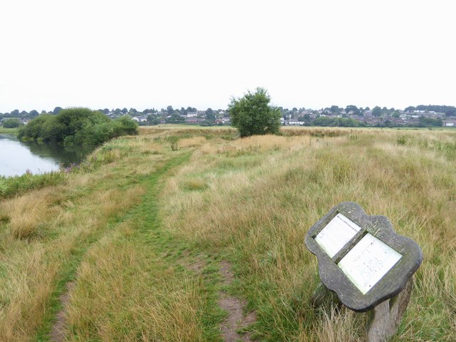
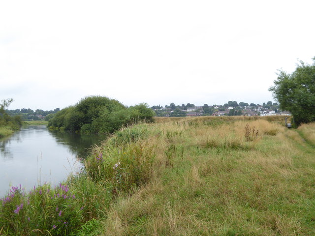
Hardham is surrounded by beautiful countryside, making it a popular destination for outdoor enthusiasts. The nearby South Downs National Park offers stunning landscapes and opportunities for hiking, cycling, and wildlife spotting. Additionally, the River Arun flows close by, providing opportunities for boating and fishing.
While there are limited amenities within the village itself, neighboring towns such as Pulborough offer a wider range of shops, services, and amenities. Hardham is well-connected to these nearby towns and cities via road and rail, making it a convenient location for those seeking a tranquil lifestyle within reach of urban facilities.
If you have any feedback on the listing, please let us know in the comments section below.
Hardham Images
Images are sourced within 2km of 50.947564/-0.525899 or Grid Reference TQ0317. Thanks to Geograph Open Source API. All images are credited.


Hardham is located at Grid Ref: TQ0317 (Lat: 50.947564, Lng: -0.525899)
Administrative County: West Sussex
District: Horsham
Police Authority: Sussex
What 3 Words
///roughest.tilting.gilding. Near Pulborough, West Sussex
Nearby Locations
Related Wikis
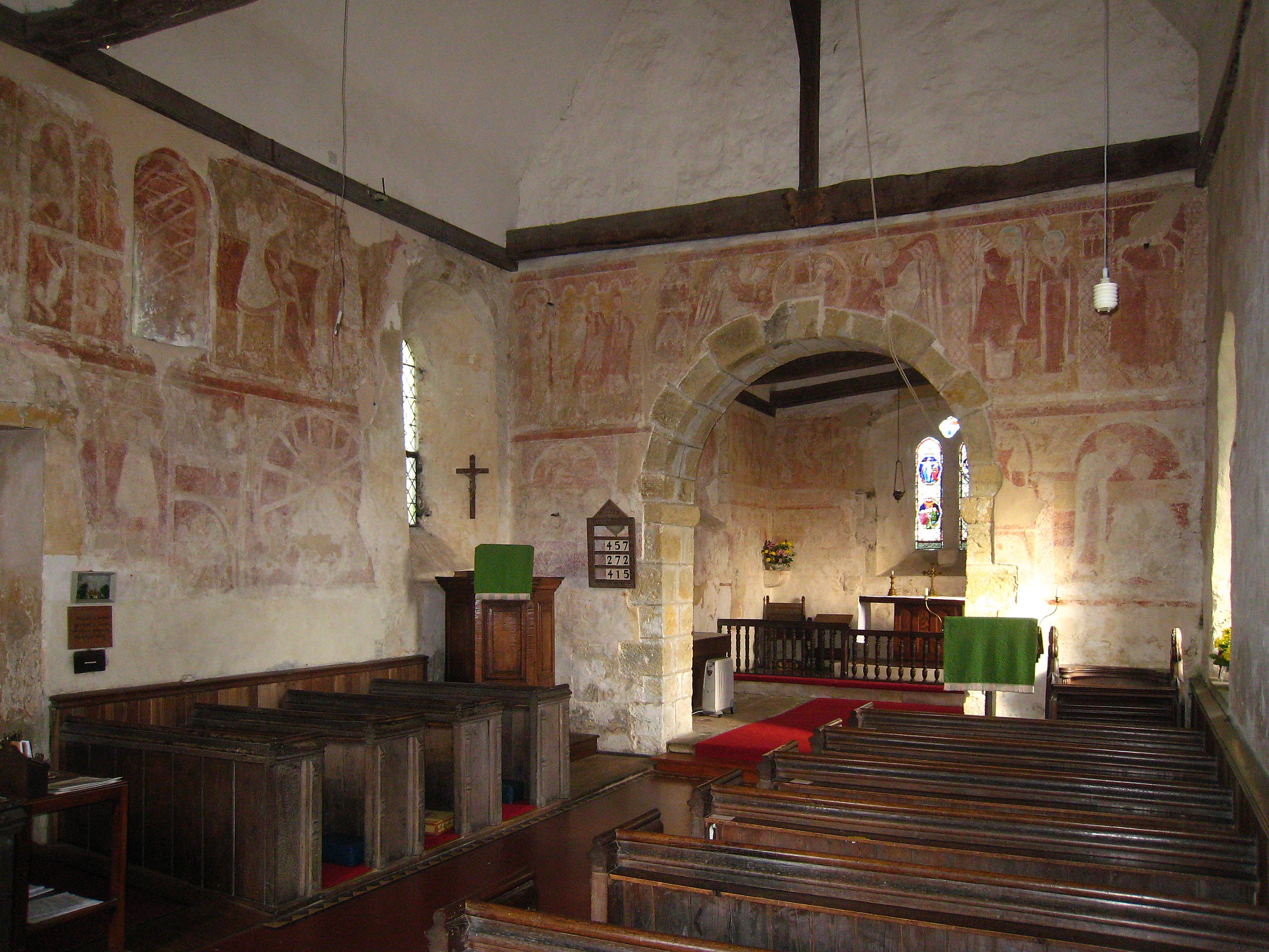
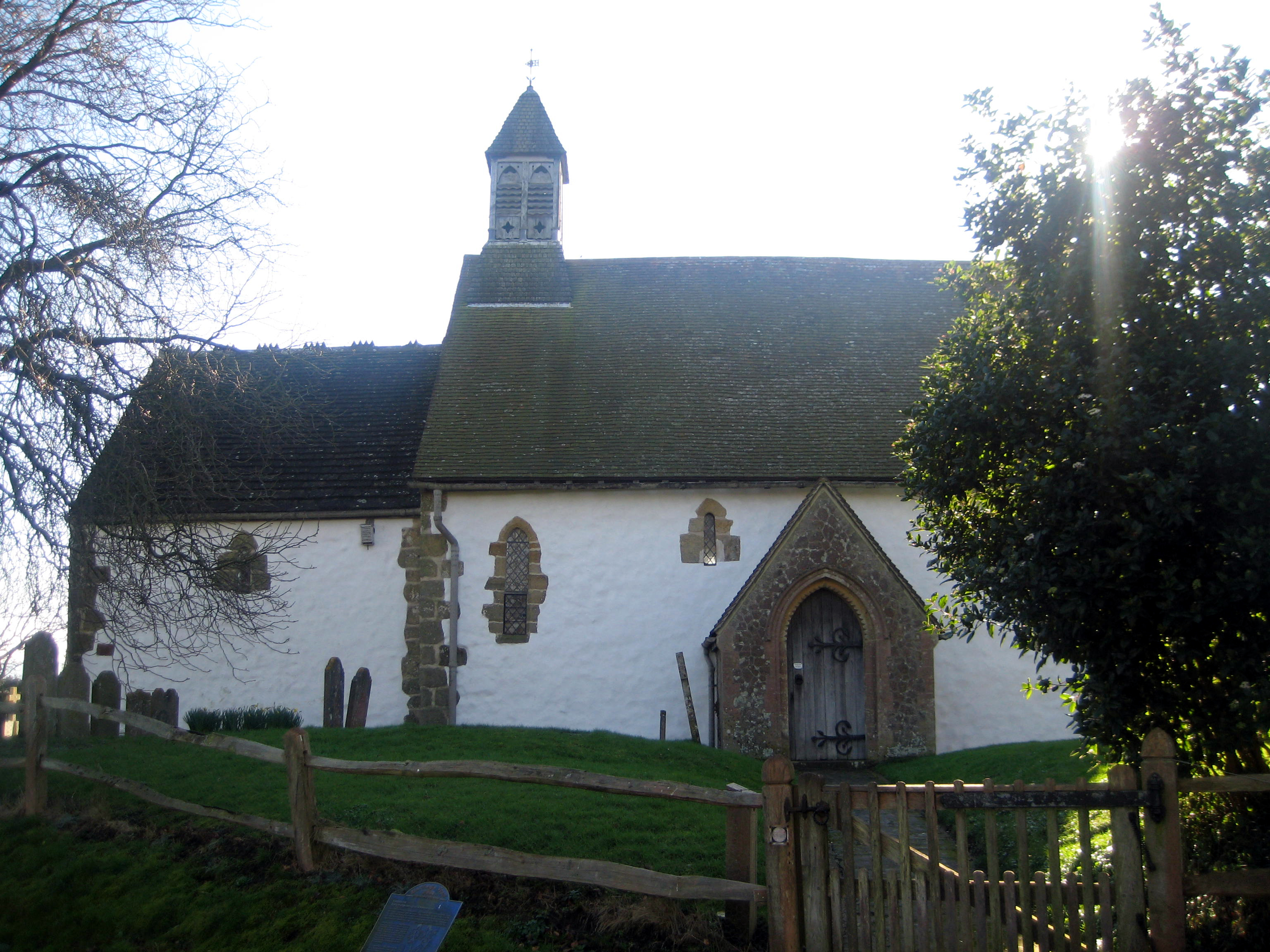
St Botolph's Church, Hardham
St Botolph's Church is the Church of England parish church of Hardham, West Sussex. It is in Horsham District and is a Grade I listed building. It contains...
Hardham
Hardham is a small village and former civil parish, now in the parish of Coldwaltham, in the Horsham district of West Sussex, England. It is on the A29...

Hardham Priory
Hardham Priory was an Augustinian priory in Hardham, West Sussex, England. It was founded around 1248 by Sir William Dawtrey as a priory of Black Canons...

River Rother, West Sussex
The River Rother flows from Empshott in Hampshire, England, to Stopham in West Sussex, where it joins the River Arun. At 52 kilometres (32 mi) long, most...

South Downs Light Railway
The South Downs Light Railway is a 10+1⁄4 in (260 mm) gauge railway at Pulborough in West Sussex, England. The line opened in 2000 (after adjusting the...
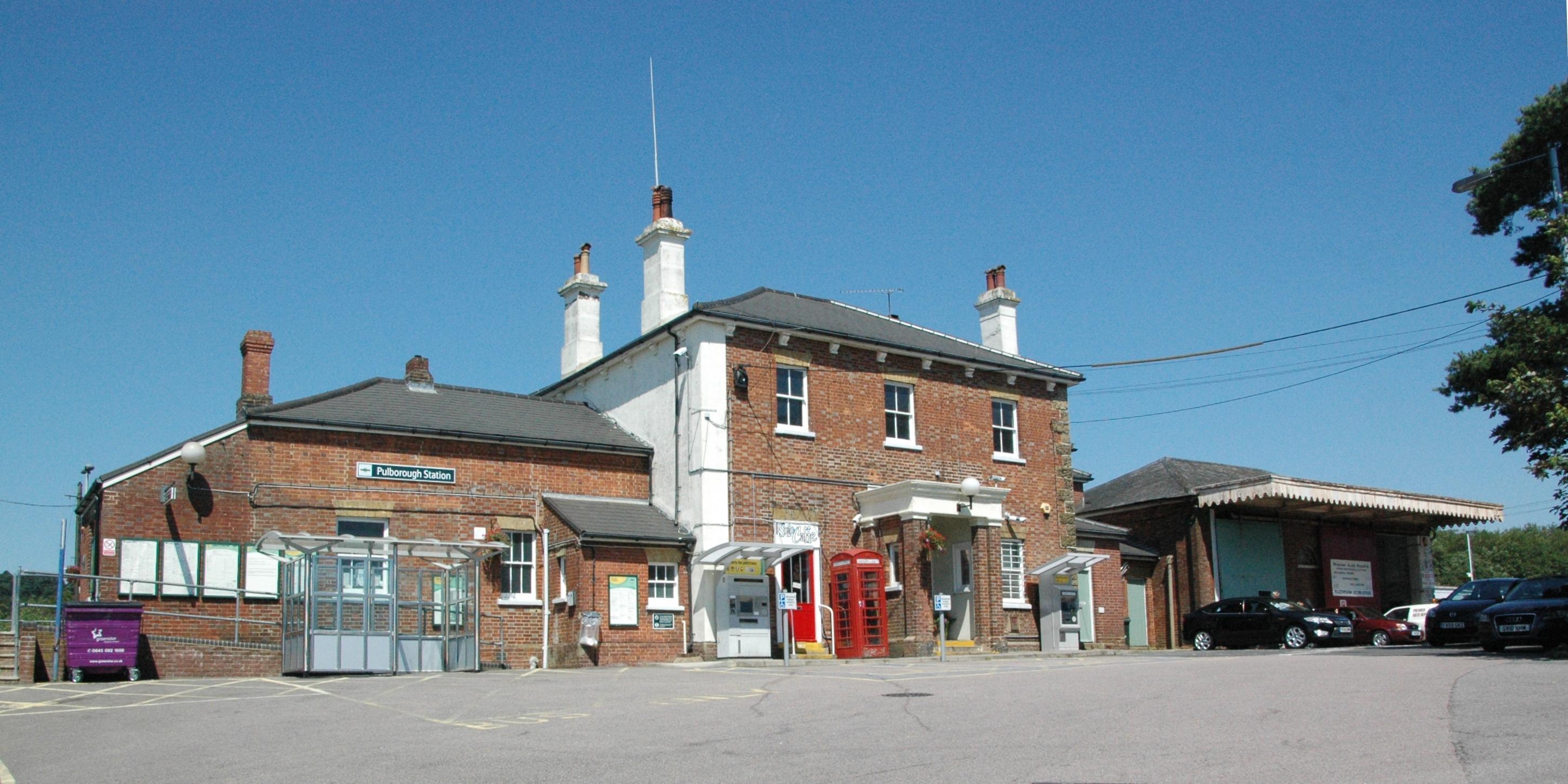
Pulborough railway station
Pulborough railway station serves the West Sussex village of Pulborough. It is at the western end of the village, just off the A283 road. It is 50 miles...

Park Farm Cutting
Park Farm Cutting is a 0.2-hectare (0.49-acre) geological Site of Special Scientific Interest west of Pulborough in West Sussex. It is a Geological Conservation...
Coldwaltham
Coldwaltham is a village and civil parish in the Horsham District of West Sussex, England. It is divided in two by the A29 road and lies 2.4 miles (3.9...
Nearby Amenities
Located within 500m of 50.947564,-0.525899Have you been to Hardham?
Leave your review of Hardham below (or comments, questions and feedback).