Chaddenwick Furze

Downs, Moorland in Wiltshire

England

Chaddenwick Furze

View from road near Mere Down Farm at harvest time
View from road near Mere Down Farm at harvest time Credit: Vieve Forward

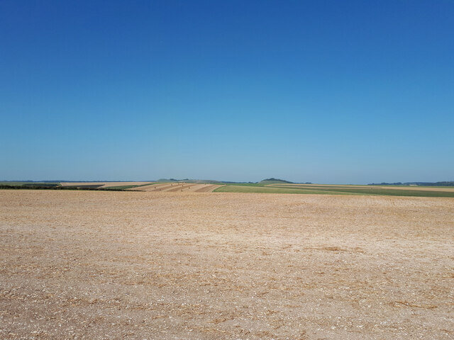
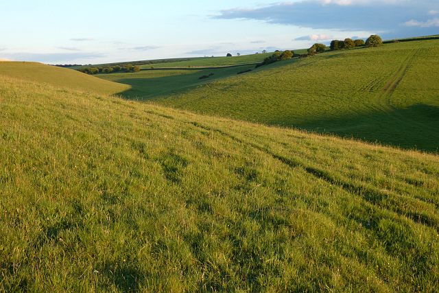
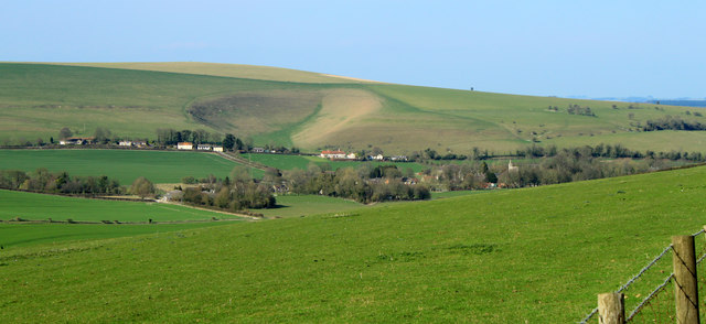
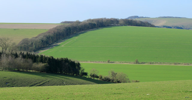
Chaddenwick Furze is a small village located in the county of Wiltshire, England. Situated on the edge of the Salisbury Plain, it is known for its picturesque landscapes and natural beauty. The village is nestled amidst rolling hills, downs, and moorland, making it an ideal destination for nature lovers and outdoor enthusiasts.

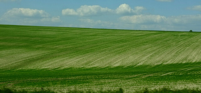
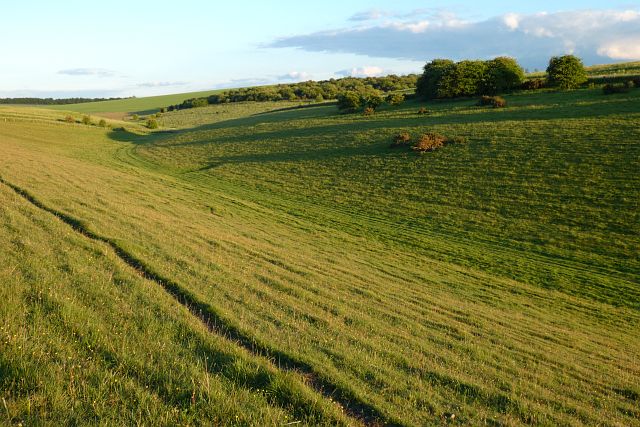
The area surrounding Chaddenwick Furze is characterized by its diverse ecosystems and abundance of wildlife. The downs offer panoramic views of the countryside, with sprawling fields and vibrant meadows stretching as far as the eye can see. Moorland areas, on the other hand, are home to heather-covered hills and scattered woodlands, creating a serene and tranquil atmosphere.

The village itself is small, with a close-knit community that prides itself on its rural charm. Traditional stone cottages line the streets, creating a quaint and idyllic setting. The local pub, The Furze Inn, is a popular gathering spot for residents and visitors alike, offering a warm and friendly atmosphere.

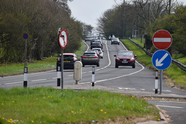
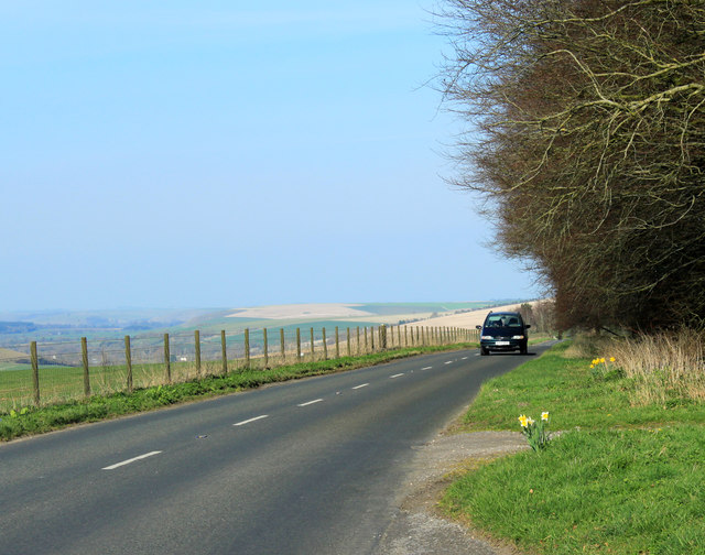
Outdoor activities are plentiful in Chaddenwick Furze. Hiking and walking trails crisscross the surrounding countryside, allowing visitors to explore the natural beauty at their own pace. The area is also ideal for birdwatching, with various species of birds making their homes in the nearby woodlands and meadows.

Chaddenwick Furze offers a peaceful escape from the hustle and bustle of city life, allowing visitors to immerse themselves in the tranquility of the countryside and experience the true essence of rural England.

If you have any feedback on the listing, please let us know in the comments section below.

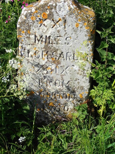
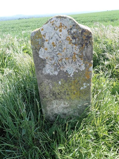
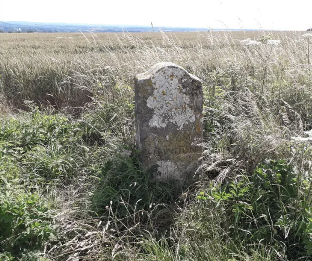
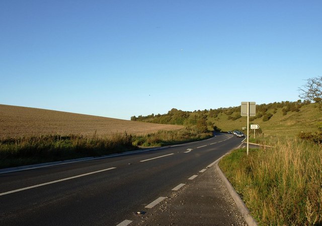
Chaddenwick Furze Images

Images are sourced within 2km of 51.107804/-2.2167792 or Grid Reference ST8434. Thanks to Geograph Open Source API. All images are credited.

View from road near Mere Down Farm at harvest time
Charnage Down Looking across a dry chalk combe from the A303.
Charnage Down
Looking across a dry chalk combe from the A303.
Chaddenwick Hill By which the A303 climbs onto the chalk.
Chaddenwick Hill
By which the A303 climbs onto the chalk.
Downland, Kingston Deverill Access land and the upper reaches of a dry valley to the west of Keysley Farm.
Downland, Kingston Deverill
Access land and the upper reaches of a dry valley to the west of Keysley Farm.
Downland, Kingston Deverill Access land with evening shadows to the west of Keysley Farm.
Downland, Kingston Deverill
Access land with evening shadows to the west of Keysley Farm.
A303 from the Willoughby Hedge lay-by Looking uphill on one of the many single carriageway sections.
A303 from the Willoughby Hedge lay-by
Looking uphill on one of the many single carriageway sections.
Willoughby Hedge Cafe Small cafe on lay-by beside the A303.
Willoughby Hedge Cafe
Small cafe on lay-by beside the A303.
Mere : Chaddenwick Hill A303 Looking along Chaddenwick Hill.
Mere : Chaddenwick Hill A303
Looking along Chaddenwick Hill.
Old Milestone by the track on Mere Down, north of Mere Carved stone post by the UC road, in parish of MERE (SALISBURY District), Mere Down; 500m East of large house and junction with B3095, against fence, on North side of track. Wilton Ox-drove stone, erected by an unknown authority in the 18th century. 

Inscription reads:-
XXI
MILES
FROM SARUM
XCIX
FROM
LONDON
1750 

Grade II listed. List Entry Number: 1300867
<span class="nowrap"><a title="https://historicengland.org.uk/listing/the-list/list-entry/1300867" rel="nofollow ugc noopener" href="https://historicengland.org.uk/listing/the-list/list-entry/1300867">Link</a><img style="margin-left:2px;" alt="External link" title="External link - shift click to open in new window" src="https://s1.geograph.org.uk/img/external.png" width="10" height="10"/></span>

Milestone Society National ID: WI_SAOD21.
Old Milestone by the track on Mere Down, north of Mere
Carved stone post by the UC road, in parish of MERE (SALISBURY District), Mere Down; 500m East of large house and junction with B3095, against fence, on North side of track. Wilton Ox-drove stone, erected by an unknown authority in the 18th century. Inscription reads:- XXI MILES FROM SARUM XCIX FROM LONDON 1750 Grade II listed. List Entry Number: 1300867 LinkExternal link Milestone Society National ID: WI_SAOD21.
Old Milestone on Charnage Down Carved stone post by the UC road, in parish of Mere (Salisbury District), Mere, Chaddenwick Furze; 900m North West of junction with the A303, on field edge, on South side of road. Wilton Ox-drove stone, erected by an unknown authority in the 18th century. 

Inscription reads:-
XX
MILES FROM
SARUM
XCVIII
FROM
LONDON
1750 

Grade II listed.
List Entry Number:1199935 <span class="nowrap"><a title="https://historicengland.org.uk/listing/the-list/list-entry/1199935" rel="nofollow ugc noopener" href="https://historicengland.org.uk/listing/the-list/list-entry/1199935">Link</a><img style="margin-left:2px;" alt="External link" title="External link - shift click to open in new window" src="https://s1.geograph.org.uk/img/external.png" width="10" height="10"/></span>

Milestone Society National ID: WI_SAOD20
Old Milestone on Charnage Down
Carved stone post by the UC road, in parish of Mere (Salisbury District), Mere, Chaddenwick Furze; 900m North West of junction with the A303, on field edge, on South side of road. Wilton Ox-drove stone, erected by an unknown authority in the 18th century. Inscription reads:- XX MILES FROM SARUM XCVIII FROM LONDON 1750 Grade II listed. List Entry Number:1199935 LinkExternal link Milestone Society National ID: WI_SAOD20
The A303 at the foot of Chaddenwick Hill
2012 : Golden daffodils by the B3095 Not a host, perhaps, but a delight to the eye for all that.
Beyond the daffs we look across Danes Bottom to Long Knoll <a href="https://www.geograph.org.uk/gridref/ST7837">ST7837</a> faint but proud on the horizon.
2012 : Golden daffodils by the B3095
Not a host, perhaps, but a delight to the eye for all that. Beyond the daffs we look across Danes Bottom to Long Knoll ST7837 faint but proud on the horizon.
2012 : North from the B3095 over Dane's Bottom The lower slopes of King's Hill to the right, Kingston Dairy, partly hidden by trees to the left is at the junction of Dane's Bottom and the Wylye Valley. Kingston Deverill, likewise partly hidden, stretches across the frame.
The row of buildings standing proud further over is the hamlet of Whitepits. Whitepits Down rises above with a coombe which I have called Whitepits Bottom because it does not seem to have any other name.
The top of Cold Kitchen Hill is in the distance.
2012 : North from the B3095 over Dane's Bottom
The lower slopes of King's Hill to the right, Kingston Dairy, partly hidden by trees to the left is at the junction of Dane's Bottom and the Wylye Valley. Kingston Deverill, likewise partly hidden, stretches across the frame. The row of buildings standing proud further over is the hamlet of Whitepits. Whitepits Down rises above with a coombe which I have called Whitepits Bottom because it does not seem to have any other name. The top of Cold Kitchen Hill is in the distance.
2012 : B3095 passing Dee Barn on King's Hill About a mile to Kingston Deverill and Monkton Deverill and nearly three to Brixton Deverill.
The B3095 drops into the Wylye Valley here which it follows to Longbridge Deverill where it joins the A350.
The straw coloured area in the distance to the right is Cow Down.
2012 : B3095 passing Dee Barn on King's Hill
About a mile to Kingston Deverill and Monkton Deverill and nearly three to Brixton Deverill. The B3095 drops into the Wylye Valley here which it follows to Longbridge Deverill where it joins the A350. The straw coloured area in the distance to the right is Cow Down.
2012 : B3095 passing Dee Plantation heading south west Nearly three miles to Mere, crossing the A303 when it gets there.
2012 : B3095 passing Dee Plantation heading south west
Nearly three miles to Mere, crossing the A303 when it gets there.
2012 : West of north from the B3095 near Dee Barn Looking across Dane's Bottom to Court Hill and Court Hill Plantation.
Bidcombe Down is in the distance on the other side of the upper Wylye Valley.
2012 : West of north from the B3095 near Dee Barn
Looking across Dane's Bottom to Court Hill and Court Hill Plantation. Bidcombe Down is in the distance on the other side of the upper Wylye Valley.
2012 : B3095 heading north east toward Kingston Deverill To the left the valley descends into Dane's Bottom, daffodils and a small plantation to the right.
The road follows the western flank of King's Hill, down to Kingston Deverill and Monkton Deverill.
Cow Down is almost lost in the haze centre horizon.
2012 : B3095 heading north east toward Kingston Deverill
To the left the valley descends into Dane's Bottom, daffodils and a small plantation to the right. The road follows the western flank of King's Hill, down to Kingston Deverill and Monkton Deverill. Cow Down is almost lost in the haze centre horizon.
Show me another place!

Chaddenwick Furze is located at Grid Ref: ST8434 (Lat: 51.107804, Lng: -2.2167792)

Unitary Authority: Wiltshire

Police Authority: Wiltshire

What 3 Words

///ladders.hourglass.suitably. Near Mere, Wiltshire

Nearby Locations

Chaddenwick Furze

Related Wikis

Charnage Down Chalk Pit

Charnage Down Chalk Pit (grid reference ST837329) is a 3.7 hectare geological Site of Special Scientific Interest in Wiltshire, England, lying east of...

West Knoyle

West Knoyle is a small village and civil parish in southwest Wiltshire, England, close to the southern edge of Salisbury Plain. The village is about 2...

Hang Wood

Hang Wood (grid reference ST861319) is a 20.3 hectare biological Site of Special Scientific Interest in Wiltshire, notified in 1986. == Sources == Natural...

Kingston Deverill

Kingston Deverill is a village and civil parish in Wiltshire, England. Its nearest towns are Mere, about 3+1⁄2 miles (6 km) to the southwest, and Warminster...

Monkton Deverill

Monkton Deverill (anciently known as East Monkton) is a village and former civil parish, now in the parish of Kingston Deverill, in Wiltshire, England...

Pertwood

Pertwood is an ancient settlement and former civil parish, near Warminster in the county of Wiltshire in the west of England. Its land and houses now lie...

Barrow Street, Wiltshire

Barrow Street is a hamlet in Wiltshire, England, about 1.9 miles (3.1 km) southeast of the town of Mere. The name comes from the early Bronze Age bowl...

Mere, Wiltshire

Mere is a market town and civil parish in Wiltshire, England. It lies at the extreme southwestern tip of Salisbury Plain, close to the borders of Somerset...

Have you been to Chaddenwick Furze?

Leave your review of Chaddenwick Furze below (or comments, questions and feedback).