South Down

Downs, Moorland in Wiltshire

England

South Down

View from road near Mere Down Farm at harvest time
View from road near Mere Down Farm at harvest time Credit: Vieve Forward

South Down is a region located in the county of Wiltshire, England. It is characterized by its stunning landscapes, which predominantly consist of rolling downs and vast moorland. The area is known for its natural beauty and is a popular destination for outdoor enthusiasts and nature lovers.

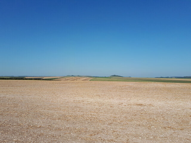
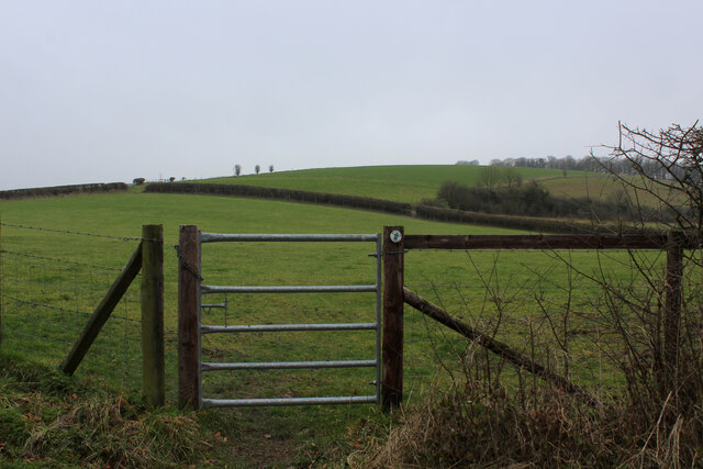
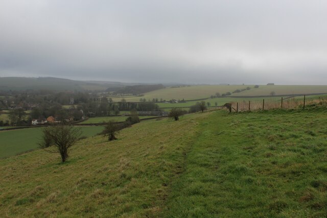
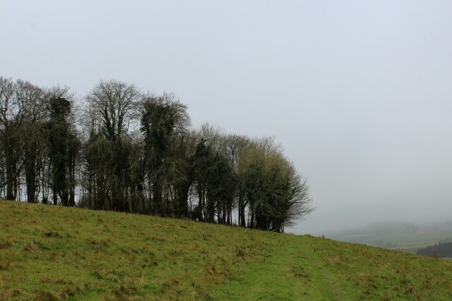
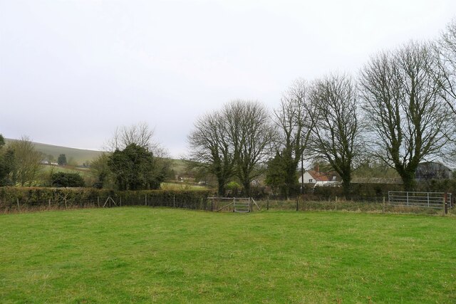
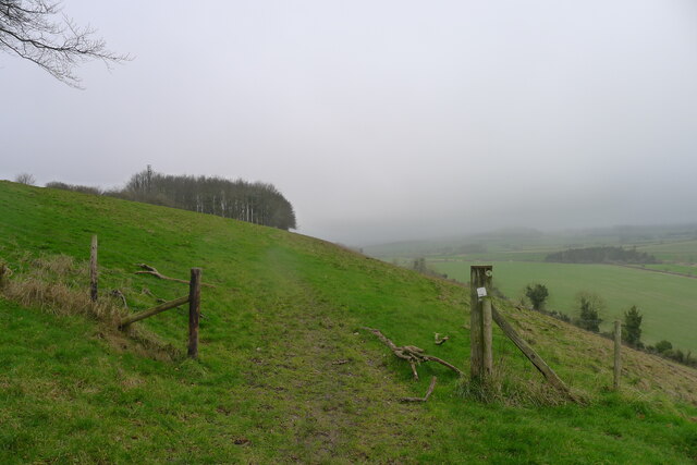
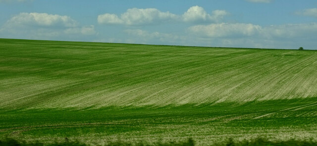
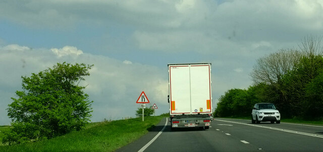
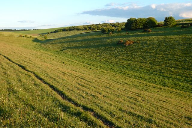
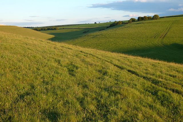
The downs in South Down are a distinctive feature of the region, comprising large areas of gently sloping hills covered in a patchwork of fields and meadows. These downs are rich in wildlife, with an abundance of flora and fauna. The undulating terrain offers breathtaking views of the surrounding countryside and is ideal for activities such as hiking, walking, and cycling.

In addition to the downs, South Down is home to extensive moorland, which adds to the area's unique charm. The moors are characterized by their rugged and wild landscapes, consisting of heather-covered hills, bogs, and marshes. This diverse habitat supports a variety of wildlife, including rare bird species and small mammals.

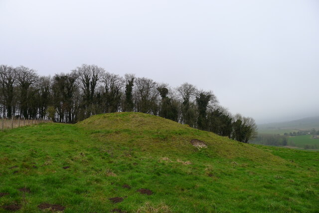
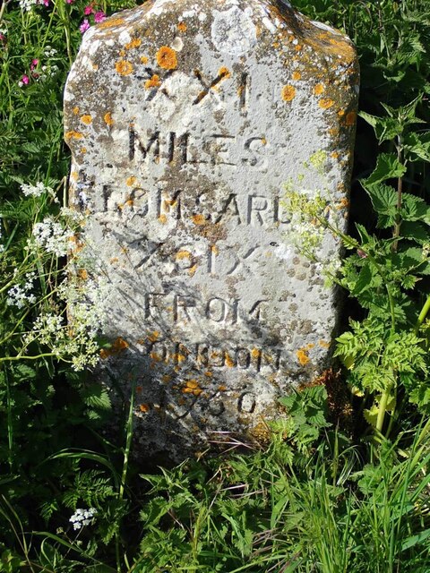
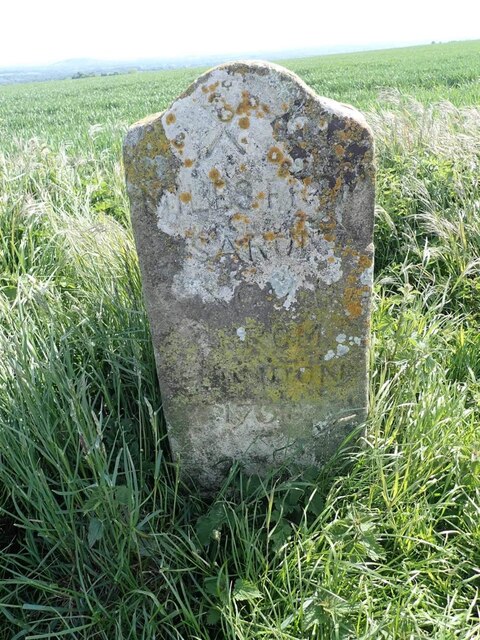
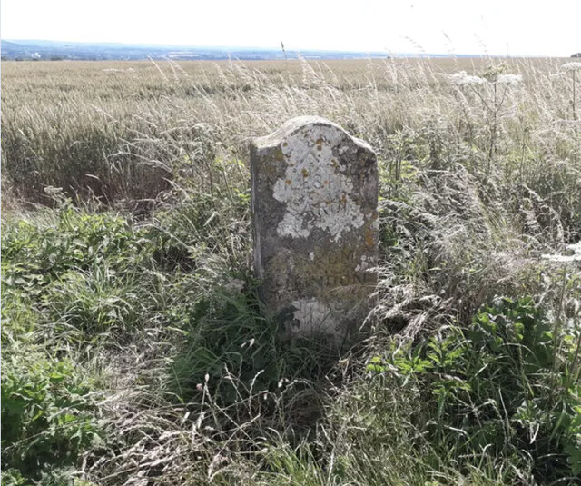
South Down is also known for its historic sites and cultural heritage. The region is dotted with ancient landmarks, such as burial mounds, stone circles, and hill forts, which provide insight into its rich history. Visitors can explore these sites and learn about the area's past through guided tours or self-guided walks.

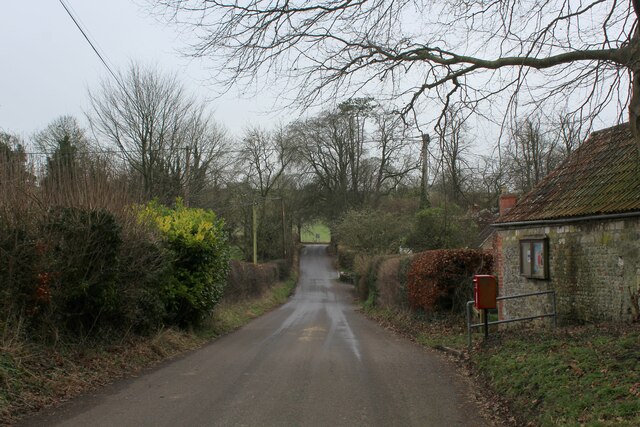
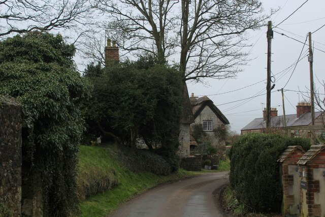
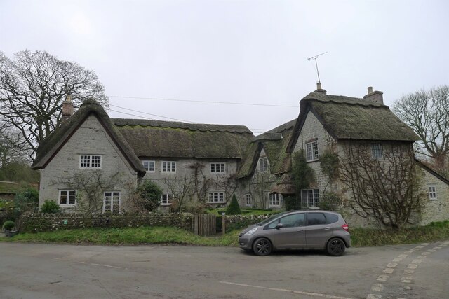
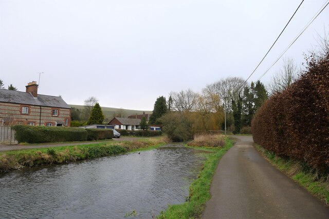
In terms of amenities, South Down offers a range of accommodation options, including cozy bed and breakfasts, self-catering cottages, and campsites. There are also several quaint villages and towns nearby, where visitors can find shops, restaurants, and pubs.

Overall, South Down, Wiltshire is a captivating region that showcases the beauty of the English countryside, with its downs and moorland, and offers a wealth of outdoor activities and historical attractions for visitors to enjoy.

If you have any feedback on the listing, please let us know in the comments section below.

South Down Images

Images are sourced within 2km of 51.116781/-2.224879 or Grid Reference ST8435. Thanks to Geograph Open Source API. All images are credited.

View from road near Mere Down Farm at harvest time
Heading towards the B3095 in Kingston Deverill Quiet lane in the village of Kingston Deverill adopted by the Mid Wilts Way long distance footpath
Heading towards the B3095 in Kingston Deverill
Quiet lane in the village of Kingston Deverill adopted by the Mid Wilts Way long distance footpath
Kingston Deverill Small ancient village in the Wylye Valley
Kingston Deverill
Small ancient village in the Wylye Valley
Footpath leading up to Court Hill Through the gate, the undefined footpath leads diagonally through the pasture to reach the flanks of Court Hill.
Footpath leading up to Court Hill
Through the gate, the undefined footpath leads diagonally through the pasture to reach the flanks of Court Hill.
Mid Wilts Way on Court Hill The long distance footpath descending towards Kingston Deverill
Mid Wilts Way on Court Hill
The long distance footpath descending towards Kingston Deverill
Approaching Court Hill Plantation Mid Wilts Way long distance footpath on Court Hill
Approaching Court Hill Plantation
Mid Wilts Way long distance footpath on Court Hill
36 and 38 Kingston Deverill Listed Grade II, 17th century semi-detached cottages <span class="nowrap"><a title="https://historicengland.org.uk/listing/the-list/list-entry/1036399?section=official-listing" rel="nofollow ugc noopener" href="https://historicengland.org.uk/listing/the-list/list-entry/1036399?section=official-listing">Link</a><img style="margin-left:2px;" alt="External link" title="External link - shift click to open in new window" src="https://s1.geograph.org.uk/img/external.png" width="10" height="10"/></span>
36 and 38 Kingston Deverill
Listed Grade II, 17th century semi-detached cottages LinkExternal link
The River Wylye through Kingston Deverill
The Mid Wilts Way entering Kingston Deverill Onto the narrow flood plain of the River Wylye after leaving Court Hill
The Mid Wilts Way entering Kingston Deverill
Onto the narrow flood plain of the River Wylye after leaving Court Hill
Tumulus on Court Hill The tumulus is on the flank of the hill, rather than its ridge. But <a href="https://www.geograph.org.uk/photo/140085">ST8337 : Wylye Valley farmland</a> shows that it is nevertheless visible from some distance
Tumulus on Court Hill
The tumulus is on the flank of the hill, rather than its ridge. But ST8337 : Wylye Valley farmland shows that it is nevertheless visible from some distance
The Mid Wilts Way on Court Hill Leading towards the small copse of Peter's Penning
The Mid Wilts Way on Court Hill
Leading towards the small copse of Peter's Penning
Charnage Down Looking across a dry chalk combe from the A303.
Charnage Down
Looking across a dry chalk combe from the A303.
Chaddenwick Hill By which the A303 climbs onto the chalk.
Chaddenwick Hill
By which the A303 climbs onto the chalk.
Downland, Kingston Deverill Access land and the upper reaches of a dry valley to the west of Keysley Farm.
Downland, Kingston Deverill
Access land and the upper reaches of a dry valley to the west of Keysley Farm.
Downland, Kingston Deverill Access land with evening shadows to the west of Keysley Farm.
Downland, Kingston Deverill
Access land with evening shadows to the west of Keysley Farm.
Old Milestone by the track on Mere Down, north of Mere Carved stone post by the UC road, in parish of MERE (SALISBURY District), Mere Down; 500m East of large house and junction with B3095, against fence, on North side of track. Wilton Ox-drove stone, erected by an unknown authority in the 18th century. 

Inscription reads:-
XXI
MILES
FROM SARUM
XCIX
FROM
LONDON
1750 

Grade II listed. List Entry Number: 1300867
<span class="nowrap"><a title="https://historicengland.org.uk/listing/the-list/list-entry/1300867" rel="nofollow ugc noopener" href="https://historicengland.org.uk/listing/the-list/list-entry/1300867">Link</a><img style="margin-left:2px;" alt="External link" title="External link - shift click to open in new window" src="https://s1.geograph.org.uk/img/external.png" width="10" height="10"/></span>

Milestone Society National ID: WI_SAOD21.
Old Milestone by the track on Mere Down, north of Mere
Carved stone post by the UC road, in parish of MERE (SALISBURY District), Mere Down; 500m East of large house and junction with B3095, against fence, on North side of track. Wilton Ox-drove stone, erected by an unknown authority in the 18th century. Inscription reads:- XXI MILES FROM SARUM XCIX FROM LONDON 1750 Grade II listed. List Entry Number: 1300867 LinkExternal link Milestone Society National ID: WI_SAOD21.
Old Milestone on Charnage Down Carved stone post by the UC road, in parish of Mere (Salisbury District), Mere, Chaddenwick Furze; 900m North West of junction with the A303, on field edge, on South side of road. Wilton Ox-drove stone, erected by an unknown authority in the 18th century. 

Inscription reads:-
XX
MILES FROM
SARUM
XCVIII
FROM
LONDON
1750 

Grade II listed.
List Entry Number:1199935 <span class="nowrap"><a title="https://historicengland.org.uk/listing/the-list/list-entry/1199935" rel="nofollow ugc noopener" href="https://historicengland.org.uk/listing/the-list/list-entry/1199935">Link</a><img style="margin-left:2px;" alt="External link" title="External link - shift click to open in new window" src="https://s1.geograph.org.uk/img/external.png" width="10" height="10"/></span>

Milestone Society National ID: WI_SAOD20
Old Milestone on Charnage Down
Carved stone post by the UC road, in parish of Mere (Salisbury District), Mere, Chaddenwick Furze; 900m North West of junction with the A303, on field edge, on South side of road. Wilton Ox-drove stone, erected by an unknown authority in the 18th century. Inscription reads:- XX MILES FROM SARUM XCVIII FROM LONDON 1750 Grade II listed. List Entry Number:1199935 LinkExternal link Milestone Society National ID: WI_SAOD20
Show me another place!

South Down is located at Grid Ref: ST8435 (Lat: 51.116781, Lng: -2.224879)

Unitary Authority: Wiltshire

Police Authority: Wiltshire

What 3 Words

///entertainer.dustbin.century. Near Mere, Wiltshire

Nearby Locations

South Down Dee Plantation

Related Wikis

Kingston Deverill

Kingston Deverill is a village and civil parish in Wiltshire, England. Its nearest towns are Mere, about 3+1⁄2 miles (6 km) to the southwest, and Warminster...

Monkton Deverill

Monkton Deverill (anciently known as East Monkton) is a village and former civil parish, now in the parish of Kingston Deverill, in Wiltshire, England...

Charnage Down Chalk Pit

Charnage Down Chalk Pit (grid reference ST837329) is a 3.7 hectare geological Site of Special Scientific Interest in Wiltshire, England, lying east of...

West Knoyle

West Knoyle is a small village and civil parish in southwest Wiltshire, England, close to the southern edge of Salisbury Plain. The village is about 2...

Have you been to South Down?

Leave your review of South Down below (or comments, questions and feedback).