Stainmore Common

Downs, Moorland in Westmorland Eden

England

Stainmore Common

Lime kiln, Windmore End Quarry
Lime kiln, Windmore End Quarry Credit: Karl and Ali

Stainmore Common, located in Westmorland, England, is a vast expanse of land characterized by its stunning natural beauty and diverse ecosystem. Stretching across the boundaries of County Durham and Cumbria, this upland area is part of the Pennines and forms a significant portion of the Northern Pennine Moors.

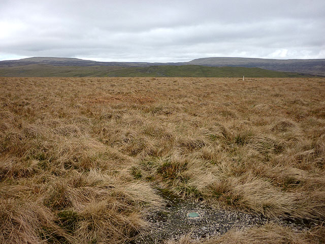
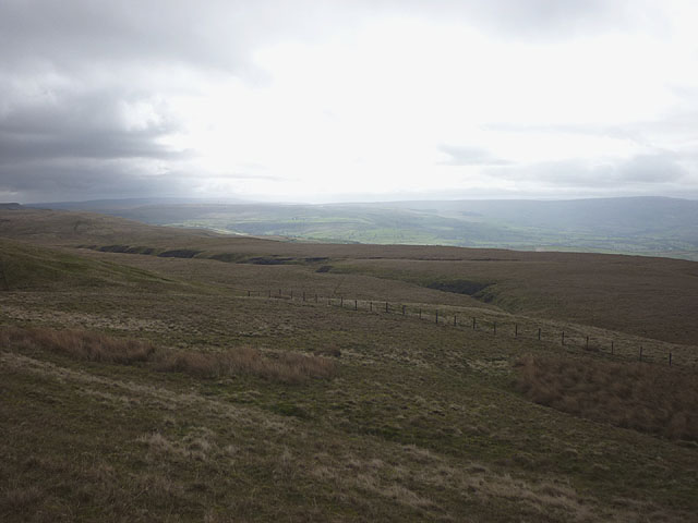
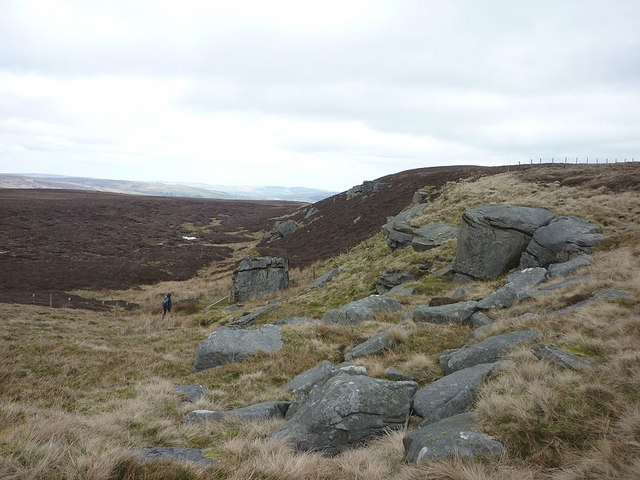
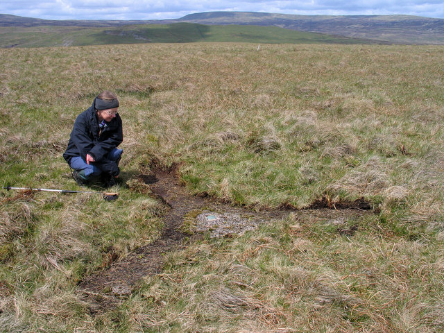
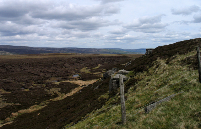
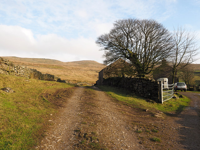
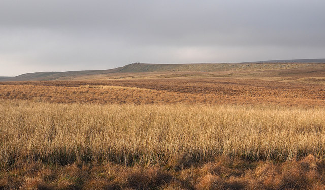
The landscape of Stainmore Common is predominantly composed of rolling hills, open moorland, and heather-clad uplands. The area is renowned for its panoramic views, with the peaks of Cross Fell and Great Dun Fell dominating the horizon. The common is crisscrossed by numerous footpaths and bridleways, making it a popular destination for hikers, cyclists, and horse riders.

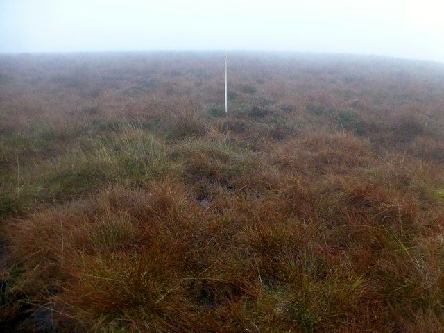
The vegetation on Stainmore Common is varied, ranging from heather and bracken to grasses and scattered woodland. This diversity supports a rich array of wildlife, including red grouse, curlews, golden plovers, and various species of birds of prey. The area is also home to several rare plant species, making it a site of botanical importance.

Stainmore Common has a rich cultural heritage, with evidence of human settlement dating back to prehistoric times. The remains of ancient settlements, cairns, and stone circles can still be found scattered across the common, providing fascinating insights into the area's past.

Throughout history, Stainmore Common has been an important transportation route, with ancient trackways and Roman roads traversing the landscape. Today, the A66 road cuts through the common, connecting the towns of Brough and Bowes.

Stainmore Common offers visitors a chance to immerse themselves in the unspoiled beauty of the Pennines, providing a haven for nature enthusiasts, history lovers, and those seeking a peaceful retreat in the heart of Westmorland.

If you have any feedback on the listing, please let us know in the comments section below.

Stainmore Common Images

Images are sourced within 2km of 54.547783/-2.2434597 or Grid Reference NY8416. Thanks to Geograph Open Source API. All images are credited.

Lime kiln, Windmore End Quarry
The curry stool trig mark on Iron Band We haven't seen one of these type of trig marks before but the OS say it's at 561.746m asl which is not the highest point on the hill (563m a little to the east). To the north west is Ley Seat (where we are heading later), overtopped by Little Fell (left) and Mickle Fell. The white stick is a marker for a grit tray for the grouse (it helps them digest their heather diet).
The curry stool trig mark on Iron Band
We haven't seen one of these type of trig marks before but the OS say it's at 561.746m asl which is not the highest point on the hill (563m a little to the east). To the north west is Ley Seat (where we are heading later), overtopped by Little Fell (left) and Mickle Fell. The white stick is a marker for a grit tray for the grouse (it helps them digest their heather diet).
Moorland, Mickle Gill
Dow Crag A collection of gritstone boulders and outcrops possibly less impressive than its Lakeland namesake? The fence is the county boundary (Durham beyond, Cumbria this side)
Dow Crag
A collection of gritstone boulders and outcrops possibly less impressive than its Lakeland namesake? The fence is the county boundary (Durham beyond, Cumbria this side)
The central part of Windmore End Quarry Only about half the height of the rock face can be seen from here due to the grassy bank in front.
The central part of Windmore End Quarry
Only about half the height of the rock face can be seen from here due to the grassy bank in front.
Curry stool at Iron Band Iron Band is a moorland high point south-east of the B6276; it crosses the Pennine watershed between Brough and Teesdale.
A Curry stool is an OS feature named so after Corporal Curry of the Royal Engineers. The structure is made from concrete and is in the form of three arms meeting at a centre at angles of 120 degrees. Lying as they do at ground level Curry stools tend to become overgrown and concealed, at least in part as is this example - peat and vegetation were scuffed away by boots to reveal the feature as it was meant to be seen! Nine Curry Stools are known in the UK. and three of them are in the North Pennines; the two other Pennine examples are nearby on Herdship Fell and on Bink Moss.
Mickle Fell can be seen distantly to the north.
Curry stool at Iron Band
Iron Band is a moorland high point south-east of the B6276; it crosses the Pennine watershed between Brough and Teesdale. A Curry stool is an OS feature named so after Corporal Curry of the Royal Engineers. The structure is made from concrete and is in the form of three arms meeting at a centre at angles of 120 degrees. Lying as they do at ground level Curry stools tend to become overgrown and concealed, at least in part as is this example - peat and vegetation were scuffed away by boots to reveal the feature as it was meant to be seen! Nine Curry Stools are known in the UK. and three of them are in the North Pennines; the two other Pennine examples are nearby on Herdship Fell and on Bink Moss. Mickle Fell can be seen distantly to the north.
Dow Crag from county boundary The outcropping rocks of Dow Crag are seen from the fence line which marks the Cumbria/County Durham boundary. To the right of the central fence post can be seen a recumbent boundary stone, one of a line of many such stones that marked originally (here at least) the Westmorland/Yorkshire county boundary. The stones were all numbered, the one in view is number 34.
Dow Crag from county boundary
The outcropping rocks of Dow Crag are seen from the fence line which marks the Cumbria/County Durham boundary. To the right of the central fence post can be seen a recumbent boundary stone, one of a line of many such stones that marked originally (here at least) the Westmorland/Yorkshire county boundary. The stones were all numbered, the one in view is number 34.
Plucka Tarn
Plucka Tarn
Borrowdale House Borrowdale House lies among fields to the north of North Stainmore.
Borrowdale House
Borrowdale House lies among fields to the north of North Stainmore.
Farm at Spurrigg End The farmland at Spurrigg End must surely be considered 'marginal' - OS mapping at 1:25 000 shows that the farm and its immediate environs are surrounded by access land and the altitude of the altitude of the buildings is well above 300 metres.
Farm at Spurrigg End
The farmland at Spurrigg End must surely be considered 'marginal' - OS mapping at 1:25 000 shows that the farm and its immediate environs are surrounded by access land and the altitude of the altitude of the buildings is well above 300 metres.
Road passing house at Long Crag The estate and farm road passes Long Crag on the way to the desolate moorland of  Stainmore Common. The house was surely once a farmhouse and perhaps it still is though there's no feeling of being close to a working farm when passing there.
Road passing house at Long Crag
The estate and farm road passes Long Crag on the way to the desolate moorland of Stainmore Common. The house was surely once a farmhouse and perhaps it still is though there's no feeling of being close to a working farm when passing there.
Moorland descending towards Powbrand Sike The grassy moorland in the foreground declines gradually towards the farmland at the buildings of Long Crag; the groove there is Powbrand Sike.
Moorland descending towards Powbrand Sike
The grassy moorland in the foreground declines gradually towards the farmland at the buildings of Long Crag; the groove there is Powbrand Sike.
Moorland of Stainmore Common Stainmore Common is an area of moorland north of the A66. The view here is from an estate road which is heading towards a shooting hut. Presently, OS mapping doesn't show the road which follows the route of a bridleway from North Stainmore but by the time this location is reached that route has been left some way to the south.
Moorland of Stainmore Common
Stainmore Common is an area of moorland north of the A66. The view here is from an estate road which is heading towards a shooting hut. Presently, OS mapping doesn't show the road which follows the route of a bridleway from North Stainmore but by the time this location is reached that route has been left some way to the south.
Shooting hut and sheepfold on Stainmore Common OS mapping currently shows neither the shooting hut nor the road approaching it; the sheepfold is marked. The hut has three rooms, one of which is at the rear and is a relatively crude attachment of metal panels; that room and the left side one in the image are unlocked. On a shoot, those rooms will doubtless be used by grouse beaters. The right side door is secured and the room is surely for the use of the guns.
Shooting hut and sheepfold on Stainmore Common
OS mapping currently shows neither the shooting hut nor the road approaching it; the sheepfold is marked. The hut has three rooms, one of which is at the rear and is a relatively crude attachment of metal panels; that room and the left side one in the image are unlocked. On a shoot, those rooms will doubtless be used by grouse beaters. The right side door is secured and the room is surely for the use of the guns.
Wall descending from west end of Millstone Band The wall descends from a wall corner at the west end of Millstone Band on Stainmore Common which is an area of desolate moorland to the north of the A66. Millstone Band itself is a minor feature being a steepening of a slope with insignificant amounts of rock protruding; some fallen rock can be seen at the bottom of the image.
Wall descending from west end of Millstone Band
The wall descends from a wall corner at the west end of Millstone Band on Stainmore Common which is an area of desolate moorland to the north of the A66. Millstone Band itself is a minor feature being a steepening of a slope with insignificant amounts of rock protruding; some fallen rock can be seen at the bottom of the image.
Iron Band Bagging the curry stool and the summit from the B road wearing my wellies.
Name: Iron Band
Hill number: 3588
Height: 563m / 1847ft
Parent (Ma/M): 2711  Mickle Fell
Section: 35A: The Northern Pennines
Area: North Pennines - Western Fells
County/UA: Cumbria (CoU)
Class: Dewey
Grid ref: NY 83736 18802
Summit feature: no feature
Drop: 80m
Col: 483m  NY828197
Iron Band
Bagging the curry stool and the summit from the B road wearing my wellies. Name: Iron Band Hill number: 3588 Height: 563m / 1847ft Parent (Ma/M): 2711 Mickle Fell Section: 35A: The Northern Pennines Area: North Pennines - Western Fells County/UA: Cumbria (CoU) Class: Dewey Grid ref: NY 83736 18802 Summit feature: no feature Drop: 80m Col: 483m NY828197
Iron Band Curry Stool Bagging the curry stool and the summit from the B road near Deadman Gill Bridge. Walked in my wellies which kept my socks dry.
A curry stool is a type of survey mark used in peaty areas where a pillar would sink and natural rock was not available. The concrete, in the form of three arms meeting at a central point, sits on the peat and it was hoped to be a stable platform. They are named after Corporal Curry of the Royal Engineers.
Iron Band Curry Stool
Bagging the curry stool and the summit from the B road near Deadman Gill Bridge. Walked in my wellies which kept my socks dry. A curry stool is a type of survey mark used in peaty areas where a pillar would sink and natural rock was not available. The concrete, in the form of three arms meeting at a central point, sits on the peat and it was hoped to be a stable platform. They are named after Corporal Curry of the Royal Engineers.
Old Boundary Marker on Stainmore Common Estate Boundary Marker beside a wire fence on Stainmore Common 1380 metres southeast of the B6276 towards Pind Hill. Inscribed 36. On the boundary of Stainmore parish, Westmorland, now Cumbria, and Lunedale parish, North Riding, now County Durham.

Milestone Society National ID: WE_CBDM036em
Old Boundary Marker on Stainmore Common
Estate Boundary Marker beside a wire fence on Stainmore Common 1380 metres southeast of the B6276 towards Pind Hill. Inscribed 36. On the boundary of Stainmore parish, Westmorland, now Cumbria, and Lunedale parish, North Riding, now County Durham. Milestone Society National ID: WE_CBDM036em
Show me another place!

Stainmore Common is located at Grid Ref: NY8416 (Lat: 54.547783, Lng: -2.2434597)

Administrative County: Cumbria

District: Eden

Police Authority: Cumbria

What 3 Words

///perfectly.pampered.stub. Near Kirkby Stephen, Cumbria

Nearby Locations

Stainmore Common

Related Wikis

A66 road

The A66 is a major road in Northern England, which in part follows the course of the Roman road from Scotch Corner to Penrith. It runs from east of Middlesbrough...

Stainmore

Stainmore is a remote geographic area in the Pennines on the border of Cumbria, County Durham and North Yorkshire. The name is used for a civil parish...

Battle of Stainmore

The Battle of Stainmore was probably fought between the Earldom of Bernicia, led by Oswulf, and the forces of the last Norse king of Jórvík (York), Eric...

Foster's Hush

Foster's Hush is a Site of Special Scientific Interest in the Teesdale district of west County Durham, England. It is located in the valley of Lune Head...

Have you been to Stainmore Common?

Leave your review of Stainmore Common below (or comments, questions and feedback).