Knowl Moor

Downs, Moorland in Lancashire

England

Knowl Moor

Valve House At Ashworth Moor Reservoir providing shade for the sheep
Valve House Credit: Kevin Waterhouse

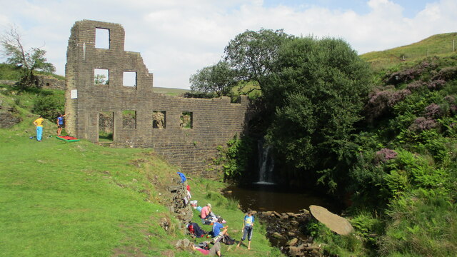
Knowl Moor is a vast expanse of moorland located in the county of Lancashire, England. Situated on the eastern edge of the Rossendale Valley, it is part of the larger West Pennine Moors and covers an area of approximately 6 square miles. The moorland is characterized by its rolling hills and rough, heather-covered terrain, providing a picturesque and rugged landscape.

Knowl Moor is a nature lover's paradise, home to a diverse range of flora and fauna. The moorland supports a variety of plant species, including heather, bracken, bilberry, and cotton grass, which create a vibrant and colorful tapestry across the hills. The area is also rich in wildlife, with species such as curlews, lapwings, and skylarks inhabiting the moorland, along with small mammals like voles and shrews.

The moorland offers numerous walking and hiking trails, allowing visitors to explore its vast beauty and soak in the tranquility of the surroundings. Some paths lead to the summit of Knowl Hill, which offers breathtaking panoramic views of the surrounding countryside and the distant city of Manchester. The moorland is also dotted with ancient stone circles and cairns, adding an air of mystery and history to the area.

Knowl Moor is a popular destination for outdoor enthusiasts, offering opportunities for birdwatching, photography, and simply enjoying the solitude of nature. It is an important conservation area, protected by various environmental organizations to preserve its unique ecosystem and cultural heritage.

Overall, Knowl Moor in Lancashire is a stunning and unspoiled natural landscape, providing a haven for wildlife and a tranquil retreat for visitors seeking solace in the beauty of the moorland.

If you have any feedback on the listing, please let us know in the comments section below.

Knowl Moor Images

Images are sourced within 2km of 53.647223/-2.2391748 or Grid Reference SD8416. Thanks to Geograph Open Source API. All images are credited.

Valve House At Ashworth Moor Reservoir providing shade for the sheep
Valve House
At Ashworth Moor Reservoir providing shade for the sheep
Lumb Mill Remains
Lumb Mill Remains
Cheesden Fold remains With the wind turbines on Knowl Hill (part of the Scout Moor wind farm) beyond
Cheesden Fold remains
With the wind turbines on Knowl Hill (part of the Scout Moor wind farm) beyond
Barn Brook remains Has some well dressed masonry
Barn Brook remains
Has some well dressed masonry
Four Acre Mill remains Most of the masonry remains are around the wheel pit with the mill pond embankment above
Four Acre Mill remains
Most of the masonry remains are around the wheel pit with the mill pond embankment above
Edenfield Road Butty Wagon I can recommend the grilled cheese barm
Edenfield Road Butty Wagon
I can recommend the grilled cheese barm
Track to Knowl More
Track to Knowl More
Knowl Moor Trig Point Flush Bracket 11121
Greenbooth Reservoir Dam Showing the sloping masonry on the inner side of the dam
Greenbooth Reservoir Dam
Showing the sloping masonry on the inner side of the dam
Car Park for Naden Valley Reservoirs On access land at the top of Woodhouse Lane. Knowl Hill is on the skyline across the valley surrounded by wind turbines
Car Park for Naden Valley Reservoirs
On access land at the top of Woodhouse Lane. Knowl Hill is on the skyline across the valley surrounded by wind turbines
Naden Lower and Middle Reservoirs With Knowl Hill across the valley
Naden Lower and Middle Reservoirs
With Knowl Hill across the valley
Naden Higher Reservoir Outflow This outflow is probably normally under the water of the Middle Reservoir and is only exposed because of the drought conditions. The grass bank is the dam of the Higher Reservoir
Naden Higher Reservoir Outflow
This outflow is probably normally under the water of the Middle Reservoir and is only exposed because of the drought conditions. The grass bank is the dam of the Higher Reservoir
Recent Rockfall in the valley of Naden Brook The brook feeds the Naden Upper Reservoir
Recent Rockfall in the valley of Naden Brook
The brook feeds the Naden Upper Reservoir
Greenbooth Mill Reservoir Dam Remains This dam is normally submerged in Greenbooth Reservoir, but exposed in drought conditions
Greenbooth Mill Reservoir Dam Remains
This dam is normally submerged in Greenbooth Reservoir, but exposed in drought conditions
Wind turbines on Knowl Hill from the access track
Wind turbines on Hail Storm Hill from the trig at Top of Leach
Old gate posts at Rooley Moor Brow
Track to Top o'th Hill Farm Just having left Edenfield Road
Track to Top o'th Hill Farm
Just having left Edenfield Road
Show me another place!

Knowl Moor is located at Grid Ref: SD8416 (Lat: 53.647223, Lng: -2.2391748)

Unitary Authority: Rochdale

Police Authority: Greater Manchester

What 3 Words

///kipper.swing.flamingo. Near Whitworth, Lancashire

Related Wikis

Scout Moor Wind Farm

Scout Moor Wind Farm is the second largest onshore wind farm in England. The wind farm, which was built for Peel Wind Power Ltd, produces electricity from...

Ashworth Moor Reservoir

Ashworth Moor Reservoir is an upland water supply reservoir amongst the Pennines in Greater Manchester, England close to the A680 road between Rochdale...

Greenbooth Reservoir

Greenbooth Reservoir is a reservoir to the north of Heywood and close to Norden in the Metropolitan Borough of Rochdale, within Greater Manchester, England...

Hail Storm Hill

Hail Storm Hill, also known as Cowpe Moss, is the highest point of the Rossendale Valley, England, an area of moorland and hill country situated between...

Nearby Amenities

Located within 500m of 53.647223,-2.2391748
Knowl Hill
Ele: 419
Man Made: survey_point
Natural: peak
Note: height 1370ft? - npe
Source: npe
Lat/Long: 53.6478785/-2.2405454
Generator Method: wind_turbine
Generator Output Electricity: 2.5 MW
Generator Source: wind
Generator Type: horizontal_axis
Power: generator
Lat/Long: 53.6508476/-2.2377014
Man Made: cairn
Lat/Long: 53.6479725/-2.2405469
Man Made: mast
Tower Type: communication
Lat/Long: 53.6474482/-2.2324138
Ford: yes
Lat/Long: 53.6442297/-2.2423682
The data included in this document is from www.openstreetmap.org. The data is made available under ODbL.

Have you been to Knowl Moor?

Leave your review of Knowl Moor below (or comments, questions and feedback).