Gayle Moor

Downs, Moorland in Yorkshire Craven

England

Gayle Moor

Gate onto Gayle Moor
Gate onto Gayle Moor Credit: David Dixon

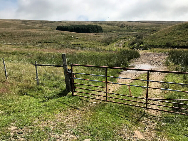
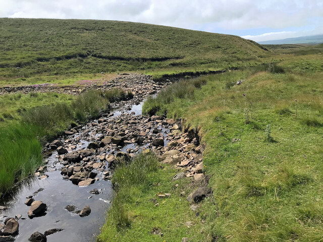
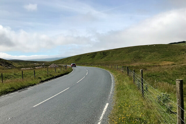
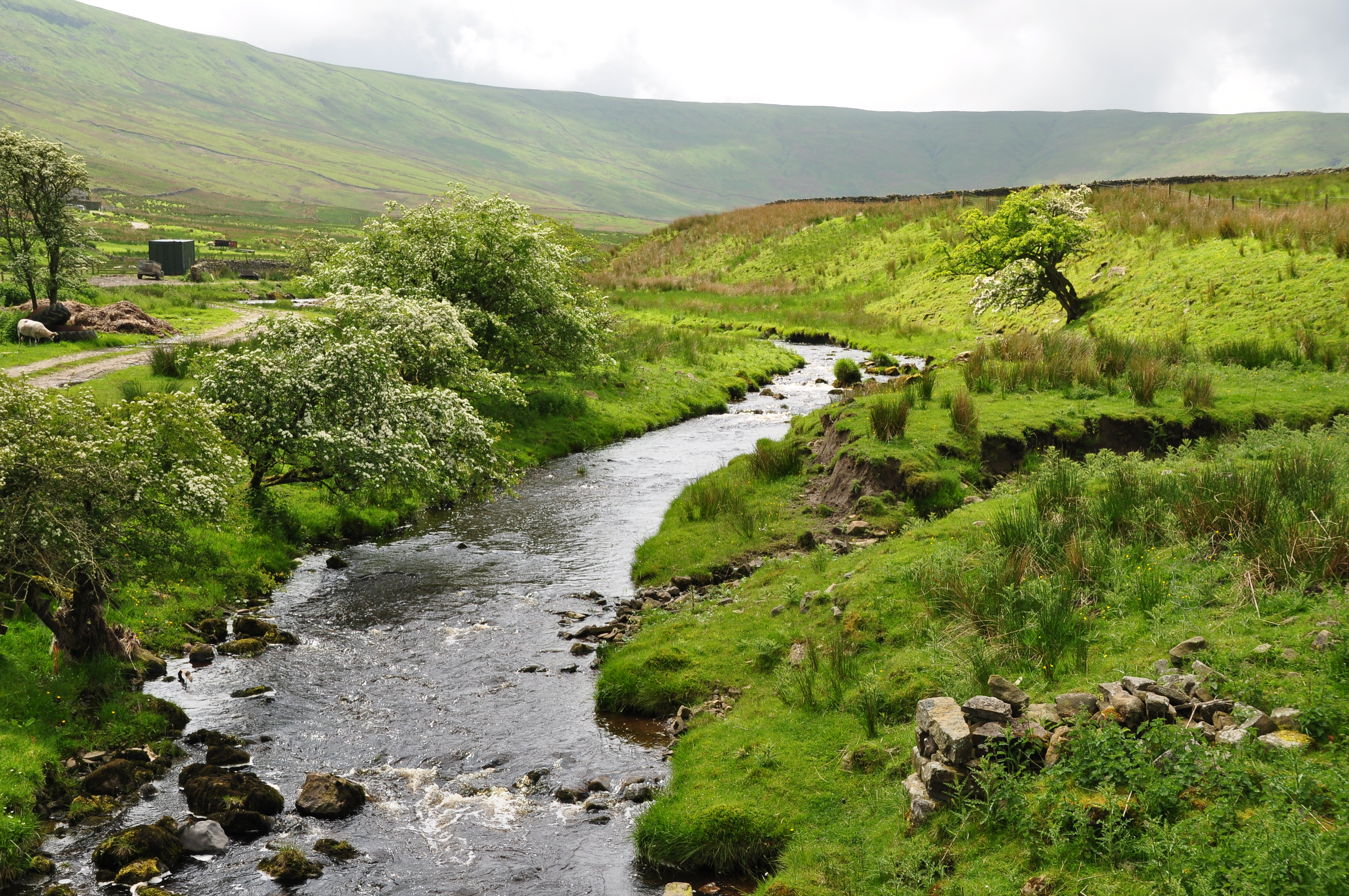
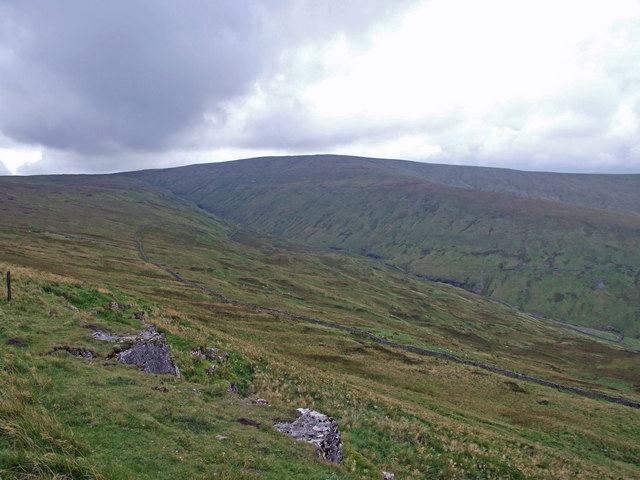
Gayle Moor is a picturesque area located in Yorkshire, England. Situated in the heart of the Yorkshire Dales National Park, it is renowned for its stunning landscapes and natural beauty. The moor is surrounded by rolling hills, verdant valleys, and rugged cliffs, providing a captivating backdrop for outdoor enthusiasts and nature lovers.

Covering an extensive area, Gayle Moor offers a diverse range of habitats, including heather moorland, grassland, and woodland. This variety supports a rich array of flora and fauna, making it an ideal destination for wildlife enthusiasts. Visitors can expect to spot a wide range of species, from birds like curlews and lapwings to mammals like hares and deer.

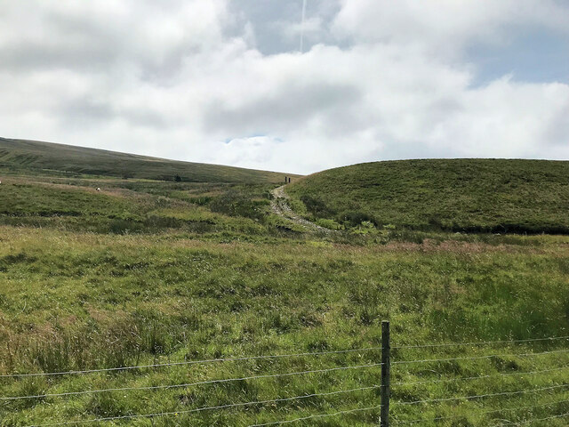
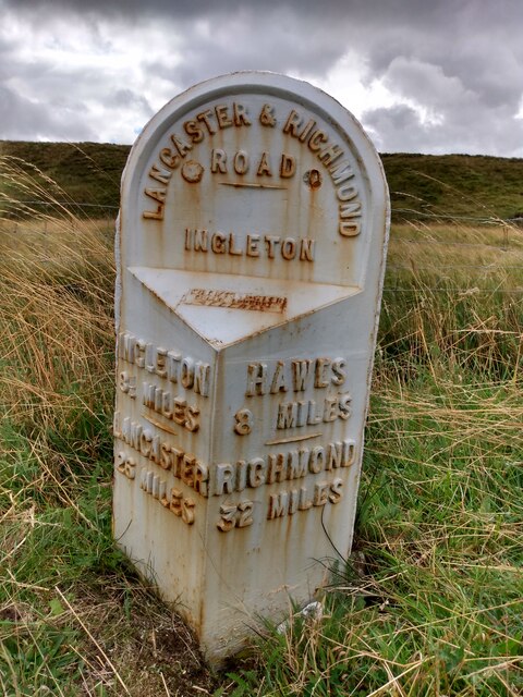
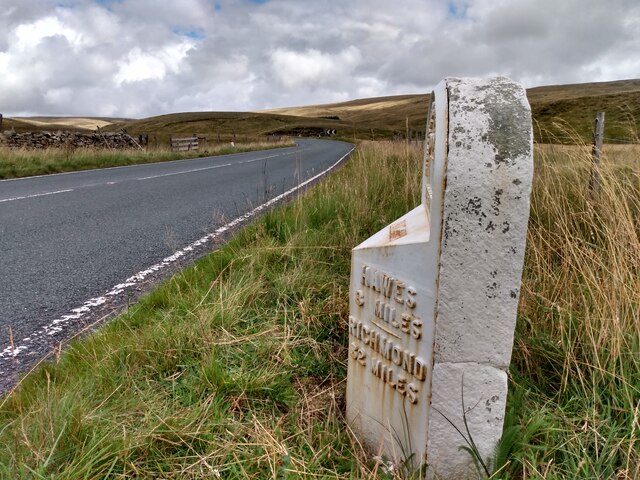
The moor is also intersected by several picturesque walking trails, allowing visitors to explore the area at their own pace. These trails offer breathtaking views of the surrounding countryside, with opportunities to discover hidden waterfalls and ancient ruins along the way.

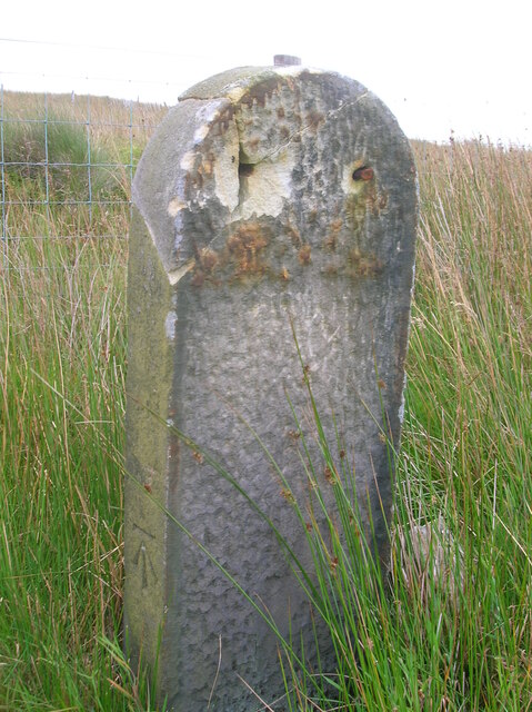
In addition to its natural beauty, Gayle Moor is also steeped in history. The area is home to several archaeological sites, including burial mounds and stone circles, which provide insight into the region's ancient past. These historical landmarks add an extra layer of intrigue to the moor, making it a fascinating destination for history enthusiasts.

Overall, Gayle Moor is a haven of tranquility and natural splendor. Whether you're seeking a peaceful hike, a wildlife-spotting adventure, or a glimpse into the region's history, this idyllic moorland has something to offer for everyone.

If you have any feedback on the listing, please let us know in the comments section below.

Gayle Moor Images

Images are sourced within 2km of 54.240733/-2.3054619 or Grid Reference SD8082. Thanks to Geograph Open Source API. All images are credited.

Gate onto Gayle Moor
Gayle Beck
Gayle Beck
Blea Moor Road
Blea Moor Road
Gayle Moor
Gayle Moor
Old milestone The backing stone of the West Riding CC milestone set up in 1893/94 that had its metal protruding attachment stolen in 2006.   The metal section was fastened to the backing stone at 4 places so would take some effort to prise off.  Hence the damage.   The legend on the left face was INGLETON/9¼ MILES/LANCASTER/27 MILES and on the right face HAWES/7 MILES/RICHMOND/31 MILES.   On the top section LANCASTER & RICHMOND /ROAD/iNGLETON.  The attachments on this route were cast by William Towler/Globe Foundry/Leeds.  This stone is on the east side of the B6255 south of the junction for Dentdale on the west side.   It is Grade II listed 1132230 so should be repaired sympathetically.
Old milestone
The backing stone of the West Riding CC milestone set up in 1893/94 that had its metal protruding attachment stolen in 2006. The metal section was fastened to the backing stone at 4 places so would take some effort to prise off. Hence the damage. The legend on the left face was INGLETON/9¼ MILES/LANCASTER/27 MILES and on the right face HAWES/7 MILES/RICHMOND/31 MILES. On the top section LANCASTER & RICHMOND /ROAD/iNGLETON. The attachments on this route were cast by William Towler/Globe Foundry/Leeds. This stone is on the east side of the B6255 south of the junction for Dentdale on the west side. It is Grade II listed 1132230 so should be repaired sympathetically.
Old milestone This milestone has been painted since <a href="https://www.geograph.org.uk/photo/6102622">SD7981 : Old Milestone by the B6255 on Gayle Moor</a> was taken but the legends have not been picked out in black.   On the bevel can be seen the rectangle with the maker's name, William Towler, Globe Foundry, Leeds.   On the 1893 contract the metal castings were to be painted blue with white lettering.   It is not known when black letters on white became the norm.   When old paint is stripped off prior to repainting patches of blue can sometimes be seen.   Grade II listed 1289368.
Old milestone
This milestone has been painted since SD7981 : Old Milestone by the B6255 on Gayle Moor was taken but the legends have not been picked out in black. On the bevel can be seen the rectangle with the maker's name, William Towler, Globe Foundry, Leeds. On the 1893 contract the metal castings were to be painted blue with white lettering. It is not known when black letters on white became the norm. When old paint is stripped off prior to repainting patches of blue can sometimes be seen. Grade II listed 1289368.
Old milestone Looking towards Hawes, it can be seen that the backing stone is cracked.   But it is securely held by 4 bolts, 2 in the top part and 2 at the base although they are hidden in the soil at this milestone.   The backing stones were not painted when they were set up but over the years some have been painted white, some black and some grey.   The stones were to be got from a quarry in Kirkstall (Leeds) or be of similar quality.
Old milestone
Looking towards Hawes, it can be seen that the backing stone is cracked. But it is securely held by 4 bolts, 2 in the top part and 2 at the base although they are hidden in the soil at this milestone. The backing stones were not painted when they were set up but over the years some have been painted white, some black and some grey. The stones were to be got from a quarry in Kirkstall (Leeds) or be of similar quality.
Gayle Beck Lodge The ruined remains of Gayle Beck Lodge, a month later the chimney and gable end totally collapsed.
Gayle Beck Lodge
The ruined remains of Gayle Beck Lodge, a month later the chimney and gable end totally collapsed.
The Pennine Way near Middle Bank Hill
The Pennine Way near Cam West End
Old milestone At SD 7984 is the boundary between the old West & North Ridings.   The last West Riding CC milestone south of the boundary is reached has now disappeared completely.   <a href="https://www.geograph.org.uk/photo/6072143">SD7984 : Old Boundary Marker by the B6255, Newby Head, Ingleton parish</a>.   This old, weathered stone is the most southerly one on the B6255, at Widdale Head, probably set up by the Sedbergh Turnpike trust in the early 19C.   This Trust covered a total of 62 miles on roads leading from and near Sedbergh   There is a very faint 6/HAWES near the base which has been highlighted in chalk.
Old milestone
At SD 7984 is the boundary between the old West & North Ridings. The last West Riding CC milestone south of the boundary is reached has now disappeared completely. SD7984 : Old Boundary Marker by the B6255, Newby Head, Ingleton parish. This old, weathered stone is the most southerly one on the B6255, at Widdale Head, probably set up by the Sedbergh Turnpike trust in the early 19C. This Trust covered a total of 62 miles on roads leading from and near Sedbergh There is a very faint 6/HAWES near the base which has been highlighted in chalk.
Pennine Way Ford on Cam High Road This is the first of many fords on the Pennine Way on the Cam High Road.
Pennine Way Ford on Cam High Road
This is the first of many fords on the Pennine Way on the Cam High Road.
Pennine Way Ford on Cam High Road. This is a second example of a ford on the Pennine Way on the Cam High Road.
Pennine Way Ford on Cam High Road.
This is a second example of a ford on the Pennine Way on the Cam High Road.
Ford on the Ribble Way This ford is found on the Ribble Way/Pennine Bridleway.
Ford on the Ribble Way
This ford is found on the Ribble Way/Pennine Bridleway.
Dales Way meets Pennine Way The point at which the Dales Way comes up from Cam Houses to join the Pennine Way for a mile down to Cam End.
Dales Way meets Pennine Way
The point at which the Dales Way comes up from Cam Houses to join the Pennine Way for a mile down to Cam End.
Cam High Road Looking SSW towards Ingleborough from Cam High Road above Cam Houses
Cam High Road
Looking SSW towards Ingleborough from Cam High Road above Cam Houses
Cam Fell Heavily rutted old road of Roman origin carrying the Pennine Way up Cam Fell
Cam Fell
Heavily rutted old road of Roman origin carrying the Pennine Way up Cam Fell
Jam Sike This stream is the longest of many in the area which become Gayle Beck and eventually become the River Ribble.
Jam Sike
This stream is the longest of many in the area which become Gayle Beck and eventually become the River Ribble.
Show me another place!

Gayle Moor is located at Grid Ref: SD8082 (Lat: 54.240733, Lng: -2.3054619)

Division: West Riding

Administrative County: North Yorkshire

District: Craven

Police Authority: North Yorkshire

What 3 Words

///laser.gross.justifies. Near Ingleton, North Yorkshire

Related Wikis

Newby Head

Newby Head, Newby Head Farm or Newby Head Inn is part of the Beresford Estate and was a popular drovers' inn in North Yorkshire, England. Now a farmhouse...

Dent Head Viaduct

Dent Head Viaduct is a railway viaduct on the Settle–Carlisle line in Dentdale, Cumbria, England. It is the second major viaduct on the line northwards...

Snaizeholme

Snaizeholme is a small side valley of Wensleydale in the Yorkshire Dales National Park (YDNP), North Yorkshire, England. The valley is noted for its red...
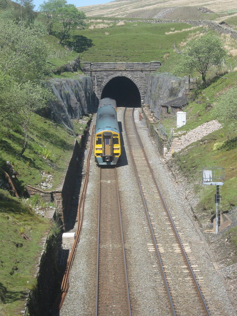
Blea Moor Tunnel

Blea Moor Tunnel is a 2,629 yards (1.494 mi)(2,404 m) railway tunnel located between Ribblehead Viaduct and Dent railway station in England. It is the...

Ribblehead

Ribblehead is the area of moorland at the head of the River Ribble in the area known as Ribblesdale, in the Yorkshire Dales National Park, England. Ribblehead...

Arten Gill Viaduct

Arten Gill Viaduct is an eleven-arch railway bridge in Dentdale, Cumbria, England. The viaduct carries the Settle to Carlisle railway line over Artengill...

Dodd Fell Hill

Dodd Fell Hill is a hill in the Yorkshire Dales, in North Yorkshire, England. It is classed as a Marilyn (a hill with topographic prominence of at least...

Ling Gill

Ling Gill is a gill (or narrow valley) in the Yorkshire Dales in North Yorkshire, England. Cam Beck, a tributary of the River Ribble, flows through the...

Nearby Amenities

Located within 500m of 54.240733,-2.3054619
Mares
Place: locality
Source: OS 1853
Lat/Long: 54.2386067/-2.302385
The data included in this document is from www.openstreetmap.org. The data is made available under ODbL.

Have you been to Gayle Moor?

Leave your review of Gayle Moor below (or comments, questions and feedback).