Taylor's Allotment

Downs, Moorland in Westmorland Eden

England

Taylor's Allotment

Wall, Pattinson's Allotment Looking down the shallow moorland valley of Peatmoor Sike. Ley Seat (left) and Iron Band form the skyline, the B6276 to Middleton-in-Teesdale going through the pass between them. The conifer plantation on Seavy Rigg can be seen further down the wall line.
Wall, Pattinson's Allotment Credit: Karl and Ali

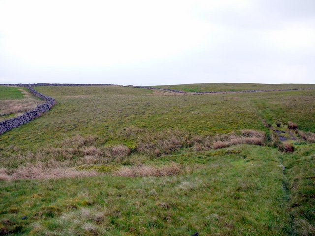
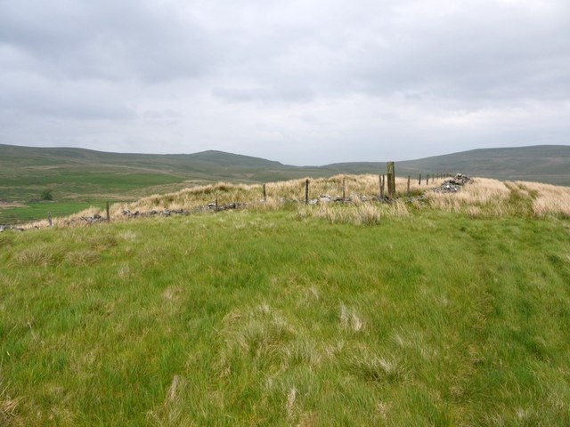
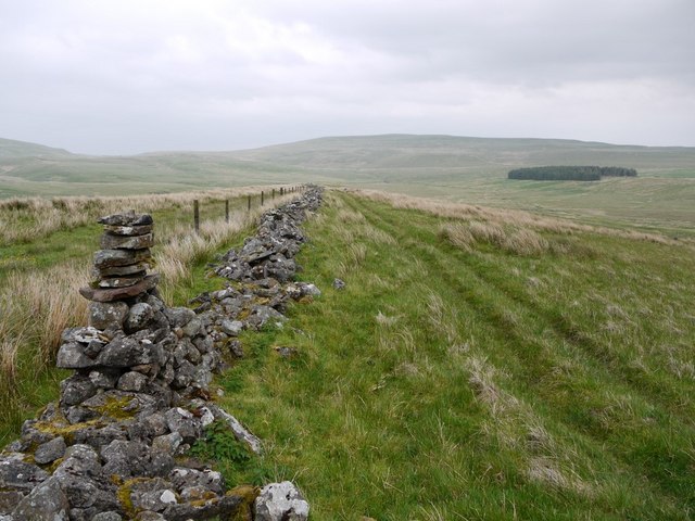
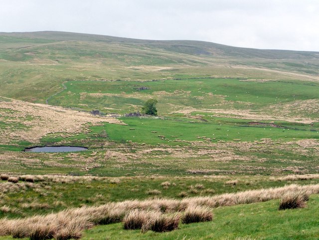
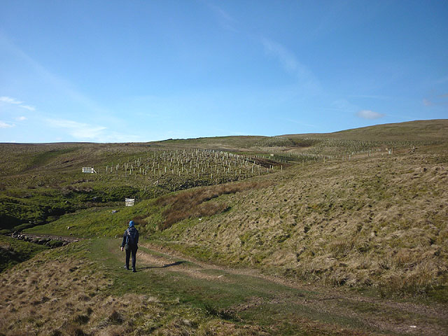
Taylor's Allotment is a picturesque piece of land nestled in the heart of Westmorland, a county in the northwest region of England. This allotment is located in an idyllic setting, surrounded by rolling hills, lush greenery, and breathtaking moorland landscapes. Covering an area of approximately 2 acres, Taylor's Allotment offers a peaceful and serene environment for both visitors and locals alike.

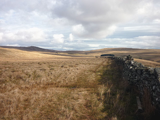
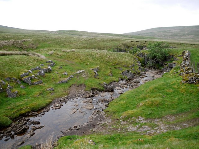
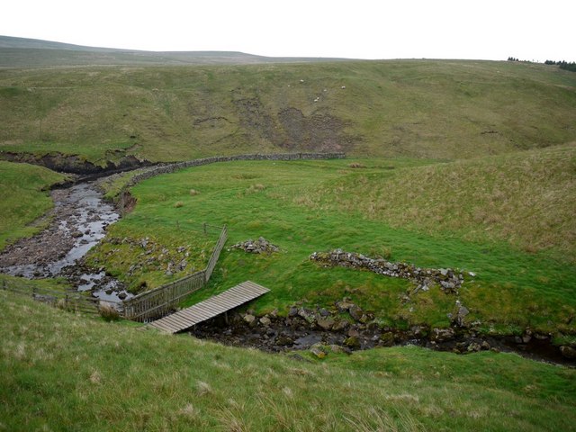
The allotment is well-maintained and divided into various sections to accommodate different types of agricultural activities. The Downs section of the allotment is primarily used for grazing livestock, with ample space for cattle and sheep to roam freely. This area is characterized by its gently sloping hills and rich grasslands, providing a perfect habitat for the animals.

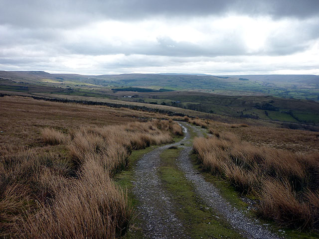
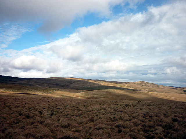
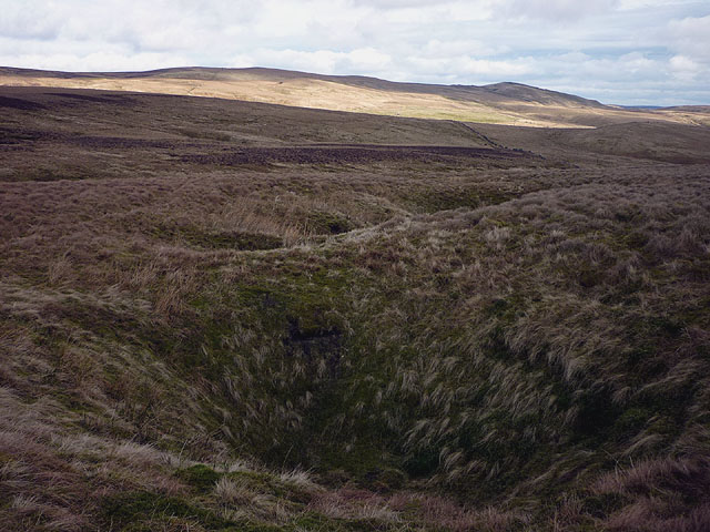
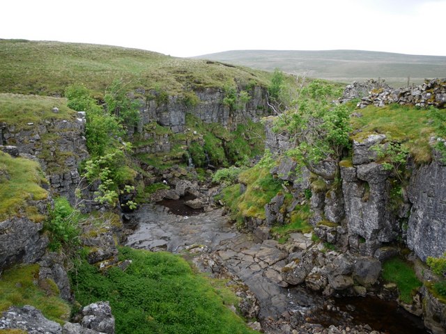
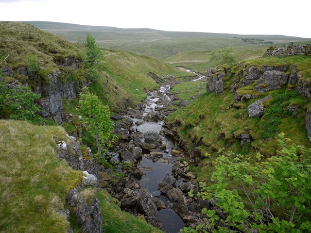
On the other hand, the Moorland section of Taylor's Allotment offers a different landscape altogether. Here, one can find heather-covered hills, rocky outcrops, and meandering streams. This section is renowned for its diverse flora and fauna, attracting nature enthusiasts and bird watchers from far and wide.

The allotment also features a small woodland area, adding to its natural charm. The woodland is home to various species of trees, including oak, birch, and beech, which create a tranquil and shaded environment for visitors to explore.

Overall, Taylor's Allotment is a hidden gem in Westmorland, offering a unique blend of downs, moorland, and woodland landscapes. Whether one is seeking a peaceful retreat or an opportunity to immerse themselves in nature, this allotment provides an ideal setting to unwind and enjoy the beauty of the English countryside.

If you have any feedback on the listing, please let us know in the comments section below.

Taylor's Allotment Images

Images are sourced within 2km of 54.565462/-2.3130056 or Grid Reference NY7918. Thanks to Geograph Open Source API. All images are credited.

Wall, Pattinson's Allotment Looking down the shallow moorland valley of Peatmoor Sike. Ley Seat (left) and Iron Band form the skyline, the B6276 to Middleton-in-Teesdale going through the pass between them. The conifer plantation on Seavy Rigg can be seen further down the wall line.
Wall, Pattinson's Allotment
Looking down the shallow moorland valley of Peatmoor Sike. Ley Seat (left) and Iron Band form the skyline, the B6276 to Middleton-in-Teesdale going through the pass between them. The conifer plantation on Seavy Rigg can be seen further down the wall line.
The track to Helbeck Low Fell Looking over North and South Stainmore.
The track to Helbeck Low Fell
Looking over North and South Stainmore.
On Pattinson's Allotment An area of rough moorland with vague boundaries and few defining features. Seavyrigg Side is the slight swelling in the middle distance. Ley Seat and the moorland rising towards Little Fell forms the skyline.
On Pattinson's Allotment
An area of rough moorland with vague boundaries and few defining features. Seavyrigg Side is the slight swelling in the middle distance. Ley Seat and the moorland rising towards Little Fell forms the skyline.
Shake holes, Watcher Rigg Indicative of limestone below the surface cover of peat and boulder clay.
Shake holes, Watcher Rigg
Indicative of limestone below the surface cover of peat and boulder clay.
Track at gate north of Thornthwaite View south-west to Mount Ida <a href="https://www.geograph.org.uk/photo/489144">NY7916 : Cairn on Mount Ida</a>
Track at gate north of Thornthwaite
View south-west to Mount Ida NY7916 : Cairn on Mount Ida
Panorama above Thornthwaite Panorama from two photos southwards over Thornthwaite <span class="nowrap"><a title="http://zoom.it/Is4K" rel="nofollow ugc noopener" href="http://zoom.it/Is4K">Link</a><img style="margin-left:2px;" alt="External link" title="External link - shift click to open in new window" src="https://s1.geograph.org.uk/img/external.png" width="10" height="10"/></span>
The valley of the Swindale Beck is on the left and Mount Ida on the right.
Panorama above Thornthwaite
Panorama from two photos southwards over Thornthwaite LinkExternal link The valley of the Swindale Beck is on the left and Mount Ida on the right.
Path over rough grassland north of Thornthwaite
Pattinson's Allotment Pattinson was allotted little more than boggy grassland and wet feet; poor grazing for few sheep.
Pattinson's Allotment
Pattinson was allotted little more than boggy grassland and wet feet; poor grazing for few sheep.
Pattinson's Allotment towards Warcop Fell The distant hill to the left, well inside the danger area, is Little Fell. Richard Webb got there in 2002 <a href="https://www.geograph.org.uk/photo/19146">NY7821 : Trig pillar, Little Fell</a> but I can't imagine anyone trying now.
Pattinson's Allotment towards Warcop Fell
The distant hill to the left, well inside the danger area, is Little Fell. Richard Webb got there in 2002 NY7821 : Trig pillar, Little Fell but I can't imagine anyone trying now.
Watcher Rigg An area of boggy grassland with shake holes draining water into the underlying limestone adjacent to the military range just beyond the wall. The slight hill on the right is Seavyrigg Side over which passes a poorly defined bridleway from Hilton to the Middleton in Teesdale Road.
Watcher Rigg
An area of boggy grassland with shake holes draining water into the underlying limestone adjacent to the military range just beyond the wall. The slight hill on the right is Seavyrigg Side over which passes a poorly defined bridleway from Hilton to the Middleton in Teesdale Road.
Seavyrigg Side
Seavyrigg Side
Bridleway on Seavyrigg Side The plantation on the right is at a site called Seavy Rigg.
Bridleway on Seavyrigg Side
The plantation on the right is at a site called Seavy Rigg.
Ruined farm by Tarn Gill Named as Tarn House on the 1:10000 OS Map.
Ruined farm by Tarn Gill
Named as Tarn House on the 1:10000 OS Map.
Ford above gorge near Swindale Head
Gorge near Swindale Head
Footbridge over Peatmoor Sike, Swindale Head
New tree planting, headwaters of Swindale Beck This looks like an attempt to start a new deciduous woodland rather than the regimented rows of nearby conifer plantations. A much needed feature on these barren and denuded moorlands.
New tree planting, headwaters of Swindale Beck
This looks like an attempt to start a new deciduous woodland rather than the regimented rows of nearby conifer plantations. A much needed feature on these barren and denuded moorlands.
Show me another place!

Taylor's Allotment is located at Grid Ref: NY7918 (Lat: 54.565462, Lng: -2.3130056)

Administrative County: Cumbria

District: Eden

Police Authority: Cumbria

What 3 Words

///lunges.downfield.shuttling. Near Kirkby Stephen, Cumbria

Related Wikis

Fox Tower, Cumbria

Fox Tower is a tower built by John Metcalf Carleton, an industrial entrepreneur, as a folly in 1775 on his large estate next to Brough, a village in Cumbria...

Helbeck

Helbeck is a settlement and civil parish near the village of Brough, in the Eden district, in the county of Cumbria, England. There is a wood called Helbeck...

Verterae

Verterae was a Roman fort in the modern-day village of Brough, Cumbria, England. Occupied between the 1st and 5th centuries AD, it protected a key Roman...

Brough, Cumbria

Brough (), sometimes known as Brough under Stainmore, is a village and civil parish in the Westmorland and Furness unitary authority of Cumbria, England...

Nearby Amenities

Located within 500m of 54.565462,-2.3130056
Musgrave Fell
Place: locality
Source: OS 7th series historic
Lat/Long: 54.564589/-2.3177121
The data included in this document is from www.openstreetmap.org. The data is made available under ODbL.

Have you been to Taylor's Allotment?

Leave your review of Taylor's Allotment below (or comments, questions and feedback).