Warcop Fell

Downs, Moorland in Westmorland Eden

England

Warcop Fell

Walls of sheepfold on south side of Little Fell A disused and derelict sheepfold situated remotely in the MOD Warcop range.
Beyond the sheepfold are slopes of Little Fell dropping to Swindale and distantly, Murton Pike.
Walls of sheepfold on south side of Little Fell Credit: Trevor Littlewood

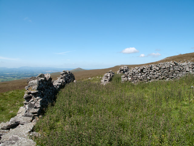
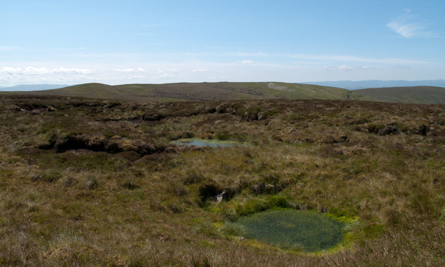
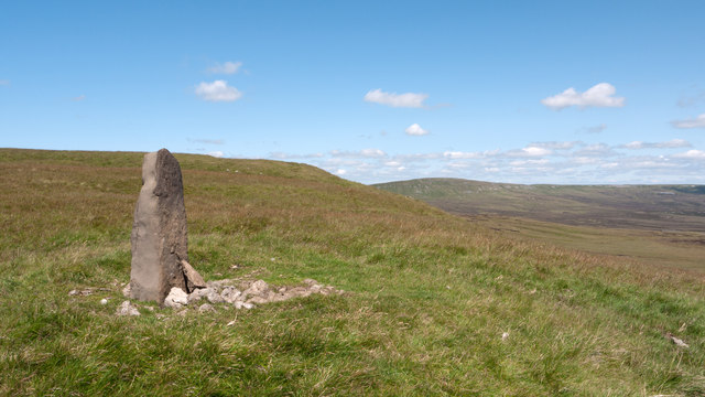
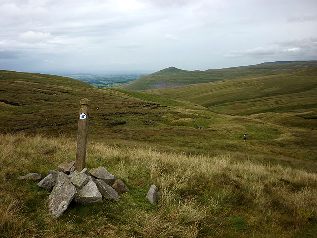
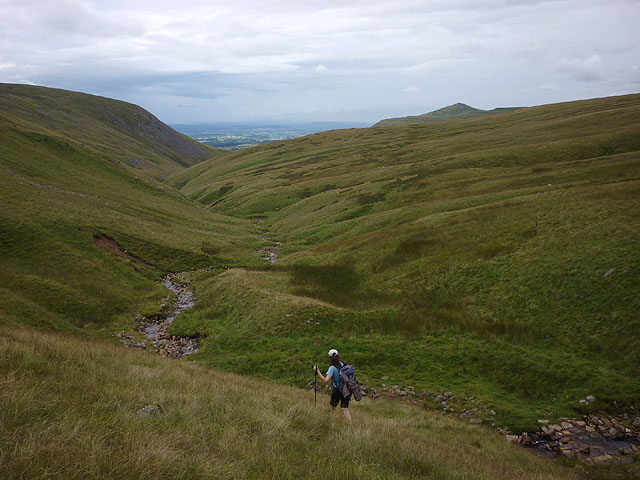
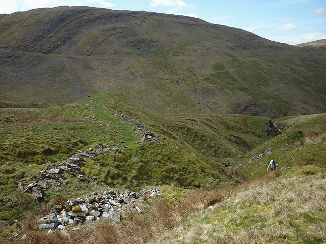
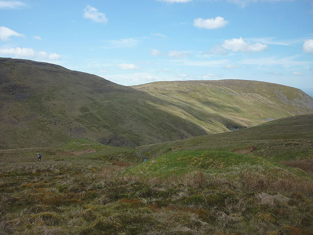
Warcop Fell is situated in the county of Westmorland, in the region of Cumbria, in north-west England. It is a vast expanse of open moorland and rolling hills, offering stunning views of the surrounding countryside. The fell is characterized by its rugged terrain, with a mixture of heather-covered slopes, rocky outcrops, and grassy meadows.

Warcop Fell is a popular destination for hikers and outdoor enthusiasts, with numerous walking trails and footpaths crisscrossing the landscape. The fell is also home to a variety of wildlife, including birds of prey, sheep, and ponies.

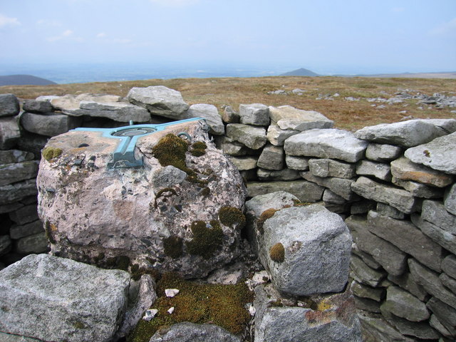
The area is steeped in history, with evidence of ancient settlements and burial mounds scattered throughout the landscape. The fell is also dotted with remnants of old mining operations, a reminder of the area's industrial past.

Overall, Warcop Fell offers visitors a peaceful and remote escape from the hustle and bustle of modern life, with its unspoiled natural beauty and tranquil atmosphere.

If you have any feedback on the listing, please let us know in the comments section below.

Warcop Fell Images

Images are sourced within 2km of 54.576278/-2.3312036 or Grid Reference NY7820. Thanks to Geograph Open Source API. All images are credited.

Walls of sheepfold on south side of Little Fell A disused and derelict sheepfold situated remotely in the MOD Warcop range.
Beyond the sheepfold are slopes of Little Fell dropping to Swindale and distantly, Murton Pike.
Walls of sheepfold on south side of Little Fell
A disused and derelict sheepfold situated remotely in the MOD Warcop range. Beyond the sheepfold are slopes of Little Fell dropping to Swindale and distantly, Murton Pike.
Water filled shake holes on south side of Little Fell Shake holes are thought to be created by the collapse of hollows beneath where limestone has been eroded to create cavities; they're very common in the northern Pennines and generally occur at a certain linear horizon on a hillside. The shake holes here occupy an area rather than a line and those in view are water filled.
The distant skyline is occupied by Tinside Rigg.
Water filled shake holes on south side of Little Fell
Shake holes are thought to be created by the collapse of hollows beneath where limestone has been eroded to create cavities; they're very common in the northern Pennines and generally occur at a certain linear horizon on a hillside. The shake holes here occupy an area rather than a line and those in view are water filled. The distant skyline is occupied by Tinside Rigg.
Boundary stone on south side of Little Fell The 'standing stone' is clearly a boundary stone; it has a 'B' engraved on its north face and 'W' on the south face. Additionally there's a date on the south face but with just the initial digit - 1, and final digit - 7 discernable. The hill in view distantly is Mickle Fell.
Boundary stone on south side of Little Fell
The 'standing stone' is clearly a boundary stone; it has a 'B' engraved on its north face and 'W' on the south face. Additionally there's a date on the south face but with just the initial digit - 1, and final digit - 7 discernable. The hill in view distantly is Mickle Fell.
This way to Swindale The bridleway across the shoulder of Tinside Rigg is virtually non-existent on the ground, only the line of the route being marked by a series of wooden marker posts. It only becomes a defined track above Swindale before descending into Scordale and so to Hilton. The shapely peak in the distance is Murton Pike.
This way to Swindale
The bridleway across the shoulder of Tinside Rigg is virtually non-existent on the ground, only the line of the route being marked by a series of wooden marker posts. It only becomes a defined track above Swindale before descending into Scordale and so to Hilton. The shapely peak in the distance is Murton Pike.
At the head of Swindale The non-existent bridleway contours along the slope north of the beck, marked only by a line of wooden posts. We decided to follow the bottom of the gill as a more interesting line of return to Scordale. The lowlands of the Eden Valley can be seen between Roman Fell (left) and Murton Pike.
At the head of Swindale
The non-existent bridleway contours along the slope north of the beck, marked only by a line of wooden posts. We decided to follow the bottom of the gill as a more interesting line of return to Scordale. The lowlands of the Eden Valley can be seen between Roman Fell (left) and Murton Pike.
Peat banks to north of Connypot Beck Desolate moorland in the remote country between Little Fell and Mickle Fell. The distant dome to the left of the image is Cleasby Hill in the Yorkshire Dales.
Peat banks to north of Connypot Beck
Desolate moorland in the remote country between Little Fell and Mickle Fell. The distant dome to the left of the image is Cleasby Hill in the Yorkshire Dales.
Damaged Trig On Little Fell The damaged trig point on Little fell is surrounded by a cairn shelter. Distant view along the moorland towards Dufton Pike.
Damaged Trig On Little Fell
The damaged trig point on Little fell is surrounded by a cairn shelter. Distant view along the moorland towards Dufton Pike.
Mining remains on Christy Bank above Swindale This curved structure set above an un-named tributary of Siss Gill may be spoil excavated from a disused bell pit nearby. Its position may indicate that it once functioned as a dam from which water would be released to scour out the gully below - an operation known as 'hushing'. Another hush is shown on the map a little further east.
Mining remains on Christy Bank above Swindale
This curved structure set above an un-named tributary of Siss Gill may be spoil excavated from a disused bell pit nearby. Its position may indicate that it once functioned as a dam from which water would be released to scour out the gully below - an operation known as 'hushing'. Another hush is shown on the map a little further east.
Disused mine shaft, Christy Bank above Swindale The small green mound (which has a central depression) is an example of a bell pit. This was an early form of mining which produced a bell-shaped chamber with the spoil being deposited in a ring around the shaft.
Disused mine shaft, Christy Bank above Swindale
The small green mound (which has a central depression) is an example of a bell pit. This was an early form of mining which produced a bell-shaped chamber with the spoil being deposited in a ring around the shaft.
Disused mine shaft, Christy Bank Sike The pile of rocks marks the centre of a bell pit. This was an early form of mining which produced a bell-shaped chamber with the spoil being deposited in a ring around the shaft. This particular example is not shown on OS maps but there is a hush just upstream which prospectors would have created in their search for lead.
Disused mine shaft, Christy Bank Sike
The pile of rocks marks the centre of a bell pit. This was an early form of mining which produced a bell-shaped chamber with the spoil being deposited in a ring around the shaft. This particular example is not shown on OS maps but there is a hush just upstream which prospectors would have created in their search for lead.
Ruined sheepfold at the head of Christy Bank Sike This ruined fold appears to have been used as target practice by army gunners. A rusting shell can be seen lying in the foreground rocks. High on the flanks of Burton Fell there is an extensive vista west over the Eden Valley towards the Lakeland fells.
Ruined sheepfold at the head of Christy Bank Sike
This ruined fold appears to have been used as target practice by army gunners. A rusting shell can be seen lying in the foreground rocks. High on the flanks of Burton Fell there is an extensive vista west over the Eden Valley towards the Lakeland fells.
On Burton (or Warcop?) Fell Heather moorland on the approach to Little Fell. The names were probably those given by shepherds to particular areas of grazing rather than topograhical features.
On Burton (or Warcop?) Fell
Heather moorland on the approach to Little Fell. The names were probably those given by shepherds to particular areas of grazing rather than topograhical features.
Pile of stones, Burton Fell Once, this may have been a well-built cairn, a useful navigation aid for shepherds in poor weather. Now, it appears to have been a target for army gunners judging by the rusting artillery shells in the vicinity.
Pile of stones, Burton Fell
Once, this may have been a well-built cairn, a useful navigation aid for shepherds in poor weather. Now, it appears to have been a target for army gunners judging by the rusting artillery shells in the vicinity.
Ruined sheepfold, Scott Howe The fold, on a shelf east of the upper slopes of Burton Fell, is completely ruinous. Across the moor is Mickle Fell, the highest point in County Durham (and once the highest point of Yorkshire).
Ruined sheepfold, Scott Howe
The fold, on a shelf east of the upper slopes of Burton Fell, is completely ruinous. Across the moor is Mickle Fell, the highest point in County Durham (and once the highest point of Yorkshire).
Spring gentian (Gentiana verna) Spotted unexpectedly somewhere on Burton Fell - no clues to the exact spot, you'll have to go and search for yourself! These rare (for Britain, at least) flowers can be seen at various locations in Upper Teesdale - the Cow Green Reservoir is probably best known. The Burren of County Clare in Ireland is the other stronghold in the British Isles. Another walker we met up here told us that he had seen some in the Pyrenees just recently.
Spring gentian (Gentiana verna)
Spotted unexpectedly somewhere on Burton Fell - no clues to the exact spot, you'll have to go and search for yourself! These rare (for Britain, at least) flowers can be seen at various locations in Upper Teesdale - the Cow Green Reservoir is probably best known. The Burren of County Clare in Ireland is the other stronghold in the British Isles. Another walker we met up here told us that he had seen some in the Pyrenees just recently.
Defunct radio station, Burton Fell The remains of what appears to have been a military radio station. The box on the left has no door and now functions as a toilet for sheep.
Defunct radio station, Burton Fell
The remains of what appears to have been a military radio station. The box on the left has no door and now functions as a toilet for sheep.
Parachute flare A change from the more numerous rusting artillery shells scattered over the fell.
Parachute flare
A change from the more numerous rusting artillery shells scattered over the fell.
Ruined sheepfold, Burton Fell Like other structures on this fell, the fold appears to have been subject to target practice by artillery. It is almost completely flattened.
Ruined sheepfold, Burton Fell
Like other structures on this fell, the fold appears to have been subject to target practice by artillery. It is almost completely flattened.
Show me another place!

Warcop Fell is located at Grid Ref: NY7820 (Lat: 54.576278, Lng: -2.3312036)

Administrative County: Cumbria

District: Eden

Police Authority: Cumbria

What 3 Words

///requests.eating.clocking. Near Appleby-in-Westmorland, Cumbria

Nearby Locations

Warcop Fell

Related Wikis

Fox Tower, Cumbria

Fox Tower is a tower built by John Metcalf Carleton, an industrial entrepreneur, as a folly in 1775 on his large estate next to Brough, a village in Cumbria...

Helbeck

Helbeck is a settlement and civil parish near the village of Brough, in the Eden district, in the county of Cumbria, England. There is a wood called Helbeck...

Mickle Fell

Mickle Fell is a mountain in the Pennines, the range of hills and moors running down the middle of Northern England. It has a maximum elevation of 788...

Murton, Cumbria

Murton is a small village and civil parish in the Eden District of Cumbria, England. The parish had a population of 330 in 2001, rising to 360 at the 2011...

Have you been to Warcop Fell?

Leave your review of Warcop Fell below (or comments, questions and feedback).