Ashes Shaw

Downs, Moorland in Yorkshire Craven

England

Ashes Shaw

A view over the upper Ribble valley from Park Fell With the cottages at Gauber visible on the right.
A view over the upper Ribble valley from Park Fell Credit: John Lucas

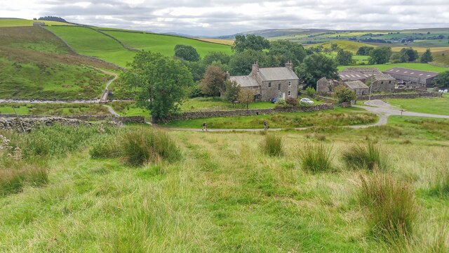
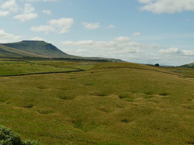
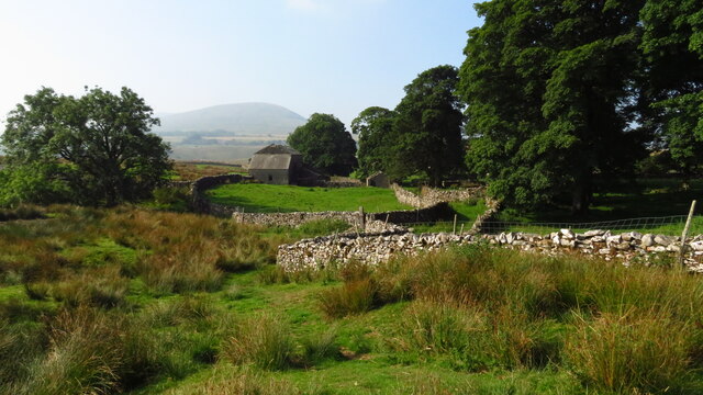
Ashes Shaw is a picturesque area located in the Yorkshire region of England. It is situated amidst the beautiful landscape of Yorkshire Downs and Moorland, offering visitors a stunning blend of natural beauty and serene surroundings.

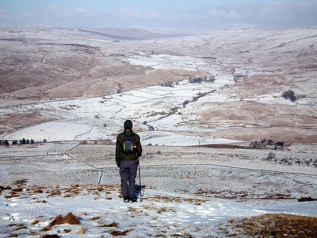
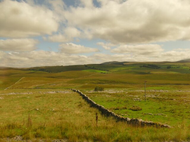
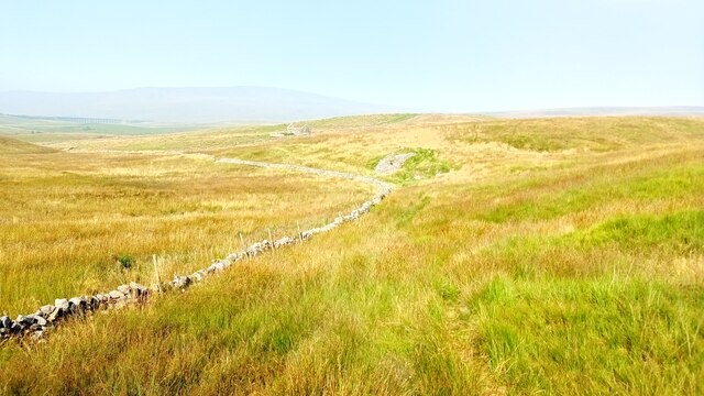
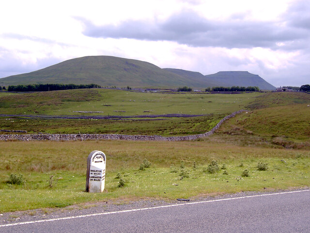
The area is known for its rolling hills, lush greenery, and breathtaking views. Ashes Shaw is a popular destination for outdoor enthusiasts, as it provides ample opportunities for hiking, walking, and exploring the countryside. The Yorkshire Downs offer extensive trails, perfect for both leisurely strolls and more challenging hikes, while the Moorland provides a unique and rugged terrain to explore.

Wildlife is abundant in Ashes Shaw, with various species of birds, mammals, and plant life thriving in the area. It is not uncommon to spot rabbits, hares, and even deer during a visit. The moorland is also home to unique species of insects and plants that are native to the region.

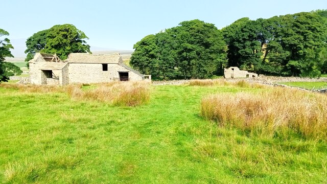
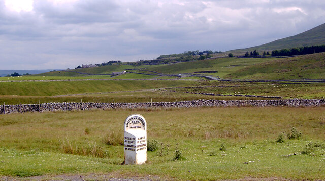
In addition to its natural beauty, Ashes Shaw is also rich in history and cultural heritage. The area is dotted with ancient ruins, stone circles, and historical landmarks, offering visitors a glimpse into the region's past.

For those seeking a peaceful and idyllic retreat, Ashes Shaw provides the perfect setting. Its tranquil atmosphere, combined with its stunning natural scenery, makes it an ideal destination for those looking to escape the hustle and bustle of city life and immerse themselves in the beauty of the Yorkshire countryside.

If you have any feedback on the listing, please let us know in the comments section below.

Ashes Shaw Images

Images are sourced within 2km of 54.196401/-2.344465 or Grid Reference SD7777. Thanks to Geograph Open Source API. All images are credited.
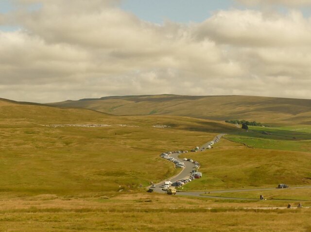
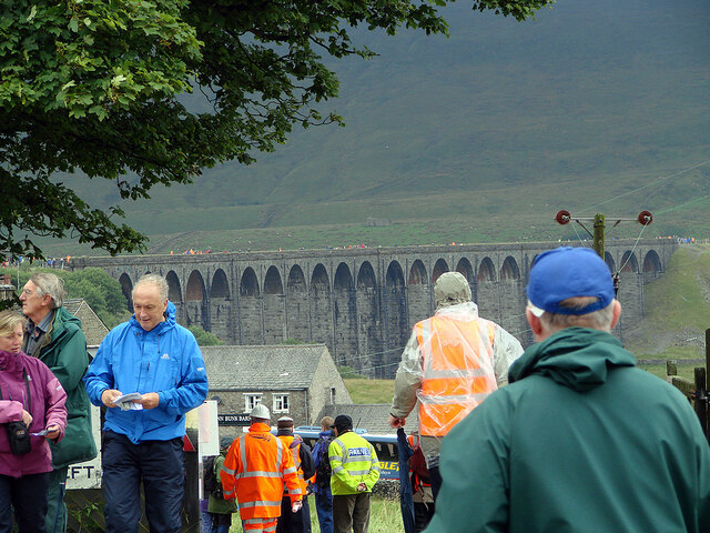
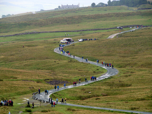
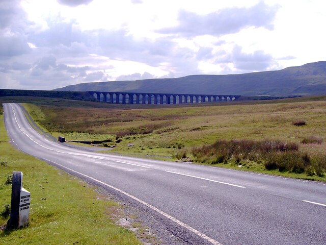
A view over the upper Ribble valley from Park Fell With the cottages at Gauber visible on the right.
A view over the upper Ribble valley from Park Fell
With the cottages at Gauber visible on the right.
Nether Lodge Ribblesdale Farm.
Nether Lodge
Ribblesdale Farm.
Shaw House A now ruined farmhouse.
Shaw House
A now ruined farmhouse.
Dry stone wall at Selside Along with the limestone pavement from which the stone was presumably taken, this is typical Ribblesdale scenery.
Dry stone wall at Selside
Along with the limestone pavement from which the stone was presumably taken, this is typical Ribblesdale scenery.
Cars parked at Gearstones This road junction at Ribblehead is popular with both visitors to the famous viaduct, and longer distance walkers.
Cars parked at Gearstones
This road junction at Ribblehead is popular with both visitors to the famous viaduct, and longer distance walkers.
Shake Holes at Batty Moss Taken from a train on the embankment approaching Ribblehead viaduct, you can see why this was difficult terrain for railway building. Ingleborough is in the distance.
Shake Holes at Batty Moss
Taken from a train on the embankment approaching Ribblehead viaduct, you can see why this was difficult terrain for railway building. Ingleborough is in the distance.
Thorns Old farm, now abandoned.
Thorns
Old farm, now abandoned.
Ribble Way Looking back in the direction of Whernside with a crumbling old lime kiln in the near distance on Thorns Moss.
Ribble Way
Looking back in the direction of Whernside with a crumbling old lime kiln in the near distance on Thorns Moss.
Viaduct walkers An official event allowing people to walk across Ribblehead Viaduct. Here people are awaiting their turn to do the walk. Walkers are seen across the viaduct. This was the last day of repairs to the viaduct and no trains were running.
Viaduct walkers
An official event allowing people to walk across Ribblehead Viaduct. Here people are awaiting their turn to do the walk. Walkers are seen across the viaduct. This was the last day of repairs to the viaduct and no trains were running.
Ribblehead viaduct walkers The Settle & Carlisle Railway was closed for repairs to the viaduct. On the last day of the closure, people were permitted to walk across the viaduct. Here, some are seen returning to Ribblehead, viewed from the viaduct.
Ribblehead viaduct walkers
The Settle & Carlisle Railway was closed for repairs to the viaduct. On the last day of the closure, people were permitted to walk across the viaduct. Here, some are seen returning to Ribblehead, viewed from the viaduct.
A busy day at Ribblehead On a day when the viaduct was open to walkers.
A busy day at Ribblehead
On a day when the viaduct was open to walkers.
Buses at Ribblehead Transporting walkers for the walking on the Ribblehead viaduct event.
Buses at Ribblehead
Transporting walkers for the walking on the Ribblehead viaduct event.
Footbridge over Cam Beck, Nether Lodge near Selside
Abandoned farmstead at Cove Hole near Ribblehead
Ribblehead [2] Although not the most pleasant of weather, the area around the Ribblehead Viaduct was crowded.
Ribblehead [2]
Although not the most pleasant of weather, the area around the Ribblehead Viaduct was crowded.
Milestone on Blea Moor Road (B6255), Ribblehead A close-up of the milestone can be seen in <a href="https://www.geograph.org.uk/photo/7041937">SD7679 : Milestone on Blea Moor Road (B6255), Ribblehead</a>.
Milestone on Blea Moor Road (B6255), Ribblehead
A close-up of the milestone can be seen in SD7679 : Milestone on Blea Moor Road (B6255), Ribblehead.
Blea Moor Road (B6255) approaching the Ribblehead Viaduct A close-up of the milestone can be seen in <a href="https://www.geograph.org.uk/photo/7041937">SD7679 : Milestone on Blea Moor Road (B6255), Ribblehead</a>.
Blea Moor Road (B6255) approaching the Ribblehead Viaduct
A close-up of the milestone can be seen in SD7679 : Milestone on Blea Moor Road (B6255), Ribblehead.
Looking towards Ingleborough from Blea Moor Road (B6255), Ribblehead A close-up of the milestone can be seen in <a href="https://www.geograph.org.uk/photo/7041937">SD7679 : Milestone on Blea Moor Road (B6255), Ribblehead</a>.
Looking towards Ingleborough from Blea Moor Road (B6255), Ribblehead
A close-up of the milestone can be seen in SD7679 : Milestone on Blea Moor Road (B6255), Ribblehead.
Show me another place!

Ashes Shaw is located at Grid Ref: SD7777 (Lat: 54.196401, Lng: -2.344465)

Division: West Riding

Administrative County: North Yorkshire

District: Craven

Police Authority: North Yorkshire

What 3 Words

///compiled.wipes.dreamers. Near Ingleton, North Yorkshire

Related Wikis

Nearby Amenities

Located within 500m of 54.196401,-2.344465
Rake Spring
Natural: spring
Lat/Long: 54.1974005/-2.3490251
Barrier: cattle_grid
Source: Bing
Lat/Long: 54.1981202/-2.3427246
Hunter Hill
Natural: peak
Source: OS 1:25k
Lat/Long: 54.198524/-2.3384145
Barrier: swing_gate
Lat/Long: 54.1967222/-2.3506379
Barrier: swing_gate
Lat/Long: 54.1967166/-2.3506163
Entrance: yes
Lat/Long: 54.1969089/-2.3369251
Entrance: yes
Lat/Long: 54.1959311/-2.3387954
Natural: sinkhole
Source: Bing
Lat/Long: 54.1937343/-2.3404095
Grave Yard
Quakers Grave Yard
Fixme: exact location needs confirming.
Source: OS sheet 96, publ. 1851
Lat/Long: 54.1974895/-2.338044
Ingman Lodge
Place: isolated_dwelling
Source: OS sheet 96, publ. 1851
Lat/Long: 54.1969874/-2.3384094
Power: pole
Lat/Long: 54.2005424/-2.3465018
Power: pole
Lat/Long: 54.1999875/-2.3454811
Power: pole
Lat/Long: 54.199538/-2.3446605
Power: pole
Lat/Long: 54.1991309/-2.3439229
Power: pole
Lat/Long: 54.1986084/-2.342947
Power: pole
Lat/Long: 54.1980484/-2.3419587
Power: pole
Lat/Long: 54.1974184/-2.3415614
Power: pole
Lat/Long: 54.1968302/-2.3411886
Power: pole
Lat/Long: 54.1962486/-2.3407782
Power: pole
Lat/Long: 54.1954886/-2.3402698
Power: pole
Lat/Long: 54.1947154/-2.3397464
Power: pole
Lat/Long: 54.1939366/-2.3392267
Power: pole
Lat/Long: 54.1993073/-2.3451444
Power: pole
Lat/Long: 54.1990099/-2.3457319
Power: pole
Lat/Long: 54.1987346/-2.346276
Power: pole
Lat/Long: 54.1979889/-2.3478256
Power: pole
Lat/Long: 54.1976133/-2.3486371
Power: pole
Lat/Long: 54.1971155/-2.3496839
Power: pole
Lat/Long: 54.1974845/-2.3407462
Power: pole
Lat/Long: 54.1975616/-2.3398932
Power: pole
Lat/Long: 54.1976244/-2.3391646
Power: pole
Lat/Long: 54.1977092/-2.3382025
Barrier: kissing_gate
Lat/Long: 54.2005254/-2.3444397
Direction: 180
Information: map
Map Size: site
Operator: Ashes Pasture Nature Reserve
Tourism: information
Lat/Long: 54.2005403/-2.3444768
Barrier: stile
Material: wood
Stile: ladder
Lat/Long: 54.1928881/-2.3470565
Bench
Lat/Long: 54.2005108/-2.3445256
Bench
Lat/Long: 54.200494/-2.344476
Historic: boundary_stone
Source: survey
Lat/Long: 54.2000205/-2.3439423
Information: map
Map Type: hiking
Tourism: information
Lat/Long: 54.1958982/-2.3502762
The data included in this document is from www.openstreetmap.org. The data is made available under ODbL.

Have you been to Ashes Shaw?

Leave your review of Ashes Shaw below (or comments, questions and feedback).