Gauber Cow Pasture

Downs, Moorland in Yorkshire Craven

England

Gauber Cow Pasture

At Far Gearstones Fields near the farm buildings, marked out by traditional dry-stone walls.
At Far Gearstones Credit: Mary and Angus Hogg

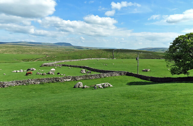
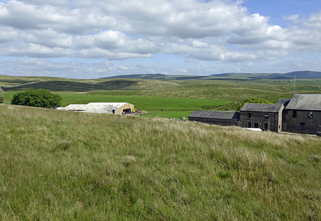
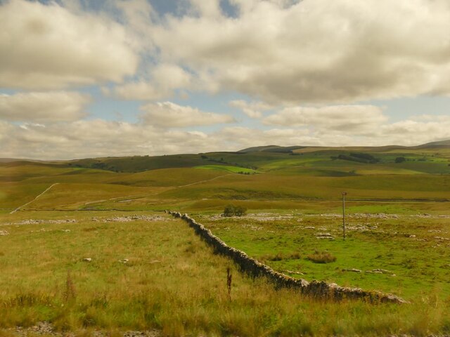
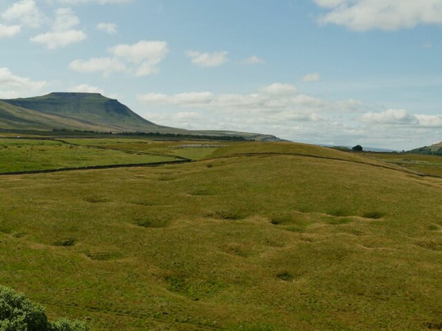
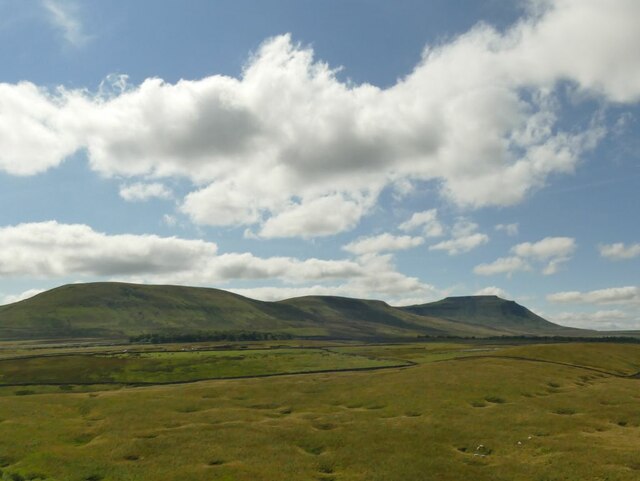
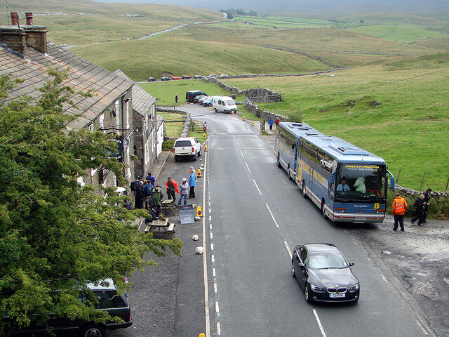
Gauber Cow Pasture, located in Yorkshire, is a picturesque countryside landscape that encompasses both downs and moorland. Spanning over a vast area, the pasture is renowned for its natural beauty, attracting visitors from all over the world.

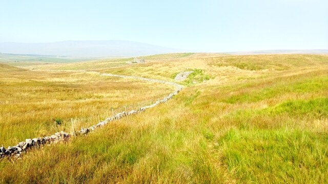
The downs in Gauber Cow Pasture are characterized by rolling hills, covered in lush green grass. These gentle slopes provide an idyllic setting for cattle to graze peacefully, creating a serene and pastoral atmosphere. The cows that inhabit the pasture are predominantly of the Gauber breed, known for their hardiness and ability to thrive in the Yorkshire climate.

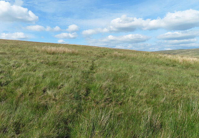
As one ventures deeper into the pasture, the landscape transitions into moorland. Here, heather dominates the scenery, painting the hills with vibrant purple hues during the summer months. The moorland is also home to a variety of other flora, such as bilberry and cotton grass, which add to the visual appeal of the area.

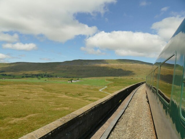
Gauber Cow Pasture is not only visually appealing but also plays a significant role in the local ecosystem. It provides a habitat for various wildlife species, including birds like curlews and lapwings, as well as smaller mammals like hares and weasels. The diversity of habitats present within the pasture contributes to the overall richness of the ecosystem.

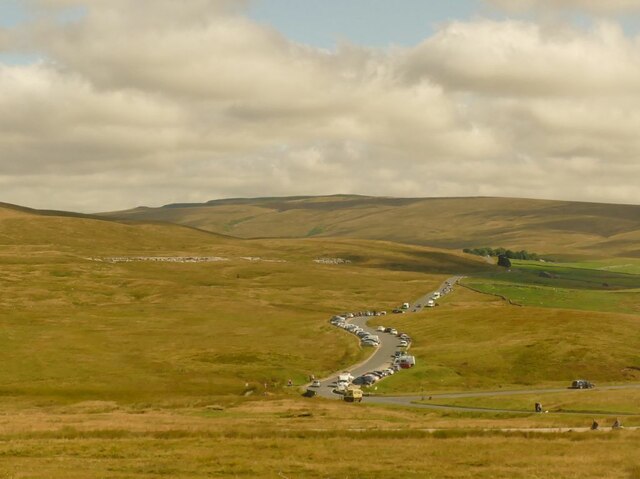
Visitors to Gauber Cow Pasture can enjoy leisurely walks, taking in the breathtaking views and immersing themselves in the tranquility of the countryside. The area is also popular among nature enthusiasts and photographers, who flock to capture the beauty of the landscape throughout the changing seasons.

If you have any feedback on the listing, please let us know in the comments section below.

Gauber Cow Pasture Images

Images are sourced within 2km of 54.199492/-2.3508061 or Grid Reference SD7778. Thanks to Geograph Open Source API. All images are credited.

At Far Gearstones Fields near the farm buildings, marked out by traditional dry-stone walls.
At Far Gearstones
Fields near the farm buildings, marked out by traditional dry-stone walls.
On Green Slack Hill A sort of a path on the moor near Gearstones.
On Green Slack Hill
A sort of a path on the moor near Gearstones.
From Green Slack Hill This view taken from the edge of the hill shows Far Gearstones on the left and Gearstones Lodge on the right.
From Green Slack Hill
This view taken from the edge of the hill shows Far Gearstones on the left and Gearstones Lodge on the right.
A view over the upper Ribble valley from Park Fell With the cottages at Gauber visible on the right.
A view over the upper Ribble valley from Park Fell
With the cottages at Gauber visible on the right.
Dry stone wall at Selside Along with the limestone pavement from which the stone was presumably taken, this is typical Ribblesdale scenery.
Dry stone wall at Selside
Along with the limestone pavement from which the stone was presumably taken, this is typical Ribblesdale scenery.
Cars parked at Gearstones This road junction at Ribblehead is popular with both visitors to the famous viaduct, and longer distance walkers.
Cars parked at Gearstones
This road junction at Ribblehead is popular with both visitors to the famous viaduct, and longer distance walkers.
Shake Holes at Batty Moss Taken from a train on the embankment approaching Ribblehead viaduct, you can see why this was difficult terrain for railway building. Ingleborough is in the distance.
Shake Holes at Batty Moss
Taken from a train on the embankment approaching Ribblehead viaduct, you can see why this was difficult terrain for railway building. Ingleborough is in the distance.
View towards Whernside Taken from a train on the Grade II* listed Ribblehead viaduct.
View towards Whernside
Taken from a train on the Grade II* listed Ribblehead viaduct.
View towards Ingleborough Taken from a train on the Grade II* listed Ribblehead viaduct.
View towards Ingleborough
Taken from a train on the Grade II* listed Ribblehead viaduct.
Crossing Ribblehead railway viaduct, 1985 Back in the day when normal service trains were longer and some needed two locomotives to haul them.
Crossing Ribblehead railway viaduct, 1985
Back in the day when normal service trains were longer and some needed two locomotives to haul them.
Ribblehead Viaduct
Ribblehead Viaduct
Thorns Old farm, now abandoned.
Thorns
Old farm, now abandoned.
Ribble Way Looking back in the direction of Whernside with a crumbling old lime kiln in the near distance on Thorns Moss.
Ribble Way
Looking back in the direction of Whernside with a crumbling old lime kiln in the near distance on Thorns Moss.
Viaduct walkers An official event allowing people to walk across Ribblehead Viaduct. Here people are awaiting their turn to do the walk. Walkers are seen across the viaduct. This was the last day of repairs to the viaduct and no trains were running.
Viaduct walkers
An official event allowing people to walk across Ribblehead Viaduct. Here people are awaiting their turn to do the walk. Walkers are seen across the viaduct. This was the last day of repairs to the viaduct and no trains were running.
Ribblehead viaduct walkers The Settle & Carlisle Railway was closed for repairs to the viaduct. On the last day of the closure, people were permitted to walk across the viaduct. Here, some are seen returning to Ribblehead, viewed from the viaduct.
Ribblehead viaduct walkers
The Settle & Carlisle Railway was closed for repairs to the viaduct. On the last day of the closure, people were permitted to walk across the viaduct. Here, some are seen returning to Ribblehead, viewed from the viaduct.
A busy day at Ribblehead On a day when the viaduct was open to walkers.
A busy day at Ribblehead
On a day when the viaduct was open to walkers.
Buses at Ribblehead Transporting walkers for the walking on the Ribblehead viaduct event.
Buses at Ribblehead
Transporting walkers for the walking on the Ribblehead viaduct event.
Ribblehead Viaduct, 1968 On the Settle and Carlisle Line, it is a Grade II*(star) listed structure.
Ribblehead Viaduct, 1968
On the Settle and Carlisle Line, it is a Grade II*(star) listed structure.
Show me another place!

Gauber Cow Pasture is located at Grid Ref: SD7778 (Lat: 54.199492, Lng: -2.3508061)

Division: West Riding

Administrative County: North Yorkshire

District: Craven

Police Authority: North Yorkshire

What 3 Words

///exits.talkative.sleep. Near Ingleton, North Yorkshire

Related Wikis

Ribblehead Quarry

Ribblehead Quarry is a former limestone quarry next to Ribblehead railway station in the Yorkshire Dales National Park, North Yorkshire, England. It had...

Ribblehead railway station

Ribblehead is a railway station on the Settle and Carlisle Line, which runs between Carlisle and Leeds via Settle. The station, situated 52 miles 17 chains...
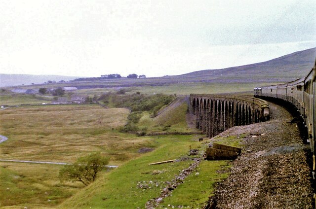
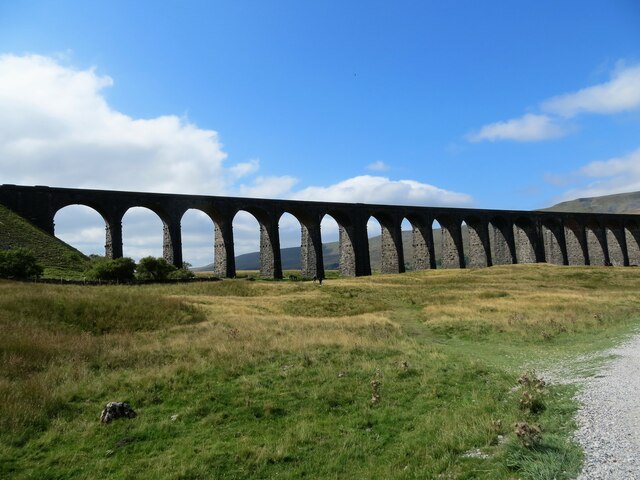
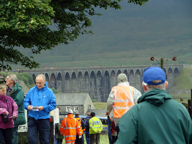
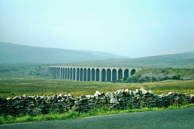
Ribblehead Viaduct

The Ribblehead Viaduct or Batty Moss Viaduct carries the Settle–Carlisle railway across Batty Moss in the Ribble Valley at Ribblehead, in North Yorkshire...
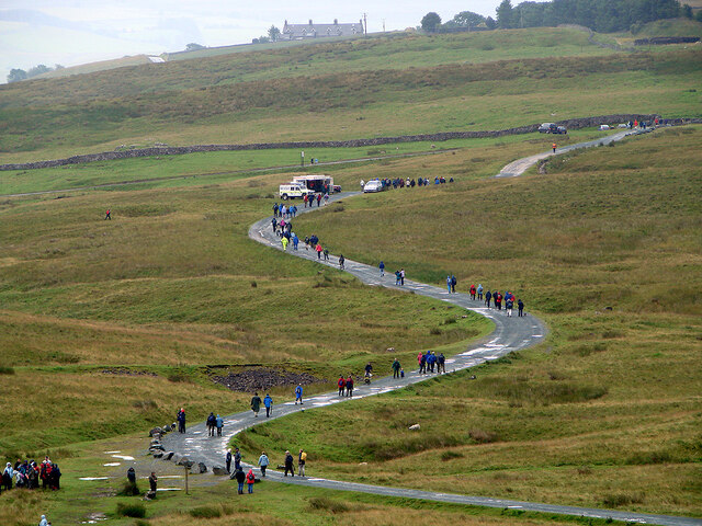
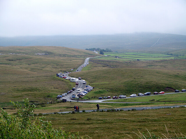
Ribblehead

Ribblehead is the area of moorland at the head of the River Ribble in the area known as Ribblesdale, in the Yorkshire Dales National Park, England. Ribblehead...

Alum Pot

Alum Pot is a pothole with a large open shaft at a surface elevation of 343 metres (1,125 ft) on the eastern flanks of Simon Fell, North Yorkshire, England...
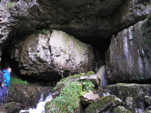
Great Douk Cave

Great Douk Cave is a shallow cave system lying beneath the limestone bench of Ingleborough in Chapel-le-Dale, North Yorkshire, England. It is popular with...

Ling Gill

Ling Gill is a gill (or narrow valley) in the Yorkshire Dales in North Yorkshire, England. Cam Beck, a tributary of the River Ribble, flows through the...

Selside, North Yorkshire

Selside is a small village in Ribblesdale in North Yorkshire, England. It lies 2 miles (3 km) north west of Horton in Ribblesdale. Selside was mentioned...

Nearby Amenities

Located within 500m of 54.199492,-2.3508061
Rake Spring
Natural: spring
Lat/Long: 54.1974005/-2.3490251
Gauber Cow Pasture
Place: locality
Source: OS 1:25k
Lat/Long: 54.1998294/-2.3510756
Barrier: cattle_grid
Source: survey
Lat/Long: 54.2007812/-2.3485732
Barrier: swing_gate
Lat/Long: 54.1967222/-2.3506379
Barrier: swing_gate
Lat/Long: 54.1967166/-2.3506163
Barrier: stile
Stile: stepover
Lat/Long: 54.2030109/-2.3526594
Barrier: stile
Lat/Long: 54.1971546/-2.3562967
Natural: sinkhole
Source: EsriWorldImageryClarity
Lat/Long: 54.2038644/-2.3519199
Power: pole
Lat/Long: 54.2037223/-2.3530911
Power: pole
Lat/Long: 54.2035036/-2.3523456
Power: pole
Lat/Long: 54.2032327/-2.3514237
Power: pole
Lat/Long: 54.2027458/-2.3505219
Power: pole
Lat/Long: 54.2023182/-2.3497409
Power: pole
Lat/Long: 54.2018881/-2.3489533
Power: pole
Lat/Long: 54.2014107/-2.3480736
Power: pole
Lat/Long: 54.2010841/-2.3474882
Power: pole
Lat/Long: 54.2005424/-2.3465018
Power: pole
Lat/Long: 54.1999875/-2.3454811
Power: pole
Lat/Long: 54.199538/-2.3446605
Power: pole
Lat/Long: 54.1991309/-2.3439229
Power: pole
Lat/Long: 54.2035579/-2.3509898
Power: pole
Lat/Long: 54.1993073/-2.3451444
Power: pole
Lat/Long: 54.1990099/-2.3457319
Power: pole
Lat/Long: 54.1987346/-2.346276
Power: pole
Lat/Long: 54.1979889/-2.3478256
Power: pole
Lat/Long: 54.1976133/-2.3486371
Power: pole
Lat/Long: 54.1971155/-2.3496839
Natural: stone
Lat/Long: 54.2026349/-2.3489385
Barrier: kissing_gate
Lat/Long: 54.2005254/-2.3444397
Direction: 180
Information: map
Map Size: site
Operator: Ashes Pasture Nature Reserve
Tourism: information
Lat/Long: 54.2005403/-2.3444768
Natural: stone
Lat/Long: 54.2038501/-2.3497717
Natural: stone
Lat/Long: 54.203852/-2.3498257
Barrier: stile
Fixme: Location approximate
Material: wood
Source: Sited from path on western side
Stile: wall
Lat/Long: 54.2024283/-2.3532195
Information: map
Map Size: local
Map Type: information
Tourism: information
Lat/Long: 54.2011587/-2.3486446
Bench
Lat/Long: 54.2005108/-2.3445256
Bench
Lat/Long: 54.200494/-2.344476
Historic: boundary_stone
Source: survey
Lat/Long: 54.2000205/-2.3439423
Information: map
Map Type: hiking
Tourism: information
Lat/Long: 54.1958982/-2.3502762
The data included in this document is from www.openstreetmap.org. The data is made available under ODbL.

Have you been to Gauber Cow Pasture?

Leave your review of Gauber Cow Pasture below (or comments, questions and feedback).