Blea Moor
Downs, Moorland in Yorkshire Craven
England
Blea Moor
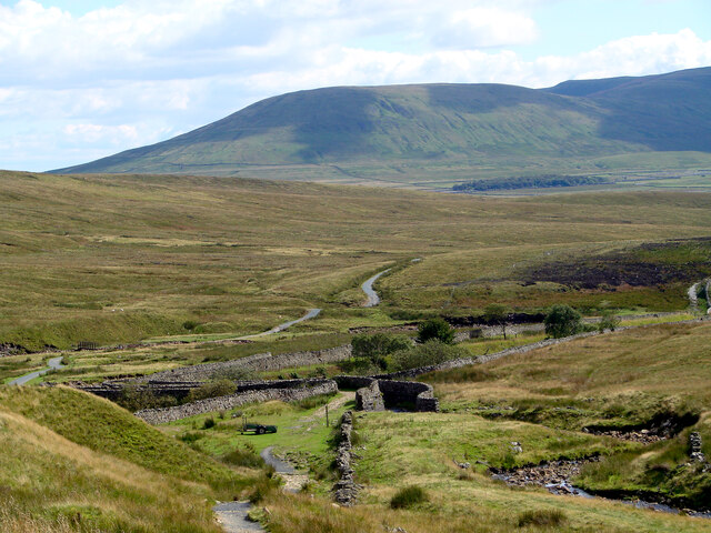
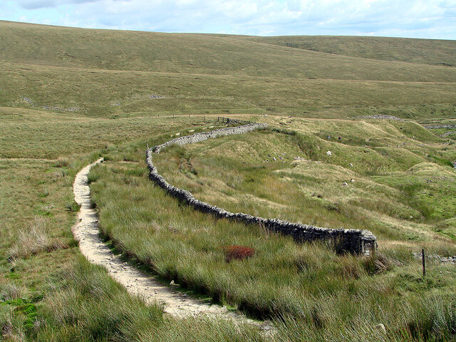
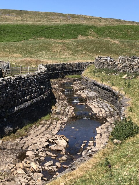
Blea Moor is a vast expanse of moorland located in the county of Yorkshire, England. Situated in the heart of the Yorkshire Dales National Park, it stretches across an area of approximately 5 square miles. The moor is characterized by its rugged and undulating terrain, covered in heather, grasses, and scattered patches of bracken.
At an elevation of around 2,000 feet, Blea Moor offers breathtaking panoramic views of the surrounding landscape. The moor is renowned for its remote and wild nature, making it a popular destination for hikers, walkers, and nature enthusiasts seeking solitude and tranquility.
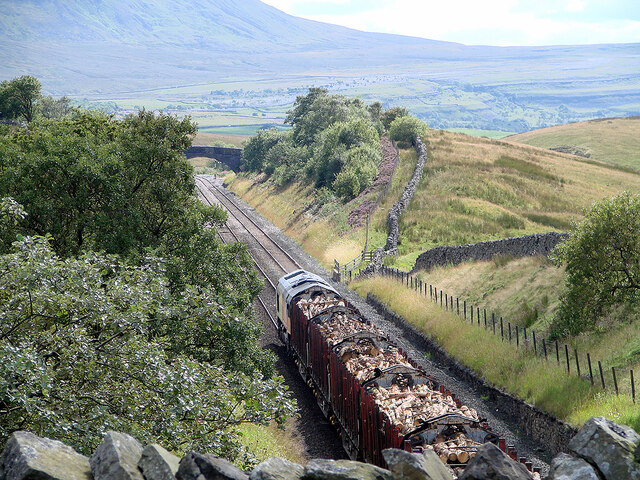
One of the most notable features of Blea Moor is the iconic Ribblehead Viaduct, which spans across the valley of the River Ribble. This impressive structure, built in the late 19th century, is a testament to Victorian engineering and adds to the area's charm and historic significance. The viaduct serves as a landmark and a reminder of the region's industrial past.
The moorland is home to a diverse range of flora and fauna, including bilberry bushes, cotton grass, curlews, lapwings, and red grouse. The area is also dotted with the remnants of ancient settlements and burial mounds, hinting at its rich history and human occupation over the centuries.
Access to Blea Moor is primarily through well-marked footpaths and bridleways, allowing visitors to explore the area's natural beauty while respecting its delicate ecosystem. The moor offers a unique and immersive experience, allowing visitors to reconnect with nature and appreciate the raw beauty of Yorkshire's countryside.
If you have any feedback on the listing, please let us know in the comments section below.
Blea Moor Images
Images are sourced within 2km of 54.236192/-2.3521608 or Grid Reference SD7782. Thanks to Geograph Open Source API. All images are credited.


Blea Moor is located at Grid Ref: SD7782 (Lat: 54.236192, Lng: -2.3521608)
Division: West Riding
Administrative County: North Yorkshire
District: Craven
Police Authority: North Yorkshire
What 3 Words
///horseshoe.beakers.spooked. Near Ingleton, North Yorkshire
Nearby Locations
Related Wikis
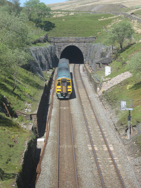
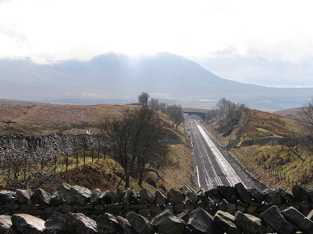
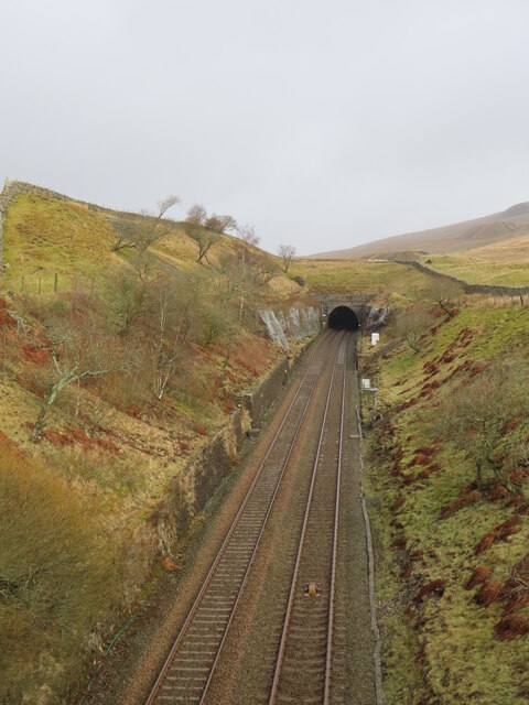
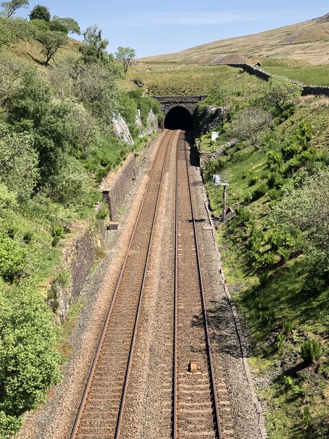
Blea Moor Tunnel
Blea Moor Tunnel is a 2,629 yards (1.494 mi)(2,404 m) railway tunnel located between Ribblehead Viaduct and Dent railway station in England. It is the...

Dent Head Viaduct
Dent Head Viaduct is a railway viaduct on the Settle–Carlisle line in Dentdale, Cumbria, England. It is the second major viaduct on the line northwards...

Ribblehead
Ribblehead is the area of moorland at the head of the River Ribble in the area known as Ribblesdale, in the Yorkshire Dales National Park, England. Ribblehead...

Newby Head
Newby Head, Newby Head Farm or Newby Head Inn is part of the Beresford Estate and was a popular drovers' inn in North Yorkshire, England. Now a farmhouse...

Ribblehead Viaduct
The Ribblehead Viaduct or Batty Moss Viaduct carries the Settle–Carlisle railway across Batty Moss in the Ribble Valley at Ribblehead, in North Yorkshire...

Ribblehead railway station
Ribblehead is a railway station on the Settle and Carlisle Line, which runs between Carlisle and Leeds via Settle. The station, situated 52 miles 17 chains...

Whernside
Whernside is a mountain in the Yorkshire Dales in Northern England. It is the highest of the Yorkshire Three Peaks, the other two being Ingleborough and...

Arten Gill Viaduct
Arten Gill Viaduct is an eleven-arch railway bridge in Dentdale, Cumbria, England. The viaduct carries the Settle to Carlisle railway line over Artengill...
Nearby Amenities
Located within 500m of 54.236192,-2.3521608Have you been to Blea Moor?
Leave your review of Blea Moor below (or comments, questions and feedback).