Twopenny Green Coppice

Downs, Moorland in Staffordshire Wyre Forest

England

Twopenny Green Coppice

Trees by Little Bank (Arley) My first photograph for 2024 was taken on a public footpath to Bank Farm. The mist in the distance disappeared a few minutes later.
Trees by Little Bank (Arley) Credit: Fabian Musto

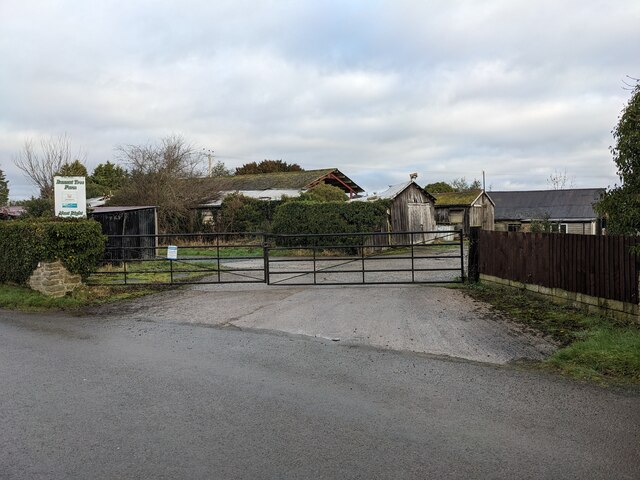
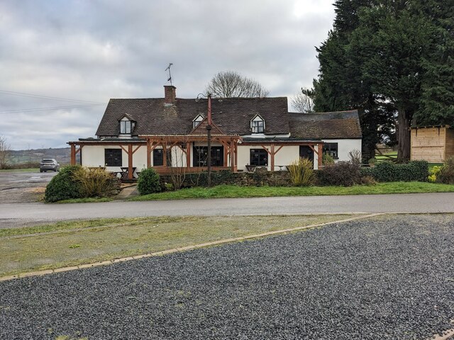
Twopenny Green Coppice is a picturesque area located in Staffordshire, England. Nestled amidst the stunning Downs and Moorland landscapes, this natural haven offers a tranquil escape from the bustling city life.

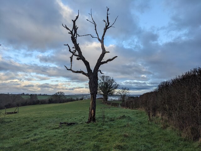
Covering an expansive area, Twopenny Green Coppice is characterized by dense woodlands, rolling hills, and meandering streams. The coppice itself refers to a woodland area where trees are periodically cut to encourage new growth. This management technique ensures a diverse ecosystem, with a variety of tree species, including oak, birch, and beech, thriving within the coppice.

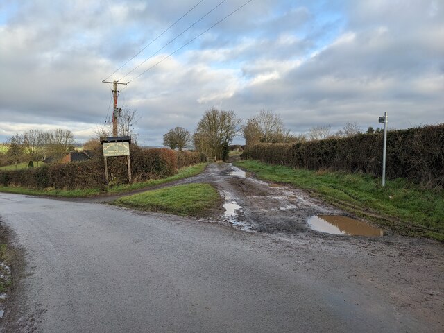
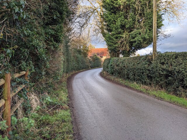
The peaceful atmosphere of Twopenny Green Coppice attracts nature enthusiasts, hikers, and photographers alike. The well-maintained walking trails provide an opportunity to explore the area’s natural beauty, offering breathtaking views of the surrounding countryside. Visitors can also spot an array of wildlife, such as deer, rabbits, and a variety of bird species, making it a popular spot for birdwatchers.

In addition to its natural wonders, Twopenny Green Coppice boasts a rich history. Evidence of ancient settlements and archaeological sites can be found in the area, adding to its allure for history buffs. The coppice has also been used for traditional woodland crafts, such as charcoal production and hazel coppicing, which have been practiced for centuries.

Twopenny Green Coppice is a hidden gem within Staffordshire, offering a peaceful retreat for those seeking solace in nature. Its stunning landscapes, diverse flora and fauna, and historical significance make it a must-visit destination for anyone exploring the region.

If you have any feedback on the listing, please let us know in the comments section below.

Twopenny Green Coppice Images

Images are sourced within 2km of 52.399531/-2.3531913 or Grid Reference SO7678. Thanks to Geograph Open Source API. All images are credited.

Trees by Little Bank (Arley) My first photograph for 2024 was taken on a public footpath to Bank Farm. The mist in the distance disappeared a few minutes later.
Trees by Little Bank (Arley)
My first photograph for 2024 was taken on a public footpath to Bank Farm. The mist in the distance disappeared a few minutes later.
Lanes at Arley The farm track in the centre provides access to two public footpaths, one of which heads east to Arley railway station on the Severn Valley line. The sign to Bank Farm Holiday Park refers to the country lane that heads west of the photo.
Lanes at Arley
The farm track in the centre provides access to two public footpaths, one of which heads east to Arley railway station on the Severn Valley line. The sign to Bank Farm Holiday Park refers to the country lane that heads west of the photo.
Old car in Arley My brother Dylan pointed this out as we were heading back from our walk, and this looks like an old vehicle from the turn of the nineteenth century.
Old car in Arley
My brother Dylan pointed this out as we were heading back from our walk, and this looks like an old vehicle from the turn of the nineteenth century.
Lane at Arley Taken on a public footpath from Ye Olde New Inn to Bank Farm.
Lane at Arley
Taken on a public footpath from Ye Olde New Inn to Bank Farm.
Bannut Tree Farm (Arley)
Ye Olde New Inn (Pound Green) Here is the Ye Olde New Inn southwest of Arley, and this pub is opposite the community hall for Pound Green and Button Oak. The building here is possibly a few centuries old, although it does not have listed status as of January 2024 (a website called What Pub states the interior houses ship's beams from 1645).
Ye Olde New Inn (Pound Green)
Here is the Ye Olde New Inn southwest of Arley, and this pub is opposite the community hall for Pound Green and Button Oak. The building here is possibly a few centuries old, although it does not have listed status as of January 2024 (a website called What Pub states the interior houses ship's beams from 1645).
Pony Paddock, Arley A pony paddock with woodland behind close to the River Severn, Arley. Photograph taken from the railway embankment.
Pony Paddock, Arley
A pony paddock with woodland behind close to the River Severn, Arley. Photograph taken from the railway embankment.
Trimpley Reservoir Viewed from the adjacent railway line, this is the reservoir at Trimpley, beside the River Severn
Trimpley Reservoir
Viewed from the adjacent railway line, this is the reservoir at Trimpley, beside the River Severn
Trimpley Reservoir, Severn Valley With the camera facing south, this is the view of Trimpley Reservoir from the adjacent railway line
Trimpley Reservoir, Severn Valley
With the camera facing south, this is the view of Trimpley Reservoir from the adjacent railway line
Picnic Area, Arley station Beside the railway line at Arley Station is a small picnic area
Picnic Area, Arley station
Beside the railway line at Arley Station is a small picnic area
River Severn near Arley Viewed from the railway line crossing Victoria Bridge, this is the River Severn flowing south near Arley
River Severn near Arley
Viewed from the railway line crossing Victoria Bridge, this is the River Severn flowing south near Arley
Track Replacement,  Arley Station Track replacement under way at Arley Station, Severn Valley Railway
Track Replacement, Arley Station
Track replacement under way at Arley Station, Severn Valley Railway
Stanier Mogul at Arley Stanier 2-6-0 No 42968 waits to leave Arley station with a train for Bridgnorth
Stanier Mogul at Arley
Stanier 2-6-0 No 42968 waits to leave Arley station with a train for Bridgnorth
Knowles Mill Preserved derelict flour mill on the Dowles Brook in the Wyre Forest. The remains of the overshot waterwheel are behind the curved wall in the foreground and the tail race is in a tunnel.
Knowles Mill
Preserved derelict flour mill on the Dowles Brook in the Wyre Forest. The remains of the overshot waterwheel are behind the curved wall in the foreground and the tail race is in a tunnel.
Knowles Mill - the remains of the waterwheel This was an overshot waterwheel with the leat coming in at high level on the left and the portal of the tail race tunnel visible to the right.
Knowles Mill - the remains of the waterwheel
This was an overshot waterwheel with the leat coming in at high level on the left and the portal of the tail race tunnel visible to the right.
Knowles Mill - machinery A nineteenth century watermill that went out of use in 1891 when it was damaged by a flood following a big freeze. It is the only recognisable mill in the Wyre Forest.

This somewhat sharpened (really!) shot shows the pit wheel, wallower, great spur wheel and crown wheel. There is a surviving stone nut and quant on the right with a bed stone on the floor above. The other stone nut and the other stones have gone. There is a fragmented French burr stone on the ground inside.
Knowles Mill - machinery
A nineteenth century watermill that went out of use in 1891 when it was damaged by a flood following a big freeze. It is the only recognisable mill in the Wyre Forest. This somewhat sharpened (really!) shot shows the pit wheel, wallower, great spur wheel and crown wheel. There is a surviving stone nut and quant on the right with a bed stone on the floor above. The other stone nut and the other stones have gone. There is a fragmented French burr stone on the ground inside.
Knowles Mill Nineteenth century watermill that has been out of use since 1891 and is now preserved by the National Trust. The bridge in the foreground crosses the Dowles Brook.
Knowles Mill
Nineteenth century watermill that has been out of use since 1891 and is now preserved by the National Trust. The bridge in the foreground crosses the Dowles Brook.
Trimpley Reservoir from the SVR Part of Birmingham's water supply system; the reservoirs hold water taken from the river, which is then added to the flow coming from the Elan Valley reservoirs via the <a title="https://www.geograph.org.uk/photo/5532" href="https://www.geograph.org.uk/photo/5532">Link</a> at times of need.
Trimpley Reservoir from the SVR
Part of Birmingham's water supply system; the reservoirs hold water taken from the river, which is then added to the flow coming from the Elan Valley reservoirs via the Link at times of need.
Show me another place!

Twopenny Green Coppice is located at Grid Ref: SO7678 (Lat: 52.399531, Lng: -2.3531913)

Administrative County: Worcestershire

District: Wyre Forest

Police Authority: West Mercia

What 3 Words

///gent.barbarian.olive. Near Bewdley, Worcestershire

Related Wikis

Pound Green

Pound Green is a hamlet in Upper Arley, Worcestershire, England. It has a number of tourist landmarks such as Ye Olde New Inn and a village hall that also...

Button Oak

Button Oak is a small village in the English county of Shropshire, England. It is 3 miles north west of Bewdley. Button Oak is very similar to nearby...

Victoria Bridge, Worcestershire

The Victoria Bridge crosses the River Severn between Arley and Bewdley in Worcestershire, England. At the time of its construction, the 200-foot railway...
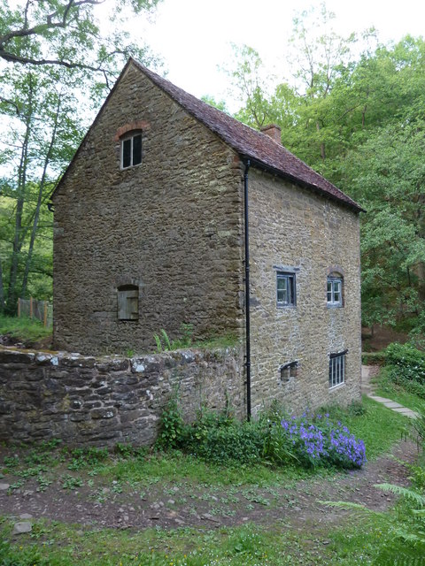
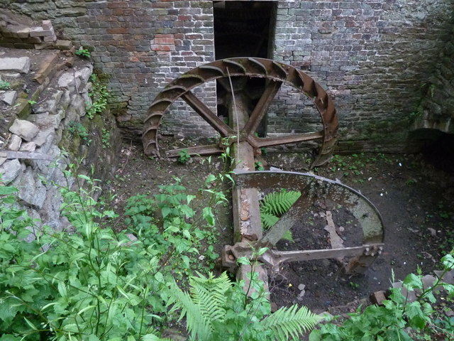
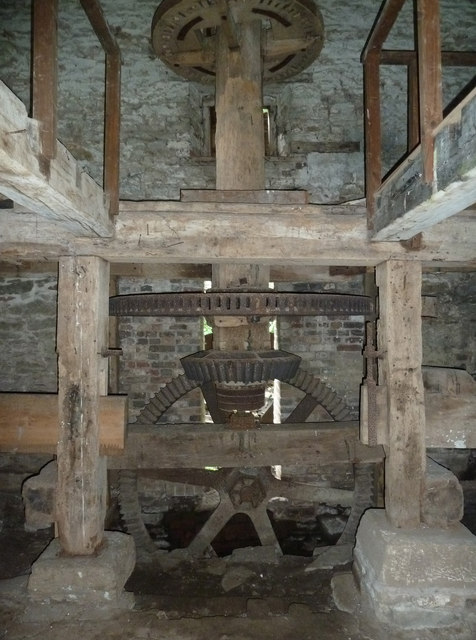
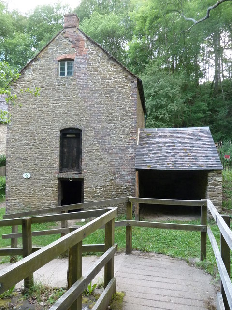
Knowles Mill

Knowles Mill is the remains of an eighteenth-century water-powered grain mill, located in the Wyre Forest in Worcestershire, England. The mill has been...

Northwood Halt railway station

Northwood Halt is an unstaffed request stop on the Severn Valley Railway in Worcestershire, situated a little to the north of Bewdley on the outskirts...

Wyre Forest

Wyre Forest is a large, semi-natural (partially unmanaged) woodland and forest measuring 26.34 square kilometres (10.17 sq mi) which straddles the borders...

Arley railway station

Arley railway station is a station on the Severn Valley Railway heritage line in Worcestershire, situated just over the River Severn from the village of...

Shatterford Hill

Shatterford Hill is an English geographical feature that extends from Bewdley in north Worcestershire to Birdsgreen near Alveley, just over the border...

Nearby Amenities

Located within 500m of 52.399531,-2.3531913
Man Made: manhole
Manhole: water
Pipeline: inspection chamber
Lat/Long: 52.4011855/-2.3507455
Man Made: manhole
Manhole: water
Pipeline: inspection chamber
Lat/Long: 52.4007431/-2.354311
Barrier: stile
Source: survey
Lat/Long: 52.396229/-2.352727
Parking
Access: yes
Capacity: 30
Fee: no
Operator: Hawkbatch Wood
Parking: lane
Source: survey
Surface: asphalt
Lat/Long: 52.3973096/-2.3514038
Barrier: stile
Source: survey
Lat/Long: 52.3991389/-2.3548203
Barrier: lift_gate
Source: survey
Lat/Long: 52.3963293/-2.3524767
Man Made: manhole
Manhole: water
Pipeline: inspection chamber
Lat/Long: 52.4015433/-2.3478258
Man Made: manhole
Manhole: water
Pipeline: inspection chamber
Lat/Long: 52.4015623/-2.347671
Man Made: manhole
Manhole: water
Pipeline: inspection chamber
Lat/Long: 52.4015255/-2.3479709
The data included in this document is from www.openstreetmap.org. The data is made available under ODbL.

Have you been to Twopenny Green Coppice?

Leave your review of Twopenny Green Coppice below (or comments, questions and feedback).