Roman Fell

Downs, Moorland in Westmorland Eden

England

Roman Fell

View past the edge of Mell Fell to Roman Fell Both fells lie within Warcop Ranges and as such are not open access. Walkers are allowed in the ranges during not firing times - after 1 pm on a Sunday and 14 weekends per year - but must stick to footpaths / bridleways.
View past the edge of Mell Fell to Roman Fell Credit: David Robinson

Roman Fell is a stunning area located in the district of Westmorland, situated in the northwestern region of England. Known for its picturesque landscapes, Roman Fell is a combination of downs and moorland, providing a diverse and captivating environment for visitors.

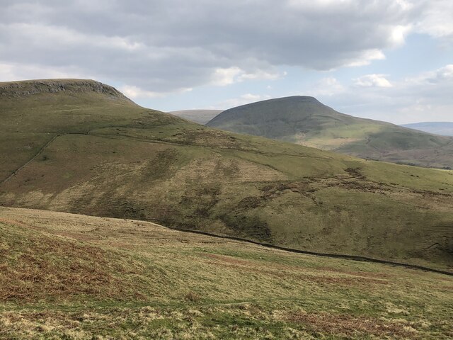
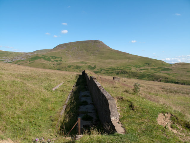
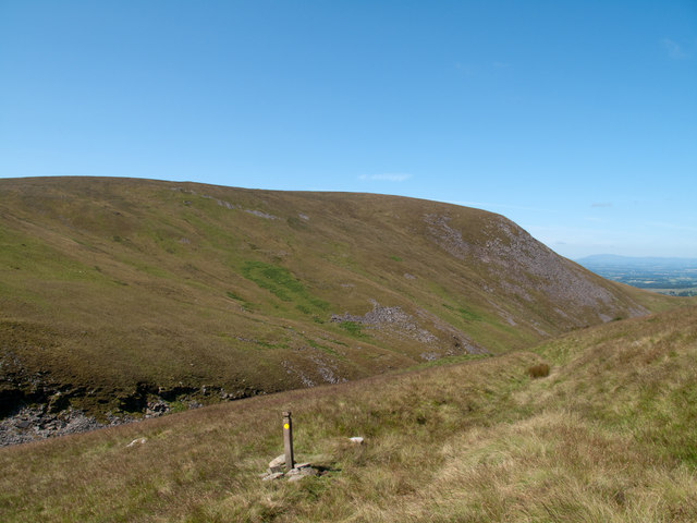
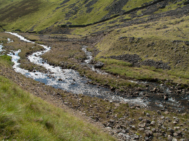
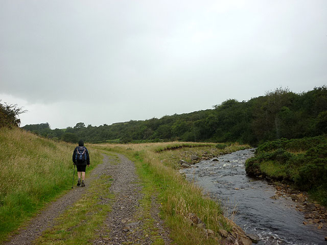
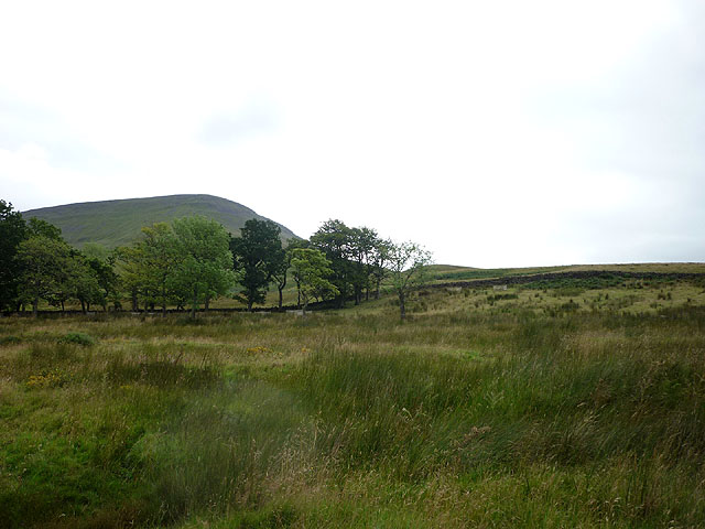
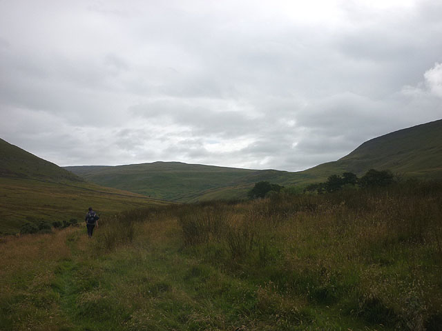
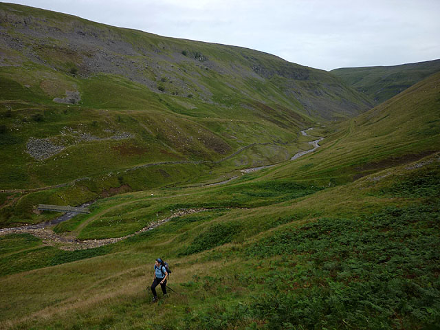
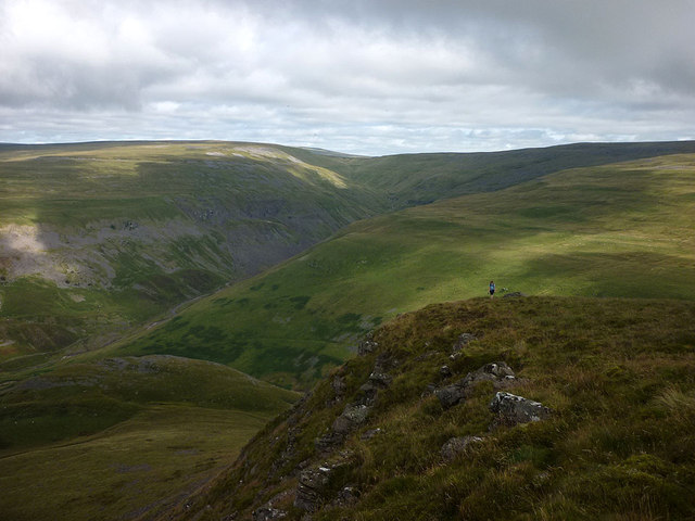
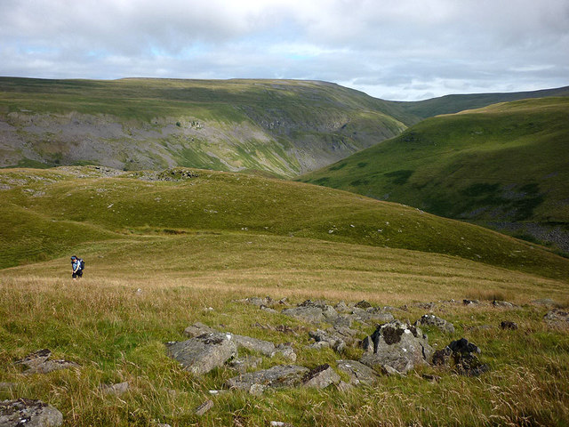
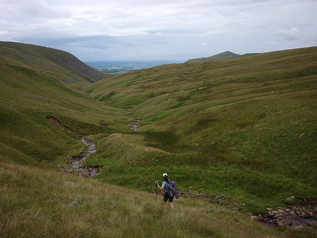
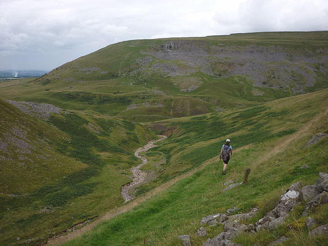
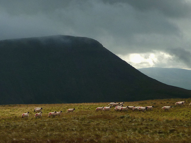
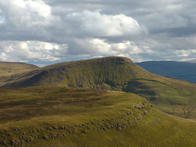
The downs of Roman Fell offer vast expanses of rolling hills covered in lush green grasses, creating a serene and peaceful atmosphere. These downs provide incredible panoramic views of the surrounding countryside, making it a popular spot for hikers, nature enthusiasts, and photographers.

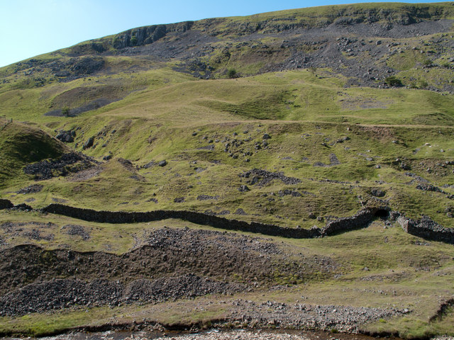
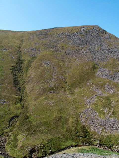
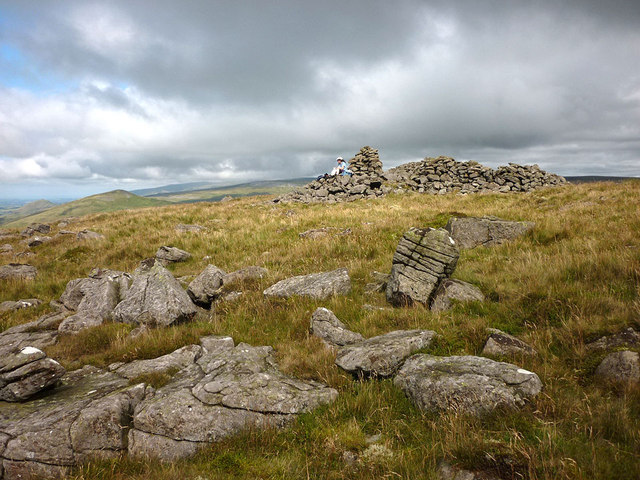
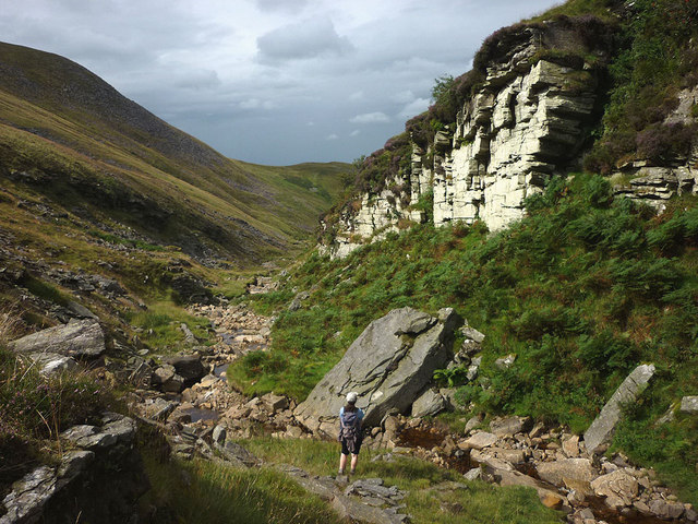
In contrast, the moorland of Roman Fell showcases a unique and rugged terrain. Characterized by its heather-covered hills and rocky outcrops, this part of the area offers a sense of wildness and untamed beauty. The moorland is also home to a variety of wildlife, including birds such as grouse and peregrine falcons, making it an ideal destination for birdwatchers.

Roman Fell is steeped in history, with evidence of Roman settlements in the area dating back centuries. Ruins of ancient Roman forts and roads can still be found, attracting history buffs and archaeology enthusiasts alike.

Visitors to Roman Fell can enjoy a range of activities, from hiking and wildlife spotting to exploring the rich historical heritage of the region. With its stunning landscapes and cultural significance, Roman Fell is a must-visit destination for those seeking a true taste of Westmorland's natural and historical wonders.

If you have any feedback on the listing, please let us know in the comments section below.

Roman Fell Images

Images are sourced within 2km of 54.575983/-2.3795747 or Grid Reference NY7520. Thanks to Geograph Open Source API. All images are credited.

View past the edge of Mell Fell to Roman Fell Both fells lie within Warcop Ranges and as such are not open access. Walkers are allowed in the ranges during not firing times - after 1 pm on a Sunday and 14 weekends per year - but must stick to footpaths / bridleways.
View past the edge of Mell Fell to Roman Fell
Both fells lie within Warcop Ranges and as such are not open access. Walkers are allowed in the ranges during not firing times - after 1 pm on a Sunday and 14 weekends per year - but must stick to footpaths / bridleways.
Rifle range target This feature installed on rough pasture land close to the village of Hilton is a disused target for the MOD firing range at Warcop. There's a concrete wall with an earth rampart on the downhill side - the direction from which fire would have come. Presumably the walkway below the wall was where targets were prepared and then raised above the parapet. The distant hill is Roman Fell and the obvious groove between it and the target is the line of Scordale Beck.
Rifle range target
This feature installed on rough pasture land close to the village of Hilton is a disused target for the MOD firing range at Warcop. There's a concrete wall with an earth rampart on the downhill side - the direction from which fire would have come. Presumably the walkway below the wall was where targets were prepared and then raised above the parapet. The distant hill is Roman Fell and the obvious groove between it and the target is the line of Scordale Beck.
Lowfield Hush in Scordale Scordale is at the south-western corner of the northern Pennines. Although a public right of way exists through the valley, it lies within the MOD Warcop firing range and access is limited to days when no 'live firing' takes place. The valley of Scordale has seen a great deal of activity even before the military occupation and evidence of the now defunct extraction industries is to be seen in this image. The apparent valley above the dry stone wall at the left side of the image is in fact a hush - a relic of lead mining days. To the right, the apparent tunnel is actually an old lime kiln.
Lowfield Hush in Scordale
Scordale is at the south-western corner of the northern Pennines. Although a public right of way exists through the valley, it lies within the MOD Warcop firing range and access is limited to days when no 'live firing' takes place. The valley of Scordale has seen a great deal of activity even before the military occupation and evidence of the now defunct extraction industries is to be seen in this image. The apparent valley above the dry stone wall at the left side of the image is in fact a hush - a relic of lead mining days. To the right, the apparent tunnel is actually an old lime kiln.
Roman Fell across Swindale The steep north-eastern face of Roman Fell is largely grassed but with an extensive area of boulders too, the upper ones at least are apparently known as Slape Stones or Fox Yards. In this view from a path across the valley below Swindale Edge, Roman Fell's summit is not in view, being beyond the apparent crest of the hill over a slope at a more gentle angle.
Roman Fell across Swindale
The steep north-eastern face of Roman Fell is largely grassed but with an extensive area of boulders too, the upper ones at least are apparently known as Slape Stones or Fox Yards. In this view from a path across the valley below Swindale Edge, Roman Fell's summit is not in view, being beyond the apparent crest of the hill over a slope at a more gentle angle.
Bridleway above north side of Swindale Swindale is a tributary valley of Scordale; the view here is to the west along a bridleway on its north side. Roman Fell is the hill on Swindale's southern side.
Bridleway above north side of Swindale
Swindale is a tributary valley of Scordale; the view here is to the west along a bridleway on its north side. Roman Fell is the hill on Swindale's southern side.
Scordale Beck below Amber Hill Scordale Beck, seen here from the path beside it below Amber Hill, splits into three channels - an example of 'braiding'?
Scordale Beck below Amber Hill
Scordale Beck, seen here from the path beside it below Amber Hill, splits into three channels - an example of 'braiding'?
Bridleway beside Scordale Beck Heading towards Hilton as the rain arrives.
Bridleway beside Scordale Beck
Heading towards Hilton as the rain arrives.
Rough pasture by the bridleway to Scordale Roman Fell beyond.
Rough pasture by the bridleway to Scordale
Roman Fell beyond.
Bridleway to Scordale Two bridleways leave Hilton then join by the beck before advancing into Scordale now opening up ahead.
Bridleway to Scordale
Two bridleways leave Hilton then join by the beck before advancing into Scordale now opening up ahead.
Starting up the north ridge of Roman Fell Leaving the good bridleway in Scordale for the rough and steep climb up the north ridge of Roman Fell. Below is the footbridge over Scordale Beck just upstream of the confluence of Swindale Beck.
Starting up the north ridge of Roman Fell
Leaving the good bridleway in Scordale for the rough and steep climb up the north ridge of Roman Fell. Below is the footbridge over Scordale Beck just upstream of the confluence of Swindale Beck.
Roman Fell Scar After a very steep climb up the north ridge the going eases above Roman Fell Scar. Far below are the deep trenches of Swindale and Scordale.
Roman Fell Scar
After a very steep climb up the north ridge the going eases above Roman Fell Scar. Far below are the deep trenches of Swindale and Scordale.
Climbing up Roman Fell Partway up the north ridge of Roman Fell there is a large flat area known as High Hause with a slight col beyond, Hause Harrows. Above here the ridge is a very steep and bouldery slope called Slape Stones (or Fox Yards). We saw no foxes but encountered clouds of midges which did not abate until a breeze on the summit kept them down.
Climbing up Roman Fell
Partway up the north ridge of Roman Fell there is a large flat area known as High Hause with a slight col beyond, Hause Harrows. Above here the ridge is a very steep and bouldery slope called Slape Stones (or Fox Yards). We saw no foxes but encountered clouds of midges which did not abate until a breeze on the summit kept them down.
The summit of Roman Fell (594m) The summit area is a large, tilted plateau of gritstone with scatterings of boulders surrounding a large cairn. The map does not suggest that this is a burial cairn but the boulders look to have been collected into a large structure part of which has also been fashioned into a fold or shelter. To the north can be seen the conical peaks of Murton and Dufton Pikes.
The summit of Roman Fell (594m)
The summit area is a large, tilted plateau of gritstone with scatterings of boulders surrounding a large cairn. The map does not suggest that this is a burial cairn but the boulders look to have been collected into a large structure part of which has also been fashioned into a fold or shelter. To the north can be seen the conical peaks of Murton and Dufton Pikes.
At the head of Swindale The non-existent bridleway contours along the slope north of the beck, marked only by a line of wooden posts. We decided to follow the bottom of the gill as a more interesting line of return to Scordale. The lowlands of the Eden Valley can be seen between Roman Fell (left) and Murton Pike.
At the head of Swindale
The non-existent bridleway contours along the slope north of the beck, marked only by a line of wooden posts. We decided to follow the bottom of the gill as a more interesting line of return to Scordale. The lowlands of the Eden Valley can be seen between Roman Fell (left) and Murton Pike.
Swindale Beck and Crag Swindale Beck at this point is fairly low in volume since much of it sinks into joints in the limestone further up the gill. The crag is sandstone, broken and a luminous lime green colour due to lichen. On our approach a large bird (owl or buzzard?) flew off from one of its ledges.
Swindale Beck and Crag
Swindale Beck at this point is fairly low in volume since much of it sinks into joints in the limestone further up the gill. The crag is sandstone, broken and a luminous lime green colour due to lichen. On our approach a large bird (owl or buzzard?) flew off from one of its ledges.
The bridleway above Swindale A lovely green track descending into Scordale.
The bridleway above Swindale
A lovely green track descending into Scordale.
Running sheep on Mell Fell The dark bulk of Roman Fell rising across the unseen Scordale.
Running sheep on Mell Fell
The dark bulk of Roman Fell rising across the unseen Scordale.
Roman Fell from Murton Pike Roman Fell is a rugged height which would not look out of place in the Lake District. Low October light accentuates the gullied flank below Roman Fell Scar. In the foreground is the limestone band of Delfekirk Scar. A zoom shot from Murton Pike to the north.
Roman Fell from Murton Pike
Roman Fell is a rugged height which would not look out of place in the Lake District. Low October light accentuates the gullied flank below Roman Fell Scar. In the foreground is the limestone band of Delfekirk Scar. A zoom shot from Murton Pike to the north.
Show me another place!

Roman Fell is located at Grid Ref: NY7520 (Lat: 54.575983, Lng: -2.3795747)

Administrative County: Cumbria

District: Eden

Police Authority: Cumbria

What 3 Words

///fonts.erupts.creatures. Near Appleby-in-Westmorland, Cumbria

Nearby Locations

Roman Fell Roman Fell

Related Wikis

Hilton, Cumbria

Hilton is a village in Cumbria, England, in the civil parish of Murton, about 3 miles (4.8 km) east of Appleby-in-Westmorland and at an elevation of 752...

Murton, Cumbria

Murton is a small village and civil parish in the Eden District of Cumbria, England. The parish had a population of 330 in 2001, rising to 360 at the 2011...

Brackenber

Brackenber is a hamlet in the civil parish of Murton in Cumbria, England. It is near the town of Appleby-in-Westmorland and the village of Hilton, Cumbria...

Murton Fell

Murton Fell is a hill of 675 metres (2,215 ft) above the village of Murton, Cumbria in Eden district, in the North Pennines. It lies east of the dramatic...

Nearby Amenities

Located within 500m of 54.575983,-2.3795747
Roman Fell
Ele: 593
Natural: peak
Lat/Long: 54.5774868/-2.38182
The data included in this document is from www.openstreetmap.org. The data is made available under ODbL.

Have you been to Roman Fell?

Leave your review of Roman Fell below (or comments, questions and feedback).